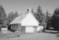
9 National Register listings published here, 1 of them a National Historic Landmark · the county-history sources tell 1 story and name 2 people · people the book names include Thp Valdez- Fairbanks Trai I. (Valdez, 1910) (machine-read).
Alaska within the United StatesChugach Census Area within Alaska
What the record shows
618 topographic sheet readings cover the county's settlements.
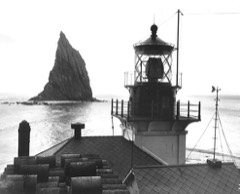
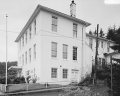
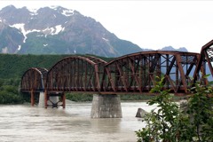
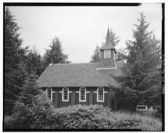
9 properties here are on the National Register of Historic Places: 4 buildings, 2 sites, 2 structures and 1 district.
4 of the 9 listings were added during the 1970s.
The Geographic Names Information System records 32 populated places in this county; 32 are covered by at least one topographic sheet.
What happened here
1 accounts
Among them: The Seasons. These passages come from the
identified county-history source books. Each inset names its own source
and opens the exact section it comes from.
THE SEASONS. Now comes the winter, which creeps in graduall)' as the days grow shorter. By October still water has frozen and November sees the rivers solid enough for the winter traffic. After the heavy snowstorms of the early part of the season the still, clear weather of the Tanana winter settles down.
Every wildfire the federal occurrence
database records inside this county: 40 of them, burning
about 212 acres. 1 started naturally and 1 was recorded as arson. Each settlement page carries the fires within
five miles of it.
Reported cause
Fires
Recreation and ceremony
15
Debris and open burning
6
Missing data/not specified/undetermined
5
Smoking
4
Fireworks
3
Other causes
2
Natural
1
Equipment and vehicle use
1
Power generation/transmission/distribution
1
Arson/incendiarism
1
Misuse of fire by a minor
1
The five largest, by the area the report
gives. None of them was recorded as arson.
Date
Cause
Size
Reported by
Name on the report
14 May 1999
Misuse of fire by a minor
104 acres
Valdez-Copper River Area
TOWNMOUNTAIN
5 May 1996
Recreation and ceremony
50 acres
Chugach National Forest
SHERIDAN GLACIER
1 May 2005
Recreation and ceremony
11 acres
Chugach National Forest
SHERIDAN GLACIER FIR
29 July 2006
Debris and open burning
10 acres
Valdez-Copper River Area
not named
27 May 2000
Debris and open burning
10 acres
Valdez-Copper River Area
VALDEZ # 1
3 August 1993
Missing data/not specified/undetermined
5.0 acres
Chugach National Forest
not named
19 June 2001
Fireworks
4.0 acres
Chugach National Forest
ALAGANIK COMPLEX
21 May 1999
Natural
4.0 acres
Chugach National Forest
SHERIDAN
Every settlement page carries the fires within five
miles of it - see the settlement index below.
Storms,
2006 to 2023
11 of 11 shown
The
NOAA Storm Events Database holds
11 reports for this county, causing no deaths, no injuries and about $26,600,000 in recorded property damage.
Each settlement page carries the reports that name it.
Kind of event
Reports
Flood
11
The most serious of them, by death, then
injury, then recorded damage. The accounts are quoted exactly as the
forecast office filed them.
Heavy rain in Valdez from an atmospheric river, caused Solomon Gulch to flood, closing Dayville Road in Valdez. This road is the access to the Solomon Gulch Dam and power plant and employees were not able to easily access the plant because the main road was flooded.
Heavy rain, on top of saturated soils, caused fast rises on the Lowe River in Valdez. The Richardson Highway was impacted in Valdez, with flooding encroaching on the highway and closing it at MP 4. Transportation into/out of Valdez was affected; this is the only road in/out of the community.
The service hydrologist spoke to Scott Benda, the Valdez Flood Manager, and found out that rivers in the area were high with some low areas taking on water along Lowe River and Glacier Steam. The Town of Valdez did not experience any high water or low areas of flooding. Alpine Woods has a fortified dike, which was relined with rocks; the sub-division was not impacted by this event because of the work on the dike. Overall all streams were high, with ample groundwater.
Heavy rainfall caused rapid rises on the Lowe River and surrounding the Solomon Gulch Lake near Valdez, AK. Widespread lowland flooding was reported by the Floodplain Manager as waters rose rapidly during the event, rising as fast as 3 feet in under 12 hours and cresting at 15.02 ft. In doing so, the Lowe River reached moderate flood stage. The Floodplain Manager reported the Lowe River being very high but not on the road. Many low areas near the river were flooded.
Heavy rains across Cordova, AK increased river levels quickly causing areas of minor flooding and lowland overflows in the area. Eyak Lake showed a rapid rise to minor flood stage, however, impacts were limited to flooding along low lying areas and along low roadways. The Eyak Lake river gage crested at 4.81 ft. Portions of the Copper River Highway, connecting Cordova to the airport, had been washed away according to the Cordova Police Department.
The Valdez-Fairbanks Trail : the Story of a Great Highway : the Tanana Valley - Valdez, the Gateway to an Empire : a Guide for the Alaska Traveler (1910)
29,917 words in 2 parts
The people it describes
2 named
Everyone The Valdez-Fairbanks Trail : the Story of a Great Highway : the Tanana Valley - Valdez, the Gateway to an Empire : a Guide for the Alaska Traveler stops to write about, with
the section that describes them. Among them are the men who founded the
place and governed the Territory. Each name opens the passage itself, in
the words of 1910.
Named settlements recorded in the Geographic Names
Information System, each with the topographic sheets covering it. Villages,
hamlets and abandoned places alike. Each is shown with the nearest named
watercourse or landform and the survey quadrangle it falls on.
Topographic sheets. USGS Historical Topographic Map Collection, county index, measured from the bulk metadata.
Fire insurance maps. Library of Congress Sanborn collection, faceted to this county.
Photographs. Each place queried individually against the Library of Congress Prints and Photographs search.
Wildfire. Short, Karen C. 2022. Spatial wildfire occurrence data for the United States, 1992-2020 [FPA_FOD_20221014]. 6th Edition. Fort Collins, CO: Forest Service Research Data Archive. https://doi.org/10.2737/RDS-2013-0009.6 Collected with United States Government funding and usable without additional permissions or fees.
Mines and quarries. USGS Mineral Resources Data System (MRDS) https://mrdata.usgs.gov/mrds/ A work of the United States government, no copyright under 17 U.S.C. 105.
Storms. NOAA National Centers for Environmental Information, Storm Events Database https://www.ncei.noaa.gov/stormevents/ A work of the United States government, no copyright under 17 U.S.C. 105. Narratives are quoted verbatim from the National Weather Service report and are not edited or summarised.
 Block