 Block
From the record
15 National Register listings published here, 1 of them a National Historic Landmark.
Sources: the National Register database, National Park Service
174 topographic sheets cover 37 settlements here, and 15 properties are on the National Register of Historic Places.
15 National Register listings published here, 1 of them a National Historic Landmark.
Sources: the National Register database, National Park Service
Every property in this county listed on the National Register of Historic Places, with the year it was listed and the federal nomination document.
| Photograph | Property | Type | Listed | Reference |
|---|---|---|---|---|
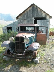 | Bremner Historic Mining District | district | 2000 | 00000659 |
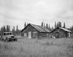 | Chisana Historic District | district | 1985 | 85002999 |
| Chistochina Trading Post | building | 1997 | 97000553 | |
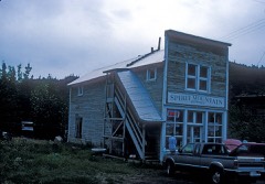 | Chitina Tin Shop | building | 1979 | 79003763 |
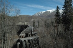 | Copper River and Northwestern Railway | district | 1973 | 73002275 |
| Copper River and Northwestern Railway Bunkhouse and Messhouse | building | 2002 | 02001460 | |
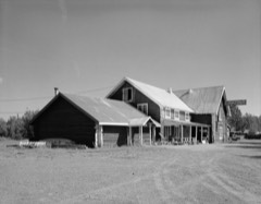 | Gakona Historic District | district | 2001 | 01000024 |
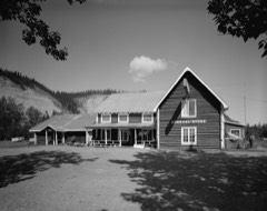 | Gakona Roadhouse | building | 1977 | 77001579 |
| Kansky's | building | 1997 | 97000432 | |
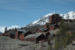 | Kennecott Mines | district | 1978 | 78003420 |
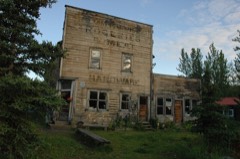 | McCarthy General Store | building | 1978 | 78003421 |
| McCarthy Power Plant | building | 1979 | 79003752 | |
| Nabesna Gold Mine Historic District | district | 1979 | 79003755 | |
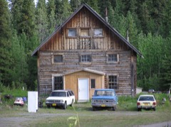 | Slana Roadhouse | district | 2005 | 04001569 |
| Valdez Trail-Copper Bluff Segment | site | 1998 | 98000077 |
Every wildfire the federal occurrence database records inside this county: 536 of them, burning about 118,202 acres. 72 started naturally and 6 were recorded as arson. Each settlement page carries the fires within five miles of it.
| Reported cause | Fires |
|---|---|
| Recreation and ceremony | 122 |
| Missing data/not specified/undetermined | 120 |
| Debris and open burning | 96 |
| Natural | 72 |
| Other causes | 39 |
| Power generation/transmission/distribution | 23 |
| Equipment and vehicle use | 21 |
| Misuse of fire by a minor | 15 |
| Smoking | 13 |
| Fireworks | 9 |
| Arson/incendiarism | 6 |
The five largest, by the area the report gives. None of them was recorded as arson.
| Date | Cause | Size | Reported by | Name on the report |
|---|---|---|---|---|
| 2 July 2009 | Natural | 56,413 acres | Alaska Fire Service | CHAKINA |
| 15 July 2016 | Natural | 19,719 acres | Alaska Fire Service | STEAMBOAT CREEK |
| 17 July 2019 | Missing data/not specified/undetermined | 14,907 acres | Valdez-Copper River Area | TOKAINA 2 |
| 15 June 1994 | Natural | 8,045 acres | Alaska Fire Service | 413330 |
| 27 June 2013 | Natural | 6,137 acres | Valdez-Copper River Area | EXCELSIOR |
| 14 July 2016 | Natural | 3,265 acres | Alaska Fire Service | YOKNEDA LAKE |
| 17 July 2019 | Natural | 2,130 acres | Alaska State Office | CHETASLINA |
| 30 May 2011 | Natural | 1,234 acres | Alaska Fire Service | GILAHINA |
Every settlement page carries the fires within five miles of it - see the settlement index below.
The NOAA Storm Events Database holds 16 reports for this county, causing no deaths, no injuries and about $20,500,000 in recorded property damage. Each settlement page carries the reports that name it.
| Kind of event | Reports |
|---|---|
| Flood | 14 |
| Hail | 2 |
The most serious of them, by death, then injury, then recorded damage. The accounts are quoted exactly as the forecast office filed them.
| When | Event | Place named | Harm | What the report says |
|---|---|---|---|---|
| October 2006 | Flood | Glennallen | $10,000,000 | no account filed |
| May 2013 | Flood | Gakona | $5,000,000 | The GRSA2 river Gauge reported flood conditions beginning the afternoon of May 24 and persisting to the end of the month. Flood stage is 12 ft and the crest was on May 30th at 14.64 ft. This level ties for the second highest crest on record for this gauge. The BLM campground at Sourdough Creek received some damage from both water and large chunks of ice. Pictures show some damage but BLM was unable to give a damage estimate when asked. Made gross estimate based on damage from pictures. |
| May 2013 | Flood | Gulkana | $5,000,000 | The Gulkana River at the Richardson Highway pushed up past flood levels the morning of May 25th and reached a crest on May 30th around midnight of 12.13 ft. Moderate flood level for this gauge is 10.5 ft. The river observer at Gulkana reported on May 25th: Ice run last night flooded parking area/boat launch area at bridge. Stranded some ice over bank. The river remained above flood stage into June. |
| May 2009 | Flood | Devil'S Mtn Lodge | $500,000 | no account filed |
| May 2024 | Flood | Glennallen | - | Warming temperatures caused dense snowpack above the town of Glennallen to rapidly melt sending a large volume of water into the town of Glennallen. A flood watch was issued as early as April 28, with the advisory covering the more severe flooding from the snowmelt. By May 2, the advisory was issued to address flooding specifically along Trooper Creek and Moose Creek. Water had flooded into the fire station (reports noted 10 inches of water in the VFD station) and surrounded the legislative office. Additionally, flooding had proven numerous local roads impassable with flooding noted across other low-lying areas across Glennallen. By May 6, flooding had expanded to close Snowshoe Drive which impacted transportation across the town. Floodwaters were threatening the close the Glenn Highway at Trooper Creek crossing, which were just contained by new culverts installed by the DOT just a day before. Colder temperatures slowed runoff on May 8 and allowed flood waters to drain across the area. |
| May 2023 | Flood | Copper Center | - | Department of Transportation reported rapid snowmelt is occurring, and is causing minor flooding with water over portions of the Old Edgerton Highway near the Richardson Highway. |
| May 2023 | Flood | Glennallen | - | Snowmelt flooding pushed Moose Creek into flood across Glennallen, AK. The flood inundated the town of Glennallen, flooding homes, businesses and Glenn Highway at MP 185, forcing it to close. Flooding was extensive and a disaster declaration was declared for Glennallen on May 13, 2023 for the severe flooding. |
| May 2023 | Flood | Gulkana | - | Snowmelt flooding pushed the Gulkana River to moderate flood levels on May 21-22, 2023. Flooding of lowland areas and impacts to locations such as the Sourdough Campground led to flood advisory issuance. Richardson Highway was surrounded by high water and travelers in the region were notified of threats in the region. |
| June 2023 | Flood | Glennallen | - | Late season snow in the Moose Creek Basin rapidly melted at the beginning of June 2023 causing another episode of flooding in the Glennallen area. While not as severe as the May flood event, the June event flooded the Glennallen Library and closed Glenn Highway due to highwater. |
| June 2013 | Flood | Gakona | - | The Gulkana River gauge at Sourdough Creek (GRSA2) entered June in flood stage and did not recede under action stage until the morning of June 12th. This continued to impact the Sourdough Creek BLM campground from the ice jam flood documented in May. |
| June 2013 | Flood | Paxson | - | The Gulkana River gauge at the Paxon Lake outlet (GPOA2) was in flood stage when June began due to snow melt. It gradually receded to below flood level around the 21st of June. The flood on this section of the river also damaged buildings and a bridge at the Gulkana Fish Hatchery on June 10th. |
| August 2009 | Flood | Glennallen | - | Pilot reports from the area stated the glacial dam lakes of the Tazlina and Nelchina glacier streams had released. |
| June 2007 | Hail | Paxson | - | Hail reported by the Paxson observer. Maximum size was 1 inch in diameter and also hail accumulated 1 inch on the ground. |
| June 2004 | Hail | Mccarthy | - | These severe thunderstorm warnings were issued for uninhabited areas. Verification for this event is solely based upon examination of satellite and radar data that indicated hail near .75 inches in diameter. |
| February 2007 | Flood | Glennallen | - | no account filed |
| March 2007 | Flood | Glennallen | - | no account filed |
Named settlements recorded in the Geographic Names Information System, each with the topographic sheets covering it. Villages, hamlets and abandoned places alike. Each is shown with the nearest named watercourse or landform and the survey quadrangle it falls on.
Copper River census subarea · 99586 · On Caribou Creek · Nabesna C-6 SW quadrangle
18 sheets, 1948 to 1960
No longer a settlement
Copper River census subarea · 99573 · Valdez D-7 SE quadrangle
16 sheets, 1949 to 1993
No longer a settlement
Copper River census subarea · On Notch Creek · Nabesna A-3 NE quadrangle
15 sheets, 1950 to 1960
No longer a settlement
Copper River census subarea · 99586 · On Sinona Creek · Gulkana C-2 SE quadrangle
16 sheets, 1949 to 1965
Copper River census subarea · 99566 · On Chitina River · Valdez C-2 SE quadrangle
16 sheets, 1951 to 1996
Copper River census subarea · 99573 · Valdez D-4 NW quadrangle
17 sheets, 1949 to 1996
Copper River census subarea · 99586 · On Gakona River · Gulkana B-3 SW quadrangle
17 sheets, 1950 to 1965
Copper River census subarea · 99586 · Gulkana B-3 SW quadrangle
17 sheets, 1950 to 1965
Copper River census subarea · 99586 · On Bear Creek · Gulkana B-3 SW quadrangle
17 sheets, 1950 to 1965
Copper River census subarea · 99566 · On National Creek · McCarthy B-6 NE quadrangle
16 sheets, 1951 to 1994
Copper River census subarea · 99573 · On Willow Creek · Valdez C-3 NW quadrangle
16 sheets, 1951 to 1996
Copper River census subarea · 99573 · Valdez D-5 NW quadrangle
17 sheets, 1948 to 1996
No longer a settlement
Copper River census subarea · 99573 · On Hundell Creek · Valdez C-2 NW quadrangle
16 sheets, 1951 to 1996
Copper River census subarea · 99588 · Gulkana A-6 NE quadrangle
16 sheets, 1949 to 1965
No longer a settlement
Copper River census subarea · 99566 · On May Creek · McCarthy B-5 SW quadrangle
15 sheets, 1951 to 1960
Copper River census subarea · 99566 · On McCarthy Creek · McCarthy B-6 NE quadrangle
16 sheets, 1951 to 1994
Copper River census subarea · 99588 · Gulkana A-6 SE quadrangle
16 sheets, 1949 to 1965
Copper River census subarea · 99780 · Nabesna D-6 NW quadrangle
19 sheets, 1949 to 1960
Copper River census subarea · 99586 · Near Swede Gulch · Nabesna B-5 SE quadrangle
15 sheets, 1950 to 1960
Copper River census subarea · 99566 · McCarthy B-5 SE quadrangle
15 sheets, 1951 to 1960
No longer a settlement
Copper River census subarea · 99566 · On Chitistone River · McCarthy B-5 NE quadrangle
15 sheets, 1951 to 1960
No longer a settlement
Copper River census subarea · 99586 · On Ahtell Creek · Nabesna C-6 NW quadrangle
18 sheets, 1948 to 1960
Copper River census subarea · 99566 · On Young Creek · McCarthy B-5 SW quadrangle
15 sheets, 1951 to 1960
No longer a settlement
Copper River census subarea · 99573 · Valdez B-4 NE quadrangle
17 sheets, 1951 to 1994
No longer a settlement
Copper River census subarea · 99566 · On Taral Creek · Valdez B-2 NE quadrangle
13 sheets, 1951 to 1960
No longer a settlement
Copper River census subarea · 99573 · On Boulder Creek · Valdez B-4 SE quadrangle
17 sheets, 1951 to 1994
No longer a settlement
Copper River census subarea · 99588 · On Little Woods Creek · Gulkana A-5 SE quadrangle
17 sheets, 1949 to 1965
Copper River census subarea · 99573 · On Bernard Creek · Valdez C-4 NE quadrangle
14 sheets, 1951 to 1996
The vanished settlements of Copper River Census Area: the places named above that are no longer on the map.