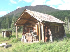
Block
From the record
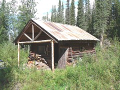
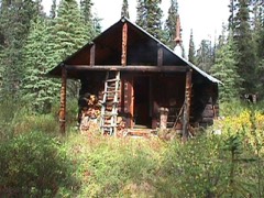
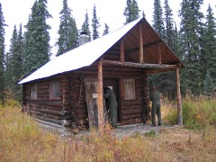
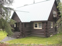
38 National Register listings published here.
Sources: the National Register database, National Park Service
109 topographic sheets cover 15 settlements here, and 38 properties are on the National Register of Historic Places.
38 National Register listings published here.
Sources: the National Register database, National Park Service
Every property in this county listed on the National Register of Historic Places, with the year it was listed and the federal nomination document.
Every wildfire the federal occurrence database records inside this county: 304 of them, burning about 1,321,152 acres. 178 started naturally and 1 was recorded as arson. Each settlement page carries the fires within five miles of it.
| Reported cause | Fires |
|---|---|
| Natural | 178 |
| Missing data/not specified/undetermined | 61 |
| Recreation and ceremony | 15 |
| Debris and open burning | 14 |
| Equipment and vehicle use | 14 |
| Other causes | 7 |
| Power generation/transmission/distribution | 6 |
| Misuse of fire by a minor | 3 |
| Smoking | 2 |
| Railroad operations and maintenance | 2 |
| Fireworks | 1 |
| Arson/incendiarism | 1 |
The five largest, by the area the report gives. None of them was recorded as arson.
| Date | Cause | Size | Reported by | Name on the report |
|---|---|---|---|---|
| 5 June 2019 | Natural | 308,923 acres | Alaska State Office | OLD GROUCH TOP |
| 17 July 2002 | Natural | 117,920 acres | Denali National Park and Preserve | MOOSE LAKE |
| 14 June 2005 | Natural | 114,444 acres | Alaska Fire Service | HIGH POWER |
| 2 August 2009 | Natural | 101,150 acres | Alaska Fire Service | REX CREEK |
| 20 June 2001 | Debris and open burning | 84,730 acres | Alaska Fire Service | FISH CREEK |
| 25 June 2013 | Natural | 62,318 acres | Alaska Fire Service | SANDLESS LAKE |
| 17 June 2009 | Natural | 50,897 acres | Alaska Fire Service | BEAR CREEK |
| 26 June 2019 | Natural | 49,528 acres | Alaska State Office | FORAKER |
Every settlement page carries the fires within five miles of it - see the settlement index below.
The NOAA Storm Events Database holds 10 reports for this county, causing 1 death, no injuries and about $120,000 in recorded property damage. Each settlement page carries the reports that name it.
| Kind of event | Reports |
|---|---|
| Flood | 5 |
| Heavy Rain | 3 |
| Lightning | 1 |
| Funnel Cloud | 1 |
The most serious of them, by death, then injury, then recorded damage. The accounts are quoted exactly as the forecast office filed them.
| When | Event | Place named | Harm | What the report says |
|---|---|---|---|---|
| August 2015 | Heavy Rain | Kantishna | 1 killed | no account filed |
| July 2008 | Flood | Healy | $105,000 | no account filed |
| June 2014 | Flood | Kantishna | $10,000 | no account filed |
| June 2015 | Lightning | Healy | $5,000 | no account filed |
| August 2019 | Flood | Healy | - | Up to 10 inches of rain fell in Denali National Park the first 8 days of Aug 2019. Saturated soils in steep terrain resulted in multiple mudslides that impacted the Denali Park Road. A larger slide on Aug 4th closed the road at MP48 for several hours. Due to the excessive rainfall and rock/mudslides, the NPS took preventative measures and closed the road beyond MP30 Teklanika Rest Area until conditions improved.||Saturated soils combined with over 4 inches of rain the first week of August in Healy caused Dry Creek to rise overbank on Aug 6-7th and resulted in flooding. The flooding washed out several roads, driveways, and the approach to the Tipple Bridge which is used to access infrastructure at the Usibelli Coal Mine. |
| August 2015 | Funnel Cloud | Denali N.P. | - | A possible funnel cloud was photographed around 1130AKST. |
| June 2012 | Heavy Rain | Denali N.P. | - | no account filed |
| June 2012 | Heavy Rain | Healy | - | no account filed |
| September 2012 | Flood | Denali N.P. | - | no account filed |
| August 2008 | Flood | Healy | - | no account filed |
Named settlements recorded in the Geographic Names Information System, each with the topographic sheets covering it. Villages, hamlets and abandoned places alike. Each is shown with the nearest named watercourse or landform and the survey quadrangle it falls on.
Denali census subarea · 99743 · On Bearpaw River · Kantishna River A-2 SE quadrangle
14 sheets, 1948 to 1964
Denali census subarea · 99729 · On Cantwell Creek · Healy B-4 NW quadrangle
15 sheets, 1949 to 1956
Denali census subarea · 99755 · On Hines Creek · Healy C-4 NW quadrangle
17 sheets, 1950 to 1956
Denali census subarea · On Moose Creek · Denali D-2 NW quadrangle
10 sheets, 1952 to 1969
No longer a settlement
Denali census subarea · 99743 · On Walker Creek · Fairbanks A-5 SE quadrangle
20 sheets, 1950 to 1964
Denali census subarea · 99743 · On Walker Creek · Fairbanks A-5 SE quadrangle
20 sheets, 1950 to 1964
Denali census subarea · 99743 · On Antler Creek · Healy D-4 SW quadrangle
15 sheets, 1950 to 1956
Denali census subarea · 99743 · On Healy Creek · Healy D-4 SW quadrangle
15 sheets, 1950 to 1956
Denali census subarea · 99743 · On Eureka Creek · Denali C-2 SW quadrangle
16 sheets, 1952 to 1969
Denali census subarea · 99743 · On Lignite Creek · Healy D-5 NE quadrangle
15 sheets, 1951 to 1956
Denali census subarea · 99743 · On Suntrana Creek · Healy D-4 SW quadrangle
15 sheets, 1950 to 1956
Denali census subarea · 99743 · Near French Gulch · Healy D-4 SW quadrangle
15 sheets, 1950 to 1956
The vanished settlements of Denali Borough: the places named above that are no longer on the map.