 Block
From the record
35 National Register listings published here, 3 of them National Historic Landmarks.
Sources: the National Register database, National Park Service
159 topographic sheets cover 44 settlements here, and 35 properties are on the National Register of Historic Places.
35 National Register listings published here, 3 of them National Historic Landmarks.
Sources: the National Register database, National Park Service
Every property in this county listed on the National Register of Historic Places, with the year it was listed and the federal nomination document.
| Photograph | Property | Type | Listed | Reference |
|---|---|---|---|---|
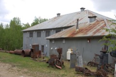 | Chatanika Gold Camp | building | 1979 | 79003753 |
| Chena Building | building | 2024 | 100011138 | |
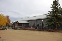 | Chena Pump House | building | 1982 | 82004900 |
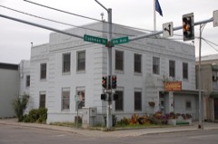 | City Hall, Old | building | 2002 | 02000561 |
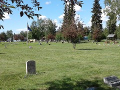 | Clay Street Cemetery (AHRS Site No. FAI-164) | site | 1982 | 82001619 |
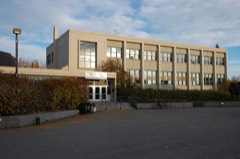 | Constitution Hall | building | 2005 | 05001196 |
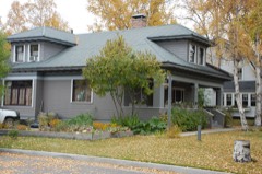 | Mary Lee Davis House | building | 1982 | 82004901 |
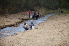 | Discovery Claim on Pedro Creek | site | 1992 | 92000498 |
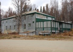 | Ester Camp Historic District | district | 1987 | 87000703 |
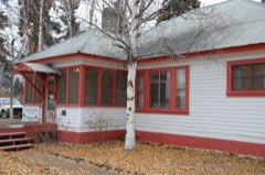 | F. E. Company Housing | district | 1997 | 97000400 |
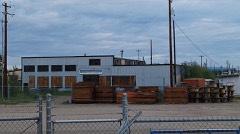 | F. E. Company Machine Shop | building | 1995 | 95001164 |
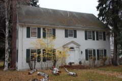 | F. E. Company Manager's House | building | 1996 | 96000095 |
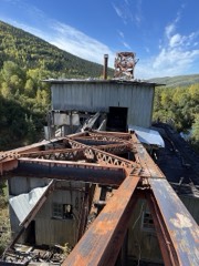 | F.E. Company Dredge No. 2 | structure | 1999 | 99000763 |
| F.E. Company Gold Dredge No. 5 | structure | 2004 | 04000186 | |
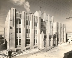 | Federal Building | building | 1978 | 78003422 |
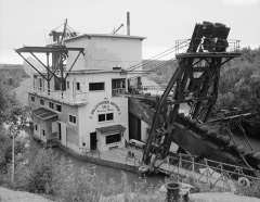 | Goldstream Dredge No. 8 | district | 1984 | 84000637 |
| Gould Cabin | building | 2021 | 100006828 | |
| Growden Memorial Ballpark | site | 2025 | 100011920 | |
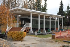 | Harding Railroad Car | structure | 1978 | 78003423 |
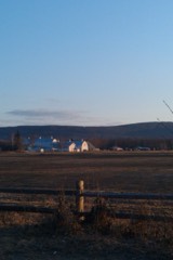 | Hinckley-Creamer Dairy | building | 1977 | 77001572 |
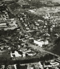 | Illinois Street Historic District | district | 2001 | 01000966 |
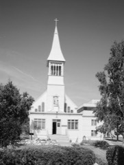 | Immaculate Conception Church | building | 1976 | 76002278 |
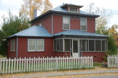 | Falcon Joslin House | building | 1980 | 80004567 |
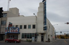 | Lacey Street Theatre | building | 1990 | 90000878 |
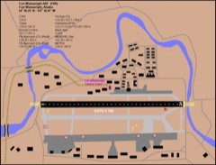 | Ladd Field | district | 1985 | 85002730 |
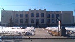 | Main School | building | 1990 | 90001472 |
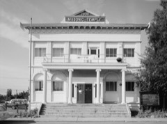 | Masonic Temple | building | 1980 | 80004568 |
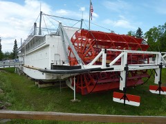 | NENANA (steamer) | structure | 1972 | 72001581 |
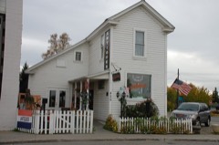 | Oddfellows House | building | 1980 | 80004569 |
| Pike's Landing | site | 2025 | 100011912 | |
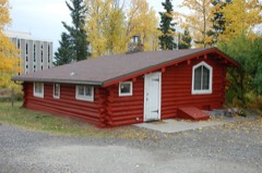 | Rainey's Cabin | building | 1975 | 75002158 |
| Rose Building | building | 1992 | 92000444 | |
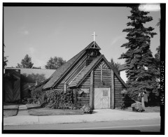 | St. Matthew's Episcopal Church | building | 2016 | 16000001 |
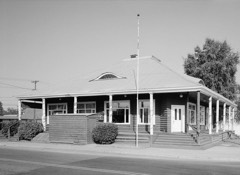 | George C. Thomas Memorial Library | building | 1972 | 72001542 |
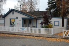 | Wickersham House | building | 1979 | 79003757 |
Every wildfire the federal occurrence database records inside this county: 2,446 of them, burning about 1,260,792 acres. 272 started naturally and 179 were recorded as arson. Each settlement page carries the fires within five miles of it.
| Reported cause | Fires |
|---|---|
| Missing data/not specified/undetermined | 568 |
| Debris and open burning | 466 |
| Natural | 272 |
| Recreation and ceremony | 198 |
| Arson/incendiarism | 179 |
| Power generation/transmission/distribution | 174 |
| Misuse of fire by a minor | 168 |
| Equipment and vehicle use | 105 |
| Other causes | 101 |
| Firearms and explosives use | 94 |
| Smoking | 92 |
| Fireworks | 25 |
| Railroad operations and maintenance | 4 |
The five largest, by the area the report gives. One of them was set deliberately.
| Date | Cause | Size | Reported by | Name on the report |
|---|---|---|---|---|
| 13 June 2004 | Natural | 537,627 acres | Alaska Fire Service | BOUNDARY |
| 12 July 2009 | Natural | 125,382 acres | Alaska Fire Service | WOOD RIVER 1 |
| 20 June 2001 | Missing data/not specified/undetermined | 112,112 acres | Alaska Fire Service | SURVEY LIN |
| 19 June 2013 | Arson/incendiarism | 87,154 acres | Alaska Fire Service | STUART CREEK 2 |
| 23 June 2012 | Natural | 47,154 acres | Alaska Fire Service | DRY CREEK |
| 20 June 2015 | Natural | 37,597 acres | Alaska Fire Service | BLAIR |
| 22 June 2015 | Natural | 31,705 acres | Alaska Fire Service | AGGIE CREEK |
| 17 July 2004 | Natural | 30,408 acres | Fairbanks Area | TORS |
Every settlement page carries the fires within five miles of it - see the settlement index below.
The NOAA Storm Events Database holds 45 reports for this county, causing no deaths, 1 injury and about $1,439,500 in recorded property damage. Each settlement page carries the reports that name it.
| Kind of event | Reports |
|---|---|
| Flood | 35 |
| Thunderstorm Wind | 4 |
| Hail | 4 |
| Heavy Rain | 1 |
| Lightning | 1 |
The most serious of them, by death, then injury, then recorded damage. The accounts are quoted exactly as the forecast office filed them.
| When | Event | Place named | Harm | What the report says |
|---|---|---|---|---|
| June 2023 | Lightning | Chatanika | 1 hurt | Lightning hit a truck causing a barrel of gas in the back to ignite, blowing out the car's window. The driver of the truck sustained facial injures due to the incident. |
| July 2008 | Flood | Eielson Afb | $1,360,000 | no account filed |
| June 2024 | Thunderstorm Wind | North Pole | $20,000 | Thunderstorms moved across the Middle Tanana Valley producing gusty winds to an estimated 50 mph, downing trees and power lines, resulting in power outages to near 4300 people. |
| July 2008 | Flood | Salcha | $20,000 | no account filed |
| July 2002 | Thunderstorm Wind | Fairbanks | $13,000 | no account filed |
| June 2014 | Flood | Chicken | $10,000 | This event is for the Salcha River flooding. |
| June 2014 | Flood | Chatanika | $5,000 | This event is for the Goldstream Creek Flooding. |
| July 2008 | Thunderstorm Wind | College | $5,000 | no account filed |
| June 2014 | Flood | Eielson Afb | $3,000 | This event is for the Salcha River flooding. |
| June 2014 | Flood | Harding Lake | $3,000 | This event is for the Salcha River flooding. |
| April 2009 | Flood | Eielson Afb | $500 | no account filed |
| June 2025 | Hail | Ester | - | Local social media reports from northeast of Fairbanks showed images of significant hail accumulation on the ground. One image did however picture one inch diameter hail near the intersection of Sheep Creek Road and Trilby Avenue. |
| June 2024 | Hail | College | - | Hail an estimated 1 in diameter was reported in the Goldstream Valley north of Fairbanks. |
| July 2023 | Thunderstorm Wind | Eielson Afb | - | Thunderstorms moved near Eielson AFB on the evening of July 24th. These storms knocked down several trees and caused widespread power outages in the Eielson and Salcha areas. |
| December 2022 | Flood | Harding Lake | - | A suspected freeze-up ice jam on the Tanana River near Harding Lake resulted in overflow and flooding along Sewell Drive. Water inundated private property at two residences and a portion of Sewell Drive was flooded. One resident had 5 inches of water in their home. Many personal items and equipment surrounding the residences were partially submerged in the floodwaters. Water slowly receded after peaking on around December 2nd. |
| September 2014 | Flood | North Pole | - | This event is for the Upper Chena River. |
| September 2014 | Flood | Chicken | - | This event is for the Upper Chena River. |
| June 2014 | Flood | Chicken | - | This event is for the the Upper Chena River flooding. |
| June 2014 | Flood | North Pole | - | This event is for the Upper Chena River Flooding. |
| July 2014 | Flood | North Pole | - | This event is for the Little Chena River. |
| July 2014 | Flood | Chicken | - | This event is for the Upper Chena River. |
| July 2014 | Flood | North Pole | - | This event is for the Upper Chena River. |
| July 2016 | Flood | Ester | - | no account filed |
| July 2016 | Flood | North Pole | - | no account filed |
| May 2013 | Flood | Salcha | - | no account filed |
| May 2013 | Flood | Eielson Afb | - | no account filed |
| May 2013 | Flood | Chicken | - | no account filed |
| April 2012 | Flood | Salcha | - | no account filed |
| May 2012 | Heavy Rain | Two Rivers | - | no account filed |
| May 2012 | Flood | Chatanika | - | no account filed |
| April 2012 | Flood | Salcha | - | no account filed |
| May 2011 | Flood | Salcha | - | no account filed |
| June 2010 | Hail | College | - | no account filed |
| June 2010 | Hail | Fairbanks | - | no account filed |
| April 2009 | Flood | Chatanika | - | no account filed |
| April 2009 | Flood | Chatanika | - | no account filed |
| May 2009 | Flood | Chatanika | - | no account filed |
| May 2008 | Flood | Salcha | - | no account filed |
| May 2008 | Flood | Eielson Afb | - | no account filed |
| August 2008 | Flood | Salcha | - | no account filed |
| August 2008 | Flood | Eielson Afb | - | no account filed |
| August 2008 | Flood | Harding Lake | - | no account filed |
| July 2008 | Flood | Chicken | - | no account filed |
| July 2008 | Flood | Two Rivers | - | no account filed |
| July 2008 | Flood | Harding Lake | - | no account filed |
Named settlements recorded in the Geographic Names Information System, each with the topographic sheets covering it. Villages, hamlets and abandoned places alike. Each is shown with the nearest named watercourse or landform and the survey quadrangle it falls on.
Fairbanks North Star census subarea · 99709 · Near Garden Island · Fairbanks D-2 SW quadrangle
30 sheets, 1949 to 1992
Fairbanks North Star census subarea · 99714 · Big Delta B-6 NW quadrangle
21 sheets, 1949 to 1992
Fairbanks North Star census subarea · 99705 · Fairbanks D-2 SE quadrangle
29 sheets, 1949 to 1992
Fairbanks North Star census subarea · 99701 · Near Bentley Island · Fairbanks D-2 SE quadrangle
29 sheets, 1949 to 1992
Fairbanks North Star census subarea · 99705 · Fairbanks C-1 NE quadrangle
23 sheets, 1949 to 1992
Fairbanks North Star census subarea · 99709 · On Cripple Creek · Fairbanks D-2 SW quadrangle
30 sheets, 1949 to 1992
Fairbanks North Star census subarea · 99712 · On Lulu Creek · Livengood A-1 SW quadrangle
22 sheets, 1945 to 1992
Fairbanks North Star census subarea · 99709 · Near Byers Island · Fairbanks D-2 SW quadrangle
30 sheets, 1949 to 1992
No longer a settlement
Fairbanks North Star census subarea · 99712 · Circle A-5 SE quadrangle
17 sheets, 1951 to 1964
Fairbanks North Star census subarea · 99709 · On Ohio Creek · Fairbanks D-3 SW quadrangle
22 sheets, 1949 to 1992
Fairbanks North Star census subarea · 99705 · On Columbia Creek · Fairbanks D-2 SE quadrangle
29 sheets, 1949 to 1992
Fairbanks North Star census subarea · 99712 · On Wolf Creek · Livengood A-1 SW quadrangle
22 sheets, 1945 to 1992
No longer a settlement
Fairbanks North Star census subarea · 99709 · On Pearl Creek · Fairbanks D-2 SW quadrangle
30 sheets, 1949 to 1992
Fairbanks North Star census subarea · 99705 · Near Lakloey Hill · Fairbanks D-2 SE quadrangle
29 sheets, 1949 to 1992
Fairbanks North Star census subarea · 99709 · Fairbanks D-2 NW quadrangle
30 sheets, 1949 to 1992
Fairbanks North Star census subarea · 99712 · On Murray Creek · Livengood A-2 SE quadrangle
23 sheets, 1945 to 1992
No longer a settlement
Fairbanks North Star census subarea · 99712 · On Last Chance Creek · Livengood A-2 SE quadrangle
23 sheets, 1945 to 1992
No longer a settlement
Fairbanks North Star census subarea · 99712 · On Calder Creek · Fairbanks D-2 NE quadrangle
29 sheets, 1949 to 1992
No longer a settlement
Fairbanks North Star census subarea · 99725 · On Ready Bullion Creek · Fairbanks D-3 SE quadrangle
22 sheets, 1949 to 1992
Fairbanks North Star census subarea · 99701 · Near Bentley Island · Fairbanks D-2 SE quadrangle
29 sheets, 1949 to 1992
Fairbanks North Star census subarea · 99712 · On Faith Creek · Circle B-5 SW quadrangle
17 sheets, 1951 to 1964
No longer a settlement
Fairbanks North Star census subarea · 99712 · On Glenn Creek · Fairbanks D-2 NE quadrangle
29 sheets, 1949 to 1992
Fairbanks North Star census subarea · 99712 · On Flume Creek · Fairbanks D-2 NE quadrangle
29 sheets, 1949 to 1992
No longer a settlement
Fairbanks North Star census subarea · 99712 · On Skoogy Creek · Livengood A-1 SW quadrangle
22 sheets, 1945 to 1992
No longer a settlement
Fairbanks North Star census subarea · 99701 · Near Bentley Island · Fairbanks D-2 SE quadrangle
29 sheets, 1949 to 1992
Fairbanks North Star census subarea · 99701 · Near Bentley Island · Fairbanks D-2 SE quadrangle
29 sheets, 1949 to 1992
Fairbanks North Star census subarea · 99714 · Big Delta B-6 NW quadrangle
21 sheets, 1949 to 1992
Fairbanks North Star census subarea · 99705 · On Thirtymile Slough · Fairbanks D-1 SW quadrangle
25 sheets, 1949 to 1992
Fairbanks North Star census subarea · 99701 · On Isabella Creek · Fairbanks D-2 SE quadrangle
29 sheets, 1949 to 1992
Fairbanks North Star census subarea · 99712 · On Alder Creek · Livengood A-1 SE quadrangle
22 sheets, 1945 to 1992
No longer a settlement
Fairbanks North Star census subarea · 99705 · On Garrison Slough · Fairbanks C-1 NE quadrangle
23 sheets, 1949 to 1992
Fairbanks North Star census subarea · 99709 · On Big Eldorado Creek · Fairbanks D-2 NW quadrangle
30 sheets, 1949 to 1992
Fairbanks North Star census subarea · 99705 · On Thirtymile Slough · Fairbanks D-1 SW quadrangle
25 sheets, 1949 to 1992
Fairbanks North Star census subarea · 99712 · On Little Eldorado Creek · Livengood A-2 SE quadrangle
23 sheets, 1945 to 1992
Fairbanks North Star census subarea · 99712 · On Flume Creek · Livengood A-2 SE quadrangle
23 sheets, 1945 to 1992
No longer a settlement
Fairbanks North Star census subarea · 99712 · Big Delta D-6 NW quadrangle
17 sheets, 1950 to 1992
Fairbanks North Star census subarea · 99714 · On Banner Creek · Big Delta B-5 SW quadrangle
17 sheets, 1949 to 1958
Fairbanks North Star census subarea · 99701 · On Isabella Creek · Fairbanks D-2 SE quadrangle
29 sheets, 1949 to 1992
Fairbanks North Star census subarea · 99701 · Near Bentley Island · Fairbanks D-2 SE quadrangle
29 sheets, 1949 to 1992
Fairbanks North Star census subarea · 99760 · On Standard Creek · Fairbanks D-4 SE quadrangle
21 sheets, 1949 to 1964
Fairbanks North Star census subarea · 99709 · On Pearl Creek · Fairbanks D-2 SW quadrangle
30 sheets, 1949 to 1992
Fairbanks North Star census subarea · 99712 · Fairbanks D-1 SE quadrangle
23 sheets, 1949 to 1992
Fairbanks North Star census subarea · 99712 · On Treasure Creek · Livengood A-2 SE quadrangle
23 sheets, 1945 to 1992
No longer a settlement
Fairbanks North Star census subarea · 99709 · On Noyes Slough · Fairbanks D-2 SW quadrangle
30 sheets, 1949 to 1992
The vanished settlements of Fairbanks North Star Borough: the places named above that are no longer on the map.