 Block
From the record
19 National Register listings published here.
Sources: the National Register database, National Park Service
110 topographic sheets cover 25 settlements here, and 19 properties are on the National Register of Historic Places.
19 National Register listings published here.
Sources: the National Register database, National Park Service
Every property in this county listed on the National Register of Historic Places, with the year it was listed and the federal nomination document.
| Photograph | Property | Type | Listed | Reference |
|---|---|---|---|---|
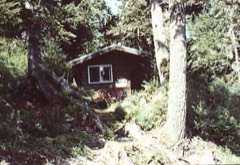 | Alexander Lake Shelter Cabin | building | 1995 | 95001296 |
| Beaver Lake Dam | structure | 1995 | 95001295 | |
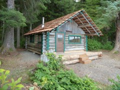 | Big Shaheen Cabin | building | 1995 | 95001292 |
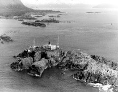 | Cape Spencer Lighthouse | structure | 1975 | 75002160 |
| Davidson Lake Shelter Cabin | building | 1995 | 95001303 | |
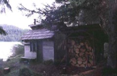 | Distin Lake Shelter Cabin | building | 1995 | 95001294 |
| Hasselborg Lake East Shelter Cabin | building | 1995 | 95001308 | |
| Hasselborg Lake North Shelter Cabin | building | 1995 | 95001307 | |
| Hasselborg Lake South Shelter Cabin | building | 1995 | 95001300 | |
| Lake Guerin East Shelter Cabin | building | 1995 | 95001306 | |
| Lake Guerin West Shelter Cabin | building | 1995 | 95001301 | |
| Mitchell Bay Shelter Cabin | building | 1995 | 95001302 | |
| Mole Harbor Shelter Cabin | building | 1995 | 95001297 | |
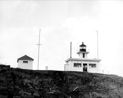 | Point Retreat Light Station | district | 2003 | 03000529 |
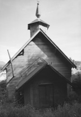 | St. John the Baptist Church | building | 1980 | 80004589 |
| Thayer Lake East Shelter Cabin | site | 1995 | 95001309 | |
| Thayer Lake North Shelter Cabin | building | 1995 | 95001304 | |
| Thayer Lake South Shelter Cabin | building | 1995 | 95001298 | |
| Windfall Harbor Shelter Cabin | building | 1995 | 95001299 |
Every wildfire the federal occurrence database records inside this county: 79 of them, burning about 57 acres. 1 started naturally and 1 was recorded as arson. Each settlement page carries the fires within five miles of it.
| Reported cause | Fires |
|---|---|
| Recreation and ceremony | 47 |
| Debris and open burning | 13 |
| Missing data/not specified/undetermined | 5 |
| Smoking | 5 |
| Other causes | 3 |
| Equipment and vehicle use | 2 |
| Natural | 1 |
| Fireworks | 1 |
| Firearms and explosives use | 1 |
| Arson/incendiarism | 1 |
The five largest, by the area the report gives. None of them was recorded as arson.
| Date | Cause | Size | Reported by | Name on the report |
|---|---|---|---|---|
| 18 August 1993 | Missing data/not specified/undetermined | 27 acres | Tongass National Forest | not named |
| 10 May 1996 | Recreation and ceremony | 5.0 acres | Tongass National Forest | 8 MILE |
| 6 July 2009 | Debris and open burning | 5.0 acres | Tongass National Forest | COUNTRY INN |
| 19 July 1993 | Missing data/not specified/undetermined | 2.0 acres | Tongass National Forest | not named |
| 27 April 1995 | Recreation and ceremony | 2.0 acres | Tongass National Forest | not named |
| 11 May 1996 | Debris and open burning | 2.0 acres | Tongass National Forest | BAYVIEW |
| 9 June 2007 | Debris and open burning | 1.0 acres | Tongass National Forest | DALTON SUBDIVISION |
| 28 June 1993 | Recreation and ceremony | 1.0 acres | Tongass National Forest | not named |
Every settlement page carries the fires within five miles of it - see the settlement index below.
The NOAA Storm Events Database holds 2 reports for this county, causing no deaths, no injuries and about $924,000 in recorded property damage. Each settlement page carries the reports that name it.
| Kind of event | Reports |
|---|---|
| Flood | 2 |
The most serious of them, by death, then injury, then recorded damage. The accounts are quoted exactly as the forecast office filed them.
| When | Event | Place named | Harm | What the report says |
|---|---|---|---|---|
| December 2020 | Flood | Hoonah | $674,000 | As the atmospheric river moved over the Hoonah and Tenakee Springs area in the early morning hours of December 1st through mid morning of December 2nd it produced significant amount of precipitation. In the first 12 hours of the event 2.5 of precipitation fell with some of that falling as snow at higher elevations. More warm and moist air moved over the region into the evening hours of the 1st and persisted into the early morning of the 2nd. More heavy precipitation fell through this time frame and produces significant runoff as the ground was totally saturated as well as runoff from snowmelt. The Hoonah COOP observer reported 4.70 on December 2nd a all time daily precipitation record and a 50 to 100 year event. It was also a 2 day all time precipitation record of 7.18 for December 1st and 2nd which is a 200 to 500 year event. At the Hoonah RAWS weather station, close to Tenakee Springs, it reported 6.9 in 24 hours and 8.74 in 48 hours which are both a 100-200 year event. During the heaviest precipitation of the event, the evening of December 1st, 3.7 in 12hrs was reported at the Hoonah RAWS with is a 10-25 year event. All of this heavy rainfall along with snowmelt overwhelmed the water treatment plant in Hoonah and damaged the system from debris from the runoff. Also there was extensive damage to roads and culverts from large amount of erosion and debris on roadways. From these impacts a disaster declaration was issued. |
| December 2020 | Flood | Gustavus | $250,000 | The atmospheric river moved over the Glacier Bay area and Gustavus in the early morning hours of December 1st and persisted through the late evening hours of December 2nd. Heavy to moderate rainfall persisted over 36 hours with the highest amounts coming during the overnight hours going into December 2nd. In the first 12 hours of the event, 2.16 of precipitation fell which is a 5 to 10 year event, some of that precipitation did fall as snow at higher elevations. There was a few inches of snow at sea level but that quickly melted. More warm and moist air moved over the region into the evening hours of the 1st and persisted into the early morning of the 2nd. More heavy precipitation fell through this time frame and produces significant runoff as the ground was totally saturated as well as runoff from snowmelt. Precipitation totals were as high as 7.25 for the event from early December 1st through the early morning hours of December 3rd which is a 200 year event. The 24 hour precipitation amount reported at the Gustavus CRN site on December 1st was 3.76 which is a 10 to 25 year event. The 48 hour precipitation amount from Bartlett Cove in Glacier Bay National Park was 6.43 and Gustavus CRN reported 5.69 which is a 50-100 year event for both sites. The magnitude of the precipitation and snowmelt overwhelmed culverts and produced record water level on the Salmon River. Roads located near the Salmon River were flooded with up to 4 feet in places as wind fall in the river directed high water into the gravel pits and into the road systems of Gustavus. The hardest hit areas were Rink Creek Rd, Wilson Rd, Toad Rd along with areas near the Salmon River. The Salmon River began to rise rapidly through the morning hours of December 1st from the first batch of heavy rainfall. The water levels continued on a steep upward trend through the morning hours of December 2nd as it crested at 17.26 feet for a total rise of over 7 feet from the extreme amount of precipitation. This was a record stage for this site which was installed by the USGS in 2014. Flooding persisted for days after the heavy rain relaxed as it took awhile for the water levels to recede from the saturated sandy soils. The city declared a disaster declaration as homes were damaged from flooding along with road infrastructure damage. |
Named settlements recorded in the Geographic Names Information System, each with the topographic sheets covering it. Villages, hamlets and abandoned places alike. Each is shown with the nearest named watercourse or landform and the survey quadrangle it falls on.
Hoonah-Angoon census subarea · 99820 · Near Village Rock · Sitka C-2 SW quadrangle
15 sheets, 1948 to 1964
Hoonah-Angoon census subarea · Near Lester Island · Juneau B-6 NW quadrangle
15 sheets, 1948 to 1962
Hoonah-Angoon census subarea · 99825 · Mount Fairweather A-2 NE quadrangle
9 sheets, 1948 to 1961
Hoonah-Angoon census subarea · Near East Redcliff Island · Sitka D-4 NE quadrangle
15 sheets, 1948 to 1997
Hoonah-Angoon census subarea · Near Star Rock · Juneau B-3 SW quadrangle
18 sheets, 1947 to 1996
Hoonah-Angoon census subarea · 99826 · On Salmon River · Juneau B-6 NE quadrangle
15 sheets, 1948 to 1962
Hoonah-Angoon census subarea · 99820 · Sitka B-2 NE quadrangle
15 sheets, 1948 to 2000
No longer a settlement
Hoonah-Angoon census subarea · 99829 · Near Pitt Island · Juneau A-5 SE quadrangle
18 sheets, 1951 to 1994
Hoonah-Angoon census subarea · 99820 · Near Table Island · Sitka B-2 NW quadrangle
15 sheets, 1948 to 2000
No longer a settlement
Hoonah-Angoon census subarea · 99841 · Near Harry Island · Juneau A-5 NW quadrangle
18 sheets, 1951 to 1994
No longer a settlement
Hoonah-Angoon census subarea · 99832 · On Pelican Creek · Sitka D-7 NW quadrangle
18 sheets, 1951 to 1997
Hoonah-Angoon census subarea · 99832 · On Cann Creek · Sitka D-7 NW quadrangle
18 sheets, 1951 to 1997
Hoonah-Angoon census subarea · 99841 · Near Grave Island · Sitka D-4 SW quadrangle
15 sheets, 1948 to 1997
Hoonah-Angoon census subarea · Near Zip Rock · Mount Fairweather A-2 NW quadrangle
9 sheets, 1948 to 1961
No longer a settlement
Hoonah-Angoon census subarea · 99820 · Sitka A-2 SW quadrangle
15 sheets, 1948 to 1964
No longer a settlement
Hoonah-Angoon census subarea · 99829 · Juneau A-5 SE quadrangle
18 sheets, 1951 to 1994
The vanished settlements of Hoonah-Angoon Census Area: the places named above that are no longer on the map.