 Block
From the record
14 National Register listings published here.
Sources: the National Register database, National Park Service
117 topographic sheets cover 35 settlements here, and 14 properties are on the National Register of Historic Places.
14 National Register listings published here.
Sources: the National Register database, National Park Service
Every property in this county listed on the National Register of Historic Places, with the year it was listed and the federal nomination document.
| Photograph | Property | Type | Listed | Reference |
|---|---|---|---|---|
| Aniakchak Bay Historic Landscape District | district | 1997 | 97000016 | |
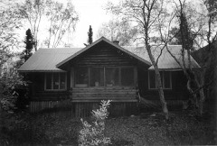 | Dr. Elmer Bly House | building | 2006 | 06000240 |
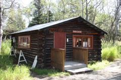 | Brooks Camp Boat House | building | 2010 | 10000071 |
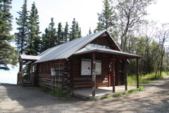 | Brooks River Historic Ranger Station | building | 2010 | 10000072 |
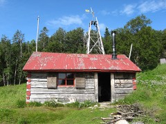 | Fure's Cabin | building | 1985 | 85000187 |
| Jay and Bella Hammond Homestead | district | 2018 | 100002107 | |
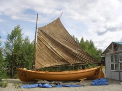 | LIBBY'S NO. 23 (bristol bay double ender) | structure | 2013 | 13000379 |
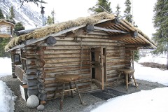 | Richard Proenneke Site | district | 2007 | 06000241 |
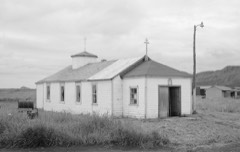 | St. John the Theologian Church | building | 1980 | 80000741 |
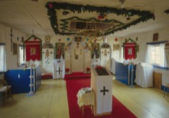 | St. Nicholas Chapel | building | 1980 | 80000751 |
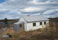 | St. Nicholas Chapel | building | 1980 | 80004579 |
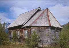 | St. Nicholas Chapel | building | 1980 | 80000753 |
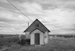 | St. Nicholas Church | building | 1980 | 80000754 |
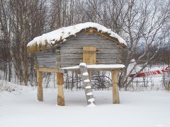 | Wassillie Trefon Dena'ina Fish Cache | structure | 2013 | 13000348 |
Every wildfire the federal occurrence database records inside this county: 81 of them, burning about 53,167 acres. 34 started naturally and none was recorded as arson. Each settlement page carries the fires within five miles of it.
| Reported cause | Fires |
|---|---|
| Natural | 34 |
| Recreation and ceremony | 14 |
| Debris and open burning | 14 |
| Missing data/not specified/undetermined | 12 |
| Smoking | 3 |
| Other causes | 2 |
| Equipment and vehicle use | 1 |
| Misuse of fire by a minor | 1 |
The five largest, by the area the report gives. None of them was recorded as arson.
| Date | Cause | Size | Reported by | Name on the report |
|---|---|---|---|---|
| 19 June 2013 | Natural | 12,853 acres | Alaska Fire Service | NIKUBUMA LAKE |
| 18 August 2019 | Natural | 9,345 acres | Alaska State Office | LEVELOCK |
| 8 July 2019 | Natural | 5,961 acres | Alaska State Office | PETE ANDREWS CREEK |
| 23 May 2003 | Debris and open burning | 5,460 acres | Alaska Fire Service | ILIAMNA |
| 29 May 2005 | Missing data/not specified/undetermined | 4,827 acres | Alaska Fire Service | PILOT POIN |
| 18 August 2019 | Missing data/not specified/undetermined | 2,733 acres | Southwest Area | OFFAL BEACH |
| 19 June 2013 | Natural | 2,447 acres | Southwest Area | CHULITNA |
| 26 June 2013 | Natural | 1,868 acres | Alaska Fire Service | CURRANT CREEK |
Every settlement page carries the fires within five miles of it - see the settlement index below.
The NOAA Storm Events Database holds 2 reports for this county, causing no deaths, no injuries and about $705,000 in recorded property damage. Each settlement page carries the reports that name it.
| Kind of event | Reports |
|---|---|
| Flood | 2 |
The most serious of them, by death, then injury, then recorded damage. The accounts are quoted exactly as the forecast office filed them.
| When | Event | Place named | Harm | What the report says |
|---|---|---|---|---|
| December 2007 | Flood | Chignik Lake | $700,000 | Heavy rain overnight November 30th into the morning of December 1st produced local flooding in Chignik. |
| October 2016 | Flood | Perryville | $5,000 | Several days of heavy rain caused the waters of Indian Creek in the City of Chignik to rise to bankfull for several days. This prolonged high-water condition led to scour along the abutments and resulted in compromise of the structural integrity of the municipal vehicle bridge as well as the pedestrian bridge in town. |
Named settlements recorded in the Geographic Names Information System, each with the topographic sheets covering it. Villages, hamlets and abandoned places alike. Each is shown with the nearest named watercourse or landform and the survey quadrangle it falls on.
Lake and Peninsula census subarea · 99647 · Iliamna D-4 SW quadrangle
13 sheets, 1952 to 1957
No longer a settlement
Lake and Peninsula census subarea · 99565 · Near Chignik Flats · Chignik B-2 SW quadrangle
5 sheets, 1963
Lake and Peninsula census subarea · On Tazimina River · Iliamna D-5 NW quadrangle
13 sheets, 1952 to 1957
Lake and Peninsula census subarea · On Hallersville Creek · Dillingham A-3 SE quadrangle
6 sheets, 1951 to 1954
Lake and Peninsula census subarea · On Chekok Creek · Iliamna D-4 SW quadrangle
13 sheets, 1952 to 1957
No longer a settlement
Lake and Peninsula census subarea · 99613 · Iliamna B-8 SW quadrangle
12 sheets, 1952 to 1957
Lake and Peninsula census subarea · 99606 · Iliamna D-6 SE quadrangle
12 sheets, 1952 to 1957
Lake and Peninsula census subarea · 99695 · Stepovak Bay D-5 NE quadrangle
7 sheets, 1951 to 1969
Lake and Peninsula census subarea · Iliamna B-5 NE quadrangle
14 sheets, 1951 to 1957
No longer a settlement
Lake and Peninsula census subarea · Chignik B-1 NW quadrangle
5 sheets, 1963
No longer a settlement
Lake and Peninsula census subarea · On Kijik River · Lake Clark B-4 SE quadrangle
9 sheets, 1946 to 1958
No longer a settlement
Lake and Peninsula census subarea · 99606 · Iliamna B-5 NW quadrangle
14 sheets, 1951 to 1957
Lake and Peninsula census subarea · 99625 · On Levelock Creek · Dillingham A-3 SE quadrangle
6 sheets, 1951 to 1954
Lake and Peninsula census subarea · Stepovak Bay D-3 NE quadrangle
7 sheets, 1951 to 1969
No longer a settlement
Lake and Peninsula census subarea · On Sea Gull Creek · Naknek D-4 NE quadrangle
14 sheets, 1952 to 1964
Lake and Peninsula census subarea · 99613 · Iliamna B-5 NW quadrangle
14 sheets, 1951 to 1957
No longer a settlement
Lake and Peninsula census subarea · Mount Katmai C-3 SW quadrangle
16 sheets, 1948 to 1964
No longer a settlement
Lake and Peninsula census subarea · 99606 · On Newhalen River · Iliamna C-6 NE quadrangle
13 sheets, 1952 to 1957
Lake and Peninsula census subarea · 99640 · On Tazimina River · Iliamna D-5 NW quadrangle
13 sheets, 1952 to 1957
Lake and Peninsula census subarea · On Chinkelyes Creek · Iliamna C-3 NE quadrangle
13 sheets, 1952 to 1957
Lake and Peninsula census subarea · 99647 · Iliamna D-3 SW quadrangle
13 sheets, 1952 to 1957
Lake and Peninsula census subarea · 99648 · Stepovak Bay D-4 NE quadrangle
7 sheets, 1951 to 1969
Lake and Peninsula census subarea · 99647 · Iliamna D-3 SE quadrangle
13 sheets, 1952 to 1957
Lake and Peninsula census subarea · 99649 · Ugashik C-5 SW quadrangle
11 sheets, 1943 to 1963
Lake and Peninsula census subarea · 99653 · On Tanalian River · Lake Clark A-4 NW quadrangle
10 sheets, 1946 to 1958
Lake and Peninsula census subarea · On Savonoski River · Mount Katmai C-4 SW quadrangle
15 sheets, 1948 to 1964
No longer a settlement
Lake and Peninsula census subarea · Near Dog Island · Iliamna D-5 SW quadrangle
13 sheets, 1952 to 1957
Lake and Peninsula census subarea · 99649 · Ugashik C-5 SE quadrangle
11 sheets, 1943 to 1963
The vanished settlements of Lake and Peninsula Borough: the places named above that are no longer on the map.