 Block
From the record
8 National Register listings published here, 1 of them a National Historic Landmark.
Sources: the National Register database, National Park Service
159 topographic sheets cover 51 settlements here, and 8 properties are on the National Register of Historic Places.
8 National Register listings published here, 1 of them a National Historic Landmark.
Sources: the National Register database, National Park Service
Every property in this county listed on the National Register of Historic Places, with the year it was listed and the federal nomination document.
| Photograph | Property | Type | Listed | Reference |
|---|---|---|---|---|
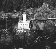 | Cape Decision Light Station | district | 2005 | 04001568 |
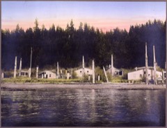 | Chief Son-I-Hat's Whale House and Totems Historic District | district | 2002 | 02000627 |
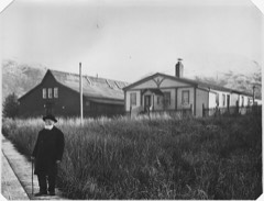 | Father William Duncan House | building | 1972 | 72001582 |
| Karl Hansen House | building | 2023 | 100009304 | |
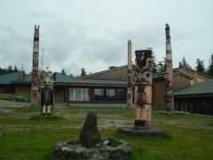 | Hydaburg Totem Park | district | 2006 | 06000491 |
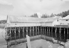 | Kake Cannery | district | 1997 | 97001677 |
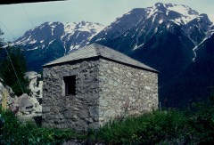 | Storehouse No. 4 | building | 1976 | 76002280 |
| Wolf Creek Boatworks Historic District | district | 2025 | 100011911 |
Every wildfire the federal occurrence database records inside this county: 121 of them, burning about 380 acres. 4 started naturally and 1 was recorded as arson. Each settlement page carries the fires within five miles of it.
| Reported cause | Fires |
|---|---|
| Recreation and ceremony | 59 |
| Debris and open burning | 22 |
| Missing data/not specified/undetermined | 15 |
| Equipment and vehicle use | 9 |
| Fireworks | 6 |
| Natural | 4 |
| Smoking | 2 |
| Misuse of fire by a minor | 2 |
| Arson/incendiarism | 1 |
| Power generation/transmission/distribution | 1 |
The five largest, by the area the report gives. None of them was recorded as arson.
| Date | Cause | Size | Reported by | Name on the report |
|---|---|---|---|---|
| 28 May 1993 | Equipment and vehicle use | 127 acres | Tongass National Forest | not named |
| 2 July 1998 | Missing data/not specified/undetermined | 118 acres | Tongass National Forest | MILL |
| 19 May 1997 | Debris and open burning | 46 acres | Tongass National Forest | COPPER MOUNTAIN |
| 20 July 1993 | Missing data/not specified/undetermined | 30 acres | Tongass National Forest | not named |
| 4 August 1996 | Missing data/not specified/undetermined | 10 acres | Tongass National Forest | NOSSUK |
| 3 June 2000 | Equipment and vehicle use | 8.0 acres | Tongass National Forest | BORDER |
| 23 September 1995 | Recreation and ceremony | 4.0 acres | Tongass National Forest | not named |
| 2 April 2002 | Recreation and ceremony | 4.0 acres | Tongass National Forest | APRIL FOOLS |
Every settlement page carries the fires within five miles of it - see the settlement index below.
The NOAA Storm Events Database holds 4 reports for this county, causing no deaths, no injuries and about $5,091,000 in recorded property damage. Each settlement page carries the reports that name it.
| Kind of event | Reports |
|---|---|
| Debris Flow | 4 |
The most serious of them, by death, then injury, then recorded damage. The accounts are quoted exactly as the forecast office filed them.
| When | Event | Place named | Harm | What the report says |
|---|---|---|---|---|
| October 2020 | Debris Flow | Craig | $4,340,000 | A very strong atmospheric river moved over western Prince of Wales and impacted areas around Craig, Klawock, Hollis, Black Bear Creek, Shaheen Creek and Staney Creek. The Klawock airport reported 3.60 of rain in 24 hours and was the 4th highest daily amount on record. Most of the rainfall fell in a short period of time and it was very exceptional from 600 AKST to 1300 AKST. The 1 hour amount of 0.74 was a 100 year return period. The 6 hour amount of 2.13 was a 25 year return period and the 12 hour amount of 3.42 was a 25 to 50 year return period. All the rainfall produced widespread debris flows that blocked roadways on forest services roads, main highways near Black Bear Creek, between Klawock and Hollis, and Port Saint Nicholas road near Craig. There was so much runoff along with debris in the water that the Klawock water treatment plant was shut down as the reservoir was overflowing and debris clogged the intake pipes. Residence were put on a water boiling notice for a time. The city of Craig declared a disaster declaration after this event. |
| November 2023 | Debris Flow | Klawock | $551,000 | Reports began coming in of landslides near the Klawock airport, close to Black Bear Creek, and near Craig in the mid morning hours of November 20th. As the day progressed, more landslides were reported across Prince of Wales Island, including along the Hollis Highway, near Hydaburg, and along Port Saint Nicholas Road. In Coffman Cove, roads were reported to be washed out, and a landslide blocked the road leading to Luck Lake. Some homes were impacted, but for the most part the landslides blocked roadways and impacted travel.||In addition to the heavy rain, the maximum sustained wind measured at the Kasaan FAA webcam was 51 mph at 350pm, a peak wind gust of 59 mph measured at the Thorne River RAWS at 554pm, and peak gusts of 55 mph were measured at Craig and Klawock between 4-6pm. At 5pm there was a report of power poles snapped in half in Hydaburg followed by a report of roofs blown off and flying debris in the same community at 631pm. There were other reports of trees down across the island and the local ferry service to Ketchikan was cancelled. |
| November 2020 | Debris Flow | Craig | $200,000 | It had been very wet in the area with 3 to 5 inches of rain over the 3 previous days. Heavy rain from an atmospheric river moved over western Prince of Wales Island on November 1 and persisted into the morning of November 2 with an additional 3 to 5 inches of rainfall. Rain rates ranged from 0.30 to 0.40 inches per hour. The heavy rain along with the already saturated soils increased the risk of debris flow near steep terrain. A debris flow was initiated above Port St. Nicholas road and blocked the single lane road to a subdivision with mud, trees and other debris. This blocked the road going to Craig, the main town in the area. |
| December 2020 | Debris Flow | Hyder | - | Significant snow fell on the days leading up to December 1 and 2 with about 35 inches at sea level with much more at higher elevations. As the temperatures warm through December 2nd heavy rain fell on the snowpack to increase runoff and slope instability. There were multiple debris flows and avalanches that isolated Hyder Alaska with Stewart British Columbia Canada by blocking the only road connecting the communities for 2 days. Hyder was also without power. |
Named settlements recorded in the Geographic Names Information System, each with the topographic sheets covering it. Villages, hamlets and abandoned places alike. Each is shown with the nearest named watercourse or landform and the survey quadrangle it falls on.
Metlakatla Indian Community census subarea · 99926 · Ketchikan A-5 SW quadrangle
10 sheets, 1952 to 1955
Prince of Wales census subarea · 99921 · On Marble Creek · Petersburg A-5 NE quadrangle
15 sheets, 1949 to 1995
No longer a settlement
Prince of Wales census subarea · 99921 · Craig A-1 NW quadrangle
8 sheets, 1948 to 1997
No longer a settlement
Prince of Wales census subarea · 99918 · On Dog Creek · Petersburg A-3 SE quadrangle
14 sheets, 1949 to 1994
Prince of Wales census subarea · 99921 · Craig A-2 NW quadrangle
8 sheets, 1948 to 1996
No longer a settlement
Prince of Wales census subarea · 99921 · On Reynolds Creek · Craig A-2 NW quadrangle
8 sheets, 1948 to 1996
No longer a settlement
Prince of Wales census subarea · 99921 · On Craig Island · Craig B-4 NE quadrangle
8 sheets, 1949 to 1957
Prince of Wales census subarea · 99921 · On Sarkar Creek · Craig D-4 NW quadrangle
9 sheets, 1949 to 1994
No longer a settlement
Prince of Wales census subarea · 99921 · On John Creek · Craig A-1 NE quadrangle
8 sheets, 1948 to 1997
No longer a settlement
Prince of Wales census subarea · 99921 · On Charley Creek · Craig D-5 NW quadrangle
9 sheets, 1951 to 1996
Prince of Wales census subarea · On Grindall Island · Craig B-1 NE quadrangle
7 sheets, 1949 to 1957
No longer a settlement
Prince of Wales census subarea · Near Mount Andrew · Craig C-1 SW quadrangle
9 sheets, 1950 to 1957
No longer a settlement
Prince of Wales census subarea · 99921 · On Hetta Creek · Craig A-2 NW quadrangle
8 sheets, 1948 to 1996
No longer a settlement
Prince of Wales census subarea · 99921 · Petersburg A-5 SE quadrangle
15 sheets, 1949 to 1995
No longer a settlement
Prince of Wales census subarea · 99921 · On Flagstaff Creek · Craig C-2 SW quadrangle
9 sheets, 1949 to 1994
Prince of Wales census subarea · 99921 · On Maybeso Creek · Craig B-3 NE quadrangle
8 sheets, 1949 to 1957
No longer a settlement
Prince of Wales census subarea · Near Channel Islands · Dixon Entrance D-3 SE quadrangle
8 sheets, 1948 to 1959
No longer a settlement
Prince of Wales census subarea · 99922 · On Hydaburg River · Craig A-3 NE quadrangle
8 sheets, 1948 to 1997
Hyder census subarea · 99923 · On Salmon River · Ketchikan D-1 NE quadrangle
9 sheets, 1952 to 1955
Prince of Wales census subarea · On Karheen Creek · Craig D-4 SW quadrangle
9 sheets, 1949 to 1994
No longer a settlement
Prince of Wales census subarea · 99919 · On Linkum Creek · Craig C-2 SE quadrangle
9 sheets, 1949 to 1994
Prince of Wales census subarea · 99925 · On Klawock Island · Craig C-4 SE quadrangle
10 sheets, 1949 to 1957
Prince of Wales census subarea · 99921 · Near Grass Rock · Dixon Entrance D-2 NE quadrangle
7 sheets, 1948 to 1959
No longer a settlement
Prince of Wales census subarea · Petersburg B-5 SW quadrangle
14 sheets, 1949 to 1995
Prince of Wales census subarea · On Lake Bay Creek · Petersburg A-3 SW quadrangle
14 sheets, 1949 to 1994
Prince of Wales census subarea · On Lake Bay Creek · Petersburg A-3 SW quadrangle
14 sheets, 1949 to 1994
No longer a settlement
Prince of Wales census subarea · Dixon Entrance D-3 NE quadrangle
8 sheets, 1948 to 1959
Metlakatla Indian Community census subarea · 99926 · Near Scrub Island · Ketchikan A-5 NW quadrangle
10 sheets, 1952 to 1955
Prince of Wales census subarea · 99921 · Near Klinau Island · Craig D-4 SW quadrangle
9 sheets, 1949 to 1994
Prince of Wales census subarea · Near El Capitan Island · Craig D-4 NW quadrangle
9 sheets, 1949 to 1994
Prince of Wales census subarea · 99921 · On Myrtle Creek · Craig A-1 SE quadrangle
8 sheets, 1948 to 1997
No longer a settlement
Prince of Wales census subarea · 99921 · On Monument Creek · Craig B-2 NE quadrangle
9 sheets, 1949 to 1997
Prince of Wales census subarea · 99927 · Near False Island · Petersburg B-5 SW quadrangle
14 sheets, 1949 to 1995
Prince of Wales census subarea · 99836 · Port Alexander A-2 NW quadrangle
12 sheets, 1948 to 1964
Prince of Wales census subarea · 99927 · Near Jackson Island · Petersburg B-5 SW quadrangle
14 sheets, 1949 to 1995
Prince of Wales census subarea · 99830 · Port Alexander C-1 NW quadrangle
15 sheets, 1948 to 1997
Prince of Wales census subarea · 99921 · Craig A-3 NE quadrangle
8 sheets, 1948 to 1997
No longer a settlement
Prince of Wales census subarea · 99921 · On Beaver Creek · Craig B-2 SW quadrangle
9 sheets, 1949 to 1997
No longer a settlement
Prince of Wales census subarea · 99919 · On Deer Creek · Craig C-2 NW quadrangle
9 sheets, 1949 to 1994
Prince of Wales census subarea · 99919 · On Thorne River · Craig C-2 NW quadrangle
9 sheets, 1949 to 1994
No longer a settlement
On Tongass Island · Prince Rupert D-3 SE quadrangle
9 sheets, 1951 to 1964
No longer a settlement
Prince of Wales census subarea · 99921 · Near Village Rock · Craig D-4 NW quadrangle
9 sheets, 1949 to 1994
No longer a settlement
Prince of Wales census subarea · 99921 · On Big Creek · Petersburg A-4 SE quadrangle
14 sheets, 1949 to 1994
The vanished settlements of Prince of Wales-Hyder Census Area: the places named above that are no longer on the map.