 Block
From the record
10 National Register listings published here, 1 of them a National Historic Landmark.
Sources: the National Register database, National Park Service
151 topographic sheets cover 29 settlements here, and 10 properties are on the National Register of Historic Places.
10 National Register listings published here, 1 of them a National Historic Landmark.
Sources: the National Register database, National Park Service
Every property in this county listed on the National Register of Historic Places, with the year it was listed and the federal nomination document.
| Photograph | Property | Type | Listed | Reference |
|---|---|---|---|---|
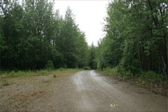 | Alaska-Canada Military Highway (Segment) | structure | 2013 | 13000543 |
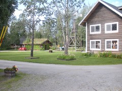 | Big Delta Historic District | district | 1991 | 91000252 |
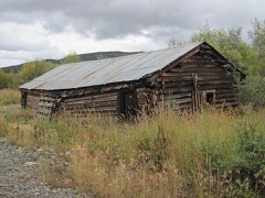 | Chicken Historic District | district | 2001 | 01001053 |
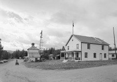 | Eagle Historic District | district | 1970 | 70000919 |
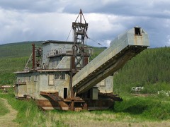 | F.E. Company Dredge No. 4 | structure | 2006 | 06000435 |
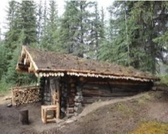 | Kink, The | site | 1975 | 75002161 |
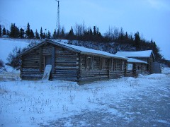 | Rapids Roadhouse | building | 2001 | 01000021 |
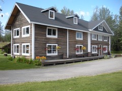 | Rika's Landing Roadhouse | building | 1976 | 76000364 |
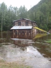 | Steele Creek Roadhouse | building | 1980 | 80004576 |
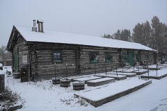 | Sullivan Roadhouse | site | 1979 | 79003756 |
Every wildfire the federal occurrence database records inside this county: 1,567 of them, burning about 3,654,408 acres. 431 started naturally and 90 were recorded as arson. Each settlement page carries the fires within five miles of it.
| Reported cause | Fires |
|---|---|
| Natural | 431 |
| Debris and open burning | 330 |
| Missing data/not specified/undetermined | 278 |
| Recreation and ceremony | 189 |
| Arson/incendiarism | 90 |
| Power generation/transmission/distribution | 66 |
| Firearms and explosives use | 57 |
| Equipment and vehicle use | 55 |
| Other causes | 32 |
| Misuse of fire by a minor | 25 |
| Fireworks | 9 |
| Smoking | 5 |
The five largest, by the area the report gives. None of them was recorded as arson.
| Date | Cause | Size | Reported by | Name on the report |
|---|---|---|---|---|
| 18 June 2004 | Natural | 463,994 acres | Alaska Fire Service | BILLY CK |
| 15 June 2004 | Natural | 320,155 acres | Alaska Fire Service | CHICKEN 1 |
| 21 June 2004 | Natural | 284,595 acres | Alaska Fire Service | PORCUPINE |
| 23 June 2004 | Natural | 175,815 acres | Delta Area | CAMP CREEK |
| 17 June 2004 | Natural | 125,643 acres | Alaska Fire Service | GARDINER C |
| 12 July 2005 | Natural | 116,371 acres | Alaska Fire Service | BOUNDARY CREEK |
| 15 June 2004 | Natural | 103,092 acres | Alaska Fire Service | DEER CREEK |
| 12 June 1999 | Natural | 92,010 acres | Alaska Fire Service | KINK |
Every settlement page carries the fires within five miles of it - see the settlement index below.
The NOAA Storm Events Database holds 23 reports for this county, causing no deaths, no injuries and about $26,828,000 in recorded property damage. Each settlement page carries the reports that name it.
| Kind of event | Reports |
|---|---|
| Flood | 17 |
| Hail | 3 |
| Funnel Cloud | 1 |
| Heavy Rain | 1 |
| Flash Flood | 1 |
The most serious of them, by death, then injury, then recorded damage. The accounts are quoted exactly as the forecast office filed them.
| When | Event | Place named | Harm | What the report says |
|---|---|---|---|---|
| July 2022 | Flash Flood | Mentasta Lake | $14,000,000 | Over 3 inches of rain caused significant rises in creeks draining the Alaska Range from the evening of July 10th. This caused minor damage to several bridges, specifically the ones over Boulder Creek, Lower Suzy Q Creek, Upper Suzy Q Creek, Falls Creek, Gunnysack Creek, and Darling Creek. The Bridge over Bear Creek received significant damage, the approach road being washed out completely. The Richardson highway was closed between MP 281 and MP 234 for over 48 hours. Flooding also damaged a fiber optic cable which resulted in communications disruptions across the Interior. |
| May 2009 | Flood | Eagle | $6,300,000 | no account filed |
| July 2010 | Flood | Chicken | $6,000,000 | no account filed |
| May 2013 | Flood | Eagle | $500,000 | no account filed |
| June 2007 | Hail | Delta Jct | $15,000 | no account filed |
| June 2013 | Flood | Tok | $5,000 | no account filed |
| June 2014 | Flood | Chicken | $4,000 | This event is for the Goodpaster River Flooding. |
| June 2014 | Flood | Big Delta | $2,000 | This event is for the Goodpaster River flooding. |
| July 2008 | Flood | Mentasta Lake | $2,000 | no account filed |
| July 2025 | Hail | Dot Lake | - | Local social media reports indicated 1 inch diameter hail falling near Dot Lake and George Lake. Additional social media reports showed numerous hailstones collected along the Alaska Highway, but likely just under 1 inch in diameter. |
| May 2023 | Flood | Chicken | - | An ice jam formed on the Mosquito Fork of the Fortymile River approximately 1.5 miles downstream from the Taylor Highway bridge. A NWS automated river gage on the bridge recorded a rise in water levels of 10 feet in 48 hours. Ice rose to the base of the bridge and lower part of the guardrail but damage to the bridge was not observed. Water also went overbank and flooded portions of a wayside at the bridge but the Taylor Highway was not impacted by floodwaters and the road remained open. |
| May 2023 | Flood | Eagle | - | Ice jam flooding started late at night on May 12th and when the Riverwatch team landed in Eagle on May 13th (early afternoon) flood waters had receded leaving stranded ice well above the bank. The USGS river gage had a preliminary crest of 42 feet at 5 AM ADT on May 13th. Moderate flood impacts included damage to the seawall with the guardrail along the seawall was destroyed, stranded ice, and flooding on the road between Eagle and Eagle Village leaving the road impassable for a week due to stranded ice. Several structures in town were damaged by ice and floodwaters, including the Falcon Inn which had a high water mark of almost 2 feet into the finished basement. Preceding the ice jam, the river was at or above bank full, with Mission Road beginning to flood late afternoon of May 12th.||Prior to the Eagle event, there were multiple significant ice jams in Canada, including a 30-mile-long jam with the toe of the ice jam located approximately 30 miles upriver from Eagle on May 12th. This jam caused major flooding in Canada. Downstream of Eagle was a mix of intact ice sheets, open water, and an ice jam 8 miles downriver from the month of the Tatonduk River. Thus, conditions were ripe for ice jams to impact Eagle once the Canadian ice jam released, which occurred late at night on May 12th. |
| July 2008 | Funnel Cloud | Paxson | - | David Payer reported this funnel cloud and photographed it July 13th 2008. |
| June 2020 | Flood | Chicken | - | no account filed |
| May 2012 | Flood | Big Delta | - | no account filed |
| June 2011 | Heavy Rain | Chicken | - | no account filed |
| June 2010 | Hail | Tok | - | no account filed |
| July 2010 | Flood | Chicken | - | no account filed |
| August 2010 | Flood | Chicken | - | no account filed |
| July 2008 | Flood | Big Delta | - | no account filed |
| July 2008 | Flood | Chicken | - | no account filed |
| June 2007 | Flood | Healy Lake | - | no account filed |
| June 2007 | Flood | Chicken | - | no account filed |
Named settlements recorded in the Geographic Names Information System, each with the topographic sheets covering it. Villages, hamlets and abandoned places alike. Each is shown with the nearest named watercourse or landform and the survey quadrangle it falls on.
Southeast Fairbanks census subarea · 99764 · Nabesna C-1 NE quadrangle
15 sheets, 1950 to 1960
Southeast Fairbanks census subarea · 99737 · On Delta River · Big Delta A-4 NW quadrangle
20 sheets, 1950 to 1962
Southeast Fairbanks census subarea · 99738 · Charley River B-3 SW quadrangle
15 sheets, 1951 to 1956
Southeast Fairbanks census subarea · 99764 · Nabesna D-2 NW quadrangle
15 sheets, 1950 to 1960
Southeast Fairbanks census subarea · 99732 · On Eagle Creek · Eagle A-2 SW quadrangle
15 sheets, 1899 to 1957
Southeast Fairbanks census subarea · 99737 · On Jarvis Creek · Big Delta A-4 SE quadrangle
20 sheets, 1950 to 1962
Southeast Fairbanks census subarea · 99738 · On Georgie Creek · Eagle B-1 NW quadrangle
16 sheets, 1899 to 1957
No longer a settlement
Southeast Fairbanks census subarea · 99737 · Mount Hayes C-4 NW quadrangle
14 sheets, 1950 to 1955
Southeast Fairbanks census subarea · 99737 · Mount Hayes C-1 NE quadrangle
13 sheets, 1950 to 1955
Southeast Fairbanks census subarea · 99737 · Mount Hayes C-1 NE quadrangle
13 sheets, 1950 to 1955
Southeast Fairbanks census subarea · 99737 · Mount Hayes C-2 NE quadrangle
12 sheets, 1950 to 1955
Southeast Fairbanks census subarea · 99738 · On Mission Creek · Eagle D-1 SE quadrangle
16 sheets, 1899 to 1957
Southeast Fairbanks census subarea · 99738 · On Buckeye Creek · Eagle D-1 SE quadrangle
16 sheets, 1899 to 1957
Southeast Fairbanks census subarea · 99738 · On Flume Creek · Eagle D-3 NW quadrangle
12 sheets, 1951 to 1957
Southeast Fairbanks census subarea · 99706 · Mount Hayes D-2 NE quadrangle
11 sheets, 1950 to 1955
Southeast Fairbanks census subarea · On Horsfeld Creek · McCarthy D-1 NE quadrangle
27 sheets, 1950 to 1960
No longer a settlement
Southeast Fairbanks census subarea · 99738 · On Walby Creek · Eagle A-1 NW quadrangle
17 sheets, 1899 to 1957
Southeast Fairbanks census subarea · 99764 · Nabesna D-2 NW quadrangle
15 sheets, 1950 to 1960
Southeast Fairbanks census subarea · 99780 · On Mansfield Creek · Tanacross B-5 NW quadrangle
16 sheets, 1948 to 1964
Southeast Fairbanks census subarea · 99764 · On Nabesna Slough · Nabesna D-2 NW quadrangle
15 sheets, 1950 to 1960
Southeast Fairbanks census subarea · 99764 · On Nabesna Slough · Nabesna D-2 NW quadrangle
15 sheets, 1950 to 1960
Southeast Fairbanks census subarea · 99764 · On Mark Creek · Tanacross A-2 SW quadrangle
14 sheets, 1949 to 1964
Southeast Fairbanks census subarea · 99764 · On Nabesna Slough · Nabesna D-2 NW quadrangle
15 sheets, 1950 to 1960
Southeast Fairbanks census subarea · 99738 · On Seventymile River · Eagle D-1 NW quadrangle
16 sheets, 1899 to 1957
No longer a settlement
Southeast Fairbanks census subarea · 99776 · Tanacross B-5 NW quadrangle
16 sheets, 1948 to 1964
Southeast Fairbanks census subarea · 99780 · On Kalukna River · Tanacross A-4 NE quadrangle
16 sheets, 1948 to 1964
Southeast Fairbanks census subarea · 99780 · Tanacross B-4 SE quadrangle
16 sheets, 1949 to 1964
Southeast Fairbanks census subarea · 99780 · Tanacross B-4 SW quadrangle
16 sheets, 1949 to 1964
The vanished settlements of Southeast Fairbanks Census Area: the places named above that are no longer on the map.