 Block
From the record
One of 32 National Register listings published here for Anchorage Municipality · listed in 2018 · category: District.
Sources: the National Register database, National Park Service
Listed on the National Register of Historic Places in 2018.
One of 32 National Register listings published here for Anchorage Municipality · listed in 2018 · category: District.
Sources: the National Register database, National Park Service
Regional context, not property-specific evidence. The federal wildfire occurrence database lists 29 fires within 5 miles of Block 13 Army Housing Association Historic District between 2002 and 2019, burning about 69 acres in total. None started naturally. 1 was recorded as arson. Distance is straight-line from the map coordinates, so a fire counted here may appear on a neighbouring settlement's page as well.
| Reported cause | Fires |
|---|---|
| Missing data/not specified/undetermined | 15 |
| Misuse of fire by a minor | 6 |
| Fireworks | 3 |
| Recreation and ceremony | 2 |
| Debris and open burning | 1 |
| Power generation/transmission/distribution | 1 |
| Arson/incendiarism | 1 |
The most recent of them, most recent first, with the day each was reported and the service that recorded it.
| Date | Cause | Size | Reported by | Name on the report |
|---|---|---|---|---|
| 6 July 2019 | Missing data/not specified/undetermined | under an acre | Mat-Su Area | LAKE OTIS |
| 3 July 2015 | Missing data/not specified/undetermined | under an acre | Alaska Fire Service | ANCHORAGE FIRE |
| 2 July 2019 | Missing data/not specified/undetermined | 25 acres | Mat-Su Area | M.L.K |
| 2 July 2008 | Missing data/not specified/undetermined | 10 acres | Mat-Su Area | PIPER |
| 13 July 2004 | Misuse of fire by a minor | under an acre | Mat-Su Area | not named |
| 10 July 2008 | Missing data/not specified/undetermined | under an acre | Mat-Su Area | CAMPBELL CREEK |
| 5 June 2003 | Misuse of fire by a minor | under an acre | Mat-Su Area | not named |
| 28 June 2018 | Missing data/not specified/undetermined | under an acre | Mat-Su Area | NORTHWOOD |
Regional context, not property-specific evidence. The federal mineral resources record lists 12 workings within 5 miles of Block 13 Army Housing Association Historic District: 10 past producers, 1 producer, 1 prospect. 1 still produces. What was taken out: Sand and Gravel, Construction. Distance is straight-line from the map coordinates, so a quarry counted here may appear on a neighbouring settlement's page as well.
| Where | Site | Commodity | Status | Recorded |
|---|---|---|---|---|
| Alagco Pit & Mill | Sand and Gravel, Construction | Past Producer | ||
| Alaska Brick Pit | Sand and Gravel, Construction | Past Producer | ||
| Alaska Brick Pit & Plant | Sand and Gravel, Construction | Past Producer | ||
| Anchorage Pit | Sand and Gravel, Construction | Past Producer | ||
| Gwartney 1 & 3 | Sand and Gravel, Construction | Past Producer | ||
| Lake Otis Plant | Sand and Gravel, Construction | Past Producer | ||
| Northern Construction | Sand and Gravel, Construction | Prospect | ||
| Pit & Screening Plant | Sand and Gravel, Construction | Past Producer | ||
| Pit 5 and Plant 2 | Sand and Gravel, Construction | Past Producer | ||
| Point Cambel Pit | Sand and Gravel, Construction | Past Producer |
Regional context, not property-specific evidence. The National Weather Service names Anchorage, the town this property stands in, in 18 storm reports between 2005 and 2024: 13 flood, 1 hail, 1 lightning, 1 funnel cloud. The reports record 2 injuries. Each account below is quoted exactly as the forecast office filed it, from the NOAA Storm Events Database, and each date opens the federal record of that event.
| When | Event | Place named | Harm | What the report says |
|---|---|---|---|---|
| May 2009 | Lightning | Anchorage | 2 hurt | Two hikers observed the building storm and decided to hike up to the ridge to storm watch. At around 630 PM AKDT lightning struck near them knocking the man and women unconscious. Upon waking up the male companion was 15 feet from his female companion. They called emergency services to facilitate the rescue of the female as she was unable to walk out on her own. The male was able to walk out. His shoes appeared melted and he suffered a cut on his forehead. The female was taken to the hospital. |
| September 2012 | Flood | Anchorage | $3,590,000 | Ship Creek Above the Glenn Highway crested at 7.13ft at 21:15 AKDT.|Damages occurred on the Eagleglen and Moose Meadows golf courses. |
| January 2009 | Flood | Anchorage | $5,000 | Reports from Municipality of Anchorage DOT of flooding on Arctic Blvd at Chester Creek. |
| July 2024 | Flood | Anchorage | - | Moderate to heavy rainfall caused rapid river rises on Chester Creek, reaching minor flood levels. Flooding along the bicycle trails as well as several roads reporting flooding. Chester Creek at Arctic Blvd (CHRA2) would crest at 4.76 ft which was above flood stage. |
| July 2024 | Flood | Anchorage | - | Heavy rain caused widespread impacts to transportation from ponded water and cars hydroplaning. Rain was intense enough to overwhelm storm drains and cause widespread street flooding. One NWS employee reported significant ponding and cars hydroplaning between Tudor and Abbot on Lake Otis Pkwy. |
| April 2024 | Tornado (EF0) | Anchorage | - | Weak landspout observed near Rusty Point. |
| August 2024 | Flood | Anchorage | - | Heavy rain from an atmospheric river caused widespread street flooding across Anchorage. Streams were high and storm drains had trouble containing the runoff which caused several streets to flood. An NWS employee reported that they encountered water which was almost over their car hood and nearly stalled out from the high water. |
| August 2024 | Flood | Anchorage | - | Heavy rains in Anchorage caused rapid rises on streams in the city. Chester Creek rose just over moderate flood stage with a crest of 5.03 ft on 8/7/24 at 11:45pm, with a secondary crest of 5.05 ft at 11:45am on 8/8/24. The high waters on Chester Creek severely flooded trails along the creek and encroached on homes near Chester Creek just immediately east of Arctic Blvd. In addition, Anchorage OEM sent out pumps to protect homes along 19th Ave. between Spenard Rd and Arctive Blvd due to flooding concerns. |
| August 2023 | Flood | Anchorage | - | Heavy rain led to numerous flooded roadways near downtown Anchorage with impacting traffic and transportation. 15th Ave at Ingra, Gambell and Cordova Streets were reported as flooded. The Carrs Store on 13th and Gambell closed due to flooding. There were reports of 0.40-0.50 inches of rain across central and northwest Anchorage within a 4 to 6 hour period. |
| August 2023 | Flash Flood | Anchorage | - | Heavy rain led to flooded creeks and streams across Anchorage, reaching up to moderate flood levels; overflows impacted nearby properties in Anchorage. Up to 2 inches of rain fell within 6 hours (with 1.27 inches reported in 1 hour by a trained spotter) on already saturated soils and already elevated streamflows August 16. This caused aerial flooding along roadways and streams in a short span of time across widespread areas of downtown Anchorage, as well as along Chester Creek. ||At 3AM, deep water at 20th and Bragaw caused cars to get stranded; 3 ft of water at 12th and Cordova led to water infiltration of ground level apartments. |
| November 2023 | Flood | Anchorage | - | Significant ponding of several inches of water on Hickel Parkway due to snowmelt flooding. Ponding was severe enough where vehicles were swerving to avoid the flooded areas. |
| November 2023 | Flood | Anchorage | - | Street flooding at the intersection of Baxter Road at Northern Lights Blvd. Water was over 1 ft. deep with chunks of ice in the water. Cars were impaired by flooding and snow covered roadways forcing cars to drive into the flooded area. |
| September 2023 | Flood | Anchorage | - | NWS Radar indicated that 0.5-1.0 inches of rainfall fell the evening of September 20, leading to a rapid response along Chester Creek at its intersection with Arctic Boulevard. Soil conditions in the Chester Creek Basin were already saturated, causing the heavy rainfall to flood nearby bike paths and low lying areas along Chester Creek. Heavy rains also caused some storm drainages to back up and flood roads in low lying areas of Anchorage in the Chester Creek Basin. |
| July 2022 | Flood | Anchorage | - | APRFC tweeted pictures of Campbell Creek overtopping bank and an inundated bike path near Dimond Blvd. |Hit minor flood stage: SF Campbell Creek (data from hydrograph used for verification timing), Chester Creek|Hit action stage: Ship Creek, Campbell Creek at Dimond, Glacier Creek in Girdwood. |
| July 2015 | Flood | Anchorage | - | A very narrow band of heavy showers and rain formed over anchorage...depositing very heavy precipitation amounts over a short time period. Chester creek rapidly rose to minor flood stage for a short period of time. A 30 unit apartment building near 12th and Cordova was evacuated. An NWS employee reported 1.39 of rainfall in 12 hours at Lake Otis Pkwy and 72nd Ave. Another NWS employee reported 1.42 of rainfall in 24 hours at Jewel Lake Rd and 80th Ave. Roads near A St and 36th Ave and International Airport Rd and Old Seward Hwy were closed due to flooding. |
| May 2009 | Funnel Cloud | Anchorage | - | A person observed the funnel cloud and took pictures of it above Wolverine Peak the evening of May 26th. |
| August 2010 | Flood | Anchorage | - | no account filed |
| July 2005 | Hail | Anchorage | - | no account filed |
No historic map-sheet match is published for this property yet. That does not mean no map exists. This record needs a coordinate-quality review before it can be joined to a sheet boundary. Browse the county's mapped places while that work is pending.
Other National Register properties close enough to walk or drive between, ordered by distance from this one. Both positions come from the same geocoding pass that matched these properties to their map sheets.
| Photograph | Property | Distance | Listed |
|---|---|---|---|
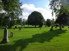 | Anchorage Cemetery | 0.3 miles | 1993 |
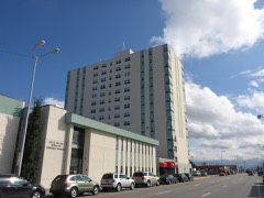 | McKinley Tower Apartments | 0.3 miles | 2008 |
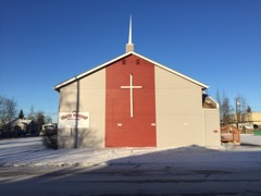 | Greater Friendship Baptist Church | 0.5 miles | 2019 |
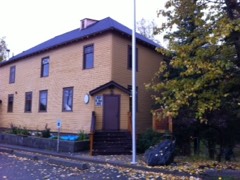 | Pioneer School House | 0.6 miles | 1980 |
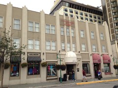 | Anchorage Hotel Annex | 0.6 miles | 1999 |
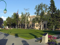 | Anchorage City Hall | 0.6 miles | 1980 |
| National Archives record | The nomination case file for reference 100003171 in Record Group 79. |
| Anchorage Municipality | All 32 listed properties in this county. |