 Block
From the record
One of 23 National Register listings published here for Sitka City and Borough · listed in 2024 · category: Building.
Sources: the National Register database, National Park Service
Listed on the National Register of Historic Places in 2024.
One of 23 National Register listings published here for Sitka City and Borough · listed in 2024 · category: Building.
Sources: the National Register database, National Park Service
Regional context, not property-specific evidence. The federal wildfire occurrence database lists 14 fires within 5 miles of Sitka Woman's Club Building between 1993 and 2019, burning about 2 acres in total. None started naturally. None was recorded as arson. Distance is straight-line from the map coordinates, so a fire counted here may appear on a neighbouring settlement's page as well.
| Reported cause | Fires |
|---|---|
| Recreation and ceremony | 7 |
| Missing data/not specified/undetermined | 4 |
| Debris and open burning | 2 |
| Fireworks | 1 |
The most recent of them, most recent first, with the day each was reported and the service that recorded it.
| Date | Cause | Size | Reported by | Name on the report |
|---|---|---|---|---|
| 17 September 2004 | Recreation and ceremony | under an acre | Tongass National Forest | CROSS TRAIL |
| 28 August 1993 | Recreation and ceremony | under an acre | Tongass National Forest | not named |
| 22 August 2001 | Recreation and ceremony | under an acre | Tongass National Forest | LEESOFFSKAIA |
| 7 July 2009 | Missing data/not specified/undetermined | under an acre | Tongass National Forest | HIGH TIDE |
| 4 July 2005 | Fireworks | under an acre | Tongass National Forest | INDEPENDENCE |
| 24 July 2019 | Missing data/not specified/undetermined | under an acre | Tongass National Forest | EMGETEN |
| 15 June 1993 | Recreation and ceremony | under an acre | Tongass National Forest | not named |
| 25 May 2014 | Recreation and ceremony | under an acre | Tongass National Forest | HERRING COVE ISLAND |
Regional context, not property-specific evidence. The federal mineral resources record lists 17 workings within 5 miles of Sitka Woman's Club Building: 7 prospects, 4 past producers, 4 occurrences, 2 producers. 2 still produce. What was taken out: Gold, Stone, Chromium, Nickel. Distance is straight-line from the map coordinates, so a quarry counted here may appear on a neighbouring settlement's page as well.
| Where | Site | Commodity | Status | Recorded |
|---|---|---|---|---|
| Billy Basin Gold-Silver-Lead Prospect | Gold, Silver, Lead | Past Producer | Gold | |
| Blue Lake | Nickel, Chromium, Cobalt, Copper, Zinc | Prospect | ||
| Cascade Copper Prospect | Copper | Occurrence | Chalcopyrite | |
| Eagle Point | Iron, Gold | Prospect | ||
| Granite Creek Pit | Sand and Gravel, Construction | Past Producer | ||
| Thetis | Gold, Lead, Silver | Prospect | ||
| Indian River | Chromium, Nickel | Occurrence | ||
| Blue Lake Chromite Occurrence | Chromium | Occurrence | 1961 | |
| Unnamed Chromite Occurrence | Chromium | Occurrence | 1961 | |
| Borrow Area-B | Stone | Past Producer |
Regional context, not property-specific evidence. The National Weather Service names Sitka, the town this property stands in, in 4 storm reports between 2014 and 2020: 2 debris flow, 1 flood, 1 flash flood. The reports record 6 deaths. Each account below is quoted exactly as the forecast office filed it, from the NOAA Storm Events Database, and each date opens the federal record of that event.
| When | Event | Place named | Harm | What the report says |
|---|---|---|---|---|
| August 2015 | Flash Flood | Sitka | 3 killed, $1,700,000 | A strong cold front with sub-tropical moisture moved into the eastern gulf and moved over the coastal areas of Southeast Alaska. As the front approached the coastal area of Sitka very high rain rates were being reported across the area in the early morning hours which lasted less than 6 hours. In three hours the Sitka airport reported one point seven inches which was a 25 year rainfall intensity return period. The Sitka Magnetic Observatory Climate Reference Station (CRN), which is closer to steep terrain, reported two point zero one inches was a 45 year rainfall intensity return period. Along with the very high rain rates there was also very strong winds of thirty-three mile per hour with much high wind gusts at higher elevations. The combination of the heavy rain and strong winds caused catastrophic debris flows across the Sitka area on the morning of August 18th. Multiple roads were blocked along with homes damaged or destroyed and there was 3 fatalities in Cramer Ave slide. A state of emergency was declared and as one point seven million dollars worth of damage was done. |
| August 2015 | Debris Flow | Sitka | 3 killed, $1,700,000 | A strong cold front with sub-tropical moisture moved into the eastern gulf and moved over the coastal areas of Southeast Alaska. As the front approached the coastal area of Sitka very high rain rates were being reported across the area in the early morning hours which lasted less than 6 hours. In three hours the Sitka airport reported one point seven inches which was a 25 year rainfall intensity return period. The Sitka Magnetic Observatory Climate Reference Station (CRN), which is closer to steep terrain, reported two point zero one inches was a 45 year rainfall intensity return period. Along with the very high rain rates there was also very strong winds of thirty-three mile per hour with much high wind gusts at higher elevations. The combination of the heavy rain and strong winds caused catastrophic debris flows across the Sitka area on the morning of August 18th. Multiple roads were blocked along with homes damaged or destroyed and there was 3 fatalities in Cramer Ave slide. A state of emergency was declared and as one point seven million dollars worth of damage was done. |
| January 2014 | Flood | Sitka | $300,000 | It rained for thirty seven days with one day without any precipitation for a total of twenty two point nine inches over the Sitka area. The average daily rainfall for this time period was greater than one half of inch of rain per day. A strong weather front moved through the area and produced heavy rain of three point fifty six inches on January 14. This broke the previous daily record of three point twenty three inches from 1965. The very moist antecedent soil conditions, high rain rates along with strong winds gusts of forty five mph triggered land/mudslides and flooded lakes and rivers. A mudslide was triggered in the Cascade Creek Road neighborhood that damaged an apartment building that was knocked off it foundation along with mud and water in the building. There was visual reports that Cascade Creek was at flow levels not seen in twenty years. There was also numerous parking lots flooded and Indian River was flowing out of its banks flooding Indian River road and destroying the trail. |
| November 2020 | Debris Flow | Sitka | $35,000 | It had been very wet in the area with 3 to 5 inches of rain over the 3 previous days. Heavy rain from an atmospheric river moved into the Sitka area on November 1 and persisted into the morning of November 2 with an additional 3 to 5 inches of rainfall. Rain rates were greater than 0.5 inches per hour. The heavy rain along with the already saturated soils increased the risk of debris flow near steep terrain. In the early evening of November 1 a debris flow blocked Sand Dollar Road. One lane was cleared for travel in the evening but another debris flow came down during the overnight hours going into November 2 and the road was blocked again. One home at the top of Sand Dollar Road was not damaged but was now on a earth cliff that needed an engineering assessment for safety reasons. Overall there were around 18 debris flows from October 26-November 2. There was also extensive flooding around the Indian River and caused damage to the dam and fresh water diversion for the Sitka Sounds Science Center's hatchery. There was damage to the dam and the road to the water intake was washed. At the hatchery the motors for the drum screen that filters the fresh water were overrun, burned out and destroyed the motor and pumps. |
No historic map-sheet match is published for this property yet. That does not mean no map exists. This record needs a coordinate-quality review before it can be joined to a sheet boundary. Browse the county's mapped places while that work is pending.
Other National Register properties close enough to walk or drive between, ordered by distance from this one. Both positions come from the same geocoding pass that matched these properties to their map sheets.
| Photograph | Property | Distance | Listed |
|---|---|---|---|
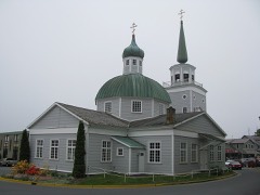 | St. Michael's Cathedral | under 500 feet | 1966 |
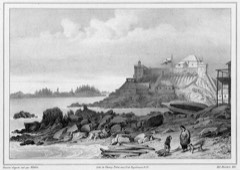 | American Flag Raising Site | under 500 feet | 1966 |
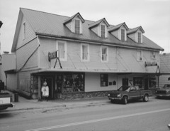 | Russian-American Building No. 29 | under 500 feet | 1987 |
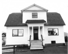 | US Coast Guard and Geodetic Survey Seismological and Geomagnetic House | 0.1 miles | 1986 |
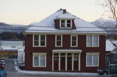 | Murray Apartments and Cottages | 0.1 miles | 1992 |
| Sitka Pioneers' Home | 0.1 miles | 1979 |
| National Archives record | The nomination case file for reference 100010895 in Record Group 79. |
| Sitka City and Borough | All 23 listed properties in this county. |