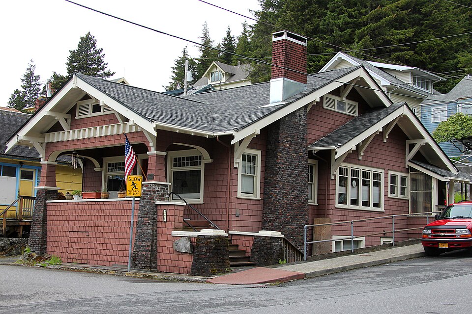
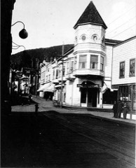
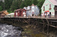
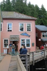
Listed on the National Register of Historic Places in 1982.
From the record
“The Walker-Broderick House, also known as the "Doc" Walker House, is a historic house at 541 Pine Street in Ketchikan, Alaska. It was listed on the National Register of Historic Places in 1982.”
Wikipedia article Walker-Broderick House, CC BY-SA 4.0.
One of 20 National Register listings published here for Ketchikan Gateway Borough · listed in 1982 · category: Building.
National Register reference number.82004903- the number the National Park Service assigned this property when it was listed, and the key its nomination file is catalogued under at the National Archives.
Fires near this property
3 since 1993
Regional context, not property-specific
evidence. The
federal wildfire occurrence database
lists 3 fires within 5 miles of Walker-Broderick House
between 1993 and 2005, burning under an acre in total. None started naturally. None was recorded as arson.
Distance is straight-line from the map coordinates, so a fire counted
here may appear on a neighbouring settlement's page as well.
Reported cause
Fires
Recreation and ceremony
3
The most recent of
them, most recent first, with the day each was reported and the service
that recorded it.
Regional context, not property-specific
evidence. The federal mineral resources record lists
44 workings within 5 miles of Walker-Broderick House: 30 prospects, 12 past producers, 1 plant, 1 producer.
2 still produce. What was taken out: Gold, Stone, Zinc, Lead, Copper. Distance is straight-line from the
map coordinates, so a quarry counted here may appear on a neighbouring
settlement's page as well.
Regional context, not property-specific
evidence. The National Weather Service names
Ketchikan, the town this property stands in, in 5 storm reports between 2013 and 2025: 3 flood, 2 debris flow.
The reports record 1 death and 3 injuries. Each account below is quoted exactly as the forecast office
filed it, from the NOAA Storm Events Database, and each date
opens the federal record of that event.
Shortly after 1500AKST on August 25th the larger of two landslides crossed the 3rd Avenue Bypass, a state road which is one of two routes for local traffic to get across town. There were 2 city employees that were working to clear culverts in their vehicle as the landslide occurred and killed the driver and significantly injuring the other passenger. As the landslide progressed down the slope, it destroyed 5 houses, caused 2 additional injuries, and damage to other surrounding properties. The entire area around the slide was evacuated until the hillside was evaluated. The 3rd AVE Bypass was closed and produced major congestion due to summer tourism as there was only one main road to move through town and this made it difficult for emergency services to get around in a timely fashion.
The second landslide, on the opposite slope of the first, went down Copper Ridge and affected a private construction yard. Construction materials stored at the yard were destroyed in the slide, which was significant loss, along with the damage/destruction of the upper part of the access road.
It rained thirty seven point twenty three inches over the Ketchikan area for about thirty six days straight with just 4 days less than a trace. A strong weather front moved through the area and produced heavy rain of three point twenty one inches on January 14. The very moist antecedent soil conditions, high rain rates along with strong winds gusts of fifty-eight mph triggered land/mudslides. These slides knocked down power lines and the power to the entire city of Ketchikan for a few hours. A slide on Price of Wales Island damaged a home near the Hollis area with another big slide that blocked the road near the town of Coffman Cove.
There was 5 days of heavy rain with very high rainfall totals from December 10-14. The Ketchikan airport received thirteen point forty six inches for a five day total with a daily record of five point zero four inches on the 11. It was the wettest five day total in December for the period of record going back to 1902. Other notable five day rainfall total from around the area was ten point twenty three inches at Ketchikan Powerhouse, twenty three point twenty three inches at Sivlis powerhouse. The excessive rainfall event produces enough runoff that area power generation reservoirs rose significantly. There was a fourteen foot rise at Upper Silvis lake and over five feet at Swan Lake. Ketchikan Lake rose over seven feet and triggered the first level of the emergency action plan as the lake level was two feet over the emergency spillway. This overflow from the reservoirs caused very high water levels down stream and produced minor to moderate flooding within the city of Ketchikan. The highest flow from the reservoirs coincided with high tide on December 14th and exacerbate the flooding situation.
Through the late morning hours of September 15th reports from the local emergency manager reported significant runoff from the steep hillside that surrounds the Ketchikan area from the very heavy rain. This overland flow continued and increased into the afternoon, which flooded numerous roads that had to be closed due to the depth of water and the risk to life and property to the drivers. Some of this urban flooding did occur in poor drainage areas, during the tourist season, and affected traffic and the safety of the visitors. In the afternoon, the emergency manager reported brown water in the runoff, causing elevated concern for landslides, although no landslides were recorded from this event. The peak wind measured at the airport during this event was 44 mph at noon AKDT.||The Ketchikan airport recorded a new daily rainfall record for September 15th of 7.66 inches. This broke the previous daily record of 2.65 inches set in 1981. ||From the record rainfall, local hydro-electric dams rose significantly, ranging from 3 to 4 feet. Along Ketchikan Creek, which is fed from overflow of Ketchikan Lakes Dam, the water level rose almost 3 feet in 6 hours, cresting just below 62 feet. Even though it remained below minor flood stage of 63.5 feet, there was a lot of water moving down the creek and right through downtown Ketchikan which caused some concerns.
No historic map-sheet match is published
for this property yet. That does not mean no map exists. This record needs
a coordinate-quality review before it can be joined to a sheet boundary.
Browse the county's mapped places while that work is
pending.
Listed places nearby
6 within 8 miles
Other National Register properties close
enough to walk or drive between, ordered by distance from this one. Both
positions come from the same geocoding pass that matched these properties
to their map sheets.
Listing record. National Park Service National Register of Historic Places, listed-properties dataset, current to 2026-05-22.
Map join. Address geocoded through the United States Census geocoder, then tested against the published boundary of every sheet in the USGS Historical Topographic Map Collection.
How this page is made. Listing fields come from federal records; map-sheet coverage is a labelled coordinate-to-boundary calculation, not a source-field claim.
Wildfire. Short, Karen C. 2022. Spatial wildfire occurrence data for the United States, 1992-2020 [FPA_FOD_20221014]. 6th Edition. Fort Collins, CO: Forest Service Research Data Archive. https://doi.org/10.2737/RDS-2013-0009.6 Collected with United States Government funding and usable without additional permissions or fees.
Mines and quarries. USGS Mineral Resources Data System (MRDS) https://mrdata.usgs.gov/mrds/ A work of the United States government, no copyright under 17 U.S.C. 105.
Storms. NOAA National Centers for Environmental Information, Storm Events Database https://www.ncei.noaa.gov/stormevents/ A work of the United States government, no copyright under 17 U.S.C. 105. Narratives are quoted verbatim from the National Weather Service report and are not edited or summarised.
 Block