 Block
From the record
17 National Register listings published here.
Sources: the National Register database, National Park Service
81 topographic sheets cover 83 settlements here, and 17 properties are on the National Register of Historic Places.
17 National Register listings published here.
Sources: the National Register database, National Park Service
Every property in this county listed on the National Register of Historic Places, with the year it was listed and the federal nomination document.
| Photograph | Property | Type | Listed | Reference |
|---|---|---|---|---|
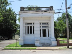 | Crittenden County Bank and Trust Company | building | 1984 | 84000662 |
 | Crittenden County Courthouse | building | 1977 | 77000251 |
| Dabbs Store | building | 1982 | 82002112 | |
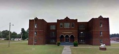 | Earle High School, Old | building | 2003 | 03000956 |
| Hamilton Apartments | building | 1998 | 98000618 | |
 | Highway A-7, Gilmore to Turrell | structure | 2009 | 09000313 |
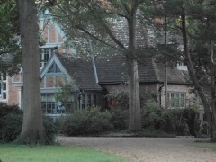 | Johnson-Portis House | building | 2017 | 100001648 |
| Lawrie House | building | 1996 | 96000330 | |
 | Marion Colored High School | building | 1995 | 95000349 |
 | Memphis and Arkansas Bridge | structure | 2001 | 01000139 |
 | Missouri Pacific Depot | building | 1986 | 86000383 |
 | Riverside Speedway | site | 2010 | 09001243 |
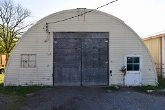 | Turrell City Hall, Old | building | 2007 | 07000962 |
 | George Berry Washington Memorial | object | 1994 | 94000824 |
| West Memphis City Hall | building | 2010 | 10000444 | |
| West Memphis Commercial Historic District | district | 2008 | 08000704 | |
 | Wilson Power and Light Company Ice Plant | building | 2010 | 09001244 |
Every wildfire the federal occurrence database records inside this county: 17 of them, burning about 137 acres. None started naturally and 3 were recorded as arson. Each settlement page carries the fires within five miles of it.
| Reported cause | Fires |
|---|---|
| Debris and open burning | 5 |
| Missing data/not specified/undetermined | 4 |
| Arson/incendiarism | 3 |
| Equipment and vehicle use | 3 |
| Recreation and ceremony | 1 |
| Smoking | 1 |
The five largest, by the area the report gives. Two of them were set deliberately.
| Date | Cause | Size | Reported by | Name on the report |
|---|---|---|---|---|
| 29 January 2015 | Debris and open burning | 38 acres | Arkansas Forestry Commission | not named |
| 27 February 2004 | Arson/incendiarism | 20 acres | Arkansas Forestry Commission | not named |
| 18 November 2017 | Missing data/not specified/undetermined | 20 acres | Arkansas Forestry Commission | not named |
| 4 March 1999 | Arson/incendiarism | 12 acres | Wapanocca National Wildlife Refuge | WAP 1 |
| 7 June 1999 | Debris and open burning | 10 acres | Wapanocca National Wildlife Refuge | WAP 2 |
| 5 March 1994 | Equipment and vehicle use | 9.5 acres | Central Arkansas Refuges Complex | WAP 1 |
| 16 December 2017 | Recreation and ceremony | 6.0 acres | Cache River National Wildlife Refuge | AUGUSTA CAMP ROAD |
| 8 August 1996 | Debris and open burning | 5.4 acres | Wapanocca National Wildlife Refuge | NEW SHOP |
Every settlement page carries the fires within five miles of it - see the settlement index below.
The NOAA Storm Events Database holds 320 reports for this county, causing 6 deaths, 135 injuries and about $45,455,030 in recorded property damage. Each settlement page carries the reports that name it.
| Kind of event | Reports |
|---|---|
| Thunderstorm Wind | 163 |
| Hail | 101 |
| Flash Flood | 25 |
| Tornado | 21 |
| Flood | 6 |
| Lightning | 4 |
The most serious of them, by death, then injury, then recorded damage. The accounts are quoted exactly as the forecast office filed them.
| When | Event | Place named | Harm | What the report says |
|---|---|---|---|---|
| December 1987 | Tornado (F3) | not stated | 6 killed, 100 hurt, $25,000,000 | no account filed |
| April 1968 | Tornado (F2) | not stated | 15 hurt, $25,000 | no account filed |
| May 2008 | Tornado (EF3) | Earle Mcneely Arpt | 4 hurt, $2,000,000 | A tornado tracked northeast into Crittenden County from Cross County. The tornado produced a nearly continuous 12 mile track from the county line to Heafer. After crossing into Crittenden County, the tornado struck the town of Earle and produced extensive EF-3 damage. The tornado severely damaged a high school, a church and a number of homes. A large warehouse was also struck and sustained extensive damage. Additional significant damage to other structures occurred between Earle and Heafer. There were 4 serious injuries and several minor injuries reported in Earle. As the tornado moved into Heafer, the tornado produced EF-2 damage. Significant damage occurred to a number of homes in Heafer. Two mobile homes were destroyed as well. Several trees and power lines were also knocked down. The tornado continued to produce intermittent EF-0 damage as it moved out of Heafer and moved northeast between the towns of Gilmore and Turrell, eventually crossing into Mississippi County. |
| February 1965 | Tornado (F2) | not stated | 3 hurt, $250,000 | no account filed |
| October 2007 | Thunderstorm Wind | Proctor | 3 hurt, $125,000 | Straight line winds blew a metal roof off a building in Proctor. Over much of Edmondson, straight line winds were estimated between 50 and 70 mph with isolated speeds of 80 to 100 mph. This resulted in the destruction to several mobile homes and significant damage to other homes and buildings. |
| June 2013 | Lightning | Wimef | 3 hurt | Three teenagers were struck by lightning on Oxford Street in West Memphis. All three were injured. |
| November 1994 | Tornado (F1) | West Memphis | 2 hurt, $5,000,000 | An F1 tornado touched down in the city of West Memphis. The tornado remained on the ground for 5 miles before lifting. The tornado damaged 27 homes and 9 apartment buildings containing 66 units. Two people residing in the apartment complex received minor injuries. Forty-three businesses were damaged, 17 of these were declared uninhabitable. Large utility poles were snapped and numerous power lines were knocked down. Several cars were also damaged. |
| May 1978 | Tornado (F0) | not stated | 2 hurt, $25,000 | no account filed |
| July 2003 | Thunderstorm Wind | Countywide | 1 hurt, $100,000 | About 20 mobile homes were damaged. Several boat houses and a grain elevator were damaged in Horseshoe Lake. Five tractor trailers were blown over. Numerous trees were blown down with some of the trees falling on houses. |
| February 1999 | Thunderstorm Wind | Earle | 1 hurt, $15,000 | Several trees and power poles were knocked down. One tree fell in the middle of a house injuring one person and trapping a second person in bed. |
| August 1986 | Thunderstorm Wind | not stated | 1 hurt | no account filed |
| May 2010 | Flash Flood | West Memphis | $7,500,000 | Heavy rain, up to 10 inches, fell across the West Memphis and Marion area. Numerous streets and roads were flooded. At least 101 homes sustained at least minor damage from the flooding. |
| March 2018 | Flood | Cloar | $1,000,000 | Heavy rainfall caused the Tyronza River to flood in Earle. Residents were evacuated from a neighborhood with 20 homes. |
| November 2002 | Tornado (F2) | Earle | $600,000 | The tornado moved into Crittenden county from Cross county and continued to move northeast. The tornado produced some damage near the town of Heafer. A mobile home and 2 farm shops were destroyed. A church and parsonage, three mobile homes and five houses were also damaged. The tornado then continued across the county and reached the town of Gilmore. Fourteen mobile homes were destroyed or suffered major damage. Nineteen houses and several cars were also damaged. Numerous trees and power lines were knocked down across the county. The tornado eventually moved out of the county near Menesha and entered Mississippi county. |
| June 2014 | Flash Flood | (Awm)West Memphis Ar | $500,000 | Heavy rain across the southwest sections of West Memphis forced the evaculationa of some homes due to high water. |
| May 2011 | Tornado (EF1) | Wimef | $500,000 | A tornado touched down in West Memphis and a large storage building received major roof damage with numerous contents removed and a few walls crippled. A mobile home received extensive damage and a tree fell on one residence. A few other tree limbs were snapped and a power pole was knocked down just east of the intersection of Highway 70 and Club Road. The estimated peak wind was 90 mph. |
| May 2011 | Flood | Bruins | $500,000 | The Mississippi River rose to record levels by the beginning and middle part of May. Levees held back the water thus only a few homes along the river were flooded and sustained damage. Several thousand acres of agriculture fields were flooded. Several roads were flooded and/or damaged. The river remained above flood stage through the end of the month. |
| November 1994 | Tornado (F1) | Proctor | $500,000 | An F1 tornado touched down near Proctor and travelled on the ground for 3 miles before lifting. A mobile home was destroyed and its roof was blown onto the highway. Several other homes and buildings in the area sustained mostly minor roof damage. Several large utility poles were snapped in half about 6 to 10 feet above the ground. |
| March 2023 | Tornado (EF2) | Cloar | $250,000 | The tornado that caused EF-3 damage in Wynne, Arkansas moved into Crittenden County just north of Earle causing EF-2 damage along Watson Road. Between Earle, AR, and the Mississippi River, very few damage indicators aided in the observed strength as it traversed mostly farmland. There were between 20 to 30 center pivot irrigation systems that were overturned along this area. The tornado then tracked into the oxbows of the Mississippi River while crossing into Tipton County. Peak winds were estimated at 125 mph in Crittenden County. |
| May 2017 | Thunderstorm Wind | Marion | $150,000 | Tree fell on a house in Marion. Trees and powerlines down county wide. |
| June 2013 | Lightning | West Memphis | $150,000 | A lightning strike caused a fire at an apartment complex on West Harrison Street in West Memphis. The fire caused extensive damage. |
| May 2017 | Thunderstorm Wind | Crawfordsville | $100,000 | A large tree fell on two mobile homes in Crawfordsville. One minor injury occurred. A farm building was pushed off it's slab on Highway 50. |
| April 2006 | Hail | Crawfordsville | $100,000 | Numerous cars were damaged by the hail. |
| April 2025 | Tornado (EF1) | Earle Mcneely Arpt | $75,000 | The tornado moved northeast, overturning a couple of center irrigation pivots east of Smithdale Corner Road, crossing the railroad tracks near Dixie Park Road. The tornado intensified as it crossed US Highway 64, snapping several utility poles and producing significant tree damage on Gaskill Road. Additional tree damage was observed along State Highway 184, with tree damage quickly becoming more sporadic as the tornado lifted east of County Road 36. Estimated peak winds were 105 mph in Crittenden County. |
| April 2008 | Thunderstorm Wind | Galilee | $70,000 | Straight line winds destroyed a trailer and a grain bin near the intersection of Highway 118 and Marlin Swamp Road. In addition, roofs were blown off of two shops in the area as well. |
| June 2013 | Thunderstorm Wind | Clarkedale | $60,000 | Straight line winds broke up a large pivot irrigation system near mile marker 17 on Interstate 55 near Jericho. In Jericho, a big oak tree fell on a SUV. |
| May 2017 | Thunderstorm Wind | Blanton | $50,000 | Damage to casino. |
| May 2025 | Thunderstorm Wind | Seyppel | $40,000 | Severe roof damage to a home on Northwood Dr with part of the roof collapsing into the home. Several other homes experienced roof damage with several trees down across the area. |
| July 2013 | Thunderstorm Wind | Crawfordsville | $32,000 | Straight line winds knocked a large tree on a car in Crawfordsville. In addition, a tree fell down on Highway 64 near Ebony. |
| May 1995 | Hail | Turrell | $30,000 | The town's high school had many of its windows broken by the hail. Numerous cars were damaged with one car totally destroyed. |
| June 2023 | Thunderstorm Wind | Lambethville | $25,000 | Trees were uprooted and a roof was blown off a structure. |
| May 2018 | Thunderstorm Wind | Earle | $25,000 | Several trees down on power lines. Shed blown over. Eighteen wheeler blown over on Highway 64 going into Earle. |
| April 2008 | Flash Flood | West Memphis | $25,000 | Heavy rain produced flash flooding in West Memphis at the intersection of Barton Street and 7th Street. A total of five cars were stalled in the flooded intersection as a result. |
| April 2006 | Tornado (F3) | Jeanette | $25,000 | The tornado continued east from Cross County lifting 4 miles west of Crawfordsville. Two commercial buildings had minor damage. The tornado produced F0 damage while in Crittenden County. |
| May 2003 | Flash Flood | Countywide | $25,000 | A church was flooded in Earle. Several homes were flooded in the county forcing sixty residents to evacuate their homes. A section of Interstate 55 was closed due to flooding. Numerous roads across the county were also flooded. Many fields were flooded. |
| April 2001 | Thunderstorm Wind | Earle | $25,000 | A roof was blown off of a clinic. Several signs were knocked down. Several houses had trees on top of them with one house receiving major damage. |
| June 1989 | Tornado (F0) | not stated | $25,000 | no account filed |
| May 1985 | Tornado (F1) | not stated | $25,000 | no account filed |
| April 1975 | Tornado (F2) | not stated | $25,000 | no account filed |
| July 2023 | Thunderstorm Wind | Gavin | $20,000 | Powerlines were knocked down and power poles were snapped in the Marion High School area. |
| April 2006 | Hail | West Memphis | $17,000 | no account filed |
| April 2025 | Tornado (EF0) | Dixie | $15,000 | The tornado crossed into Crittenden County and continued moving northeast, knocking down a few power poles and trees near the intersection of County Road 1005 and Highway 149, lifting just west of the Jeanette community. Peak winds were estimated to be 85 mph. |
| March 2023 | Tornado (EF2) | Lambethville | $15,000 | The tornado that tracked through Wynne, Arkansas eventually moved from through the oxbows of the Mississippi River crossing between Tennessee and Arkansas a couple of times. Significant tree damage along the Mississippi River occurred. |
| May 2020 | Thunderstorm Wind | James Mill | $15,000 | A camper was flipped over near mile marker 12 on Interstate 55. |
| July 2005 | Thunderstorm Wind | West Memphis | $15,000 | A fireworks stand was destroyed. |
| July 2004 | Thunderstorm Wind | Marion | $15,000 | The roof of the car wash at a convenience store was blown off and landed against a house. Some power lines and tree were knocked down. |
| March 2026 | Thunderstorm Wind | Blanton | $10,000 | Roof damage to a casino. |
| April 2025 | Thunderstorm Wind | Earle | $10,000 | A mobile home was pushed off block piers due to straight-line winds. |
| May 2003 | Thunderstorm Wind | Crawfordsville | $10,000 | Some trees and power lines were knocked down. |
| May 2003 | Thunderstorm Wind | Jericho | $10,000 | Several trees and power lines were blown down. |
| May 2003 | Thunderstorm Wind | Pinckney | $10,000 | Some trees and power lines were knocked down. |
| May 2003 | Thunderstorm Wind | Horseshoe Lake | $10,000 | Several trees and power lines were blown down. |
| December 2002 | Flash Flood | Countywide | $10,000 | Flood water reached up to several houses. Several roads were flooded. |
| June 2002 | Thunderstorm Wind | West Memphis | $10,000 | Some trees and power lines were blown down. |
| August 2000 | Thunderstorm Wind | Edmondson | $10,000 | Several trees and power lines were blown down. |
| May 1999 | Lightning | Crawfordsville | $10,000 | A house was damaged by a fire started by lightning. |
| July 1998 | Lightning | Marion | $10,000 | Three homes and one business caught on fire due to lightning strikes. |
| January 1996 | Thunderstorm Wind | West Memphis | $10,000 | no account filed |
| April 2025 | Thunderstorm Wind | West Memphis | $5,000 | A gas station awning collapsed. |
| May 2024 | Thunderstorm Wind | Clarkedale | $5,000 | Powerpoles down. |
The Survey's mineral resources record lists 11 workings inside this county. 6 still produce and 5 are closed or unrecorded. Each settlement page carries the workings within five miles of it.
| Commodity | Workings |
|---|---|
| Sand and Gravel, Construction | 9 |
| Gypsum-Anhydrite | 1 |
| Clay | 1 |
The least common of them first, because a county's hundredth gravel pit says nothing its first ten did not.
| Where | Site | Commodity | Status | Recorded |
|---|---|---|---|---|
| Temple Gypsum Mill | Gypsum-Anhydrite | Producer | ||
| West Memphis Pit & Plant | Clay | Producer | ||
| Carter | Sand and Gravel, Construction | Producer | ||
| Mauldin Pit | Sand and Gravel, Construction | Past Producer | ||
| Morrison Pit | Sand and Gravel, Construction | Producer | ||
| Rosebud Island | Sand and Gravel, Construction | Producer | ||
| Turbyfill Pit | Sand and Gravel, Construction | Producer | ||
| Unk | Sand and Gravel, Construction | Past Producer | ||
| Unk | Sand and Gravel, Construction | Past Producer | ||
| Unknown | Sand and Gravel, Construction | Unknown | ||
| Weeks Pit | Sand and Gravel, Construction | Past Producer |
Named settlements recorded in the Geographic Names Information System, each with the topographic sheets covering it. Villages, hamlets and abandoned places alike. Each is shown with the nearest named watercourse or landform and the survey quadrangle it falls on.
Mississippi township · 72301 · West Memphis quadrangle
18 sheets, 1916 to 1997
No longer a settlement
Bob Ward township · 72376 · On Beaver Slough · Edmondson quadrangle
11 sheets, 1939 to 1986
Bob Ward township · 72376 · On Beaver Slough · Edmondson quadrangle
11 sheets, 1939 to 1986
Mississippi township · 72301 · West Memphis quadrangle
18 sheets, 1916 to 1997
No longer a settlement
Lucas township · 72348 · Near Goat Island · Horseshoe Lake quadrangle
19 sheets, 1931 to 1990
Fogleman township · 72384 · Tyronza quadrangle
10 sheets, 1940 to 1986
No longer a settlement
Mississippi township · 72364 · Northwest Memphis quadrangle
18 sheets, 1916 to 1997
No longer a settlement
Lucas township · 72348 · On Lost Creek · Horseshoe Lake quadrangle
19 sheets, 1931 to 1990
No longer a settlement
Fogleman township · 72384 · On Chute 38 · Frenchmans Bayou quadrangle
14 sheets, 1931 to 1986
Mississippi township · 72376 · On Garant Bayou · Crawfordsville quadrangle
12 sheets, 1939 to 1986
Fogleman township · 72384 · On Bellhammer Slough · Frenchmans Bayou quadrangle
14 sheets, 1931 to 1986
Mound City township · 72364 · Near Chicken Island · West Memphis quadrangle
18 sheets, 1916 to 1997
Bob Ward township · 72376 · On Lost Creek · Edmondson quadrangle
11 sheets, 1939 to 1986
Bob Ward township · 72376 · On Warehouse Bayou · Edmondson quadrangle
11 sheets, 1939 to 1986
Mound City township · 72364 · Near Chicken Island · Northwest Memphis quadrangle
18 sheets, 1916 to 1997
Fogleman township · 72384 · Frenchmans Bayou quadrangle
14 sheets, 1931 to 1986
No longer a settlement
Bob Ward township · 72348 · On Tenmile Bayou · Edmondson quadrangle
11 sheets, 1939 to 1986
Fogleman township · 72384 · On Bellhammer Slough · Frenchmans Bayou quadrangle
14 sheets, 1931 to 1986
Proctor township · 72376 · On Fletcher Bayou · Fletcher Lake quadrangle
18 sheets, 1916 to 1986
Tyronza township · 72331 · On Wildcat Bayou · Jeanette quadrangle
12 sheets, 1939 to 1986
No longer a settlement
The vanished settlements of Crittenden County: the places named above that are no longer on the map.