Block
From the record
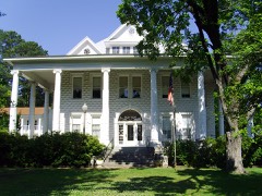
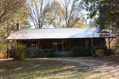
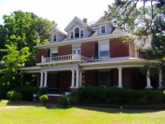
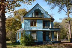
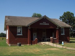
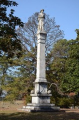
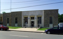
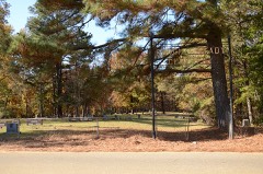
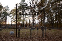
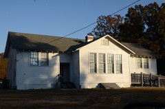
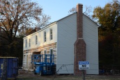
27 National Register listings published here.
Sources: the National Register database, National Park Service
60 topographic sheets cover 56 settlements here, and 27 properties are on the National Register of Historic Places.
27 National Register listings published here.
Sources: the National Register database, National Park Service
Every property in this county listed on the National Register of Historic Places, with the year it was listed and the federal nomination document.
Every wildfire the federal occurrence database records inside this county: 602 of them, burning about 7,910 acres. 31 started naturally and 109 were recorded as arson. Each settlement page carries the fires within five miles of it.
| Reported cause | Fires |
|---|---|
| Missing data/not specified/undetermined | 238 |
| Debris and open burning | 152 |
| Arson/incendiarism | 109 |
| Equipment and vehicle use | 60 |
| Natural | 31 |
| Misuse of fire by a minor | 7 |
| Recreation and ceremony | 2 |
| Smoking | 2 |
| Railroad operations and maintenance | 1 |
The five largest, by the area the report gives. Two of them were set deliberately.
| Date | Cause | Size | Reported by | Name on the report |
|---|---|---|---|---|
| 14 August 2012 | Missing data/not specified/undetermined | 1,414 acres | Arkansas Forestry Commission | LACEY |
| 18 September 2010 | Arson/incendiarism | 1,013 acres | Arkansas Forestry Commission | DREW |
| 9 February 2016 | Missing data/not specified/undetermined | 606 acres | Arkansas Forestry Commission | not named |
| 19 September 2013 | Missing data/not specified/undetermined | 495 acres | Arkansas Forestry Commission | TEN MILE CREEK |
| 1 October 2010 | Missing data/not specified/undetermined | 176 acres | Arkansas Forestry Commission | DREW 2 |
| 10 March 2009 | Arson/incendiarism | 157 acres | Arkansas Forestry Commission | PARADICE |
| 26 September 2019 | Missing data/not specified/undetermined | 125 acres | Arkansas Forestry Commission | not named |
| 7 May 2011 | Debris and open burning | 115 acres | Arkansas Forestry Commission | WILMAR |
Every settlement page carries the fires within five miles of it - see the settlement index below.
The NOAA Storm Events Database holds 370 reports for this county, causing 1 death, 11 injuries and about $7,490,030 in recorded property damage. Each settlement page carries the reports that name it.
| Kind of event | Reports |
|---|---|
| Thunderstorm Wind | 182 |
| Hail | 92 |
| Flash Flood | 50 |
| Tornado | 21 |
| Lightning | 9 |
| Heavy Rain | 9 |
| Flood | 6 |
| Funnel Cloud | 1 |
The most serious of them, by death, then injury, then recorded damage. The accounts are quoted exactly as the forecast office filed them.
| When | Event | Place named | Harm | What the report says |
|---|---|---|---|---|
| October 1980 | Tornado (F2) | not stated | 1 killed, 2 hurt, $250,000 | no account filed |
| May 2009 | Thunderstorm Wind | Rock Spgs | 3 hurt, $2,500,000 | Trees were down on houses, vehicles, and power lines. Approximately 30 homes were damaged and three people were injured by the falling trees. Much of the roof was removed from an exhibition building at the Drew County Fairgrounds. |
| April 1973 | Tornado (F2) | not stated | 1 hurt, $250,000 | no account filed |
| June 2008 | Thunderstorm Wind | Monticello | 1 hurt, $100,000 | Large trees were blown down, and one of the trees fell into a house. |
| April 2009 | Thunderstorm Wind | Mount Tabor | 1 hurt, $60,000 | A mobile home was overturned, injuring one person, and another mobile home was damaged. Approximately 15 large trees were blown down. |
| January 2013 | Lightning | Monticello | 1 hurt | A person inside a house was shocked by lightning. The person was not transported to a hospital. |
| February 2001 | Tornado (F1) | Selma | 1 hurt | A weak tornado was spawned in northeast Drew County about 6 miles southwest of Selma. The tornado moved quickly northeast, and badly damaged a home. A house trailer was also damaged. Roofs were damaged at a few homes, and many trees were uprooted or snapped. There was one minor injury reported. The tornado travelled about 5.5 miles before dissipating 2.7 miles west-northwest of Selma. |
| February 1998 | Thunderstorm Wind | Collins | 1 hurt | Thunderstorm winds downed a number of trees and power lines. One house also sustained damage. A woman inside the house sustained minor injuries after being trapped for a period of time. |
| September 2008 | Flash Flood | Bethel | $340,000 | Sanderlin Road, Panther Creek Road, 4 Mile Creek Road, 16th Section Road, Old Warren Road, Old Dermott Road and Arkansas Highway 172 west of U.S. Highway 425 were closed due to flooding. |
| March 2021 | Tornado (EF2) | Rose Hill | $300,000 | The tornado started just southwest of the intersection of US-425 and state highway 35 off of Kays Lane where some tree limbs were snapped or trees uprooted. Damage to roofs was also noted in this neighborhood. The most significant damage was on the east side of US-425, where multiple construction company trucks were tossed into a field. The tornado continued northeast uprooting additional trees, then lifting near the intersection of Rose Hill Cutoff Road and State Highway 83. |
| December 2009 | Flash Flood | Rock Spgs | $250,000 | Widespread heavy rain resulted in the development of flash flooding on the 24th. |
| December 2009 | Flood | Rock Spgs | $250,000 | Flash flooding, which developed on the morning of the 24th, became widespread areal flooding later on the 24th and continued into Christmas morning. Numerous county roads were flooded. |
| May 2011 | Flood | Rock Spgs | $250,000 | no account filed |
| February 1971 | Tornado (F2) | not stated | $250,000 | no account filed |
| May 1957 | Tornado (F3) | not stated | $250,000 | no account filed |
| January 2020 | Tornado (EF0) | Jerome | $100,000 | The tornado struck a series of large industrial grain and feed silos and caused substantial damage. One of the silos had its foundation ripped out of the ground and it was bolted into concrete in several locations. The roof of another large silo was blown downwind at least a half mile and fell apart into pieces. Power poles were snapped and trees were snapped at the trunk or uprooted along this short path. |
| January 2013 | Thunderstorm Wind | College Station | $100,000 | On the campus of the University of Arkansas at Monticello, a large metal barn was picked up by the wind and thrown about 100 yards. No horses in the barn were injured. A roof was blown off of a cattle feeder. |
| April 2011 | Flood | Rock Spgs | $100,000 | Widespread areal flooding occurred. |
| May 2009 | Flood | Carpenter | $100,000 | Within Drew County, flooding of the Saline River damaged roads and impacted cabins along the river. A few structures were impacted north of the Longview community at the Arkansas Highway 8 bridge, near Gee's Landing, and Ozment Bluff. About 3 to 5 structures were impacted by the high river stages. County roads in the flood plain of southwest Drew county were also impacted. |
| October 2009 | Heavy Rain | Monticello | $100,000 | Heavy rain caused the roof of an old two-story building on the Courthouse Square in Monticello to collapse. The roof cave-in caused two walls of the building to collapse, sending bricks and other construction materials out into the street and breaking a natural gas line. The broken gas line was beneath the rubble, so repairs were delayed. Nearby businesses were ordered closed until the leak could be repaired. |
| February 2007 | Tornado (EF2) | Monticello | $100,000 | A strong tornado touched down in Drew County, about 4.5 miles north of Monticello. Damage along the track of the tornado consisted of downed trees onto a vehicle and mobile home. Windows were blown out of a house, a large metal shop building was destroyed, and a metal barn sustained major damage. The tornado continued moving to the northeast into Lincoln County. |
| January 2013 | Flash Flood | Rock Spgs | $75,000 | Arkansas 35, 138, and 83 were flooded. Numerous county roads were inundated, as were some streets in Monticello. Garnett Rd. collapsed just north of Arkansas 83. Cut-Off Creek flooded. |
| July 2011 | Thunderstorm Wind | Monticello | $75,000 | At least 20 trees were blown down in Monticello and nearby areas. One of the trees fell on a car. Falling trees just barely missed another car and a house. Power lines were also blown down. |
| October 2009 | Thunderstorm Wind | Wilmar | $75,000 | A number of trees were blown down in and around Wilmar. Some of the trees landed on power lines and roofs of several homes. |
| October 2009 | Thunderstorm Wind | Monticello | $75,000 | Trees and power lines were down. Some homes sustained roof damage from fallen trees. |
| October 2009 | Flash Flood | Bethel | $75,000 | Countywide flooding occurred and several county roads had to be closed due to high water. |
| March 2016 | Flash Flood | Jerome | $60,000 | Emergency management reported that the crossing on highway 165 was washed out. |
| July 2016 | Thunderstorm Wind | Monticello | $60,000 | Roofs were blown off of three businesses in town. |
| January 2020 | Thunderstorm Wind | Green Hill | $50,000 | A large swath of thunderstorm wind damage was found from 7.5 miles southwest of Monticello moving southeast, ending near the town of Jerome. The damage to the trees and homes in this path were found to be consistent with 80 to 95 mph winds. |
| June 2019 | Thunderstorm Wind | Monticello | $50,000 | Several pictures of large trees blown down and onto homes were shared via email. Estimated wind speeds of 70 to 75 mph caused the damage throughout the city of Monticello. |
| June 2019 | Thunderstorm Wind | Monticello | $50,000 | Several pictures of large trees blown down and onto homes were shared via email. Estimated wind speeds of 70 to 75 mph caused the damage throughout the city of Monticello. |
| April 2017 | Tornado (EF0) | Ozmont Bluff | $50,000 | Several trees were snapped or uprooted. A few mobile homes sustained heavy roof damage. One outbuilding had a tree fall through it. |
| December 2015 | Tornado (EF1) | Green Hill | $50,000 | A roof of a home was blown off, landing onto a shed to the northwest of that home. Several trees were snapped or uprooted along the path. |
| April 2014 | Thunderstorm Wind | Monticello | $50,000 | Many trees and power lines were blown down in the Monticello area and elsewhere in Drew County. |
| July 2011 | Flash Flood | Monticello | $50,000 | Street flooding occurred in Monticello, and water entered some businesses. The Arkansas Forestry Commission station at Monticello measured 2.50 inches of rain in a short amount of time. |
| May 2009 | Tornado (EF1) | Rose Hill | $50,000 | A tornado was embedded within a large bow echo (curving line of thunderstorms shaped like a backwards C). The tornado knocked down trees and power lines. |
| October 2009 | Flash Flood | Rock Spgs | $50,000 | Roads were impassable in Monticello due to high water. Several feet of water was in area yards with the ditches overflowing. Arkansas Highway 138 was closed. A number of county roads were damaged. |
| February 2008 | Thunderstorm Wind | Monticello | $50,000 | Power lines were blown down and trees were snapped and uprooted. Also, storage buildings were destroyed and a roof was blown off of a saw mill. Trees and power lines were blown down across Arkansas Highway 35. Trees blown down onto power lines caused power outages on Old Deane Road, Old Troy Road, and Midway Route. |
| June 1994 | Thunderstorm Wind | Monticello | $50,000 | Thunderstorm winds knocked down trees onto houses. |
| November 1994 | Thunderstorm Wind | Monticello | $50,000 | Thunderstorm winds destroyed a storage building. |
| November 1994 | Thunderstorm Wind | Monticello | $50,000 | Thunderstorm winds damaged a home antenna and moved a house trailer off its foundation. |
| April 1993 | Thunderstorm Wind | Tillar | $50,000 | Thunderstorm winds moved several cotton trailers. An airplane was moved and an airport hangar was also damaged. Several mobile homes were also moved off their supports slightly. |
| June 2019 | Thunderstorm Wind | Montongo | $30,000 | The damage across Drew County near Montongo was determined to be the result of straight line winds between 60 and 85 mph. Many trees were uprooted across the area. An outbuilding was destroyed. A stand alone carport sustained damage and some siding was peeled off a home. Some trees across the county fell onto homes. Trees and power lines were down county wide according to the Emergency Manager. |
| August 2014 | Thunderstorm Wind | Florence | $25,000 | Trees were blown down, and one of the trees landed on a house. |
| August 2014 | Thunderstorm Wind | New Hope | $25,000 | Trees and power lines were blown down, blocking some county roads. |
| August 2012 | Thunderstorm Wind | Monticello | $25,000 | Numerous trees and power lines were blown down in Monticello. The automated weather station at the airport measured a wind gust to 63 mph at 8:32 PM CDT. |
| September 2011 | Lightning | Monticello | $25,000 | Lightning struck a transformer and knocked down power lines on N. Gabbert St. |
| April 2009 | Thunderstorm Wind | Tillar | $25,000 | Trees were down across the area. |
| April 2008 | Thunderstorm Wind | Coleman | $25,000 | A tree fell on a mobile home on Pleasant Springs Road. |
| January 1974 | Tornado (F1) | not stated | $25,000 | no account filed |
| March 1973 | Tornado (F2) | not stated | $25,000 | no account filed |
| July 2023 | Thunderstorm Wind | Monticello | $20,000 | The awning of a gas station was displaced in Monticello. Winds estimated by radar were 45 to 50 mph. |
| November 2015 | Thunderstorm Wind | Coleman | $20,000 | The roof was blown off a house on East Mt. Zion Rd. Trees were also blown down. This is close to the Lincoln an Drew County line. |
| June 2014 | Lightning | Monticello Muni Arpt | $20,000 | Lightning struck a house on the east side of Monticello, damaging the house's wiring, gas pipes, and kitchen stove. |
| January 2013 | Tornado (EF0) | Monticello Muni Arpt | $20,000 | An EF0 tornado blew part of the roof off a mobile home and blew some shingles off several houses. A few trees were blown down, one of which fell on power lines and snapped a power pole. One carport was blown down and another one was blown into a tree line. Several outbuildings were damaged. |
| February 2011 | Thunderstorm Wind | Monticello | $20,000 | Trees were blown down in and around Monticello. |
| October 2009 | Thunderstorm Wind | College Station | $20,000 | A large tree fell and crushed a vehicle. |
| July 2009 | Thunderstorm Wind | Green Hill | $15,000 | A tree fell on a car near Wilmar. |
| October 2009 | Flash Flood | Rose Hill | $15,000 | Arkansas Highway 138 and U.S. Highway 278 had water over them, and several county roads were closed due to flooding. |
| April 2008 | Thunderstorm Wind | College Station | $15,000 | A traffic light was damaged at the intersection of Arkansas Highway 83 and U.S. Highway 425. |
The Survey's mineral resources record lists 49 workings inside this county. 5 still produce and 44 are closed or unrecorded. Each settlement page carries the workings within five miles of it.
| Commodity | Workings |
|---|---|
| Sand and Gravel, Construction | 47 |
| Clay | 1 |
| Sand and Gravel, Construction, Stone, Crushed/Broken | 1 |
The least common of them first, because a county's hundredth gravel pit says nothing its first ten did not.
| Where | Site | Commodity | Status | Recorded |
|---|---|---|---|---|
| Drew Mill | Sand and Gravel, Construction, Stone, Crushed/Broken | Producer | ||
| Unk | Clay | Past Producer | ||
| Boyd Pit | Sand and Gravel, Construction | Past Producer | ||
| Burton Mine | Sand and Gravel, Construction | Past Producer | ||
| C & W Pit & Plant | Sand and Gravel, Construction | Past Producer | ||
| Chatman Pit | Sand and Gravel, Construction | Producer | ||
| Clyde Rogers Sand & Gravel | Sand and Gravel, Construction | Past Producer | ||
| Cooper Sand and Gravel Pit | Sand and Gravel, Construction | Past Producer | ||
| Drew County Pit | Sand and Gravel, Construction | Producer | ||
| Drew County Pit | Sand and Gravel, Construction | Producer | ||
| H L Oneill & Son Pit | Sand and Gravel, Construction | Producer | ||
| Rc McKins | Sand and Gravel, Construction | Past Producer | ||
| Savage Nobel Co Van Horn Pit | Sand and Gravel, Construction | Past Producer | ||
| Scifres A | Sand and Gravel, Construction | Past Producer | ||
| Unk | Sand and Gravel, Construction | Past Producer | ||
| Unk | Sand and Gravel, Construction | Past Producer | ||
| Unk | Sand and Gravel, Construction | Past Producer | ||
| Unk | Sand and Gravel, Construction | Past Producer | ||
| Unk | Sand and Gravel, Construction | Past Producer | ||
| Unk | Sand and Gravel, Construction | Past Producer | ||
| Unk | Sand and Gravel, Construction | Past Producer | ||
| Unk | Sand and Gravel, Construction | Past Producer | ||
| Unk | Sand and Gravel, Construction | Past Producer | ||
| Unk | Sand and Gravel, Construction | Past Producer | ||
| Unk | Sand and Gravel, Construction | Past Producer | ||
| Unk | Sand and Gravel, Construction | Past Producer | ||
| Unk | Sand and Gravel, Construction | Past Producer | ||
| Unk | Sand and Gravel, Construction | Past Producer | ||
| Unk | Sand and Gravel, Construction | Past Producer | ||
| Unk | Sand and Gravel, Construction | Past Producer | ||
| Unk | Sand and Gravel, Construction | Past Producer | ||
| Unk | Sand and Gravel, Construction | Past Producer | ||
| Unk | Sand and Gravel, Construction | Past Producer | ||
| Unk | Sand and Gravel, Construction | Past Producer | ||
| Unk | Sand and Gravel, Construction | Past Producer | ||
| Unk | Sand and Gravel, Construction | Past Producer | ||
| Unk | Sand and Gravel, Construction | Past Producer | ||
| Unk | Sand and Gravel, Construction | Past Producer | ||
| Unk | Sand and Gravel, Construction | Past Producer | ||
| Unk | Sand and Gravel, Construction | Past Producer | ||
| Unk | Sand and Gravel, Construction | Past Producer | ||
| Unk | Sand and Gravel, Construction | Past Producer | ||
| Unk | Sand and Gravel, Construction | Past Producer | ||
| Unk | Sand and Gravel, Construction | Past Producer | ||
| Unk | Sand and Gravel, Construction | Past Producer | ||
| Unk | Sand and Gravel, Construction | Past Producer | ||
| Unk | Sand and Gravel, Construction | Past Producer | ||
| Unk | Sand and Gravel, Construction | Past Producer | ||
| Unk Gravel Pits 3 | Sand and Gravel, Construction | Past Producer |
Named settlements recorded in the Geographic Names Information System, each with the topographic sheets covering it. Villages, hamlets and abandoned places alike. Each is shown with the nearest named watercourse or landform and the survey quadrangle it falls on.
Marion township · 71655 · Monticello South quadrangle
9 sheets, 1953 to 1986
No longer a settlement
Veasey township · 71642 · On North Fork Panther Creek · Ladelle quadrangle
9 sheets, 1953 to 1986
Veasey township · 71642 · On North Fork Panther Creek · Ladelle quadrangle
9 sheets, 1953 to 1986
Cominto township · 71655 · On Dickie Branch · Cominto quadrangle
14 sheets, 1935 to 1986
No longer a settlement
Bearhouse township · On Lost Creek · Mist NW quadrangle
13 sheets, 1935 to 1986
No longer a settlement
Bartholomew township · 71638 · McGehee South quadrangle
13 sheets, 1936 to 1986
No longer a settlement
Veasey township · 71655 · Ladelle quadrangle
9 sheets, 1953 to 1986
No longer a settlement
Crook township · 71675 · On Brown Creek · Longview quadrangle
9 sheets, 1953 to 1986
No longer a settlement
Marion township · 71655 · Monticello South quadrangle
9 sheets, 1953 to 1986
No longer a settlement
Franklin township · 71655 · Collins NW quadrangle
14 sheets, 1935 to 1986
No longer a settlement
Spring Hill township · 71655 · Collins NW quadrangle
14 sheets, 1935 to 1986
No longer a settlement
Marion township · 71655 · Monticello South quadrangle
9 sheets, 1953 to 1986
No longer a settlement
Marion township · 71655 · Monticello South quadrangle
9 sheets, 1953 to 1986
No longer a settlement
Veasey township · 71655 · Monticello South quadrangle
9 sheets, 1953 to 1986
No longer a settlement
Marion township · 71655 · Monticello South quadrangle
9 sheets, 1953 to 1986
No longer a settlement
Marion township · 71655 · Near Gaster Hill · Monticello North quadrangle
9 sheets, 1953 to 1986
Marion township · 71655 · Monticello South quadrangle
9 sheets, 1953 to 1986
No longer a settlement
Marion township · 71655 · Monticello South quadrangle
9 sheets, 1953 to 1986
No longer a settlement
Marion township · 71655 · On Wood Creek · Monticello North quadrangle
9 sheets, 1953 to 1986
The vanished settlements of Drew County: the places named above that are no longer on the map.