 Block
From the record
13 National Register listings published here.
Sources: the National Register database, National Park Service
83 topographic sheets cover 72 settlements here, and 13 properties are on the National Register of Historic Places.
13 National Register listings published here.
Sources: the National Register database, National Park Service
Every property in this county listed on the National Register of Historic Places, with the year it was listed and the federal nomination document.
| Photograph | Property | Type | Listed | Reference |
|---|---|---|---|---|
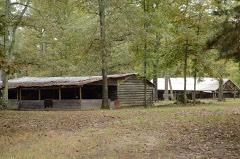 | Ebenezer Campground | site | 1976 | 76000416 |
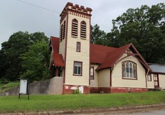 | First Presbyterian Church | building | 1976 | 76000418 |
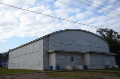 | Garrett Whiteside Hall | building | 1994 | 94001340 |
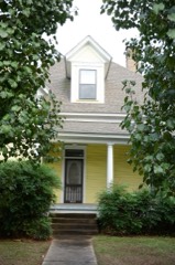 | Elbert W. Holt House | building | 1984 | 84000901 |
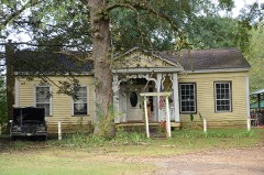 | Flavius Holt House | building | 1978 | 78000593 |
 | Howard County Courthouse | building | 1990 | 90000902 |
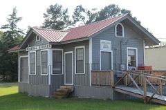 | Memphis, Paris, and Gulf Depot | building | 1978 | 78000592 |
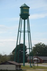 | Mineral Springs Waterworks | structure | 2007 | 07000473 |
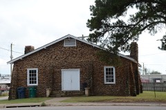 | Nashville American Legion Building | building | 1990 | 90001463 |
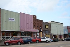 | Nashville Commercial Historic District | district | 2010 | 10000784 |
 | Nashville Post Office | building | 1998 | 98000913 |
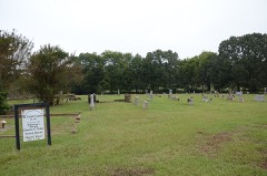 | Old Corinth Cemetery | site | 2012 | 12000022 |
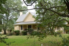 | Womack-Parker House | building | 1978 | 78000594 |
Every wildfire the federal occurrence database records inside this county: 472 of them, burning about 4,843 acres. 42 started naturally and 188 were recorded as arson. Each settlement page carries the fires within five miles of it.
| Reported cause | Fires |
|---|---|
| Arson/incendiarism | 188 |
| Missing data/not specified/undetermined | 123 |
| Debris and open burning | 72 |
| Natural | 42 |
| Equipment and vehicle use | 30 |
| Recreation and ceremony | 5 |
| Smoking | 4 |
| Misuse of fire by a minor | 4 |
| Railroad operations and maintenance | 4 |
The five largest, by the area the report gives. 6 of them were set deliberately.
| Date | Cause | Size | Reported by | Name on the report |
|---|---|---|---|---|
| 3 April 2011 | Arson/incendiarism | 900 acres | Arkansas Forestry Commission | not named |
| 5 September 2010 | Arson/incendiarism | 570 acres | Arkansas Forestry Commission | BUD SHAW |
| 5 August 2011 | Equipment and vehicle use | 181 acres | Arkansas Forestry Commission | SCHAAL ROAD |
| 20 September 2000 | Arson/incendiarism | 130 acres | Arkansas Forestry Commission | not named |
| 23 March 2011 | Arson/incendiarism | 122 acres | Arkansas Forestry Commission | not named |
| 2 September 2005 | Arson/incendiarism | 105 acres | Arkansas Forestry Commission | UMPIRE |
| 16 July 1998 | Natural | 85 acres | Arkansas Forestry Commission | not named |
| 10 April 2003 | Arson/incendiarism | 67 acres | Arkansas Forestry Commission | not named |
Every settlement page carries the fires within five miles of it - see the settlement index below.
The NOAA Storm Events Database holds 592 reports for this county, causing 12 deaths, 51 injuries and about $14,417,650 in recorded property damage. Each settlement page carries the reports that name it.
| Kind of event | Reports |
|---|---|
| Hail | 252 |
| Thunderstorm Wind | 252 |
| Flash Flood | 40 |
| Tornado | 35 |
| Heavy Rain | 6 |
| Funnel Cloud | 3 |
| Flood | 3 |
| Lightning | 1 |
The most serious of them, by death, then injury, then recorded damage. The accounts are quoted exactly as the forecast office filed them.
| When | Event | Place named | Harm | What the report says |
|---|---|---|---|---|
| March 1952 | Tornado (F4) | not stated | 7 killed, 9 hurt, $25,000 | no account filed |
| April 1982 | Tornado (F4) | not stated | 3 killed, 23 hurt, $2,500,000 | no account filed |
| May 2015 | Tornado (EF2) | Nashville | 2 killed, 8 hurt, $1,500,000 | A damage survey was completed in Howard County Arkansas and it was determined that the damage was consistent with that of an EF2 tornado. The most extensive damage was located on the southwest side of Nashville at the D&J Mobile Home Park. Five mobile homes were completely destroyed. There were 2 fatalities in this mobile home park and 8 additional injuries. There were 40 to 60 homes suffering minor to moderate damage from the tornado...mainly from fallen trees. Other damage consisted of numerous trees snapped and/or uprooted with power lines downed as well. The Governor of Arkansas was given a tour of the damage areas on the ground and in the air. |
| April 1967 | Tornado (F2) | not stated | 4 hurt, $25,000 | no account filed |
| April 1979 | Tornado (F2) | not stated | 2 hurt, $250,000 | no account filed |
| April 1954 | Tornado (F3) | not stated | 2 hurt, $250,000 | no account filed |
| April 1984 | Tornado (F1) | not stated | 1 hurt, $2,500,000 | no account filed |
| April 2009 | Tornado (EF2) | Center Pt | 1 hurt, $500,000 | This tornado initially touched down near an open field, approximately 1.5 mile south of Centerpoint, along Coonridge Road. Travelling slightly east of due north, the tornado snapped and uprooted numerous pine and oak trees. The most significant damage occurred at a single-family residence 0.75 mile north of the touchdown, where the house suffered a considerable amount of damage. The garage, roof, and many supporting walls were removed from the foundation. All windows not completely blown out by the storm were still shattered. A barn adjacent to the house had a considerable loss of roofing material but, although shifted off its foundation, remained largely intact. Trees and powerlines were snapped or uprooted as the storm moved through the community of Centerpoint before lifting along Billings Road, about 0.25 mile east of SR-4. There was one injury at the residence but the injury was not life threatening. The Arkansas governor declared Howard County a disaster area because of the tornado damage in the county. |
| May 1957 | Tornado (F2) | not stated | 1 hurt, $25,000 | no account filed |
| April 2009 | Tornado (EF3) | Dierks | $1,500,000 | This tornado continued into Howard County from Sevier County Arkansas. The Dierks Lake area received significant damage near the Sevier, Howard County line. The Army Corps of Engineers office had significant roof damage to their office building with roofing material found in the trees adjacent to the building. The tornado was strongest in Howard County where the entire second story of a reinforced concrete building was decimated and strewn across the road. This was consistent with EF3 tornado damage with wind speeds of 140 mph. The tornado then moved into Pike County, Arkansas about 3.5 miles southwest of New Hope, Arkansas. The Arkansas governor declared Howard County a disaster area because of the tornado damage. |
| May 2000 | Thunderstorm Wind | Nashville | $1,100,000 | Pine, Oak, and Pecan trees over a 15 mile wide area were flattened along with 2 homes destroyed, 5 homes suffering major damage, 30 homes suffering minor damage, 3 mobile homes totally destroyed and one new motor home crushed by a fallen tree. No injuries or deaths occurred. |
| June 2004 | Thunderstorm Wind | Nashville | $500,000 | Nashville and surrounding rural areas of Howard County had numerous trees and power lines down. Many homes suffered wind damage as well as many chicken houses. |
| May 1998 | Flash Flood | Nashville | $500,000 | Numerous local and county roads were underwater and closed. Hwy 4 was completely underwater and washed out in two places. Nashville totalled 10.30 inches of rain. Numerous homes and businesses were also flooded. |
| April 1994 | Thunderstorm Wind | Schaal | $500,000 | Thunderstorm winds destroyed two chicken houses and blew down numerous trees. |
| July 2006 | Flash Flood | Nashville | $250,000 | Numerous roads were underwater and impassable. Water entered several homes on the east side of town. Numerous cars were stalled out in the high water as well. Local law enforcement measured nearly 9 inches of rain since the rain began earlier that morning. |
| May 1975 | Tornado (F1) | not stated | $250,000 | no account filed |
| April 1970 | Tornado (F2) | not stated | $250,000 | no account filed |
| November 2022 | Tornado (EF2) | Center Pt | $200,000 | An EF-2 tornado with estimated maximum winds near 115 mph touched down near the intersection of Possum Hollow Road and Highway 26 just southwest of the Center Point community, where a metal outbuilding was destroyed and numerous trees were snapped or uprooted. The tornado continued northeast damaging chicken houses near Madison Street and significantly damaged a mobile home off of Billings Road and Highway 278. The tornado continued to snap and uproot trees in a heavily forested area southwest of Briar before lifting just north of Muddy Fork Road. |
| April 2010 | Tornado (EF2) | Dierks | $200,000 | An EF2 tornado touched down in Dierks, Arkansas destroying a laundrymat and damaging numerous homes and businesses. Numerous trees were snapped or uprooted along the track which started on the southwest side of town where a storage building was destroyed. The tornado crossed the town downing trees and powerlines. Shingles were torn off of numerous homes within the town. The tornado continued northeast and ripped a 100 ft section of roof off of a chicken house. The tornado lifted northeast of the chicken house. Maximum winds are estimated at 105-115 mph. |
| March 2008 | Tornado (EF0) | Schaal | $200,000 | An EF0 tornado damaged a building along Cottonshed Lane and several trees were downed on the east side of Millwood Lake. Minor damage also occurred in Tollette to Town Hall and to a baseball field adjacent to it. Several homes sustained minor roof damage in the town of Tollette. One mile east of town, damage occurred to a chicken house. |
| June 2003 | Thunderstorm Wind | Nashville | $130,000 | A chicken house had 300 feet of roof stripped off. Numerous trees down. |
| April 2018 | Tornado (EF2) | Umpire | $100,000 | An EF-2 tornado, with estimated maximum winds around 115 mph, touched down along Linville Road where it snapped several trees. It continued north where it snapped and uprooted numerous trees near Cedar Hill Cemetery, then crossed Cedar Hill Road where portions of a tin roof were peeled back from a metal barn and a nearby poorly constructed metal barn was destroyed. The tornado tracked north where it snapped several utility poles and a large swath of trees, at which point the tornado was at its strongest and widest. It crossed Kirby Road where it caused significant roof damage to two large chicken houses, while uprooting and snapping several more trees. Intermittent damage was found as the tornado continued north before lifting just north of Highway 278 northwest of the Umpire community a few miles south of Gatlin Road. Numerous trees were snapped or uprooted here before the tornado finally lifted. |
| May 2008 | Tornado (EF1) | Umpire | $100,000 | An EF1 tornado with winds of 95 to 105 mph occurred near Umpire Arkansas in Howard County beginning near the Davis Cemetary along Pinkerton road. The tornado destroyed 2 barns and damaged a mobile home from a falling tree. Numerous trees were snapped and uprooted along the 4 mile track ending near the intersection of Parsons|road and Hill lane. The tornado was on the ground from 903 am until 908 am and was 50 yards wide at its widest point and 4.5 miles long. |
| April 2011 | Tornado (EF1) | Umpire | $70,000 | An NWS Storm Survey Team concluded that the damage across northern Howard County, Arkansas was consistent with an EF1 tornado. The tornado first touched down just northeast of Umpire, Arkansas along SR 84 where a large tree was snapped. The storm continued in a north northeast trajectory moving parallel to SR 84 snapping a few trees along its path as it moved towards the community of Mineola. The tornado did its worst damage just before lifting on Midway Road. The tornado hit a brick house where nearly half of the roof was completely removed. A large storage building was completely destroyed along with severe damage to an adjacent chicken house. Large trees were also uprooted adjacent to the dwelling. Estimated wind speeds were 90-100 mph at this point. |
| March 1999 | Tornado (F2) | Galena | $60,000 | Tornado entered Howard County from Polk County, moved across Howard County, then into Pike County. Damage was largely confined to rural wooded area with little or no population. A mobile home was heavily damaged and scores of trees were toppled along the tornado path. |
| December 1999 | Thunderstorm Wind | Center Pt | $60,000 | House destroyed by thunderstorm winds. |
| October 1993 | Thunderstorm Wind | Mineral Springs | $50,000 | Thunderstorm winds damaged several sheds and knocked down a few trees. |
| November 1993 | Thunderstorm Wind | Tollette | $50,000 | Numerous trees were blown down. |
| April 1993 | Thunderstorm Wind | Tollette | $50,000 | Thunderstorm winds damaged a number of trees. |
| April 1993 | Thunderstorm Wind | Nashville | $50,000 | Thunderstorm winds damaged two chicken barns and blew down several trees. |
| May 1993 | Thunderstorm Wind | Center Point | $50,000 | Thunderstorm winds blew down numerous trees. |
| May 1993 | Thunderstorm Wind | Nashville | $50,000 | Thunderstorm winds knocked down numerous trees. |
| February 1997 | Thunderstorm Wind | Dierks | $50,000 | no account filed |
| December 1999 | Thunderstorm Wind | Nashville | $48,000 | Three barns destroyed and minor roof damage to a residence. Numerous power outages |
| July 2014 | Thunderstorm Wind | Nashville | $35,000 | Trees and large limbs were downed for severe thunderstorm wind gusts in Nashville, Arkansas. Two homes were hit by fallen trees in Nashville. There were no reports of injuries. |
| October 1998 | Tornado (F1) | Umpire | $35,000 | Tornado occurred on Cedar Hill road. An old barn had its roof destroyed. The barn was full of hay which was also lost. Trees and powerlines were knocked down. |
| February 1999 | Thunderstorm Wind | Nashville | $30,000 | Shingles blown off a local radio station and wind damage to three homes on the north side of town. |
| July 2013 | Thunderstorm Wind | Center Pt | $25,000 | A 300 foot section of a roof from a chicken house was torn off on Boyd Road in the Center Point community. Trees were also downed on several county roads throughout Howard County. |
| November 2012 | Thunderstorm Wind | Nashville | $25,000 | A large tree limb fell through the bedroom of a home in Nashville, Arkansas. There were no reports of any injuries. |
| May 1985 | Tornado (F1) | not stated | $25,000 | no account filed |
| February 1965 | Tornado (F1) | not stated | $25,000 | no account filed |
| June 2003 | Thunderstorm Wind | Center Pt | $20,000 | Numerous trees and power lines were toppled from Saratoga to the Mt Carmel area which is west of Center Point. One tree fell across a house on Cornbrige Road near York Chapel Road. |
| June 2001 | Thunderstorm Wind | Nashville | $20,000 | Windows blown out of business downtown. |
| July 2001 | Thunderstorm Wind | Umpire | $20,000 | Roof was torn off a chicken house and a nearby out building. Damage to a chimney and roofing shingles on a residential dwelling. |
| May 2000 | Thunderstorm Wind | Nashville | $20,000 | Several trees toppled including several that fell on homes. |
| April 1999 | Thunderstorm Wind | Nashville | $20,000 | Trees and powerlines down. A metal canopy over gas pumps at a service station was flipped upside down onto two cars. |
| October 2001 | Thunderstorm Wind | Nashville | $15,000 | Trees were felled north of town. In addition, 2 chicken houses were damaged. |
| June 1999 | Thunderstorm Wind | Dierks | $14,000 | Tree fell on a house. |
| July 2001 | Thunderstorm Wind | Umpire | $12,000 | A house was damaged when strong winds removed shingles, a tree top, and part of a chimney. A shed was also unroofed on the east side of the house. |
| May 2008 | Thunderstorm Wind | Umpire | $10,000 | Trees were downed. A home and a barn were damaged in town on Hwy 278 west. |
| March 2006 | Tornado (F1) | Center Pt | $10,000 | An F1 tornado touched down in Howard County near Center Point and moved northeast to the Pike County line approximately 11 miles northeast of Center Point. The tornado was on the ground for nearly 11 miles and damage consisted of numerous trees snapped and uprooted. Minor roof damage was observed to two homes and a barn was destroyed. |
| April 1999 | Thunderstorm Wind | Nashville | $10,000 | Seven chicken houses suffered moderate damage and several chickens were killed. |
| November 1998 | Thunderstorm Wind | Mineral Spgs | $10,000 | Two chicken houses damaged with 375 feet of tin off one roof and 60 feet of sheet iron off the second. Damage location along County Rd 355 and Hwy 24. |
| November 1996 | Thunderstorm Wind | Nashville | $10,000 | no account filed |
| August 1996 | Lightning | Mineral Spgs | $10,000 | no account filed |
| July 2001 | Thunderstorm Wind | Umpire | $8,000 | Nearly 100 feet of a chicken house roof was blown off. No injuries to the chickens. |
| February 1997 | Thunderstorm Wind | Dierks | $6,000 | no account filed |
| October 2014 | Thunderstorm Wind | Nashville | $5,000 | Several trees were downed throughout mainly the northern half of the county blocking roadways. A few chicken houses suffered minor damage as well. |
| July 2013 | Thunderstorm Wind | Center Pt | $5,000 | A shop was damaged on Mount Pleasant Drive from thunderstorm wind gusts. |
| April 2010 | Tornado (EF0) | Center Pt | $5,000 | An EF0 tornado briefly touched down north of Centerpoint Arkansas along Highway 278. One barn had a portion of its roof removed and a small outbuilding sustained minor damage. Several trees had large limbs broken out and a few trees were partially snapped. Maximum winds are estimated at 60-65 mph. |
The Survey's mineral resources record lists 95 workings inside this county. 3 still produce and 92 are closed or unrecorded. Each settlement page carries the workings within five miles of it.
| Commodity | Workings |
|---|---|
| Sand and Gravel, Construction | 62 |
| Strontium | 8 |
| Gypsum-Anhydrite | 6 |
| Mercury | 5 |
| Barium-Barite | 4 |
| Stone, Crushed/Broken | 2 |
| Clay | 2 |
| Titanium | 2 |
| Quartz | 2 |
| Lead | 2 |
| Zinc | 2 |
| Titanium, Metal | 1 |
The least common of them first, because a county's hundredth gravel pit says nothing its first ten did not.
| Where | Site | Commodity | Status | Recorded |
|---|---|---|---|---|
| Beulah Green-Pink Green Placer | Titanium, Metal | Occurrence | Ilmenite | |
| Adolph Chanosky Deposit | Titanium | Occurrence | ||
| Arkansas-Louisiana Lime Co.Pit | Stone, Crushed/Broken | Unknown | ||
| Buzbee Prospect | Lead, Zinc | Occurrence | ||
| Henry Lode Property | Lead, Zinc | Occurrence | ||
| Okay Pit & Plant | Stone, Crushed/Broken, Clay | Producer | ||
| Shale Pit | Clay | Unknown | ||
| Unknown | Quartz | Occurrence | ||
| Unknown | Quartz | Occurrence | ||
| Unknown | Titanium | Occurrence | ||
| Cherry Deposit | Barium-Barite | Occurrence | ||
| Lucky 13 Deposit | Barium-Barite | Occurrence | ||
| Section 13 Deposit | Barium-Barite | Occurrence | ||
| Unk | Barium-Barite | Occurrence | ||
| Floyd Prospect | Mercury | Occurrence | 1933 | |
| Henry Placer | Mercury | Occurrence | Placer | |
| Hintz Prospect | Mercury | Past Producer | ||
| Pyle Prospect | Mercury | Past Producer | Cinnabar | |
| Rock Fence Prospect | Mercury | Past Producer | Cinnabar | |
| Howard County Gypsum | Gypsum-Anhydrite | Occurrence | ||
| Unknown | Gypsum-Anhydrite | Unknown | ||
| Unknown | Gypsum-Anhydrite | Occurrence | ||
| Unknown | Gypsum-Anhydrite | Unknown | ||
| Unknown | Gypsum-Anhydrite | Occurrence | ||
| Weyerhaeuser Mine and Plant | Gypsum-Anhydrite | Producer | ||
| Beane Prospect | Strontium | Occurrence | ||
| Dierks Prospect | Strontium | Occurrence | ||
| James Prospect | Strontium | Occurrence | ||
| Messer Creek Prospect | Strontium | Occurrence | ||
| Payne Prospect | Strontium | Occurrence | ||
| Richards Prospect | Strontium | Occurrence | ||
| Unknown | Strontium | Occurrence | ||
| Wynn Prospect | Strontium | Occurrence | ||
| Bell Sand & Gravel | Sand and Gravel, Construction | Unknown | ||
| Bevell Pit | Sand and Gravel, Construction | Past Producer | ||
| Bobby Smith Sand & Gravel | Sand and Gravel, Construction | Unknown | ||
| G Blackwod | Sand and Gravel, Construction | Past Producer | ||
| Gravel Pit | Sand and Gravel, Construction | Unknown | ||
| Gravel Pit | Sand and Gravel, Construction | Unknown | ||
| Gravel Pit | Sand and Gravel, Construction | Unknown | ||
| Gravel Pit | Sand and Gravel, Construction | Unknown | ||
| Gravel Pit | Sand and Gravel, Construction | Unknown | ||
| Gravel Pit | Sand and Gravel, Construction | Unknown | ||
| Gravel Pit | Sand and Gravel, Construction | Unknown | ||
| Gravel Pit | Sand and Gravel, Construction | Unknown | ||
| Gravel Pit | Sand and Gravel, Construction | Unknown | ||
| Gravel Pit | Sand and Gravel, Construction | Unknown | ||
| Gravel Pit | Sand and Gravel, Construction | Unknown | ||
| Gravel Pit | Sand and Gravel, Construction | Unknown | ||
| Gravel Pit | Sand and Gravel, Construction | Unknown | ||
| Gravel Pit | Sand and Gravel, Construction | Unknown | ||
| Gravel Pit | Sand and Gravel, Construction | Unknown | ||
| Gravel Pit | Sand and Gravel, Construction | Unknown | ||
| Gravel Pit | Sand and Gravel, Construction | Unknown | ||
| Gravel Pit | Sand and Gravel, Construction | Unknown | ||
| Gravel Pit | Sand and Gravel, Construction | Unknown | ||
| Gravel Pit | Sand and Gravel, Construction | Unknown | ||
| Gravel Pit | Sand and Gravel, Construction | Unknown | ||
| Gravel Pit | Sand and Gravel, Construction | Unknown | ||
| Gravel Pit | Sand and Gravel, Construction | Unknown | ||
| Gravel Pit | Sand and Gravel, Construction | Unknown | ||
| Gravel Pit | Sand and Gravel, Construction | Unknown | ||
| Gravel Pit | Sand and Gravel, Construction | Unknown | ||
| Gravel Pit | Sand and Gravel, Construction | Unknown | ||
| Gravel Pit | Sand and Gravel, Construction | Unknown | ||
| Gravel Pit | Sand and Gravel, Construction | Unknown | ||
| Gravel Pit | Sand and Gravel, Construction | Unknown | ||
| Gravel Pit | Sand and Gravel, Construction | Unknown | ||
| Gravel Pit | Sand and Gravel, Construction | Unknown | ||
| Gravel Pit | Sand and Gravel, Construction | Unknown | ||
| Gravel Pit | Sand and Gravel, Construction | Unknown | ||
| Gravel Pit | Sand and Gravel, Construction | Unknown | ||
| Gravel Pit | Sand and Gravel, Construction | Unknown | ||
| Gravel Pit | Sand and Gravel, Construction | Unknown | ||
| Gravel Pit | Sand and Gravel, Construction | Unknown | ||
| Gravel Pit | Sand and Gravel, Construction | Unknown | ||
| Gravel Pit | Sand and Gravel, Construction | Unknown | ||
| Gravel Pit | Sand and Gravel, Construction | Unknown | ||
| Gravel Pit | Sand and Gravel, Construction | Unknown | ||
| Gravel Pit | Sand and Gravel, Construction | Unknown | ||
| Gravel Pit | Sand and Gravel, Construction | Unknown | ||
| Gravel Pit | Sand and Gravel, Construction | Unknown | ||
| Gravel Pit | Sand and Gravel, Construction | Unknown | ||
| Gravel Pit | Sand and Gravel, Construction | Unknown | ||
| Gravel Pit | Sand and Gravel, Construction | Unknown | ||
| Gravel Pit | Sand and Gravel, Construction | Unknown | ||
| Hardin Lavenrne S & G | Sand and Gravel, Construction | Past Producer | ||
| J Watson | Sand and Gravel, Construction | Past Producer | ||
| Laverne Hardin Sand & Gravel | Sand and Gravel, Construction | Past Producer | ||
| Mine Creek Pit | Sand and Gravel, Construction | Past Producer | ||
| N Davis | Sand and Gravel, Construction | Past Producer | ||
| Nashville Ready Mix | Sand and Gravel, Construction | Past Producer | ||
| R Morris | Sand and Gravel, Construction | Past Producer | ||
| Smith Pit & Plant | Sand and Gravel, Construction | Producer | ||
| Smith Ready Mix #2 Pit | Sand and Gravel, Construction | Unknown |
Named settlements recorded in the Geographic Names Information System, each with the topographic sheets covering it. Villages, hamlets and abandoned places alike. Each is shown with the nearest named watercourse or landform and the survey quadrangle it falls on.
Blackland township · 71851 · On Baber Creek · Mineral Springs South quadrangle
15 sheets, 1951 to 1989
Nashville township · 71852 · On Temperanceville Creek · Mineral Springs North quadrangle
14 sheets, 1951 to 1989
No longer a settlement
Umpire township · On Hunters Creek · Gillham Dam quadrangle
14 sheets, 1913 to 1986
No longer a settlement
Umpire township · 71971 · On Baker Creek · Baker Springs quadrangle
17 sheets, 1913 to 1986
Umpire township · 71971 · On Moore Creek · Umpire quadrangle
18 sheets, 1913 to 1986
No longer a settlement
Umpire township · 71833 · On Bethel Branch · Umpire quadrangle
18 sheets, 1913 to 1986
No longer a settlement
County Line township · 71852 · On Little Bayou · Mineral Springs North quadrangle
14 sheets, 1951 to 1989
Umpire township · 71971 · On Tobe Branch · Umpire quadrangle
18 sheets, 1913 to 1986
No longer a settlement
Clay township · 71959 · On Long Creek · Athens quadrangle
16 sheets, 1906 to 1986
No longer a settlement
Buck Range township · 71852 · On Little Brushy Creek · Columbus quadrangle
14 sheets, 1951 to 1989
Umpire township · 71971 · Umpire quadrangle
18 sheets, 1913 to 1986
No longer a settlement
Duckett township · 71973 · Near Devils Hollow · Baker Springs quadrangle
17 sheets, 1913 to 1986
Duckett township · 71973 · On White Oak Creek · Baker Springs quadrangle
17 sheets, 1913 to 1986
Blue Ridge township · 71833 · On Flowers Spring Creek · Dierks Dam quadrangle
14 sheets, 1913 to 1986
County Line township · 71852 · Mineral Springs North quadrangle
14 sheets, 1951 to 1989
No longer a settlement
Holly Creek township · 71833 · On Trout Branch · Newhope quadrangle
12 sheets, 1906 to 1986
No longer a settlement
Nashville township · 71852 · On Sandy Branch · Mineral Springs North quadrangle
14 sheets, 1951 to 1989
Mineral Springs township · 71851 · On Dillard Creek · Mineral Springs North quadrangle
14 sheets, 1951 to 1989
Center Point township · 71833 · On Beech Creek · Dierks quadrangle
14 sheets, 1913 to 1986
County Line township · 71852 · Mineral Springs North quadrangle
14 sheets, 1951 to 1989
No longer a settlement
Umpire township · 71971 · On Indian Creek · Umpire quadrangle
18 sheets, 1913 to 1986
No longer a settlement
Nashville township · 71852 · On Dodson Creek · Nashville quadrangle
14 sheets, 1951 to 1989
Mountain township · 71971 · Umpire quadrangle
18 sheets, 1913 to 1986
No longer a settlement
Mountain township · 71959 · Athens quadrangle
16 sheets, 1906 to 1986
No longer a settlement
Madison township · 71833 · On Holly Creek · Dierks quadrangle
14 sheets, 1913 to 1986
No longer a settlement
Saratoga township · 71859 · Near Devils Backbone · Mineral Springs South quadrangle
15 sheets, 1951 to 1989
Blue Ridge township · 71833 · Dierks Dam quadrangle
14 sheets, 1913 to 1986
No longer a settlement
Mountain township · 71959 · On Indian Creek · Athens quadrangle
16 sheets, 1906 to 1986
No longer a settlement
Blue Ridge township · 71833 · On Flowers Spring Creek · Dierks Dam quadrangle
14 sheets, 1913 to 1986
No longer a settlement
Clay township · 71959 · On Bethel Branch · Athens quadrangle
16 sheets, 1906 to 1986
No longer a settlement
Umpire township · On Pryor Creek · Baker Springs quadrangle
17 sheets, 1913 to 1986
No longer a settlement
Nashville township · 71852 · On Pump Springs Branch · Nathan quadrangle
12 sheets, 1906 to 1986
No longer a settlement
Center Point township · 71852 · On Brushy Creek · Silver Ridge quadrangle
10 sheets, 1951 to 1990
No longer a settlement
Clay township · 71959 · On Amos Branch · Dierks Dam quadrangle
14 sheets, 1913 to 1986
No longer a settlement
Saratoga township · 71859 · Near Devils Backbone · Mineral Springs South quadrangle
15 sheets, 1951 to 1989
Franklin township · 71851 · On Negro Branch · Mineral Springs South quadrangle
15 sheets, 1951 to 1989
Clay township · 71959 · On Long Creek · Newhope quadrangle
12 sheets, 1906 to 1986
No longer a settlement
Umpire township · 71973 · Gillham Dam quadrangle
14 sheets, 1913 to 1986
No longer a settlement
Center Point township · 71833 · On Beech Creek · Dierks quadrangle
14 sheets, 1913 to 1986
No longer a settlement
Nashville township · 71852 · Mineral Springs North quadrangle
14 sheets, 1951 to 1989
Tollette township · 71851 · On Grahm Creek · Mineral Springs South quadrangle
15 sheets, 1951 to 1989
Nashville township · 71852 · On Temperanceville Creek · Nashville quadrangle
14 sheets, 1951 to 1989
Umpire township · 71973 · On French Creek · Gillham Dam quadrangle
14 sheets, 1913 to 1986
No longer a settlement
Nashville township · 71852 · On Sandy Branch · Mineral Springs North quadrangle
14 sheets, 1951 to 1989
No longer a settlement
The vanished settlements of Howard County: the places named above that are no longer on the map.