 Block
From the record
18 National Register listings published here.
Sources: the National Register database, National Park Service
90 topographic sheets cover 55 settlements here, and 18 properties are on the National Register of Historic Places.
18 National Register listings published here.
Sources: the National Register database, National Park Service
Every property in this county listed on the National Register of Historic Places, with the year it was listed and the federal nomination document.
| Photograph | Property | Type | Listed | Reference |
|---|---|---|---|---|
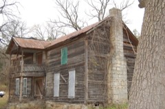 | Arnold Springs Farmstead | building | 2010 | 10000285 |
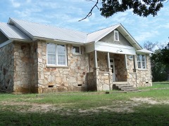 | Boswell School | building | 1992 | 92001178 |
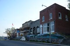 | Calico Rock Historic District | district | 1985 | 85003499 |
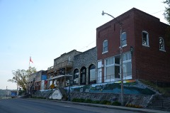 | Calico Rock Historic District (Boundary Increase) | building | 1989 | 88002827 |
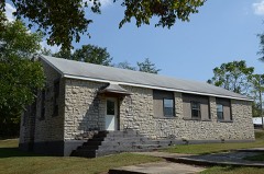 | Calico Rock Home Economics Building | building | 1992 | 92001200 |
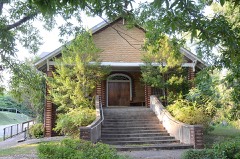 | Calico Rock Methodist Episcopal Church | building | 2007 | 07000971 |
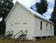 | Caney Springs Cumberland Presbyterian Church | building | 1995 | 95000693 |
 | Izard County Courthouse | building | 1993 | 93001025 |
| Jeffery Cemetery | site | 1999 | 99001261 | |
| A. C. Jeffery Farmstead | building | 1994 | 94000825 | |
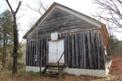 | Jumbo Church of Christ | building | 1999 | 99000222 |
| Missouri Pacific Railroad Depot | building | 2004 | 04001036 | |
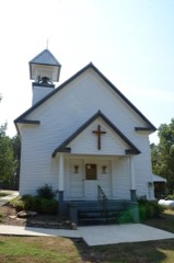 | Mount Olive Cumberland Presbyterian Church | building | 2004 | 04000503 |
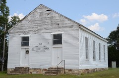 | Philadelphia Methodist Church | building | 1976 | 76000420 |
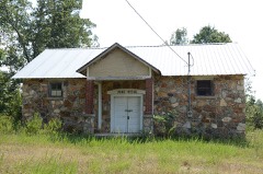 | Pine Ridge School Building | building | 1994 | 94000161 |
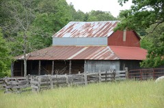 | Rector Log Barn | building | 1993 | 93000488 |
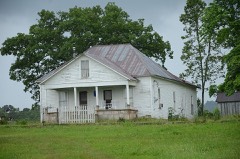 | Sylvester Smith Farmstead | building | 1992 | 92001222 |
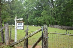 | Vest Cemetery | building | 2016 | 15000284 |
Every wildfire the federal occurrence database records inside this county: 996 of them, burning about 25,344 acres. 12 started naturally and 377 were recorded as arson. Each settlement page carries the fires within five miles of it.
| Reported cause | Fires |
|---|---|
| Arson/incendiarism | 377 |
| Debris and open burning | 320 |
| Missing data/not specified/undetermined | 243 |
| Equipment and vehicle use | 26 |
| Natural | 12 |
| Recreation and ceremony | 8 |
| Smoking | 5 |
| Misuse of fire by a minor | 4 |
| Railroad operations and maintenance | 1 |
The five largest, by the area the report gives. Three of them were set deliberately.
| Date | Cause | Size | Reported by | Name on the report |
|---|---|---|---|---|
| 23 March 2011 | Missing data/not specified/undetermined | 928 acres | Arkansas Forestry Commission | DOLPH |
| 13 April 2003 | Arson/incendiarism | 800 acres | Arkansas Forestry Commission | D8166 |
| 6 March 2016 | Debris and open burning | 370 acres | Arkansas Forestry Commission | not named |
| 9 March 2007 | Arson/incendiarism | 322 acres | Arkansas Forestry Commission | TURKEY PEN |
| 5 February 2017 | Missing data/not specified/undetermined | 284 acres | Arkansas Forestry Commission | not named |
| 15 February 2011 | Debris and open burning | 258 acres | Arkansas Forestry Commission | DEER PEN |
| 3 April 2011 | Arson/incendiarism | 246 acres | Arkansas Forestry Commission | BOSWELL FIRE |
| 27 March 2000 | Debris and open burning | 244 acres | Arkansas Forestry Commission | not named |
Every settlement page carries the fires within five miles of it - see the settlement index below.
The NOAA Storm Events Database holds 355 reports for this county, causing 5 deaths, 61 injuries and about $39,677,530 in recorded property damage. Each settlement page carries the reports that name it.
| Kind of event | Reports |
|---|---|
| Thunderstorm Wind | 147 |
| Hail | 135 |
| Tornado | 25 |
| Flash Flood | 24 |
| Flood | 15 |
| Lightning | 5 |
| Heavy Rain | 4 |
The most serious of them, by death, then injury, then recorded damage. The accounts are quoted exactly as the forecast office filed them.
| When | Event | Place named | Harm | What the report says |
|---|---|---|---|---|
| April 1996 | Tornado (F4) | Sylamore | 2 killed, 30 hurt, $5,000,000 | no account filed |
| February 2008 | Tornado (EF3) | Guion | 2 killed, 20 hurt, $11,500,000 | The tornado moved out of Stone County, northeast of Mountain View, into Izard County, just northwest of Guion. A survey by the Federal Emergency Management Agency indicated 106 residential structures (houses and mobile homes) suffered damage. This included 43 residences destroyed, 14 with major damage, 36 with minor damage, and 13 others affected. A cattle farmer lost hundreds of cattle to the tornado. Two fatalities occurred: One in a mobile home in the Rose Trail area, and the other in a mobile home at Zion. The tornado continued into Sharp County, in the area northwest of Evening Shade. |
| January 2007 | Heavy Rain | Zion | 1 killed | Heavy rainfall increased water levels along a number of low water crossings across Izard County. A vehicle attempted to drive through a low water crossing along the Piney Fork of the Strawberry River, northeast of Zion, and was swept downstream. The only person in the vehicle was the driver who drowned. |
| March 2022 | Tornado (EF2) | Sage | 5 hurt, $325,000 | This tornado started in central Izard county, just southeast of Melbourne, and tracked northeast 9.86 miles in Izard county. The tornado continued into into western Sharp county and dissipating northwest of Evening Shade. There was mostly tree damage. Several homes in and around Sage had roof damage, with a few barns and sheds heavily damaged. The worst damage was 0.5 mile east of Sage, with numerous trees snapped and a horse barn destroyed. Farther northeast, a mobile home was rolled, and a person was injured. A modular home was ripped apart about 4.0 miles west-northwest of Evening Shade. The occupants went to a nearby metal storage container for shelter, and it was rolled. There were four injuries reported here, including one serious injury. |
| March 1996 | Tornado (F3) | Melbourne | 2 hurt, $1,000,000 | no account filed |
| April 2013 | Thunderstorm Wind | Horseshoe Bend Arpt | 1 hurt, $1,800,000 | Most of the thunderstorm wind damage was close to the shore of Crown Lake, but several houses near Diamond Lake also sustained damage. Altogether, 41 houses were damaged. Of this number, 3 were destroyed and 8 had major damage. The remaining 30 houses had lesser amounts of damage. One woman was injured when a brick wall of her home collapsed inward. |
| November 1988 | Tornado (F1) | not stated | 1 hurt, $250,000 | no account filed |
| March 1950 | Tornado (F3) | not stated | 1 hurt, $250,000 | no account filed |
| May 1957 | Tornado (F2) | not stated | 1 hurt, $25,000 | no account filed |
| March 2008 | Flood | Boswell | $12,000,000 | Heavy rain caused the White River at Calico Rock to go well above major flood level. The river crested less than a foot lower than the December, 1982 flood crest, but there has been substantial development in the floodplain during the last 25 years. Water was covering Arkansas Highways 5 and 56. The foot bridges that crossed Calico Creek were washed out. Water got into the lower units of a motel, into a business in Peppersauce Alley, buildings on Chesmond Landing, and many houses. At least 20 homes in Mt. Olive and 13 in Guion were flooded or totally washed away. Over 40 homes sustained some degree of damage and about 20 were washed away by the floodwaters. There was a fishing outfitting businesses that was destroyed, with the business and the dock with boats and equipment torn away by the swift waters. There were also reports of large round hay bales and cattle, both alive and dead, in the river. |
| April 2011 | Flood | Horseshoe Bend | $2,000,000 | Widespread areal flooding occurred. On the 27th, a Missouri and Northern Arkansas train derailed after hitting a track washout near Twin Creek. The locomotive and one car fell into the White River. |
| May 2011 | Flood | Horseshoe Bend | $1,500,000 | no account filed |
| March 2008 | Flash Flood | Dolph | $1,000,000 | Low lying roads, bridges, and low water crossings were flooded. Arkansas Highway 56 was closed briefly between Calico Rock and Brockwell due to flooding. |
| September 1993 | Thunderstorm Wind | Melbourne | $500,000 | Thunderstorm winds blew the roof off the drive-thru at a bank and several metal buildings were damaged. A high school gymnasium roof also sustained damage. |
| April 2013 | Tornado (EF2) | Mt Olive | $350,000 | An EF2 tornado caused damage along the White River and just a couple of blocks on land adjacent to the river. It was apparent that a portion of this tornado was a waterspout in the river. A log house and its adjacent garage were destroyed. The house had its roof and part of its back wall torn off, and the structure was shifted on its foundation. Several other houses were damaged, primarily on their roofs. One house had a covered porch torn off and another had a tree fall against it. A four-slip boat dock was overturned on the White River and two boats were sunk. Hundreds of trees were snapped off or uprooted. |
| April 2008 | Flood | Pineville | $250,000 | Heavy rain produced significant rises on the upper White River and tributaries. The combination of high river flows and the excessive upstream reservoir releases caused a second major flood event at the Calico Rock gage. Homes and businesses were flooded for a second time in less than month in Calico Rock and Sylamore. Damages were limited to repairs made since the March flooding. |
| May 1974 | Tornado (F1) | not stated | $250,000 | no account filed |
| April 1970 | Tornado (F2) | not stated | $250,000 | no account filed |
| March 1996 | Tornado (F2) | Oxford | $180,000 | no account filed |
| April 2014 | Flash Flood | Dolph | $150,000 | Arkansas 69 was under water at Mt. Pleasant. County roads suffered damage. |
| April 2011 | Thunderstorm Wind | Melbourne | $125,000 | Part of the roof of a house was torn off, allowing water to run inside and ruin many of the furnishings in the house. The roof was also taken off of a pole barn. |
| May 2022 | Thunderstorm Wind | Franklin | $100,000 | Fallen trees caused damage to a home and a vehicle in Franklin. |
| June 2008 | Lightning | Brockwell | $100,000 | A fire destroyed a sawmill. Lightning struck a power pole, setting fire to the electrical lines, then the electrical boxes, and finally, the building. |
| March 2022 | Thunderstorm Wind | Bone Town | $80,000 | Two barns on Finely Creek Rd. sustained damage, and multiple mobile homes were blown off of their blocks on Piney Cove Rd. |
| December 2009 | Flood | Horseshoe Bend Arpt | $75,000 | North Little Rock Road and Tri Lakes Road were closed due to flooding. |
| October 2009 | Flash Flood | Calico Rock | $65,000 | Significant flooding occurred along County Road 9 and Arkansas Highways 56 and 69. Many other county roads were covered by water. |
| August 2013 | Flash Flood | Pineville | $50,000 | A bridge on Harris Rd. sustained serious damage, causing the road to be closed. Near the junction of Arkansas Highways 223 and 56, parts of both roads were under water. Two footbridges were washed away by Fairgrounds Creek at Earl King Park in Calico Rock. A water line was washed out at Wideman. |
| August 2011 | Lightning | Oxford | $50,000 | Lightning started a grass fire, which spread to a residence. |
| September 1993 | Thunderstorm Wind | Melbourne | $50,000 | Thunderstorm winds downed some trees and power lines. |
| November 1993 | Thunderstorm Wind | Brockwell | $50,000 | Thunderstorm winds damaged the roof of a residence, and a barn was also damaged. Several large trees were blown down. |
| December 2010 | Thunderstorm Wind | Wiseman | $40,000 | Several windows were blown out in Wiseman. A tractor was blown over and moved, and part of a roof was torn off. |
| August 2011 | Lightning | Melbourne | $25,000 | Lightning struck a tree in Melbourne, causing it to catch fire. After the fire was extinguished, it was discovered that there was also a leak in a 1.5 inch natural gas line. The gas company responded to repair the leak. |
| April 2008 | Flash Flood | Sylamore | $25,000 | Arkansas Highway 9 between Newburg and Brockwell was flooded. Several county roads were flooded. |
| September 2008 | Tornado (EF0) | Gid | $25,000 | A weak tornado was spawned by Tropical Depression Gustav. A mobile home had damage to its roof, the porch roof and the underpinning were torn off, and the carport sailed up a hill and became stuck in a fence. A storm door was torn off a house, as were a few pieces of siding. A carport and trampoline at a house were destroyed. A few large limbs were torn off trees. |
| September 1989 | Tornado (F0) | not stated | $25,000 | no account filed |
| June 1973 | Tornado (F1) | not stated | $25,000 | no account filed |
| April 1964 | Tornado (F0) | not stated | $25,000 | no account filed |
| July 2012 | Thunderstorm Wind | Calico Rock | $20,000 | Trees and power lines were blown down. One of the trees fell on Arkansas 223, blocking a lane. Power outages occurred in the southwest part of town. |
| July 2016 | Thunderstorm Wind | La Crosse | $15,000 | There was significant roof damage at a manufacturing plant. Several large sections of roofing material were blown off, causing damage to some of the a/c units. |
| June 2007 | Lightning | Horseshoe Bend | $12,000 | Lightning struck a 1,000 gallon tank propane system at Crown Point Resort causing a fire which melted the siding on a guest unit. The resulting electrical surge burned out 18 televisions, several office telephones and a communications control panel. |
| July 2012 | Thunderstorm Wind | Twin Creek | $10,000 | Several trees were snapped off, there was minor roof damage to several houses, and lawn furniture was thrown around 300 feet. |
| April 2011 | Flash Flood | Oxford | $10,000 | Several streams went out of their banks after 2 3/4 inches of rain fell between 4:30 and 5:30 PM CDT. |
| April 2009 | Thunderstorm Wind | Franklin | $10,000 | Trees were down across County Road 69. A house lost its shingles. |
| May 2011 | Flood | Calico Rock | $10,000 | no account filed |
| August 2015 | Thunderstorm Wind | Calico Rock | $5,000 | A tree fell onto a house. |
| April 2014 | Thunderstorm Wind | Calico Rock | $5,000 | A few trees were blown down in the Calico Rock area. |
| February 2011 | Flash Flood | Love | $5,000 | Hars Creek Rd. was blocked south of Arkansas Highway 56. |
| July 2011 | Flash Flood | Franklin | $5,000 | Flash flooding occurred on Arkansas 56 east of Franklin toward Myron. |
| May 2011 | Thunderstorm Wind | Wideman | $5,000 | Trees and power lines were blown down. |
| August 2011 | Thunderstorm Wind | Melbourne | $5,000 | Two trees and a power line were blown down. |
| July 2010 | Thunderstorm Wind | Melbourne | $5,000 | Several trees were blown down. |
| November 1994 | Thunderstorm Wind | Pineville | $5,000 | Thunderstorm winds downed some trees and power lines. |
| November 1993 | Thunderstorm Wind | Violet Hill | $5,000 | Several trees were blown down. |
| November 1993 | Thunderstorm Wind | Zion | $5,000 | Some trees were knocked down by thunderstorm winds. |
| April 2011 | Flood | Calico Rock | $5,000 | no account filed |
| May 2011 | Flood | Calico Rock | $5,000 | no account filed |
| May 2011 | Thunderstorm Wind | Horseshoe Bend | $4,000 | Two power poles were snapped just outside Horseshoe Bend along Arkansas Highway 289. |
| July 2012 | Thunderstorm Wind | Wideman | $3,000 | Trees were blown down. |
| June 1974 | Tornado (F1) | not stated | $2,500 | no account filed |
| June 2014 | Thunderstorm Wind | Horseshoe Bend | $2,000 | A large limb was broken off a tree and many smaller limbs and branches were blown down. |
The Survey's mineral resources record lists 81 workings inside this county. 1 still produces and 80 are closed or unrecorded. Each settlement page carries the workings within five miles of it.
| Commodity | Workings |
|---|---|
| Manganese | 59 |
| Sand and Gravel, Construction | 8 |
| Stone | 4 |
| Iron | 3 |
| Limestone, Dimension | 3 |
| Aluminum | 2 |
| Stone, Crushed/Broken | 2 |
| Sulfur-Pyrite, Lead | 1 |
| Silica, Stone, Crushed/Broken | 1 |
| Marble, Dimension | 1 |
| Limestone, High Calcium | 1 |
The least common of them first, because a county's hundredth gravel pit says nothing its first ten did not.
| Where | Site | Commodity | Status | Recorded |
|---|---|---|---|---|
| Guion Mine & Plant | Silica, Stone, Crushed/Broken | Producer | Massive bedded St. Peter Sandstone | |
| Stone Produducts Corp.Quarry | Marble, Dimension, Stone, Crushed/Broken | Unknown | Bedded limestone - Kimmswick formation | |
| Time Stokes | Iron, Sulfur-Pyrite, Lead | Occurrence | ||
| Williamson Property | Limestone, High Calcium | Unknown | Bedded limestone | |
| Arkansas Limestone Co. | Limestone, Dimension, Aluminum, Stone | Unknown | Bedded high calcium limestone | |
| Meyersville Spur | Stone, Crushed/Broken | Unknown | ||
| Meyersville Spur Limestone Property | Aluminum | Past Producer | Surface | |
| Bolt Spur | Limestone, Dimension | Unknown | ||
| L.C.Crutchfield Deposit | Iron | Occurrence | ||
| Love Hollow Limestone Co. | Limestone, Dimension | Prospect | ||
| Unk | Iron | Unknown | ||
| Unk | Stone | Unknown | ||
| Unk | Stone | Unknown | ||
| Unk | Stone | Unknown | ||
| Unk | Sand and Gravel, Construction | Unknown | ||
| Unk | Sand and Gravel, Construction | Unknown | ||
| Unk | Sand and Gravel, Construction | Unknown | ||
| Unk | Sand and Gravel, Construction | Unknown | ||
| Unk | Sand and Gravel, Construction | Unknown | ||
| Unk | Sand and Gravel, Construction | Unknown | ||
| Unk | Sand and Gravel, Construction | Unknown | ||
| Unk | Sand and Gravel, Construction | Unknown | ||
| Adler Hollow Mine | Manganese | Past Producer | 1918 | |
| Alexander Hill | Manganese | Prospect | ||
| Anderson Prospect | Manganese | Past Producer | ||
| Austin Property | Manganese | Occurrence | ||
| Barksdale Mine | Manganese | Past Producer | 1918 | |
| Bevans Prospect | Manganese | Prospect | ||
| Bone Prospect | Manganese | Past Producer | 1918 | |
| Breeden Prospect | Manganese | Past Producer | 1917 | |
| C L Sanders Prospect | Manganese | Past Producer | 1917 | |
| Caraway Prospect | Manganese | Past Producer | 1918 | |
| Casey Prospect | Manganese | Past Producer | 1929 | |
| Cave Hill Mine | Manganese | Past Producer | 1917 | |
| Clous-Dobson | Manganese | Prospect | ||
| Crutchfield Farm | Manganese | Occurrence | ||
| Cummins Hollow Mine | Manganese | Past Producer | 1918 | |
| E D Winkle Prospect | Manganese | Past Producer | ||
| Earl Collie Mine | Manganese | Past Producer | 1917 | |
| Edmunson Prospect | Manganese | Past Producer | ||
| Ernest D.Martin Property | Manganese | Past Producer | ||
| Glen C.Brewster Property | Manganese | Occurrence | ||
| H.J.Ray Prospect | Manganese | Occurrence | ||
| Haddock Prospect | Manganese | Past Producer | 1917 | |
| Hall Prospect | Manganese | Past Producer | 1918 | |
| Helm Prospect | Manganese | Occurrence | ||
| Henry King Prospect | Manganese | Prospect | ||
| Hollawell Prospect | Manganese | Past Producer | 1918 | |
| Izard Mine | Manganese | Past Producer | 1917 | |
| Johnson Hill Mine | Manganese | Past Producer | 1918 | |
| Klondike Mine | Manganese | Past Producer | 1918 | |
| L B Ray Prospect | Manganese | Past Producer | 1918 | |
| L J Weaver Mine | Manganese | Past Producer | ||
| Lewis Prospect | Manganese | Prospect | ||
| Love Prospect | Manganese | Occurrence | ||
| M E Wilson Prospect | Manganese | Past Producer | 1918 | |
| Manganese Field Mine | Manganese | Past Producer | 1918 | |
| Mcconnell Mine | Manganese | Past Producer | 1918 | |
| Moser Prospect | Manganese | Past Producer | ||
| O Gilsby Prospect | Manganese | Past Producer | 1918 | |
| Penters Bluff Mine | Manganese | Past Producer | 1929 | |
| Pittman Mine | Manganese | Past Producer | 1928 | |
| Pittman Mines | Manganese | Past Producer | 1918 | |
| Pugh Mine | Manganese | Past Producer | 1918 | |
| Rudolph Prospect | Manganese | Past Producer | 1917 | |
| Ruminer Rough Mine | Manganese | Past Producer | 1918 | |
| Sand Field Mine | Manganese | Past Producer | 1918 | |
| Shaft Hill Mine | Manganese | Past Producer | 1918 | |
| Skelton Hill Mine | Manganese | Past Producer | 1918 | |
| Skelton-Hanford Prospect | Manganese | Prospect | ||
| Speck Mine | Manganese | Past Producer | 1934 | |
| St.Clair Marble Co's Prospect | Manganese | Occurrence | ||
| T.C.Winkle Prospect | Manganese | Occurrence | ||
| United Phosphate and Chem Co | Manganese | Past Producer | 1917 | |
| Unk | Manganese | Unknown | ||
| Verna Mine | Manganese | Past Producer | 1918 | |
| W A King Mine | Manganese | Past Producer | 1918 | |
| W.D.Lewis | Manganese | Occurrence | ||
| W.K.Tate Prospect | Manganese | Occurrence | ||
| Williamson Gully Prospect | Manganese | Past Producer | ||
| Williamson-Gulley Prospect | Manganese | Past Producer | 1917 |
Named settlements recorded in the Geographic Names Information System, each with the topographic sheets covering it. Villages, hamlets and abandoned places alike. Each is shown with the nearest named watercourse or landform and the survey quadrangle it falls on.
White River township · 72556 · Near Gann Hollow · Sylamore quadrangle
16 sheets, 1892 to 1992
No longer a settlement
Newburg township · 72556 · On Little Hurricane Creek · Melbourne quadrangle
10 sheets, 1951 to 1984
Athens township · 72556 · On Vest Spring Branch · Boswell quadrangle
19 sheets, 1890 to 1985
White River township · 72556 · On Brandenburg Mountain · Sylamore quadrangle
16 sheets, 1892 to 1992
Union township · 72519 · On Fairgrounds Creek · Calico Rock quadrangle
19 sheets, 1890 to 1985
Lafferty township · 72561 · Near Love Hollow · Mount Pleasant quadrangle
19 sheets, 1890 to 1989
Union township · 72585 · On Flat Rock Creek · Pineville quadrangle
17 sheets, 1890 to 1985
Violet Hill township · 72584 · Oxford quadrangle
10 sheets, 1951 to 1984
No longer a settlement
Lafferty township · 72561 · Near Stillhouse Hollow · Mount Pleasant quadrangle
19 sheets, 1890 to 1989
Lunenburg township · 72556 · Near Bear Spring Hollow · Melbourne quadrangle
10 sheets, 1951 to 1984
Jefferson township · 72513 · Near Davidson Hill · Myron quadrangle
9 sheets, 1957 to 1983
No longer a settlement
Lunenburg township · 72556 · On Haley Creek · Melbourne quadrangle
10 sheets, 1951 to 1984
Mount Olive township · 72556 · On Pelham Creek · Boswell quadrangle
19 sheets, 1890 to 1985
Barren Fork township · 72561 · Near Shaw Hill · Mount Pleasant quadrangle
19 sheets, 1890 to 1989
Lafferty township · 72561 · Near Lafferty Hollow · Guion quadrangle
14 sheets, 1890 to 1986
Pleasant Hill township · 72577 · On Hamms Schoolhouse Branch · Sidney quadrangle
8 sheets, 1957 to 1983
Newburg township · 72556 · On Band Mill Creek · Melbourne quadrangle
10 sheets, 1951 to 1984
Lafferty township · 72561 · Near Alexander Hill · Bethesda quadrangle
18 sheets, 1890 to 1989
No longer a settlement
Union township · 72519 · On Goodman Creek · Norfork Dam South quadrangle
19 sheets, 1890 to 1985
White River township · 72560 · Near Ripley Hollow · Sylamore quadrangle
16 sheets, 1892 to 1992
No longer a settlement
White River township · 72560 · Near Canning Kitchen Hollow · Sylamore quadrangle
16 sheets, 1892 to 1992
White River township · 72556 · On East Twin Creek · Sylamore quadrangle
16 sheets, 1892 to 1992
Athens township · 72556 · Near Turkey Knob · Boswell quadrangle
19 sheets, 1890 to 1985
No longer a settlement
The vanished settlements of Izard County: the places named above that are no longer on the map.