 Block
From the record
10 National Register listings published here.
Sources: the National Register database, National Park Service
56 topographic sheets cover 46 settlements here, and 10 properties are on the National Register of Historic Places.
10 National Register listings published here.
Sources: the National Register database, National Park Service
Every property in this county listed on the National Register of Historic Places, with the year it was listed and the federal nomination document.
| Photograph | Property | Type | Listed | Reference |
|---|---|---|---|---|
| Crow House | building | 1976 | 76000426 | |
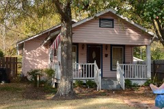 | Oscar Crow House | building | 1992 | 92001343 |
| Cummins Prison Chapel | building | 2024 | 100010309 | |
 | Lincoln County Courthouse | building | 1994 | 94000141 |
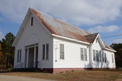 | Mt. Zion Presbyterian Church | building | 1988 | 87002496 |
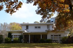 | Parker House | building | 2000 | 00000607 |
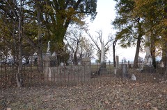 | Rice Family Cemetery | site | 2003 | 03000464 |
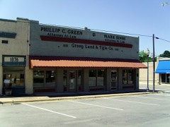 | Star City Commercial Historic District | district | 1999 | 99000152 |
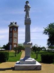 | Star City Confederate Memorial | object | 1996 | 96000448 |
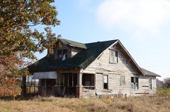 | Charles Hampton Tracy House | building | 2011 | 10001156 |
Every wildfire the federal occurrence database records inside this county: 219 of them, burning about 1,615 acres. 11 started naturally and 40 were recorded as arson. Each settlement page carries the fires within five miles of it.
| Reported cause | Fires |
|---|---|
| Debris and open burning | 80 |
| Missing data/not specified/undetermined | 72 |
| Arson/incendiarism | 40 |
| Natural | 11 |
| Equipment and vehicle use | 10 |
| Smoking | 2 |
| Misuse of fire by a minor | 2 |
| Recreation and ceremony | 2 |
The five largest, by the area the report gives. Five of them were set deliberately.
| Date | Cause | Size | Reported by | Name on the report |
|---|---|---|---|---|
| 12 November 2005 | Arson/incendiarism | 102 acres | Arkansas Forestry Commission | not named |
| 22 February 2014 | Arson/incendiarism | 75 acres | Arkansas Forestry Commission | LIN3319785 |
| 26 March 2007 | Arson/incendiarism | 59 acres | Arkansas Forestry Commission | not named |
| 21 October 2003 | Arson/incendiarism | 49 acres | Arkansas Forestry Commission | not named |
| 19 January 2015 | Debris and open burning | 42 acres | Arkansas Forestry Commission | not named |
| 22 November 2009 | Arson/incendiarism | 40 acres | Arkansas Forestry Commission | not named |
| 26 December 2019 | Missing data/not specified/undetermined | 40 acres | Arkansas Forestry Commission | not named |
| 18 October 2015 | Smoking | 37 acres | Arkansas Forestry Commission | not named |
Every settlement page carries the fires within five miles of it - see the settlement index below.
The NOAA Storm Events Database holds 244 reports for this county, causing 5 deaths, 24 injuries and about $5,883,000 in recorded property damage. Each settlement page carries the reports that name it.
| Kind of event | Reports |
|---|---|
| Thunderstorm Wind | 106 |
| Hail | 74 |
| Flash Flood | 34 |
| Tornado | 21 |
| Flood | 5 |
| Heavy Rain | 3 |
| Funnel Cloud | 1 |
The most serious of them, by death, then injury, then recorded damage. The accounts are quoted exactly as the forecast office filed them.
| When | Event | Place named | Harm | What the report says |
|---|---|---|---|---|
| April 1968 | Tornado (F4) | not stated | 5 killed, 16 hurt, $250,000 | no account filed |
| May 1981 | Tornado (F2) | not stated | 5 hurt, $250,000 | no account filed |
| December 2002 | Tornado (F1) | Garrett Bridge | 2 hurt | An F1 tornado touched down briefly just to the northeast of Garrett Bridge. The first noted damage was at a church on Highway 54 where several flag poles were bent over and some tree limbs were downed. More significant damage was noted about 1/2 mile to the northeast where a mobile home was flipped over and destroyed. Two people inside the mobile home were injured and hospitalized. The tornado lifted shortly thereafter with no other damage noted. |
| October 2007 | Tornado (EF1) | Feenyville | 1 hurt, $200,000 | An EF1 tornado touched down about 4.5 miles west of Star City and tracked to the northeast. According to the Arkansas Department of Emergency Management, six mobile homes were destroyed, one mobile home suffered major damage, and four houses had minor damage. In addition, several barns and outbuildings were destroyed, hundreds of trees were uprooted or snapped off, and power lines were knocked down. The majority of the damage was close to the Feenyville community. One man was injured when his mobile home was flipped upside down while he was inside. Arkansas Governor Mike Beebe declared Lincoln County a state disaster area. |
| April 2011 | Flood | Grady | $750,000 | Widespread areal flooding occurred. Nineteen homes in Gould were damaged. |
| May 2011 | Flood | Grady | $750,000 | no account filed |
| April 2013 | Tornado (EF1) | Warrenton | $500,000 | An EF1 tornado destroyed two mobile homes, one of which rolled over and smashed into a large tree. Two other mobile homes were crushed by falling trees. A church had roof damage, allowing rainwater to pour inside. Windows and doors of the church were broken. Several houses and mobile homes suffered roof damage, some due to falling trees and others from the wind associated with the tornado. Close to three dozen outbuildings and sheds were destroyed. Some of the sheds were overturned. The back wall of a four-car garage was blown down. Several vehicles were damaged. A large tractor shed was blown down onto large farm machinery. Two grain bins were dented in. Many hundreds of trees were snapped off or blown down. Cypress and tupelo trees on Bayou Bartholomew were snapped off. |
| October 2009 | Flash Flood | Griffith Spgs | $300,000 | Numerous county roads were damaged by flash flooding. |
| April 2011 | Thunderstorm Wind | Glendale | $250,000 | Numerous trees were blown down. Several houses were damaged by trees falling into them. A mobile home was destroyed. The roof of a small house was destroyed, as were several sheds and carports. Porches were blown off mobile homes. Part of the roof was blown off the Glendale fire station. |
| December 2009 | Flood | Griffith Spgs | $250,000 | Flash flooding, which developed on the morning of the 24th, became widespread areal flooding later on the 24th and continued into Christmas morning. Arkansas Highway 54 was closed at Glendale. |
| December 2009 | Flash Flood | Griffith Spgs | $250,000 | Widespread heavy rain resulted in the development of flash flooding on the 24th. Numerous county roads were flooded. |
| December 1979 | Tornado (F1) | not stated | $250,000 | no account filed |
| December 1978 | Tornado (F2) | not stated | $250,000 | no account filed |
| September 2008 | Flash Flood | Tarry | $200,000 | Flooding occurred across the county. |
| October 2009 | Flash Flood | Cornerville | $100,000 | Many county roads were damaged by flooding and at least one bridge was washed out. |
| May 2009 | Flash Flood | Star City | $100,000 | Flooding occurred across the county. |
| October 2009 | Flash Flood | Griffith Spgs | $100,000 | Bayou Bartholomew and Abel's Creek inundated thousands of acres of crops. Arkansas Highways 114, 212, and 54 were temporarily closed by flooding. Numerous county roads were underwater. |
| February 2007 | Tornado (EF2) | Garrett Bridge | $100,000 | A strong tornado moved out of Drew County and into Lincoln County about 5.2 miles south-southwest of Garrett Bridge. Damage along the path of the tornado consisted of hundreds of downed trees. Part of a house was destroyed and several shop buildings sustained damage. The tornado dissipated about 3.5 miles southeast of Garrett Bridge. |
| March 1997 | Flash Flood | Star City | $100,000 | no account filed |
| March 2022 | Tornado (EF1) | Glendale | $75,000 | This tornado began in western Lincoln county, just south of Glendale, and tracked east-northeast for about 9 miles before dissipating over U.S. Hwy 425, just south of Yorktown. The tornado initially damaged some poultry houses near the start of the path, with the rest of the damage limited to trees. |
| April 2008 | Thunderstorm Wind | Grady | $75,000 | A home and several outbuildings were damaged. |
| March 2016 | Flash Flood | Griffith Spgs | $60,000 | Emergency manager reported that several county roads are closed due to flooding, and a bridge on Jasper road washed out. |
| April 2020 | Thunderstorm Wind | Rest | $50,000 | Numerous trees were blown down as well as power lines. There was some damage to roofs and small sheds. |
| May 2011 | Thunderstorm Wind | Grady | $50,000 | Many trees and power lines were blown down. Several homes were damaged. |
| April 1994 | Thunderstorm Wind | Fresno | $50,000 | Thunderstorm winds downed trees and damaged a farm shed. |
| June 1994 | Thunderstorm Wind | Star City | $50,000 | Some trees were blown down and several windows were broken out of buildings. |
| November 1994 | Thunderstorm Wind | Glendale | $50,000 | Thunderstorm winds downed some trees and power lines. |
| August 1993 | Thunderstorm Wind | Pinebergen | $50,000 | Trees and power lines were blown down. |
| August 1993 | Thunderstorm Wind | not stated | $50,000 | Trees and power lines were downed. |
| November 1993 | Thunderstorm Wind | Tarry | $50,000 | Several homes sustained some roof damage in Tarry. |
| January 2013 | Flash Flood | Tarry | $48,000 | Approximate 98% of the county roads had wash-outs on them. Water was still over many roads on the 15th, with three roads still closed. The county declared a disaster. |
| June 2019 | Thunderstorm Wind | Avery | $30,000 | Several trees were reported down, including one on a house. A pole barn was also destroyed. |
| July 2009 | Tornado (EF0) | Cummins | $30,000 | All of the damage from this tornado occurred on the farm at Cummins Prison, well away from the prison building itself. A farm shop building had a metal door blown in and a metal wall peeled back. Quite a few trees had large limbs torn off, and a few trees were uprooted altogether. |
| February 2011 | Thunderstorm Wind | Star City | $25,000 | Trees and signs were blown down in Star City. |
| April 2009 | Thunderstorm Wind | Little Garnett | $25,000 | A carport was thrown against a trailer, an air conditioning unit was knocked off, and a satellite dish was blown through a wall of a trailer. Also, trees were down in the area. |
| April 1982 | Tornado (F1) | not stated | $25,000 | no account filed |
| April 2014 | Thunderstorm Wind | Tarry | $20,000 | A large tree was blown down onto U.S. 425, blocking the highway. The tree fell on a vehicle, but its occupants were not injured. |
| May 2013 | Flash Flood | Griffith Spgs | $20,000 | Numerous roads were flooded. |
| January 2012 | Thunderstorm Wind | Star City | $15,000 | Trees were blown down. |
| June 2009 | Thunderstorm Wind | Star City | $15,000 | Trees were down across the county. |
| June 2011 | Thunderstorm Wind | Star City | $10,000 | Some trees were blown down. |
| May 2011 | Thunderstorm Wind | Cades | $10,000 | An anemometer at a flying service measured an 89 mph wind gust. Some trees were blown down in the vicinity, and some shingles and siding were blown off a building. |
| January 2023 | Thunderstorm Wind | Star City | $5,000 | A tree was knocked down and partially fell on a home. |
| May 2022 | Thunderstorm Wind | Garrett Bridge | $5,000 | A shed was destroyed along Highway 293. |
| June 2021 | Thunderstorm Wind | Cummins | $5,000 | Several tree limbs were down in the area. A portion of the chapel roof was damaged. |
| November 1994 | Thunderstorm Wind | Yorktown | $5,000 | Thunderstorm winds knocked down some large tree limbs and power lines. |
| April 1994 | Thunderstorm Wind | Gould | $5,000 | Thunderstorm winds knocked down trees. |
| May 1994 | Thunderstorm Wind | not stated | $5,000 | Thunderstorm winds blew down several large trees. |
| August 1993 | Thunderstorm Wind | Gould | $5,000 | Thunderstorm winds downed some trees. |
| August 1993 | Thunderstorm Wind | Gould | $5,000 | Some trees were downed. |
| July 2012 | Thunderstorm Wind | Glendale | $2,000 | A tree was blown down onto Arkansas 54, blocking one lane. |
| June 2009 | Thunderstorm Wind | Garrett Bridge | $2,000 | A tree was blown down on Arkansas Highway 293 south of Arkansas Highway 54. |
| August 2008 | Thunderstorm Wind | Cornerville | $2,000 | Trees were blown onto power lines. |
| August 2010 | Thunderstorm Wind | Griffith Spgs | $1,000 | A tree was blown down. |
| July 2010 | Flash Flood | Star City | $1,000 | U.S. Highway 425 was covered by water. |
| February 2007 | Tornado (EF1) | Garrett Bridge | $1,000 | The tornado moved out of Drew County and into Lincoln County about 5.5 miles south-southeast of Garrett Bridge. The tornado weakened somewhat as it tracked across the southeast corner of Lincoln County. Damage noted along the tornado path consisted of two downed power lines and a few dozen trees that were uprooted or snapped off. The tornado continued moving northeastward into Desha County. |
| April 1994 | Thunderstorm Wind | Grady | $500 | Thunderstorm winds blew down tree limbs. |
| October 1993 | Thunderstorm Wind | Star City | $500 | Thunderstorm winds blew a large tree down across Highway 114. |
| May 2025 | Thunderstorm Wind | Cummins | - | Metal roofing panels were blown off from an outbuilding. |
| May 2025 | Hail | Tyro | - | Half dollar sized hail was measured via southeast Lincoln County Fire and Rescue. |
The Survey's mineral resources record lists 42 workings inside this county. 4 still produce and 38 are closed or unrecorded. Each settlement page carries the workings within five miles of it.
| Commodity | Workings |
|---|---|
| Sand and Gravel, Construction | 42 |
The least common of them first, because a county's hundredth gravel pit says nothing its first ten did not.
| Where | Site | Commodity | Status | Recorded |
|---|---|---|---|---|
| Fowler Pit | Sand and Gravel, Construction | Past Producer | ||
| Hb Roberts | Sand and Gravel, Construction | Past Producer | ||
| Lincoln County Pit | Sand and Gravel, Construction | Producer | ||
| Mangum Pit | Sand and Gravel, Construction | Producer | ||
| Rupe Pit | Sand and Gravel, Construction | Producer | ||
| Smith Gravel Pit | Sand and Gravel, Construction | Producer | ||
| Star City Pit | Sand and Gravel, Construction | Past Producer | ||
| Unk | Sand and Gravel, Construction | Past Producer | ||
| Unk | Sand and Gravel, Construction | Past Producer | ||
| Unk | Sand and Gravel, Construction | Past Producer | ||
| Unk | Sand and Gravel, Construction | Past Producer | ||
| Unk | Sand and Gravel, Construction | Past Producer | ||
| Unk | Sand and Gravel, Construction | Past Producer | ||
| Unk | Sand and Gravel, Construction | Past Producer | ||
| Unk | Sand and Gravel, Construction | Past Producer | ||
| Unk | Sand and Gravel, Construction | Past Producer | ||
| Unk | Sand and Gravel, Construction | Past Producer | ||
| Unk | Sand and Gravel, Construction | Past Producer | ||
| Unk | Sand and Gravel, Construction | Past Producer | ||
| Unk | Sand and Gravel, Construction | Past Producer | ||
| Unk | Sand and Gravel, Construction | Past Producer | ||
| Unk | Sand and Gravel, Construction | Past Producer | ||
| Unk | Sand and Gravel, Construction | Past Producer | ||
| Unk | Sand and Gravel, Construction | Past Producer | ||
| Unk | Sand and Gravel, Construction | Past Producer | ||
| Unk | Sand and Gravel, Construction | Past Producer | ||
| Unk | Sand and Gravel, Construction | Past Producer | ||
| Unk | Sand and Gravel, Construction | Past Producer | ||
| Unk | Sand and Gravel, Construction | Past Producer | ||
| Unk | Sand and Gravel, Construction | Past Producer | ||
| Unk | Sand and Gravel, Construction | Past Producer | ||
| Unk | Sand and Gravel, Construction | Past Producer | ||
| Unk | Sand and Gravel, Construction | Past Producer | ||
| Unk | Sand and Gravel, Construction | Past Producer | ||
| Unk | Sand and Gravel, Construction | Past Producer | ||
| Unk | Sand and Gravel, Construction | Past Producer | ||
| Unk | Sand and Gravel, Construction | Past Producer | ||
| Unk | Sand and Gravel, Construction | Past Producer | ||
| Unk | Sand and Gravel, Construction | Past Producer | ||
| Unk | Sand and Gravel, Construction | Past Producer | ||
| Unk | Sand and Gravel, Construction | Past Producer | ||
| Unk | Sand and Gravel, Construction | Past Producer |
Named settlements recorded in the Geographic Names Information System, each with the topographic sheets covering it. Villages, hamlets and abandoned places alike. Each is shown with the nearest named watercourse or landform and the survey quadrangle it falls on.
Wells Bayou township · 71643 · Avery quadrangle
13 sheets, 1935 to 1986
No longer a settlement
Mill Creek township · 71667 · On Clear Creek · Cornerville quadrangle
10 sheets, 1935 to 1986
Bartholomew township · 71643 · Grady quadrangle
15 sheets, 1935 to 1986
No longer a settlement
Wells Bayou township · 71639 · On Johnny Branch · Tyro quadrangle
12 sheets, 1935 to 1986
Kimbrough township · 71644 · Cornerstone quadrangle
16 sheets, 1935 to 1986
No longer a settlement
Auburn township · 71643 · Cades quadrangle
15 sheets, 1935 to 1986
No longer a settlement
Mill Creek township · 71667 · Glendale quadrangle
11 sheets, 1935 to 1986
No longer a settlement
Auburn township · 71643 · Gillett quadrangle
12 sheets, 1935 to 1986
No longer a settlement
Smith township · 71667 · On Cane Creek · Star City quadrangle
11 sheets, 1935 to 1986
No longer a settlement
Spring township · 71667 · On Flat Creek · Pinebergen quadrangle
16 sheets, 1935 to 1986
No longer a settlement
Bartholomew township · 71667 · On Beaver Brake · Tarry quadrangle
15 sheets, 1935 to 1986
Kimbrough township · 71644 · Near Huffs Island · Cornerstone quadrangle
16 sheets, 1935 to 1986
No longer a settlement
The vanished settlements of Lincoln County: the places named above that are no longer on the map.