 Block
From the record
20 National Register listings published here.
Sources: the National Register database, National Park Service
37 topographic sheets cover 47 settlements here, and 20 properties are on the National Register of Historic Places.
20 National Register listings published here.
Sources: the National Register database, National Park Service
Every property in this county listed on the National Register of Historic Places, with the year it was listed and the federal nomination document.
| Photograph | Property | Type | Listed | Reference |
|---|---|---|---|---|
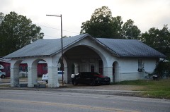 | Allen Tire Company and Gas Station | building | 2001 | 01000523 |
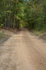 | Camden to Washington Road-Rosston Segment | structure | 2009 | 08001374 |
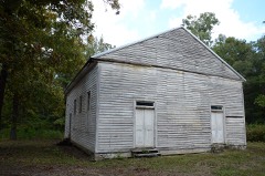 | Carolina Methodist Church | building | 1991 | 90001947 |
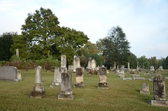 | De Ann Cemetery Historic Section | site | 2005 | 05000498 |
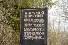 | Elkins' Ferry | site | 1994 | 94001182 |
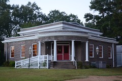 | Emmet Methodist Church | building | 2009 | 09000742 |
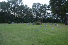 | Ephesus Cemetery | site | 2009 | 08001340 |
 | Henry McKenzie House | building | 1998 | 98001128 |
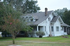 | D. L. McRae House | building | 1982 | 82000869 |
| T. C. McRae House | site | 1982 | 82000870 | |
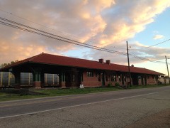 | Missouri Pacific Depot | building | 1978 | 78000614 |
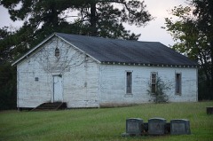 | Moscow Methodist Church and Cemetery | site | 2006 | 06000826 |
 | Nevada County Courthouse | building | 2018 | 100002454 |
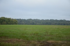 | Prairie De Ann Battlefield | site | 1974 | 74000481 |
| Prescott & Northwestern Railroad Caboose No. 3 | structure | 2020 | 100005585 | |
| Prescott City Hall | building | 2022 | 100008190 | |
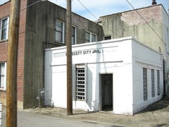 | Prescott City Jail | building | 2005 | 05001077 |
 | Prescott Commercial Historic District | district | 2008 | 08000818 |
| Willow Oak Acres Horse Barn | building | 2021 | 100006043 | |
| Wortham Gymnasium | building | 90000667 |
Every wildfire the federal occurrence database records inside this county: 681 of them, burning about 9,721 acres. 65 started naturally and 206 were recorded as arson. Each settlement page carries the fires within five miles of it.
| Reported cause | Fires |
|---|---|
| Arson/incendiarism | 206 |
| Missing data/not specified/undetermined | 194 |
| Debris and open burning | 134 |
| Natural | 65 |
| Equipment and vehicle use | 56 |
| Smoking | 11 |
| Railroad operations and maintenance | 8 |
| Recreation and ceremony | 4 |
| Misuse of fire by a minor | 3 |
The five largest, by the area the report gives. 6 of them were set deliberately.
| Date | Cause | Size | Reported by | Name on the report |
|---|---|---|---|---|
| 10 March 2006 | Equipment and vehicle use | 905 acres | Arkansas Forestry Commission | not named |
| 9 February 2016 | Arson/incendiarism | 506 acres | Arkansas Forestry Commission | not named |
| 10 April 2009 | Arson/incendiarism | 256 acres | Arkansas Forestry Commission | BODCAW |
| 17 March 2008 | Arson/incendiarism | 225 acres | Arkansas Forestry Commission | not named |
| 17 March 2008 | Arson/incendiarism | 220 acres | Arkansas Forestry Commission | not named |
| 17 July 2006 | Railroad operations and maintenance | 201 acres | Arkansas Forestry Commission | CLARK RR |
| 21 June 2005 | Arson/incendiarism | 150 acres | Arkansas Forestry Commission | not named |
| 2 February 2003 | Arson/incendiarism | 150 acres | Arkansas Forestry Commission | NEVADA 30 |
Every settlement page carries the fires within five miles of it - see the settlement index below.
The NOAA Storm Events Database holds 344 reports for this county, causing 1 death, 10 injuries and about $5,911,750 in recorded property damage. Each settlement page carries the reports that name it.
| Kind of event | Reports |
|---|---|
| Thunderstorm Wind | 142 |
| Hail | 129 |
| Flash Flood | 43 |
| Tornado | 24 |
| Funnel Cloud | 2 |
| Heavy Rain | 2 |
| Lightning | 1 |
| Flood | 1 |
The most serious of them, by death, then injury, then recorded damage. The accounts are quoted exactly as the forecast office filed them.
| When | Event | Place named | Harm | What the report says |
|---|---|---|---|---|
| February 1998 | Flash Flood | Prescott | 1 killed | A local man was apparently fishing in the Cross Tierre Rouge Creek when he was swept away by flood waters. He was found 5 days later. |
| November 1988 | Thunderstorm Wind | not stated | 4 hurt | no account filed |
| March 1997 | Tornado (F3) | Hope | 2 hurt, $2,000,000 | no account filed |
| May 1960 | Tornado (F2) | not stated | 2 hurt, $250,000 | no account filed |
| December 1982 | Tornado (F1) | not stated | 1 hurt, $250,000 | no account filed |
| March 2026 | Tornado (EF2) | Willisville | 1 hurt, $100,000 | During the early morning hours on March 7th, a severe thunderstorm produced an EF2 tornado with estimated maximum winds of 125 mph just west of Willisville in Southern Nevada County, Arkansas. This storm also had a history of producing an earlier tornado in East Texas. The first sign of damage from the tornado was seen just south of the intersection of Highway 32 and County Road 9 near a large open field. The tornado brought down multiple large trees before heading northeast through the large open field. On the far northeast corner of the field is where tree damage picked up again, before tracking across Highway 32 just to the west of County Road 17. The more significant damage was found near County Road 122, County Road 17, and County Road 1702, where numerous structures sustained damage. A single wide mobile home was lifted off the rooted foundation and tossed around 100 feet before landing and being completely destroyed. There was one occupant in the residence who walked away from the incident with only minor injuries. It was at this location that the tornado was rated an EF2 with maximum winds of 125 mph. The tornado then went through another grove of trees before crossing County Road 17 just north of County Road 1702 where it destroyed a small garage/storage unit. Damage from this unit was scattered all throughout an open field all the way to County Road 124. It also brought down a number of very large trees as it crossed the road. As the tornado crossed over County Road 124, it appeared to have started to lift, as damage was more sporadic in a wide open field. The adjacent tree line at the end of the field along the path of the tornado had a few trees down, but there was no clear indication that the tornado remained on the ground beyond this point. |
| June 1994 | Thunderstorm Wind | Bodcaw | $500,000 | Thunderstorm winds damaged a number of roofs and blew down numerous trees and power lines. |
| March 2025 | Tornado (EF2) | Cale | $250,000 | An EF2 tornado with estimated maximum winds near 115 mph touched down late in the evening on March 14th, 2025, along County Road 2434 near the intersection with Highway 200 where damage to vegetation was noted, mainly in the form of large branches broken and a few uprooted trees. The tornado then continued northeast, causing more damage around the intersection of County Road 432 and County Road 45. Here, major loss of roof panels was noted on several small barns and outbuildings. The tornado then continued to track a few miles northeast, passing near Dills Mills and surrounding forested land before strengthening and passing along Highway 299, north of its intersection with County Road 47. This stretch of highway, between County Road 47 and County Road 423, featured extensive damage to trees, with numerous trees snapped and uprooted, some of which fell onto several homes. The tornado reached its peak intensity in this area, with winds speeds of around 115 mph. The tornado continued east/northeast across County Road 424 where more tree damage was found. The tornado's track would then end at White Oak Lake State Park where additional tree damage was found, causing all hiking trails in the park to be temporarily closed. The tornado may have continued briefly over White Oak Lake before lifting as it moved near the Ouachita County line. |
| April 2011 | Thunderstorm Wind | Dian | $250,000 | Five homes were damaged, three of those by downed trees just south of Prescott near Emmet, close to Hwy. 53 and Hwy. 24. |
| March 1983 | Tornado (F1) | not stated | $250,000 | no account filed |
| April 1979 | Tornado (F2) | not stated | $250,000 | no account filed |
| July 1999 | Thunderstorm Wind | Emmet | $245,000 | Two homes suffered heavy roof damage and two large barns were blown down. Also, numerous trees were toppled and broken. |
| April 2011 | Thunderstorm Wind | Dian | $200,000 | Damage was reported to a residence and several chicken houses off CR. 23. Numerous county roads were blocked due to downed trees. |
| December 2015 | Tornado (EF1) | Delta | $100,000 | An NWS Storm Survey team concluded that the damage near Willisville, Arkansas was consistent with that of an EF-1 tornado. This tornado snapped and uprooted numerous trees along its path. Several outbuildings were destroyed and several homes had minor to moderate roof damage as well. |
| October 2009 | Flash Flood | Dian | $100,000 | Hwy. 371...32...76...278...and numerous other county roads were under water and closed due to flooding. Nevada County was one of 20 counties across the state that were declared disaster areas from rainfall up to the 13th, 14th and 15th of October. In addition to the state declaration, Nevada County qualified for federal assistance as the county was deemed a Federal Disaster Area from the flash flooding and storm damage that ensued during the month of October. |
| May 2004 | Tornado (F1) | Laneburg | $80,000 | NWS conducted a storm survey and determined that damage in Nevada County was consistent with that of a tornado. Damage consisted of metal roofing partially peeled off a barn, a tree down on a house, a barn destroyed and two trees down across a mobile home. Several trees were also uprooted along the 10 mile track including several along route 299 from Morris to Bluff City. A tree also fell across a home just southwest of Bluff City. |
| December 2012 | Thunderstorm Wind | Weaver | $70,000 | A mobile home was nearly destroyed due to damaging wind gusts. The home was located near Nevada County Road 246 just west of the Redland Community. Four individuals were in the home at the time but none sustained any injuries. |
| May 2020 | Tornado (EF1) | Bodcaw | $50,000 | An EF-1 tornado with estimated maximum winds around 90 mph touched down near Highway 32, where it uprooted a few trees and snapped several large limbs. After crossing the highway, it moved northwest to near Nevada 15 where it picked up a metal overhang and threw it approximately 150 yards over a home and into a nearby field. The tornado also snapped and uprooted several hardwood and softwood trees near this location. It also uprooted several more trees as it crossed Nevada 15 and then lifted near the intersection of Nevada 120 and Nevada 15 in the Bodcaw community. |
| April 2014 | Thunderstorm Wind | Dian | $50,000 | Several trees were downed throughout the county. Trees fell on two homes in Prescott, Arkansas causing minor to moderate damage. |
| April 2011 | Thunderstorm Wind | Emmet | $50,000 | Numerous trees were downed in the community of Emmet, Arkansas. Tim roofs were removed from storage facilities. |
| June 1994 | Thunderstorm Wind | Prescott | $50,000 | Several trees and power lines were blown down. |
| June 1994 | Thunderstorm Wind | Prescott | $50,000 | Thunderstorm winds downed numerous trees. |
| June 1994 | Thunderstorm Wind | Emmet | $50,000 | Several chicken houses were damaged. |
| November 1994 | Thunderstorm Wind | Waterloo | $50,000 | Thunderstorm winds damaged the roof of a chicken barn and knocked down some trees. |
| April 1994 | Thunderstorm Wind | Laneburg | $50,000 | Thunderstorm winds knocked down several trees. |
| June 1994 | Thunderstorm Wind | Willisville | $50,000 | Thunderstorm winds blew trees down and damaged a chicken house. |
| April 1994 | Thunderstorm Wind | Waterloo | $50,000 | Thunderstorm winds downed many trees. |
| May 1993 | Thunderstorm Wind | Boughton | $50,000 | Thunderstorm winds knocked down a number of trees. |
| December 2009 | Flash Flood | Bodcaw | $40,000 | Local Coordinator reported that Hwy. 299 between Laneburg and Emmett, Hwy 371 between Prescott and Blevins, and numerous county roads are closed due to flooding. There have been several traffic accidents due to these conditions. Due to the infrastructure problems throughout the county, Nevada County will receive Federal assistance. |
| May 2008 | Thunderstorm Wind | Willisville | $40,000 | A tree fell on top of a house approximately 4 miles south of Rosston, Arkansas on U.S. Hwy 371. |
| March 2007 | Thunderstorm Wind | Prescott | $40,000 | Winds of about 70 mph destroyed a couple of storage sheds on County Rd. 1. Some trees were also downed along Interstate 30. |
| April 2025 | Tornado (EF1) | Register | $30,000 | This is a continuation of the Eastern Hempstead County EF-1 tornado. This tornado, with estimated maximum winds near 105 mph, continued northeast west of the Bodcaw community across portions of Nevada 111 and Nevada 13, ending before it crossed County Road 11 to the northeast. Along the tornado's path, a majority of the damage was to hardwood and softwood trees, although a few structures were damaged, including some chicken houses near the end of the tornado's path. |
| August 2010 | Thunderstorm Wind | Dian | $30,000 | Trees and powerlines were downed in Prescott, Arkansas. There were approximately 5 structures with roof damage in town. One structure that received damage was the County Jail when a one-ton air conditioning unit was almost blown off the roof, peeling back several sheets of tin. |
| January 1999 | Thunderstorm Wind | Rosston | $30,000 | Numerous trees downed. Minor damage to one church and two homes. |
| May 2008 | Thunderstorm Wind | Laneburg | $25,000 | A fallen tree resulted in substantial roof damage to a home. Several other trees bell behind the home. |
| September 1996 | Tornado (F1) | Willisville | $25,000 | no account filed |
| November 1984 | Tornado (F3) | not stated | $25,000 | no account filed |
| October 1984 | Tornado (F1) | not stated | $25,000 | no account filed |
| April 1979 | Tornado (F1) | not stated | $25,000 | no account filed |
| January 1998 | Thunderstorm Wind | Rosston | $20,000 | Damage to houses from fallen trees. |
| April 2011 | Thunderstorm Wind | Emmet | $15,000 | A tree was downed on a vehicle on Hwy. 299 east of Emmitt, Arkansas. There was no report of injuries. |
| April 1999 | Thunderstorm Wind | Prescott | $15,000 | Several trees down and one chicken house crushed by fallen tree. |
| October 2001 | Flash Flood | Prescott | $12,000 | Four homes were flooded including the local ambulance service building. |
| July 2024 | Tornado (EF1) | Mendenhall | $10,000 | This is a continuation of the Ouachita County tornado. Drone video indicated that this EF-1 tornado, with estimated maximum winds near 90 mph, tracked northwest into extreme Eastern Nevada County just south of County Road 332/County Road 25, and snapped/uprooted trees along its path, while also ripping the metal roof off of a barn just south of CR 25 just west of the Ouachita County line. The tornado then lifted just north of CR 25, but not before additional trees were snapped and minor roof damage occurred to a home. |
| October 2009 | Flash Flood | Bodcaw | $10,000 | A high water rescue was performed on County Road 5 near Bodcaw, Arkansas when a car became stranded. |
| May 2009 | Thunderstorm Wind | Rosston | $10,000 | Trees downed near Rosston, Arkansas. Other trees were downed along Hwy 278 in Nevada County. A vehicle struck a downed tree and the accident resulted in two injuries. |
| January 1998 | Hail | Rosston | $10,000 | Trees were also pushed over along Hwy 371. Minor damage to homes was reported. Hail was three inches deep downtown. |
| August 2010 | Lightning | Prescott | $5,000 | A lightning strike resulted in a fire that torched nearly 100 acres of timberland near the town of Prescott, Arkansas. |
| November 1994 | Thunderstorm Wind | Young | $5,000 | Several trees were blown down. |
| November 1994 | Thunderstorm Wind | Young | $5,000 | Some trees were blown down and a chicken house was damaged. |
| January 1993 | Thunderstorm Wind | Emmett | $5,000 | Several trees were blown down. |
| July 2008 | Thunderstorm Wind | Sutter | $4,000 | The roof was blown off of four chicken houses near the Sutton, Arkansas community. A few trees were also downed in the area. |
| February 1955 | Tornado (F1) | not stated | $2,500 | no account filed |
| April 1954 | Tornado (F3) | not stated | $2,500 | no account filed |
| July 1994 | Thunderstorm Wind | Willisville | $500 | Thunderstorm winds downed some tree limbs. |
| April 1973 | Tornado (F1) | not stated | $250 | no account filed |
| March 2026 | Thunderstorm Wind | Laneburg | - | Multiple trees downed across Highway 371 in Laneburg. |
| March 2025 | Thunderstorm Wind | Bluff City | - | Multiple trees downed across roadways, including Highway 24 east of Prescott. |
| April 2025 | Flash Flood | Emmet | - | Widespread flash flooding was reported across Nevada County. Multiple county roads were flooded and closed, with several bridges washed out. |
| April 2025 | Thunderstorm Wind | Young | - | Trees were blown down along Highway 278 in Eastern Nevada County. |
The Survey's mineral resources record lists 78 workings inside this county. 5 still produce and 73 are closed or unrecorded. Each settlement page carries the workings within five miles of it.
| Commodity | Workings |
|---|---|
| Sand and Gravel, Construction | 60 |
| Iron | 14 |
| Clay | 4 |
The least common of them first, because a county's hundredth gravel pit says nothing its first ten did not.
| Where | Site | Commodity | Status | Recorded |
|---|---|---|---|---|
| No Name | Clay | Past Producer | ||
| No Name | Clay | Past Producer | ||
| Unk | Clay | Producer | ||
| Unk | Clay | Past Producer | ||
| Falcon Mine | Iron | Prospect | ||
| Falcon Operations | Iron | Past Producer | ||
| Johnson & Billingsley | Iron | Past Producer | ||
| Mccrea Property | Iron | Past Producer | ||
| Rosston Deposits | Iron | Past Producer | ||
| Unk | Iron | Past Producer | ||
| Unk | Iron | Past Producer | ||
| Unk | Iron | Past Producer | ||
| Unk | Iron | Past Producer | ||
| Unk | Iron | Past Producer | ||
| Unk | Iron | Past Producer | ||
| Unk | Iron | Past Producer | ||
| Unk | Iron | Past Producer | ||
| Unk | Iron | Past Producer | ||
| E Ingram | Sand and Gravel, Construction | Past Producer | ||
| Grayson Pit & Plant | Sand and Gravel, Construction | Past Producer | ||
| H Farris | Sand and Gravel, Construction | Past Producer | ||
| Hawthorne Pit | Sand and Gravel, Construction | Producer | ||
| Hickey Bros Service Station | Sand and Gravel, Construction | Past Producer | ||
| L Haynie | Sand and Gravel, Construction | Past Producer | ||
| Loe Pit | Sand and Gravel, Construction | Producer | ||
| Prescott Pit & Plant | Sand and Gravel, Construction | Producer | ||
| Unk | Sand and Gravel, Construction | Past Producer | ||
| Unk | Sand and Gravel, Construction | Past Producer | ||
| Unk | Sand and Gravel, Construction | Past Producer | ||
| Unk | Sand and Gravel, Construction | Past Producer | ||
| Unk | Sand and Gravel, Construction | Past Producer | ||
| Unk | Sand and Gravel, Construction | Past Producer | ||
| Unk | Sand and Gravel, Construction | Unknown | ||
| Unk | Sand and Gravel, Construction | Past Producer | ||
| Unk | Sand and Gravel, Construction | Past Producer | ||
| Unk | Sand and Gravel, Construction | Past Producer | ||
| Unk | Sand and Gravel, Construction | Past Producer | ||
| Unk | Sand and Gravel, Construction | Past Producer | ||
| Unk | Sand and Gravel, Construction | Past Producer | ||
| Unk | Sand and Gravel, Construction | Past Producer | ||
| Unk | Sand and Gravel, Construction | Past Producer | ||
| Unk | Sand and Gravel, Construction | Past Producer | ||
| Unk | Sand and Gravel, Construction | Past Producer | ||
| Unk | Sand and Gravel, Construction | Past Producer | ||
| Unk | Sand and Gravel, Construction | Past Producer | ||
| Unk | Sand and Gravel, Construction | Past Producer | ||
| Unk | Sand and Gravel, Construction | Past Producer | ||
| Unk | Sand and Gravel, Construction | Past Producer | ||
| Unk | Sand and Gravel, Construction | Past Producer | ||
| Unk | Sand and Gravel, Construction | Past Producer | ||
| Unk | Sand and Gravel, Construction | Past Producer | ||
| Unk | Sand and Gravel, Construction | Past Producer | ||
| Unk | Sand and Gravel, Construction | Past Producer | ||
| Unk | Sand and Gravel, Construction | Past Producer | ||
| Unk | Sand and Gravel, Construction | Past Producer | ||
| Unk | Sand and Gravel, Construction | Past Producer | ||
| Unk | Sand and Gravel, Construction | Past Producer | ||
| Unk | Sand and Gravel, Construction | Past Producer | ||
| Unk | Sand and Gravel, Construction | Past Producer | ||
| Unk | Sand and Gravel, Construction | Past Producer | ||
| Unk | Sand and Gravel, Construction | Past Producer | ||
| Unk | Sand and Gravel, Construction | Past Producer | ||
| Unk | Sand and Gravel, Construction | Past Producer | ||
| Unk | Sand and Gravel, Construction | Past Producer | ||
| Unk | Sand and Gravel, Construction | Past Producer | ||
| Unk | Sand and Gravel, Construction | Past Producer | ||
| Unk | Sand and Gravel, Construction | Past Producer | ||
| Unk | Sand and Gravel, Construction | Past Producer | ||
| Unk | Sand and Gravel, Construction | Past Producer | ||
| Unk | Sand and Gravel, Construction | Past Producer | ||
| Unk | Sand and Gravel, Construction | Past Producer | ||
| Unk | Sand and Gravel, Construction | Past Producer | ||
| Unk | Sand and Gravel, Construction | Past Producer | ||
| Unk | Sand and Gravel, Construction | Past Producer | ||
| Unk | Sand and Gravel, Construction | Past Producer | ||
| Unk | Sand and Gravel, Construction | Past Producer | ||
| Unk | Sand and Gravel, Construction | Past Producer | ||
| Walters Gravel | Sand and Gravel, Construction | Producer |
Named settlements recorded in the Geographic Names Information System, each with the topographic sheets covering it. Villages, hamlets and abandoned places alike. Each is shown with the nearest named watercourse or landform and the survey quadrangle it falls on.
Parker township · 71858 · Willisville quadrangle
15 sheets, 1901 to 1989
No longer a settlement
Parker township · 71858 · Willisville quadrangle
15 sheets, 1901 to 1989
No longer a settlement
Jackson township · 71858 · On Black Branch · Waterloo quadrangle
16 sheets, 1901 to 1989
No longer a settlement
Union township · 71858 · On Tunnel Branch · Bluff City quadrangle
16 sheets, 1901 to 1989
Union township · 71722 · On Mill Creek · Bluff City quadrangle
16 sheets, 1901 to 1989
No longer a settlement
Redland township · 71857 · On Little Caney Creek · Bluff City quadrangle
16 sheets, 1901 to 1989
No longer a settlement
Albany township · 71835 · On Little Sandy Creek · Laneburg quadrangle
15 sheets, 1901 to 1989
Caney township · 71858 · Laneburg quadrangle
15 sheets, 1901 to 1989
No longer a settlement
Georgia township · 71857 · On Cantley Branch · Laneburg quadrangle
15 sheets, 1901 to 1989
No longer a settlement
Taylor township · 71770 · On Stockton Bottom · Lamartine quadrangle
13 sheets, 1953 to 1989
Union township · 71858 · On Mill Branch · Bluff City quadrangle
16 sheets, 1901 to 1989
No longer a settlement
The vanished settlements of Nevada County: the places named above that are no longer on the map.