 Block
From the record
9 National Register listings published here.
Sources: the National Register database, National Park Service
68 topographic sheets cover 50 settlements here, and 9 properties are on the National Register of Historic Places.
9 National Register listings published here.
Sources: the National Register database, National Park Service
Every property in this county listed on the National Register of Historic Places, with the year it was listed and the federal nomination document.
| Photograph | Property | Type | Listed | Reference |
|---|---|---|---|---|
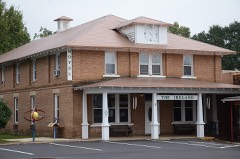 | Conway Hotel | building | 1986 | 86000384 |
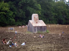 | Crater Of Diamonds State Park | site | 1973 | 73000386 |
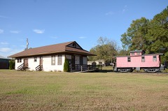 | Glenwood Iron Mountain Railroad Depot | building | 1996 | 96000692 |
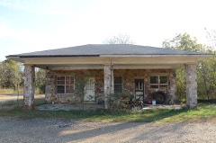 | Jones General Store and Esso Station | building | 2000 | 00000609 |
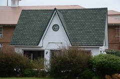 | Murfreesboro Cities Service Station | building | 2003 | 03000400 |
 | Pike County Courthouse | building | 1986 | 86002863 |
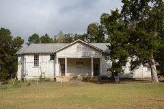 | Rosenwald School | building | 1990 | 90001381 |
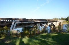 | Self Creek Bridge | structure | 2000 | 00000635 |
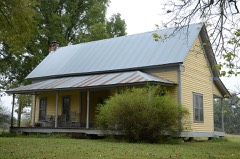 | Shelton-Lockeby House | building | 2005 | 05001079 |
Every wildfire the federal occurrence database records inside this county: 496 of them, burning about 4,986 acres. 61 started naturally and 127 were recorded as arson. Each settlement page carries the fires within five miles of it.
| Reported cause | Fires |
|---|---|
| Arson/incendiarism | 127 |
| Missing data/not specified/undetermined | 111 |
| Debris and open burning | 95 |
| Equipment and vehicle use | 62 |
| Natural | 61 |
| Railroad operations and maintenance | 25 |
| Smoking | 6 |
| Recreation and ceremony | 5 |
| Misuse of fire by a minor | 4 |
The five largest, by the area the report gives. Five of them were set deliberately.
| Date | Cause | Size | Reported by | Name on the report |
|---|---|---|---|---|
| 6 August 2011 | Arson/incendiarism | 313 acres | Arkansas Forestry Commission | JOHN ASHLEY ROAD |
| 10 July 1998 | Natural | 243 acres | Arkansas Forestry Commission | not named |
| 9 September 2005 | Arson/incendiarism | 210 acres | Arkansas Forestry Commission | not named |
| 8 August 1999 | Arson/incendiarism | 204 acres | Arkansas Forestry Commission | not named |
| 23 March 1997 | Arson/incendiarism | 178 acres | Arkansas Forestry Commission | not named |
| 7 April 1998 | Arson/incendiarism | 157 acres | Arkansas Forestry Commission | not named |
| 16 February 2005 | Equipment and vehicle use | 142 acres | Arkansas Forestry Commission | not named |
| 20 May 2012 | Equipment and vehicle use | 132 acres | Arkansas Forestry Commission | BUCK |
Every settlement page carries the fires within five miles of it - see the settlement index below.
The NOAA Storm Events Database holds 440 reports for this county, causing no deaths, 8 injuries and about $9,829,000 in recorded property damage. Each settlement page carries the reports that name it.
| Kind of event | Reports |
|---|---|
| Thunderstorm Wind | 177 |
| Hail | 177 |
| Flash Flood | 37 |
| Tornado | 24 |
| Heavy Rain | 17 |
| Funnel Cloud | 3 |
| Flood | 3 |
| Lightning | 2 |
The most serious of them, by death, then injury, then recorded damage. The accounts are quoted exactly as the forecast office filed them.
| When | Event | Place named | Harm | What the report says |
|---|---|---|---|---|
| March 2023 | Tornado (EF2) | Kirby | 5 hurt | This tornado started just north of Kirby, completely destroying|two chicken houses on the west side of Arkansas Highway 27. The tornado|moved north-northeast along highway 27, causing moderate roof|damage to a home, and snapping several large trees at their|trunks. The tornado continued to move north-northeast,|paralleling Ebenezer Road where it did the most significant|damage. Several tree lines along the road had snapped trunks. A|mobile home on Ebenezer Road, which had securing tie-down straps,|was completely lofted, rolled, and tossed approximately 100 feet|into a tree line, completely destroying it. There were|4 occupants, two only had minor injuries. Farther east on|Ebenezer road, the tornado damaged a few more mobile homes. The|first one was shifted off of it's supporting blocks, and some|roof and siding damage was observed. There were three minor|injuries noted among the occupants, and were transported to a|local hospital. In the neighboring lot to the east, a large oak|tree was uprooted onto a brand new mobile home, smashing the|structure in the middle, twisting the supporting frame, snapping|two of the tie-down straps, and effectively destroying the unit.|There were no occupants at the time of the tornado. The tornado|continued moving northeast of Ebenezer road, snapping several|trees and power poles along the road. Damage was observed along|Mason Road, with numerous large trees uprooted and snapped. A few|large trees were blown onto a home on Mason Road, but only minor|damage was observed on the home. The tornado dissipated shortly|thereafter. This tornado was rated an EF2 with estimated peak winds|of 135 mph. |
| November 2005 | Tornado (F1) | Kirby | 1 hurt | A weak tornado was spawned in northeastern Pike County roughly 3 miles south-southwest of Kirby and tracked quickly to the northeast. The tornado removed the roof of a barn, and damaged or destroyed several chicken houses. A roof was also partially removed from a mobile home. Numerous trees were downed, especially near Glenwood around a country club. The tornado continued into southeastern Montgomery County. |
| May 1990 | Tornado (F0) | not stated | 1 hurt | no account filed |
| May 1990 | Thunderstorm Wind | not stated | 1 hurt | no account filed |
| March 2023 | Thunderstorm Wind | Kirby | $6,000,000 | The emergency manager reported 20 or 30 homes in and around Kirby damaged or destroyed. Several chicken houses were also destroyed and numerous trees were blown down. |
| May 2011 | Flood | Langley | $1,000,000 | no account filed |
| April 2011 | Flood | Langley | $350,000 | Widespread areal flooding occurred. |
| April 1986 | Tornado (F1) | not stated | $250,000 | no account filed |
| May 2020 | Flash Flood | Glenwood | $200,000 | The Pike County Sheriff Office reported multiple vehicles near the Caddo River were washed away due to flash flooding. There were also flooded roads in and near Glenwood. |
| April 2011 | Tornado (EF1) | Daisy | $200,000 | The tornado removed part of the second floor from a house, and damaged barns and outbuildings. Numerous trees were blown down, with trees landing on a house, a mobile home, and a vehicle. |
| July 2018 | Thunderstorm Wind | Daisy | $100,000 | Damage occurred near Lake Greeson and in areas to the south, near Murfreesboro. |Near Lake Greeson, damage to the roof of the marina was found, along with docks E and D. The damage near Murfreesboro was several trees blown down. A review of videos taken at the time reveal a circulation over Lake Greeson when the damage occurred. From the video evidence and a careful review of radar data, a strong microburst occurred in between Daisy and Murfreesboro resulting in a sustained circulation over Lake Greeson that, when over land, is typically referred to as a gustnado. This appeared to be a gustnado over water. With the damage being initiated by downdraft, it is considered thunderstorm wind damage. |
| April 2014 | Thunderstorm Wind | Murfreesboro | $100,000 | Two homes and a storage shed sustained major damage. Trees and power lines were blown down. |
| December 2012 | Thunderstorm Wind | Bowen | $100,000 | Three barns were destroyed and the roofs of two houses were damaged. |
| April 2011 | Tornado (EF1) | Pisgah | $100,000 | The tornado blew down numerous trees, one of which fell on the cab of a tractor-trailer. |
| April 2008 | Flash Flood | Nathan | $100,000 | Most major streets in Murfreesboro were flooded. Several highways in the southern portion of the county were under water. The cabins at the old city park were under water. A store was flooded in Murfreesboro. Pike County Memorial Hospital's parking lot was flooded. |
| May 2008 | Tornado (EF1) | Billstown | $100,000 | One chicken house was badly damaged, and an old, unused chicken house collapsed. Much of the tin roof was taken off of an old barn. Dozens of trees were blown down. |
| July 1998 | Thunderstorm Wind | Daisy | $100,000 | no account filed |
| July 2013 | Thunderstorm Wind | Delight | $50,000 | A few houses sustained minor damage due to falling trees and an abandoned chicken house was destroyed. |
| June 2010 | Flash Flood | Langley | $50,000 | Flash flooding occurred along the Little Missouri River, the Caddo River, and many of their tributaries. Many highways and secondary roads were flooded. In Glenwood, the Caddo River flooded the cattle auction business, a gas station, and a canoe rental business. Just west of Langley, the Little Missouri River rose from 3 feet to more than 23 feet in only 4 hours. Rainfall for the 24 hour period ending at 7 AM on the 11th included 7.60 inches at Glenwood and 7.20 inches at Langley. The majority of this rain occurred after thunderstorms developed during the early morning hours of the 11th. |
| July 2010 | Thunderstorm Wind | Kirby | $50,000 | Trees were blown down. One of the trees fell on a church, causing substantial roof damage. |
| May 2009 | Flash Flood | Langley | $50,000 | Several county roads were under water, and water entered the county jail at Murfreesboro. |
| April 2009 | Tornado (EF1) | Grandfield | $50,000 | This tornado moved out of Howard County, and entered Pike County southwest of New Hope. Hundreds of trees were knocked down or snapped off in the forest, primarily on private timber company land. |
| March 2008 | Flash Flood | Kimberley | $50,000 | The Little Missouri River filled and covered Arkansas Highway 27. |
| September 2008 | Flash Flood | Salem | $50,000 | Many county roads and backroads were flooded. One foot of water was over Amity Road. |
| April 1994 | Thunderstorm Wind | Delight | $50,000 | Thunderstorm winds damaged two barns. |
| October 1993 | Thunderstorm Wind | Delight | $50,000 | Thunderstorm winds downed numerous trees. |
| May 2015 | Thunderstorm Wind | Delight | $30,000 | A home in Delight received major damage from high winds. |
| April 2014 | Thunderstorm Wind | Murfreesboro | $30,000 | Numerous trees were blown down, a shed was blown away, and two homes sustained damage. |
| July 2012 | Thunderstorm Wind | Wolf Creek | $30,000 | Two barns were destroyed, there was damage to the roof of one occupied structure, and significant debris along fence lines. |
| April 2008 | Flash Flood | Langley | $30,000 | Damage occurred to roadways due to flash flooding. |
| August 2014 | Thunderstorm Wind | Murfreesboro | $25,000 | Outflow from weakening thunderstorms blew down some trees, causing minor damage to two cars and one house. |
| October 2014 | Thunderstorm Wind | Glenwood | $25,000 | Trees and power lines were blown down. |
| May 2012 | Thunderstorm Wind | Roy | $25,000 | Trees and power lines were blown down. |
| May 2012 | Thunderstorm Wind | Sweet Home | $25,000 | Trees and power lines were blown down. |
| May 2012 | Thunderstorm Wind | Highland | $25,000 | Trees and power lines were blown down. |
| October 2011 | Lightning | Glenwood | $25,000 | Lightning stuck a natural gas metering station, causing the natural gas to catch fire. |
| April 2011 | Tornado (EF1) | Rosboro | $25,000 | The tornado blew down trees. The tornado exited Pike County north-northeast of Rosboro and moved into Clark County north-northwest of Amity. |
| December 2009 | Heavy Rain | Rosboro | $25,000 | Heavy rain caused a tree to fall on an electric transmission line between Glenwood and Amity. Power was knocked out to 8,000 customers. |
| April 2009 | Tornado (EF1) | New Hope | $25,000 | Trees were knocked down, all of which were on private timber company land. |
| May 1957 | Tornado (F2) | not stated | $25,000 | no account filed |
| April 2020 | Thunderstorm Wind | Daisy | $20,000 | Trees were blown down along with power outages. A dock was damaged. |
| May 2017 | Thunderstorm Wind | Kirby | $20,000 | A tree branch fell through the roof of a home. |
| July 2009 | Flash Flood | Kirby | $20,000 | A house was flooded in Kirby. Also, minor street flooding occurred in the city. |
| April 2014 | Thunderstorm Wind | Antoine | $15,000 | Trees and power lines were blown down. |
| April 2014 | Thunderstorm Wind | Delight | $15,000 | Trees and power lines were blown down. |
| October 2014 | Thunderstorm Wind | Lodi | $15,000 | Trees and power lines were blown down. |
| January 2012 | Thunderstorm Wind | Delight | $15,000 | Trees and power lines were blown down west of Delight. |
| April 2011 | Thunderstorm Wind | Delight | $15,000 | A number of trees were blown down on roads just outside of Stelltown. |
| June 2001 | Thunderstorm Wind | Nathan | $15,000 | Thunderstorm winds damaged a chicken house at Nathan. |
| July 2016 | Thunderstorm Wind | Glenwood | $10,000 | Trees were blown down and some were on houses. |
| June 2014 | Thunderstorm Wind | Daisy | $10,000 | Trees were blown down at Kirby Landing. |
| May 2013 | Tornado (EF1) | Kirby | $10,000 | An EF1 tornado blew down timber and deer stands. |
| December 2012 | Thunderstorm Wind | Murfreesboro | $10,000 | A few trees were blown down in and around Murfreesboro. |
| April 2010 | Thunderstorm Wind | Murfreesboro | $10,000 | A few trees were blown down around Murfreesboro. |
| July 2010 | Thunderstorm Wind | Pisgah | $10,000 | Trees and power lines were blown down. |
| August 2009 | Flash Flood | Delight | $10,000 | Flooding occurred along Arkansas Highway 26 in and around Delight. |
| July 2009 | Thunderstorm Wind | Murfreesboro | $10,000 | Trees were down in Murfreesboro. |
| August 2009 | Thunderstorm Wind | Kirby | $10,000 | Trees and power lines were down around Kirby. |
| July 2010 | Lightning | Mt Moriah | $8,000 | Lightning killed eight cows and two yearlings on a farm. The majority of the cows were under a tree, which the lightning struck first. A couple of the cows were about 75 yards away from the others. |
| July 2016 | Thunderstorm Wind | Kirby | $5,000 | Trees were blown down and some were on houses. |
The Survey's mineral resources record lists 133 workings inside this county. 9 still produce and 124 are closed or unrecorded. Each settlement page carries the workings within five miles of it.
| Commodity | Workings |
|---|---|
| Mercury | 57 |
| Sand and Gravel, Construction | 35 |
| Manganese | 9 |
| Diamond | 8 |
| Antimony | 7 |
| Gypsum-Anhydrite | 7 |
| Clay | 6 |
| Barium-Barite | 2 |
| Stone | 2 |
| Kaolin | 2 |
| Slate, Dimension | 2 |
| Antimony, Mercury | 1 |
| Arsenic, Antimony, Silver | 1 |
| Zinc | 1 |
The least common of them first, because a county's hundredth gravel pit says nothing its first ten did not.
| Where | Site | Commodity | Status | Recorded |
|---|---|---|---|---|
| Gap Ridge Mine | Mercury, Arsenic, Antimony, Silver, Zinc | Past Producer | 1931 | |
| Langley | Silica | Unknown | ||
| Parker Hill Mine | Antimony, Mercury | Past Producer | 1931 | |
| V. B. Lewis Pit | Strontium | Unknown | ||
| Bear Creek Prospect | Barium-Barite | Unknown | ||
| Mill Creek Prospect | Barium-Barite | Unknown | ||
| Pike County Clays | Kaolin | Unknown | ||
| Pike Mining Co | Slate, Dimension | Unknown | ||
| Unknown | Kaolin | Unknown | ||
| Unknown | Slate, Dimension | Unknown | ||
| Unknown Quarry | Stone | Unknown | ||
| Unknown Quarry | Stone | Unknown | ||
| Twin Knobs Claypit | Clay | Unknown | ||
| Unknown Shale Pit | Clay | Unknown | ||
| Unknown Shale Pit | Clay | Unknown | ||
| Unknown Shale Pit | Clay | Unknown | ||
| Unknown Shale Pit | Clay | Unknown | ||
| Unknown Shale Pit | Clay | Unknown | ||
| Arkansas Gypsum Company | Gypsum-Anhydrite | Producer | ||
| Craig Mine | Mercury, Antimony | Past Producer | Calomel, Cinnabar, Metacinnabar, Stibiconite, Stibnite | |
| East Gap Ridge Mine | Mercury, Antimony | Past Producer | 1931 | |
| F S Neely Co Mine | Gypsum-Anhydrite | Unknown | ||
| Hales Mine | Mercury, Antimony | Past Producer | 1940 | |
| Highland Mine | Gypsum-Anhydrite | Unknown | ||
| Interstate Mill (Facility) | Mercury, Antimony | Plant | Calomel, Cinnabar, Metacinnabar, Stibiconite, Stibnite | |
| Mac-Holmes Mine | Mercury, Antimony | Past Producer | 1931 | |
| Parnell Hill Mine | Mercury, Antimony | Past Producer | 1931 | |
| U.S. Mercury Co. Mine | Mercury, Antimony | Past Producer | Calomel, Cinnabar, Metacinnabar, Stibiconite, Stibnite | |
| Unknown | Gypsum-Anhydrite | Unknown | ||
| Unknown Mine | Gypsum-Anhydrite | Unknown | ||
| Unknown Mine | Gypsum-Anhydrite | Unknown | ||
| Unknown Mine | Gypsum-Anhydrite | Unknown | ||
| American Mines | Diamond | Unknown | ||
| Crater of Diamonds -North | Diamond | Prospect | ||
| Crater of Diamonds -South | Diamond | Prospect | ||
| Kimberlite Mine | Diamond | Unknown | ||
| Mauney Mine | Diamond | Unknown | ||
| Ozark Mine | Diamond | Unknown | ||
| Prairie Creek Diamond Area | Diamond | Unknown | ||
| Prairie Creek Kimberlite | Diamond | Producer | 1906, 1909, 1949 | |
| Caddo River | Manganese | Unknown | ||
| Fagan Mine | Manganese | Past Producer | 1917 | |
| Featherstone Property | Manganese | Unknown | ||
| Joseph Kehr Manganese | Manganese | Unknown | ||
| Kettelberger Property | Manganese | Unknown | ||
| Prospect Number Three | Manganese | Prospect | 1916 | |
| Still Mine | Manganese | Past Producer | 1916 | |
| United Minerals Industries Inc | Manganese | Unknown | ||
| Unk | Manganese | Unknown | ||
| Arkansas Pit | Sand and Gravel, Construction | Producer | ||
| Delight Pit | Sand and Gravel, Construction | Producer | ||
| Murfreesboro Pit & Plant | Sand and Gravel, Construction | Producer | ||
| Shields Pit & Plant | Sand and Gravel, Construction | Producer | ||
| Unknown Gravel Pit | Sand and Gravel, Construction | Unknown | ||
| Unknown Gravel Pit | Sand and Gravel, Construction | Unknown | ||
| Unknown Gravel Pit | Sand and Gravel, Construction | Unknown | ||
| Unknown Gravel Pit | Sand and Gravel, Construction | Unknown | ||
| Unknown Gravel Pit | Sand and Gravel, Construction | Unknown | ||
| Unknown Gravel Pit | Sand and Gravel, Construction | Unknown | ||
| Unknown Gravel Pit | Sand and Gravel, Construction | Unknown | ||
| Unknown Gravel Pit | Sand and Gravel, Construction | Unknown | ||
| Unknown Gravel Pit | Sand and Gravel, Construction | Unknown | ||
| Unknown Gravel Pit | Sand and Gravel, Construction | Unknown | ||
| Unknown Gravel Pit | Sand and Gravel, Construction | Unknown | ||
| Unknown Gravel Pit | Sand and Gravel, Construction | Unknown | ||
| Unknown Gravel Pit | Sand and Gravel, Construction | Unknown | ||
| Unknown Gravel Pit | Sand and Gravel, Construction | Unknown | ||
| Unknown Gravel Pit | Sand and Gravel, Construction | Unknown | ||
| Unknown Gravel Pit | Sand and Gravel, Construction | Unknown | ||
| Unknown Gravel Pit | Sand and Gravel, Construction | Unknown | ||
| Unknown Gravel Pit | Sand and Gravel, Construction | Unknown | ||
| Unknown Gravel Pit | Sand and Gravel, Construction | Unknown | ||
| Unknown Gravel Pit | Sand and Gravel, Construction | Unknown | ||
| Unknown Gravel Pit | Sand and Gravel, Construction | Unknown | ||
| Unknown Gravel Pit | Sand and Gravel, Construction | Unknown | ||
| Unknown Gravel Pit | Sand and Gravel, Construction | Unknown | ||
| Unknown Gravel Pit | Sand and Gravel, Construction | Unknown | ||
| Unknown Gravel Pit | Sand and Gravel, Construction | Unknown | ||
| Unknown Gravel Pit | Sand and Gravel, Construction | Unknown | ||
| Unknown Gravel Pit | Sand and Gravel, Construction | Unknown | ||
| Unknown Gravel Pit | Sand and Gravel, Construction | Unknown | ||
| Unknown Gravel Pit | Sand and Gravel, Construction | Unknown | ||
| Unknown Gravel Pit | Sand and Gravel, Construction | Unknown | ||
| Womack Pit | Sand and Gravel, Construction | Producer | ||
| Ainsworth Prospect | Mercury | Occurrence | Cinnabar | |
| Antimony, Ltd. | Mercury | Past Producer | Cinnabar | |
| Atlas Quicksilver | Mercury | Occurrence | Cinnabar | |
| Bell Prospect | Mercury | Past Producer | Cinnabar | |
| Bemis Hill | Mercury | Past Producer | Cinnabar | |
| Blount | Mercury | Occurrence | ||
| Clark's Prospect | Mercury | Occurrence | Cinnabar | |
| Cox Prospect | Mercury | Occurrence | Cinnabar | |
| Eastburn | Mercury | Occurrence | ||
| Featherstone | Mercury | Occurrence | Mercury | |
| Funderburk Prospect | Mercury | Occurrence | 1944 | |
| Hill 2 | Mercury | Past Producer | Cinnabar | |
| Hill 3 | Mercury | Past Producer | Cinnabar | |
| Hintze | Mercury | Past Producer | ||
| Holmes | Mercury | Past Producer | Cinnabar | |
| Hopkins Prospect | Mercury | Past Producer | Cinnabar | |
| Hudgins Prospect | Mercury | Past Producer | Cinnabar | |
| Lowery and James | Mercury | Past Producer | Cinnabar | |
| Marino | Mercury | Occurrence | Surface | |
| Mill Mountain Prospects | Mercury | Occurrence | Cinnabar | |
| Muddy Fork | Mercury | Past Producer | 1939, 1945 | |
| Nelson's Prospect | Mercury | Past Producer | Cinnabar | |
| O.K. Shaft | Mercury | Occurrence | Underground | |
| Old Argentine Prospect | Mercury | Past Producer | 1941, 1943 | |
| Ozan's Sec. 31 | Mercury | Past Producer | 1940 | |
| Ozan's Sec. 5 | Mercury | Occurrence | 1941 | |
| Palmer Prospect | Mercury | Occurrence | Cinnabar | |
| Parker Prospect | Mercury | Past Producer | 1942 | |
| Pike City Prospect | Mercury | Occurrence | Cinnabar | |
| Pike Mining Co. | Mercury | Past Producer | Cinnabar | |
| Reduction Plant of Am Sci Mercury C (facility) | Mercury | Plant | ||
| Salt Gum Ford | Mercury | Unknown | ||
| Section 11 Mine | Mercury | Unknown | ||
| Section 33 Prospect | Mercury | Unknown | ||
| Section 9 Mine | Mercury | Unknown | ||
| South Mill Mt. Prospect | Mercury | Unknown | ||
| Superior Mining Co. | Mercury | Past Producer | 1942 | |
| Union Mine | Mercury | Past Producer | 1942 | |
| Unnamed | Mercury | Occurrence | Cinnabar | |
| Unnamed | Mercury | Occurrence | Cinnabar, Mercury | |
| Unnamed | Mercury | Occurrence | Cinnabar | |
| Unnamed | Mercury | Occurrence | ||
| Wall Mountain Shaft | Mercury | Past Producer | Cinnabar | |
| Wall Rock Shaft | Mercury | Past Producer | Cinnabar | |
| Wann Mine | Mercury | Past Producer | 1941 | |
| West Gap Ridge | Mercury | Occurrence | Cinnabar | |
| Wheeler's Property | Mercury | Occurrence | Cinnabar, Metacinnabar | |
| Yantis Mine | Mercury | Past Producer | 1941, 1942 | |
| Yenglin Prospect | Mercury | Past Producer | Surface, Surface/Underground |
Named settlements recorded in the Geographic Names Information System, each with the topographic sheets covering it. Villages, hamlets and abandoned places alike. Each is shown with the nearest named watercourse or landform and the survey quadrangle it falls on.
Antoine township · 71958 · On Skelton Creek · Narrows Dam quadrangle
14 sheets, 1906 to 1986
No longer a settlement
Pike City township · Murfreesboro NE quadrangle
12 sheets, 1906 to 1986
No longer a settlement
Pike City township · 71958 · Murfreesboro quadrangle
13 sheets, 1906 to 1986
No longer a settlement
Thompson township · 71852 · By Plaster Bluff · Murfreesboro quadrangle
13 sheets, 1906 to 1986
No longer a settlement
Wolf Creek township · 71940 · On Camel Branch · Piney Grove quadrangle
16 sheets, 1901 to 1989
Missouri township · 71958 · On Mill Branch · Delight quadrangle
12 sheets, 1906 to 1986
No longer a settlement
Clark township · 71921 · On Little Antoine Creek · Glenwood quadrangle
16 sheets, 1906 to 1986
Self Creek township · 71950 · On Mile Branch · Lodi quadrangle
17 sheets, 1906 to 1986
No longer a settlement
Muddy Fork township · On Parker Creek · Center Point NE quadrangle
11 sheets, 1906 to 1986
No longer a settlement
Missouri township · 71940 · On Little Wolf Creek · Delight quadrangle
12 sheets, 1906 to 1986
Pike City township · Near Wall Mountain · Murfreesboro NE quadrangle
12 sheets, 1906 to 1986
No longer a settlement
Muddy Fork township · 71958 · Near Beacon Hill · Narrows Dam quadrangle
14 sheets, 1906 to 1986
No longer a settlement
Missouri township · 71940 · Delight quadrangle
12 sheets, 1906 to 1986
No longer a settlement
Thompson township · 71958 · On Poorhouse Branch · Murfreesboro quadrangle
13 sheets, 1906 to 1986
Mountain township · 71952 · On Little Blocker Creek · Langley quadrangle
15 sheets, 1906 to 1986
Antoine township · 71958 · Murfreesboro NE quadrangle
12 sheets, 1906 to 1986
No longer a settlement
Thompson township · 71852 · By Plaster Bluff · Murfreesboro quadrangle
13 sheets, 1906 to 1986
No longer a settlement
Thompson township · 71958 · On West Fork Prairie Creek · Murfreesboro quadrangle
13 sheets, 1906 to 1986
Thompson township · 71958 · On Caney Creek · Murfreesboro quadrangle
13 sheets, 1906 to 1986
Muddy Fork township · 71852 · On Lynn Creek · Nathan quadrangle
12 sheets, 1906 to 1986
No longer a settlement
Antoine township · On Allen Branch · Chalybeate Mountain West quadrangle
10 sheets, 1943 to 1986
Pike City township · 71958 · On Mill Branch · Murfreesboro quadrangle
13 sheets, 1906 to 1986
No longer a settlement
Pike City township · 71958 · Murfreesboro NE quadrangle
12 sheets, 1906 to 1986
No longer a settlement
Clark township · 71943 · On Mud Lick Creek · Glenwood quadrangle
16 sheets, 1906 to 1986
No longer a settlement
Pike City township · 71958 · Narrows Dam quadrangle
14 sheets, 1906 to 1986
No longer a settlement
White township · 71959 · On Brickyard Creek · Center Point NE quadrangle
11 sheets, 1906 to 1986
No longer a settlement
Thompson township · 71958 · On West Fork Prairie Creek · Murfreesboro quadrangle
13 sheets, 1906 to 1986
No longer a settlement
Pike City township · Near Wall Mountain · Murfreesboro NE quadrangle
12 sheets, 1906 to 1986
No longer a settlement
Eagle township · 71943 · Near Wilson Mountain · Lodi quadrangle
17 sheets, 1906 to 1986
No longer a settlement
The vanished settlements of Pike County: the places named above that are no longer on the map.