 Block
From the record
17 National Register listings published here.
Sources: the National Register database, National Park Service
50 topographic sheets cover 44 settlements here, and 17 properties are on the National Register of Historic Places.
17 National Register listings published here.
Sources: the National Register database, National Park Service
Every property in this county listed on the National Register of Historic Places, with the year it was listed and the federal nomination document.
| Photograph | Property | Type | Listed | Reference |
|---|---|---|---|---|
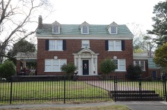 | Bishop Brookes House | building | 1999 | 99001352 |
| De Queen & Eastern Railroad Overpass | structure | 2023 | 100008976 | |
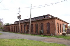 | DeQueen & Eastern Railroad Machine Shop | building | 1996 | 96000643 |
 | DeQueen Commercial Historic District | district | 2012 | 11001051 |
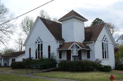 | First Presbyterian Church | building | 1994 | 94001419 |
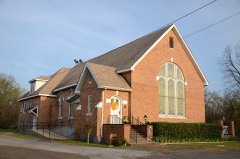 | First United Methodist Church | building | 1994 | 94000468 |
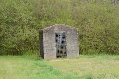 | Gillham City Jail | building | 2012 | 11001052 |
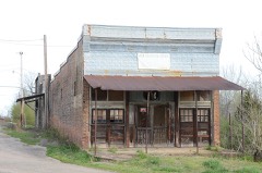 | Goff and Gamble Merchandise Store | building | 1996 | 96000646 |
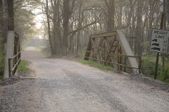 | Hale Creek Bridge | structure | 2004 | 04000489 |
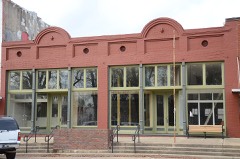 | Hayes Hardware Store | building | 1980 | 80000787 |
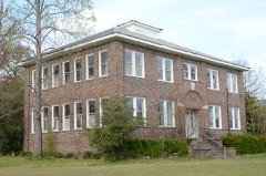 | King Schoolhouse | building | 1996 | 96000645 |
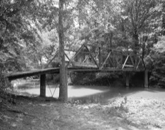 | Little Cossatot River Bridge | structure | 1990 | 90000538 |
| Lockesburg High School Gymnasium | building | 2018 | 100002458 | |
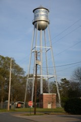 | Lockesburg Waterworks | structure | 2007 | 07000964 |
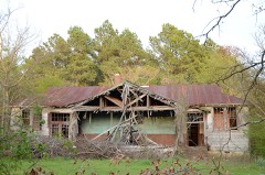 | Oak Grove Rosenwald School | building | 2004 | 04000494 |
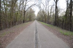 | Old US 71-Little River Approach | structure | 2004 | 04000493 |
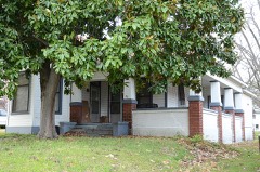 | Otis Theodore and Effiegene Locke Wingo House | building | 2004 | 04000501 |
Every wildfire the federal occurrence database records inside this county: 556 of them, burning about 5,863 acres. 57 started naturally and 252 were recorded as arson. Each settlement page carries the fires within five miles of it.
| Reported cause | Fires |
|---|---|
| Arson/incendiarism | 252 |
| Missing data/not specified/undetermined | 117 |
| Debris and open burning | 84 |
| Natural | 57 |
| Equipment and vehicle use | 20 |
| Railroad operations and maintenance | 12 |
| Smoking | 8 |
| Recreation and ceremony | 3 |
| Misuse of fire by a minor | 3 |
The five largest, by the area the report gives. 6 of them were set deliberately.
| Date | Cause | Size | Reported by | Name on the report |
|---|---|---|---|---|
| 20 July 1998 | Arson/incendiarism | 456 acres | Arkansas Forestry Commission | not named |
| 31 August 2011 | Debris and open burning | 280 acres | Pond Creek National Wildlife Refuge | COSSATOT |
| 28 August 2000 | Arson/incendiarism | 258 acres | Arkansas Forestry Commission | not named |
| 28 August 2000 | Arson/incendiarism | 228 acres | Arkansas Forestry Commission | not named |
| 10 September 2011 | Arson/incendiarism | 212 acres | Arkansas Forestry Commission | RED BARN |
| 19 August 1999 | Arson/incendiarism | 210 acres | Felsenthal National Wildlife Refuge | SALT LICK |
| 27 August 2000 | Arson/incendiarism | 179 acres | Arkansas Forestry Commission | not named |
| 7 September 2012 | Missing data/not specified/undetermined | 120 acres | Arkansas Forestry Commission | LOCKESBURG |
Every settlement page carries the fires within five miles of it - see the settlement index below.
The NOAA Storm Events Database holds 470 reports for this county, causing no deaths, 16 injuries and about $11,074,130 in recorded property damage. Each settlement page carries the reports that name it.
| Kind of event | Reports |
|---|---|
| Thunderstorm Wind | 217 |
| Hail | 188 |
| Flash Flood | 31 |
| Tornado | 23 |
| Lightning | 5 |
| Flood | 4 |
| Funnel Cloud | 2 |
The most serious of them, by death, then injury, then recorded damage. The accounts are quoted exactly as the forecast office filed them.
| When | Event | Place named | Harm | What the report says |
|---|---|---|---|---|
| April 2009 | Tornado (EF3) | West Line | 7 hurt, $3,500,000 | Tornado destroyed at least 10 to 12 mobile homes along US-71 just north of De Queen, AR. Numerous trees and powerlines were also uprooted or snapped. There were 7 reported injuries, all in the mobile home park north of Dequeen, Arkansas but none were life threatening. The Arkansas governor declared Sevier County a disaster area because of the tornado damage in the county. |
| November 1973 | Tornado (F2) | not stated | 6 hurt, $250,000 | no account filed |
| March 1978 | Tornado (F1) | not stated | 1 hurt, $250,000 | no account filed |
| September 2000 | Thunderstorm Wind | Ben Lomond | 1 hurt, $15,000 | A weigh station was damaged and numerous trees down. |
| August 1954 | Tornado (F2) | not stated | 1 hurt, $2,500 | no account filed |
| April 1982 | Tornado (F4) | not stated | $2,500,000 | no account filed |
| September 2000 | Thunderstorm Wind | De Queen | $2,000,000 | Numerous trees and power lines down. Twenty eight (28) homes damaged. A chicken house was destroyed and 30 thousand chickens were contaminated resulting in their destruction. |
| May 2024 | Tornado (EF1) | Beacon Hill | $500,000 | During the early morning hours of May 24th, an EF-1 tornado with maximum winds estimated at 110 mph, first touched down on Beacon Hill Road in rural Central Sevier County, Arkansas between the towns of De Queen and Lockesburg in association with a quasi-linear convective system. It continued to move northeastward for 4 to 5 miles, crossing US Highway 71 just south of the US Hwy 70 intersection, then lifting along Sevier County Road 328. Damage consisted mostly of uprooted and snapped trees and power lines, with structural damage to a few outbuildings and sheds. A few residences were damaged due to falling trees or branches. Peak intensity of the tornado was estimated as the tornado crossed Farm-to-Market Road 15 south of the community of Geneva. There, many trees where snapped, a residence was damaged, and a chicken house had roof panels removed. Many areas northeast of this location were hard to access by the NWS survey team, but the team found enough evidence to conclude the tornado continued to the northeast for several more miles before lifting. |
| April 2020 | Tornado (EF2) | Cheatham | $400,000 | This is the continuation of the Eastern McCurtain County EF-2 tornado. This tornado snapped and uprooted numerous trees along Kellum Road in Northwest Sevier County, and continued to touch down intermittently several times as it tracked southeast. It touched down again along Bellah Mine Road as it crossed DeQueen Lake, with additional trees snapped and uprooted along Story Creek Road and DeQueen Lake Road. Minor metal roof damage to a garage of a home also occurred in this area. The damage swath broadened as the tornado approached Highway 71, when it crossed Crosstrails Road, damaging the roofs of two chicken houses while uprooting and snapping numerous trees. The tornado continued on to cross Highway 71 where numerous trees were snapped, a single-wide mobile home was rolled and destroyed, and the roof of a farm building was partially damaged. The tornado snapped approximately ten more trees before lifting just south of Highway 71/371 several miles east of DeQueen just east of the intersection of Farm to Market Road. Although the tornado will be rated an EF-2 with estimated maximum winds near 125 mph, found in Eastern McCurtain County Oklahoma, the tornadic damage in North-central Sevier County was estimated to be EF-1, with estimated maximum winds up to 105 mph. The total tornado path length from Eastern McCurtain County Oklahoma into North-central Sevier County Arkansas was near 20 miles. |
| May 2008 | Tornado (EF1) | Avon | $250,000 | An EF1 tornado with winds of 85 to 95 mph occurred on the north side of the town of Dequeen, Arkansas. The main track paralleled West Robinson Road west of U.S. Hwy 71 North. Numerous large trees were snapped and uprooted including several that fell on homes. Several trees also fell in the town of DeQueen mainly along Altena Street in association with strong straight line winds from the same tornadic thunderstorm. |
| April 1979 | Tornado (F2) | not stated | $250,000 | no account filed |
| May 2015 | Thunderstorm Wind | De Queen | $200,000 | Widespread wind damage was reported in Sevier County, Arkansas as well as in the city of DeQueen, Arkansas. Some damage was reported to homes, mainly from fallen trees. Numerous other trees were snapped and uprooted across the county as well. |
| November 2011 | Lightning | Horatio | $150,000 | Lightning struck a home in Horatio, Arkansas, burning it to the ground. There were no reports of injuries. |
| April 2005 | Lightning | Lockesburg | $125,000 | Lightning struck a home in town resulting in a fire. The house burned to the ground but there were no injuries. |
| August 2010 | Lightning | De Queen | $100,000 | Fire destroyed a home on Mountain View Road near De Queen Lake in De Queen, Ark., Monday evening. It was determined that the fire was started by a lightning strike from thunderstorms in the evening. There were no injuries reported from the fire but the house was a total loss. |
| April 2025 | Tornado (EF1) | Lockesburg | $50,000 | An EF-1 tornado with estimated maximum winds near 95 mph touched down just south of of Highway 24 about 2 miles west of Lockesburg, where it caused significant damage to a small shed. The tornado then moved northeast across Highway 24, snapping and uprooting trees and just missing a home on the north side of the highway. A trampoline and small playground near the home were blown about 50 yards directly to the west from their original location. Although the road network became sparse beyond this point, drone footage indicated that the damage path continued from the home to Wildwood and Hilltop Roads where a number of trees were snapped and uprooted. The tornado did cause significant damage to three chicken coops located just north of Hilltop Road, while also snapping/uprooting additional trees in this area as well. It then tracked across Shady Lane just to the north of Hilltop Road and uprooted a very large tree, with another tree uprooted and having fallen onto a small home on the west side of Shady Lane. The tornado continued to move northeast over North Park Avenue, Elm Drive, and Highway 71 north of Lockesburg. The damage path became more sparse as the tornado crossed Montgomery Lane just east of Highway 71, with a few other small trees downed on Provo Road just east of Big Timber Lane before the tornado lifted. |
| May 2001 | Hail | Horatio | $50,000 | Numerous cars were dented and windows and windshields broken. |
| April 1994 | Thunderstorm Wind | Ben Lomond | $50,000 | Thunderstorm winds damaged two barns. |
| June 1994 | Thunderstorm Wind | Central | $50,000 | Thunderstorm winds knocked down several trees and damaged a chicken house. |
| August 1993 | Thunderstorm Wind | DeQueen | $50,000 | Thunderstorm winds downed numerous trees. |
| August 1993 | Thunderstorm Wind | DeQueen | $50,000 | Thunderstorm winds damaged a chicken house and knocked down several trees. |
| January 1993 | Thunderstorm Wind | Central | $50,000 | Thunderstorm winds blew down several trees and damaged a chicken barn. |
| August 2008 | Lightning | De Queen | $40,000 | Lightning struck the fire department's radio tower in De Queen, Arkansas. The electricity from the strike followed the wiring into the wall resulting in a fire inside the local fire department. Moderate damage was reported. |
| December 2012 | Thunderstorm Wind | Horatio | $30,000 | A tree was downed on a house in Horatio, Arkansas. No injuries were reported. |
| March 2026 | Tornado (EF1) | King | $25,000 | Early on the morning of March 11th, a line of severe thunderstorms moved into Sevier County, Arkansas. The line of thunderstorms produced a brief EF1 tornado with estimated maximum winds near 95 mph just east of U.S. Highway 71 southeast of Gillham. As the tornado touched down east of the highway, it damaged several large barns before it then snapped several hardwood trees in a downstream field. The tornado then crossed Kind Road where multiple trees were snapped and uprooted. As the tornado moved east of Kind Road, it damaged several more trees before quickly lifting. |
| May 2007 | Thunderstorm Wind | De Queen | $22,000 | Trees downed in town and minor roof damage as well. A tree also fell on top of an automobile. No reports of injuries. |
| December 2012 | Thunderstorm Wind | Ben Lomond | $20,000 | Wind damage was reported to the front porch of a home and the chimney of the same house. |
| September 2011 | Flood | Horatio | $20,000 | The Horatio Grocery Store located at Main and Hwy. 41 was flooded. Emergency manager reported over 5 inches of rain in just a few hours. |
| November 2015 | Flash Flood | Rock Hill | $5,000 | A car was submerged by flood waters and the occupant had to be rescued. |
| July 2014 | Thunderstorm Wind | De Queen | $5,000 | Estimated wind gust by a Trained Spotter in DeQueen, Arkansas. A large tree fell on Courthouse causing minor damage. |
| June 1994 | Thunderstorm Wind | Cheatham | $5,000 | The Army Corps of Engineers reported that thunderstorm winds damaged trees near DeQueen Dam. |
| May 1994 | Thunderstorm Wind | King | $5,000 | Thunderstorm winds downed several trees. |
| May 1994 | Thunderstorm Wind | Central | $5,000 | Thunderstorm winds downed several trees. |
| July 1994 | Thunderstorm Wind | DeQueen | $5,000 | Thunderstorm winds downed several trees. |
| November 1994 | Thunderstorm Wind | Central | $5,000 | Thunderstorm winds downed several trees. |
| May 1993 | Thunderstorm Wind | Horatio | $5,000 | Thunderstorm winds blew down several trees. |
| August 1993 | Thunderstorm Wind | DeQueen | $5,000 | Several trees were blown down. |
| August 1993 | Thunderstorm Wind | Gillham | $5,000 | Thunderstorm winds knocked some trees down. |
| October 1993 | Thunderstorm Wind | Lockesburg | $5,000 | Thunderstorm winds blew down several trees. |
| April 1993 | Thunderstorm Wind | Lockesburg | $5,000 | Thunderstorm winds knocked down several trees. |
| August 1993 | Thunderstorm Wind | DeQueen | $5,000 | Some trees were downed. |
| April 1996 | Lightning | De Queen | $5,000 | no account filed |
| July 2011 | Thunderstorm Wind | Lockesburg | $2,000 | Numerous trees were snapped in the Lockesburg community. Power poles were snapped along Hwy. 71. Highways 329 and 371 were blocked from downed trees. Some structural damage to outbuildings were also reported. |
| April 2000 | Tornado (F1) | Horatio | $2,000 | Supercells developed in unstable airmass ahead of a multicellular squall line which moved east across the area. Both the supercells and squall line produced tornadoes. Damage consisted mainly of numerous snapped and fallen small trees. Shingles were partially removed from one roof and a swing set was tossed 100 feet at another home. This tornado moved into Sevier County, AR from Little River County, AR. |
| May 2024 | Tornado (EF0) | Milford | $500 | A brief landspout tornado was captured on video briefly touching down along Red Colony Road several miles southeast of Lockesburg, where it snapped small branches and tore off a small portion of the roof of a poorly constructed detached exterior carport. A few shingles were also removed from the the roof of an adjacent single family home. The landspout then crossed a hay meadow and snapped a small limb off of a hardwood tree before lifting along TJ King Road. Estimated maximum winds were 65 mph. |
| July 2009 | Hail | Bellview | $100 | Nickel sized hail busted out a windshield south of Lockesburg, Arkansas. |
| April 1973 | Tornado (F1) | not stated | $30 | no account filed |
| March 2026 | Thunderstorm Wind | Avon | - | Trees downed on power lines just north of De Queen. |
| March 2026 | Thunderstorm Wind | Central | - | Trees downed in the Central community between Horatio and Ben Lomond. |
| April 2026 | Thunderstorm Wind | Rock Hill | - | Multiple trees downed across the county, some of which were located along U.S. Highway 371 near Lockesburg and on Elm Drive in Lockesburg. |
| January 2025 | Flash Flood | Cheatham | - | Multiple secondary roads were closed across Sevier County due to flooding. |
| May 2025 | Thunderstorm Wind | Neal Spgs | - | A tree was blown down on Highway 24 near Wilson Lane. |
| March 2025 | Thunderstorm Wind | Central | - | Multiple trees downed on Frog Level Road southeast of Horatio. |
| April 2025 | Thunderstorm Wind | Lockesburg | - | Large branches snapped off of trees in Lockesburg. |
| June 2025 | Thunderstorm Wind | Lockesburg | - | Trees downed near U.S. Highway 371 and Liggin Drive east of Lockesburg. |
| July 2025 | Thunderstorm Wind | Beacon Hill | - | A large tree limb was blown down across Highway 41 South between De Queen and Horatio. |
| September 2025 | Thunderstorm Wind | Gillham | - | A tree was blown down along Highway 71 just south of Gillham. |
| September 2025 | Thunderstorm Wind | De Queen | - | Trees were blown down on East Red Bridge Road just to the southeast of Highway 41. |
| September 2025 | Thunderstorm Wind | De Queen | - | Trees were blown down on Johnson Bridge Road just off of Highway 70 W just west of De Queen. |
| September 2025 | Thunderstorm Wind | Gillham | - | An NWS survey team confirmed that a microburst produced a narrow swath of wind damage in the town of Gillham just south of the Kansas City Southern Railway to just east of Highway 71. The damage consisted almost entirely of uprooted hardwood and softwood trees, although a few softwood trees were also snapped. The damage was particularly concentrated just north of and down a hill from Gillham Baptist Church. The damage pattern was almost entirely unidirectional, pointing to the northeast, and even diverged slightly in a couple of places, which strongly indicated straight-line wind damage with estimated winds near 90 mph. |
The Survey's mineral resources record lists 77 workings inside this county. 7 still produce and 70 are closed or unrecorded. Each settlement page carries the workings within five miles of it.
| Commodity | Workings |
|---|---|
| Sand and Gravel, Construction | 43 |
| Diatomite | 21 |
| Barium-Barite | 3 |
| Antimony, Lead | 2 |
| Stone | 2 |
| Flagstone | 2 |
| Copper, Antimony, Silver | 1 |
| Zinc, Silver | 1 |
| Gold | 1 |
| Calcium | 1 |
| Copper, Lead, Zinc | 1 |
| Stone, Crushed/Broken | 1 |
The least common of them first, because a county's hundredth gravel pit says nothing its first ten did not.
| Where | Site | Commodity | Status | Recorded |
|---|---|---|---|---|
| Bob Wolf Mine | Copper, Antimony, Silver | Occurrence | Cervantite, Galena, Stibnite | |
| Davis Mine | Copper, Lead, Zinc | Past Producer | ||
| Dequeen Rock Quarry | Stone, Crushed/Broken | Producer | ||
| No Name | Calcium | Past Producer | ||
| Otto | Antimony, Lead, Zinc, Silver, Gold | Producer | 1877 | |
| Dequeen Rock Quarry | Flagstone | Producer | ||
| Rolling Fork Pit & Plant | Flagstone | Producer | ||
| Stewart May | Antimony, Lead | Producer | Siderite, Stibnite | |
| Unk | Stone | Past Producer | ||
| Unk | Stone | Past Producer | ||
| Section 16 Barite Deposit | Barium-Barite | Past Producer | ||
| Unk | Barium-Barite | Prospect | ||
| Unk | Barium-Barite | Prospect | ||
| Antimony Bluff Mine | Diatomite | Past Producer | ||
| Bellah Mine | Diatomite | Past Producer | ||
| Black Horse Mine | Diatomite | Past Producer | ||
| Brewer Mine | Diatomite | Past Producer | ||
| Clark Mine | Diatomite | Past Producer | ||
| Hankins Mine | Diatomite | Past Producer | ||
| Harrel Prospect | Diatomite | Prospect | ||
| Lignitz Mine | Diatomite | Past Producer | ||
| Luttrell Lease | Diatomite | Prospect | ||
| May Mine | Diatomite | Past Producer | ||
| Mickle Mine | Diatomite | Past Producer | ||
| New Discovery Shaft | Diatomite | Past Producer | ||
| Otto Mine | Diatomite | Past Producer | ||
| Petty Prospect | Diatomite | Prospect | ||
| Poor Boy Mine | Diatomite | Past Producer | ||
| Stewart Mine | Diatomite | Past Producer | ||
| Valley Mine | Diatomite | Past Producer | ||
| Warner Mine No 1 | Diatomite | Past Producer | ||
| Werner Mine No 2 | Diatomite | Past Producer | ||
| Werner Prospect | Diatomite | Prospect | ||
| Wolfton Mine | Diatomite | Past Producer | ||
| Dequeen Sand & Gravel Co | Sand and Gravel, Construction | Past Producer | ||
| McKeller Pit & Plant | Sand and Gravel, Construction | Producer | ||
| Unk | Sand and Gravel, Construction | Past Producer | ||
| Unk | Sand and Gravel, Construction | Past Producer | ||
| Unk | Sand and Gravel, Construction | Past Producer | ||
| Unk | Sand and Gravel, Construction | Past Producer | ||
| Unk | Sand and Gravel, Construction | Past Producer | ||
| Unk | Sand and Gravel, Construction | Past Producer | ||
| Unk | Sand and Gravel, Construction | Past Producer | ||
| Unk | Sand and Gravel, Construction | Past Producer | ||
| Unk | Sand and Gravel, Construction | Past Producer | ||
| Unk | Sand and Gravel, Construction | Past Producer | ||
| Unk | Sand and Gravel, Construction | Past Producer | ||
| Unk | Sand and Gravel, Construction | Past Producer | ||
| Unk | Sand and Gravel, Construction | Unknown | ||
| Unk | Sand and Gravel, Construction | Past Producer | ||
| Unk | Sand and Gravel, Construction | Producer | ||
| Unk | Sand and Gravel, Construction | Past Producer | ||
| Unk | Sand and Gravel, Construction | Past Producer | ||
| Unk | Sand and Gravel, Construction | Past Producer | ||
| Unk | Sand and Gravel, Construction | Past Producer | ||
| Unk | Sand and Gravel, Construction | Past Producer | ||
| Unk | Sand and Gravel, Construction | Past Producer | ||
| Unk | Sand and Gravel, Construction | Past Producer | ||
| Unk | Sand and Gravel, Construction | Past Producer | ||
| Unk | Sand and Gravel, Construction | Past Producer | ||
| Unk | Sand and Gravel, Construction | Past Producer | ||
| Unk | Sand and Gravel, Construction | Past Producer | ||
| Unk | Sand and Gravel, Construction | Past Producer | ||
| Unk | Sand and Gravel, Construction | Past Producer | ||
| Unk | Sand and Gravel, Construction | Past Producer | ||
| Unk | Sand and Gravel, Construction | Past Producer | ||
| Unk | Sand and Gravel, Construction | Past Producer | ||
| Unk | Sand and Gravel, Construction | Past Producer | ||
| Unk | Sand and Gravel, Construction | Past Producer | ||
| Unk | Sand and Gravel, Construction | Past Producer | ||
| Unk | Sand and Gravel, Construction | Past Producer | ||
| Unk | Sand and Gravel, Construction | Past Producer | ||
| Unk | Sand and Gravel, Construction | Past Producer | ||
| Unk | Sand and Gravel, Construction | Past Producer | ||
| Unk | Sand and Gravel, Construction | Past Producer | ||
| Unk | Sand and Gravel, Construction | Past Producer | ||
| Unk | Sand and Gravel, Construction | Past Producer |
Named settlements recorded in the Geographic Names Information System, each with the topographic sheets covering it. Villages, hamlets and abandoned places alike. Each is shown with the nearest named watercourse or landform and the survey quadrangle it falls on.
Mineral township · 71841 · Gillham quadrangle
15 sheets, 1913 to 1986
No longer a settlement
Monroe township · 71832 · Chapel Hill quadrangle
15 sheets, 1913 to 1986
No longer a settlement
Red Colony township · 71846 · On Little Bellville Creek · Lockesburg quadrangle
10 sheets, 1951 to 1990
Mineral township · 71841 · De Queen NW quadrangle
15 sheets, 1913 to 1986
No longer a settlement
Paraclifta township · 71846 · On Sand Creek · Ben Lomond quadrangle
11 sheets, 1950 to 1990
No longer a settlement
Bear Creek township · 71832 · De Queen quadrangle
14 sheets, 1913 to 1986
No longer a settlement
De Queen East township · 71832 · On Little Bear Creek · De Queen quadrangle
14 sheets, 1913 to 1986
Paraclifta township · 71842 · On Millwee Creek · Lockesburg quadrangle
10 sheets, 1951 to 1990
Red Colony township · 71846 · Near Steele Hill · Silver Ridge quadrangle
10 sheets, 1951 to 1990
Paraclifta township · 71846 · On Cossatot River · Falls Chapel quadrangle
11 sheets, 1950 to 1990
Paraclifta township · 71846 · On Bellville Creek · Lockesburg quadrangle
10 sheets, 1951 to 1990
Clear Creek township · 71842 · On Mill Creek · Horatio quadrangle
10 sheets, 1951 to 1990
Monroe township · 71832 · Near Glen Canyon · Chapel Hill quadrangle
15 sheets, 1913 to 1986
Monroe township · 71832 · Near Glen Canyon · Chapel Hill quadrangle
15 sheets, 1913 to 1986
Paraclifta township · 71846 · On Woolsey Creek · Falls Chapel quadrangle
11 sheets, 1950 to 1990
No longer a settlement
Paraclifta township · 71846 · On Blacks Branch · Ben Lomond quadrangle
11 sheets, 1950 to 1990
Red Colony township · 71846 · On Hurricane Creek · Geneva quadrangle
14 sheets, 1913 to 1986
No longer a settlement
Paraclifta township · 71842 · On Millwee Creek · Lockesburg quadrangle
10 sheets, 1951 to 1990
Clear Creek township · 71842 · On Walnut Springs Creek · Horatio quadrangle
10 sheets, 1951 to 1990
The vanished settlements of Sevier County: the places named above that are no longer on the map.