 Block
From the record
15 National Register listings published here.
Sources: the National Register database, National Park Service
91 topographic sheets cover 66 settlements here, and 15 properties are on the National Register of Historic Places.
15 National Register listings published here.
Sources: the National Register database, National Park Service
Every property in this county listed on the National Register of Historic Places, with the year it was listed and the federal nomination document.
| Photograph | Property | Type | Listed | Reference |
|---|---|---|---|---|
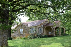 | Melvin Chrisco House | building | 2005 | 05001082 |
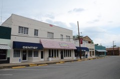 | Clinton Commercial Historic District | district | 2006 | 06000410 |
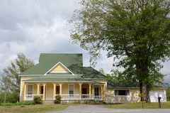 | Collums-Baker House | building | 1992 | 92001282 |
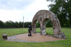 | Damascus CCC Camp, Co. No. 3781 Historic District | district | 2002 | 02001631 |
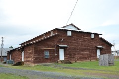 | Damascus Gymnasium | building | 1992 | 92001122 |
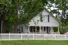 | Joclin-Bradley-Bowling House | building | 2007 | 06001316 |
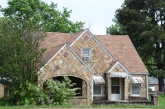 | Carl and Esther Lee House | building | 2005 | 05001170 |
 | Middle Fork of the Little Red River Bridge | structure | 2010 | 09001260 |
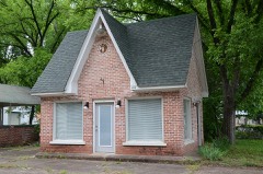 | Walter Patterson Filling Station | building | 2001 | 01000074 |
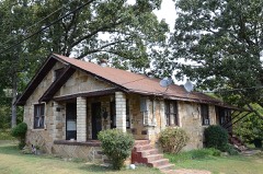 | Walter Patterson House | building | 2007 | 07000504 |
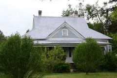 | Art Scanlan House | building | 1999 | 99001355 |
| South Side High School Sign | object | 2023 | 100008573 | |
| Titan II ICBM Launch Complex 374-7 Site | site | 2000 | 98001434 | |
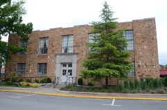 | Van Buren County Courthouse | building | 1991 | 91000584 |
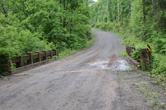 | Van Buren County Road 2E Bridge | structure | 1995 | 95000570 |
Every wildfire the federal occurrence database records inside this county: 521 of them, burning about 9,971 acres. 14 started naturally and 126 were recorded as arson. Each settlement page carries the fires within five miles of it.
| Reported cause | Fires |
|---|---|
| Missing data/not specified/undetermined | 174 |
| Debris and open burning | 162 |
| Arson/incendiarism | 126 |
| Equipment and vehicle use | 37 |
| Natural | 14 |
| Recreation and ceremony | 4 |
| Smoking | 2 |
| Misuse of fire by a minor | 2 |
The five largest, by the area the report gives. Three of them were set deliberately.
| Date | Cause | Size | Reported by | Name on the report |
|---|---|---|---|---|
| 6 November 2010 | Missing data/not specified/undetermined | 1,004 acres | Arkansas Forestry Commission | VAN BUREN |
| 20 March 2011 | Arson/incendiarism | 736 acres | Arkansas Forestry Commission | QUEEN SIMMONS |
| 23 March 2004 | Arson/incendiarism | 334 acres | Arkansas Forestry Commission | OXLEY |
| 1 March 2006 | Arson/incendiarism | 324 acres | Arkansas Forestry Commission | not named |
| 4 April 2004 | Debris and open burning | 303 acres | Arkansas Forestry Commission | not named |
| 28 August 2012 | Debris and open burning | 300 acres | Arkansas Forestry Commission | CLAUDE SCHOOLHOUSE |
| 31 October 2017 | Missing data/not specified/undetermined | 243 acres | Arkansas Forestry Commission | not named |
| 8 April 1996 | Missing data/not specified/undetermined | 162 acres | Ozark-St. Francis National Forests | LIBERTY |
Every settlement page carries the fires within five miles of it - see the settlement index below.
The NOAA Storm Events Database holds 447 reports for this county, causing 8 deaths, 136 injuries and about $78,998,500 in recorded property damage. Each settlement page carries the reports that name it.
| Kind of event | Reports |
|---|---|
| Thunderstorm Wind | 187 |
| Hail | 166 |
| Flash Flood | 36 |
| Tornado | 35 |
| Heavy Rain | 9 |
| Lightning | 6 |
| Flood | 6 |
| Funnel Cloud | 2 |
The most serious of them, by death, then injury, then recorded damage. The accounts are quoted exactly as the forecast office filed them.
| When | Event | Place named | Harm | What the report says |
|---|---|---|---|---|
| February 2008 | Tornado (EF4) | Beverage Town | 3 killed, 77 hurt, $22,750,000 | The tornado moved from Conway County, northeast of Cleveland, into Van Buren County, south-southeast of Beverage Town. A Red Cross survey indicated that 41 houses were destroyed, 26 suffered major damage, 29 had minor damage, and 30 others were affected. In addition, 21 mobile homes were destroyed, 4 suffered major damage, 2 had minor damage, and one other was affected. A boat factory was destroyed, and a church and a number of businesses were damaged. Three fatalities occurred: One in a house 3.2 miles south-southwest of Clinton, one at the boat factory in Clinton, and one in a mobile home 2.5 miles west of Shirley. The tornado continued into Stone County, south-southwest of Rushing. |
| May 2008 | Tornado (EF3) | Damascus | 3 killed, 6 hurt, $10,000,000 | This tornado moved out of Conway County, east of Center Ridge, and entered Van Buren County, west-southwest of Damascus. The tornado destroyed 17 permanent homes and 8 mobile homes. It caused major damage to 30 homes and minor damage to 19 homes. Four chicken houses were destroyed, 8 horses were killed, and one bull was killed. A feed mill was destroyed and three businesses received major damage. One church was destroyed and another was severely damaged. A 4 year-old girl and her grandparents were killed when their house was destroyed on Scroggins Creek Rd. (County Road 65). The tornado exited Van Buren County, east-northeast of Morganton, and moved into Cleburne County, northwest of Crossroads. |
| April 2010 | Tornado (EF3) | Liberty Spgs | 1 killed, 15 hurt, $4,000,000 | This tornado exited Conway County north of Cleveland and entered Van Buren County south-southeast of Liberty Springs. The tornado, rated EF3 in Van Buren County, caused extensive damage to the town of Scotland, especially in areas along Lo Gap Road. A 67 year-old woman was killed when she was thrown from her home. Approximately 15 others were injured. A damage assessment by the Arkansas Department of Emergency Management indicated 13 homes (including houses and mobile homes) destroyed, 3 homes with major damage, 7 homes with minor damage, and 11 homes affected. In addition, Scotland's community center was destroyed, and barns, outbuildings, and a gas well were damaged. Thousands of trees and numerous power lines were blown down. |
| November 1988 | Tornado (F3) | not stated | 1 killed, 10 hurt, $2,500,000 | no account filed |
| June 1989 | Tornado (F2) | not stated | 6 hurt, $250,000 | no account filed |
| April 2013 | Tornado (EF2) | Pleasant Grove | 5 hurt, $3,500,000 | An EF2 tornado destroyed a church, badly damaged a fire station, and also damaged a natural gas well. Six houses were destroyed, 14 had major damage, 29 had minor damage, and 20 others had very minor damage. Many of the damaged houses had roofs partially torn off. Several dozen outbuildings were damaged or destroyed. A number of vehicles were damaged and some were overturned. |
| November 1955 | Tornado (F2) | not stated | 5 hurt, $25,000 | no account filed |
| May 1960 | Tornado (F2) | not stated | 4 hurt, $2,500 | no account filed |
| February 1984 | Thunderstorm Wind | not stated | 3 hurt | no account filed |
| January 2014 | Flood | Copeland | 2 hurt, $40,000 | A large pickup truck was swept off a private low-water crossing on a farm about 6 miles southwest of Dennard. The truck traveled a short distance down Archey Creek and became hung up on a large rock. The three occupants of the truck climbed atop it and waited for rescue. Due to the complicated, precarious nature of the situation, the rescue ended up taking more than 7 hours. During that time, a cold front moved through and the temperature dropped below freezing, causing ice to form on the rescue ropes. All three people were rescued successfully, but two were transported to the hospital for hypothermia. |
| December 2007 | Lightning | Damascus | 1 hurt | A man in his early 20's was injured by lightning while working outside on a farm. He complained of tingling and numbness and was treated at a hospital. |
| June 2004 | Lightning | Dennard | 1 hurt | An off duty police officer was struck by lightning, and was not seriously injured. |
| August 2000 | Lightning | Clinton | 1 hurt | no account filed |
| March 1984 | Tornado (F4) | not stated | $25,000,000 | no account filed |
| December 1982 | Tornado (F3) | not stated | $2,500,000 | no account filed |
| May 2011 | Flood | Alread | $1,500,000 | Some of the campsites around Greers Ferry Lake were closed due to flooding. |
| March 2008 | Flash Flood | Dennard | $1,000,000 | Water was across roads and low water crossings in Clinton. Water was over Arkansas Highway 16 East. Water swept away the ballfield at Shirley City Park. The basketball courts, walkways, and much of Archey Fork Park were under water. Flooding occurred on U.S. Highway 65 at Bee Branch. |
| April 2011 | Flood | Alread | $600,000 | Widespread areal flooding occurred. |
| January 2007 | Flash Flood | Clinton | $542,000 | Street flooding was reported near Clinton. |
| February 2009 | Thunderstorm Wind | Choctaw | $500,000 | Trees and power lines were blown down on Arkansas Highway 330. Hundreds of pine trees were down, with some landing on houses. |
| November 1994 | Tornado (F1) | Clinton to | $500,000 | An F1 tornado touched down in Clinton and travelled about 2 miles before lifting. The worst damage occurred at the Clinton airport, where four planes were destroyed and 8 others were damaged. Eight houses and several businesses in Clinton were also damaged. Most of the damage consisted of broken windows and portions of roofs being blown off. Some trees and power lines were also knocked down. |
| September 2008 | Flash Flood | Shirley | $450,000 | Flooding occurred across the county. |
| October 2009 | Flash Flood | Una | $250,000 | Numerous county roads were damaged by flooding. |
| June 1979 | Tornado (F2) | not stated | $250,000 | no account filed |
| March 1976 | Tornado (F1) | not stated | $250,000 | no account filed |
| February 1956 | Tornado (F3) | not stated | $250,000 | no account filed |
| May 2013 | Flash Flood | Rupert | $175,000 | Heavy rain caused considerable damage to county roads and bridges. |
| June 2012 | Thunderstorm Wind | Shirley | $150,000 | Thousands of trees were snapped off, uprooted and/or blown down within a seven mile radius of Shirley. Several trees fell on houses. Shingles were taken off of roofs and metal off of barns. Outbuildings were damaged and a vehicle was trapped by fallen power lines. |
| November 2011 | Flash Flood | Chalk | $150,000 | Some low-lying areas around Clinton were flooded. Creeks were out of their banks in the northern part of the county. Roads and low-water bridges were washed out. |
| February 2009 | Thunderstorm Wind | Formosa | $125,000 | A barn was blown onto Arkansas Highway 9 near Formosa. Nine roofs were blown off houses. |
| December 2015 | Thunderstorm Wind | Koch Ridge | $100,000 | Severe thunderstorm winds associated with a down-burst or even a possible brief gust-nado caused damage 4 miles west of Clinton on Hwy 16. These severe thunderstorm winds damaged a home, shop and a barn. A carport was thrown and destroyed. Several trees and power lines were also blown down. |
| February 2009 | Thunderstorm Wind | Clinton | $100,000 | Trees were down on Arkansas Highway 95. One tree fell on a garage. Power lines were down across Clinton and gas meters were torn off in the area. |
| January 2008 | Tornado (EF1) | Liberty Spgs | $100,000 | The tornado from Conway County continued into Van Buren County. Hundreds of trees were blown down in the Ozark National Forest. The tornado dissipated before leaving the boundaries of the forest. |
| March 1997 | Tornado (F2) | Scotland | $100,000 | no account filed |
| April 2010 | Tornado (EF1) | Rubek | $90,000 | This EF1 tornado was spawned by the same supercell thunderstorm that produced the EF3 tornado at Scotland. A mobile home was destroyed, with the roof of the mobile home blowing up against a barn. A recreational vehicle was overturned, hitting the side of a mobile home and damaging it. Trees and power lines were blown down. The tornado exited Van Buren County northeast of Rubek and entered Stone County east-southeast of Old Lexington. |
| December 2015 | Tornado (EF1) | Morganton | $80,000 | A home was destroyed by a weak, brief tornado east of Bee Branch during the morning hours of the 23rd. |
| January 2013 | Flash Flood | Una | $80,000 | Numerous county roads and some highways were impassable or had water over them, including some areas around Shirley, Choctaw, Scotland, Damascus, the Van Buren/Stone County line, and Fairfield Bay. The county declared a disaster. |
| March 2012 | Flood | Una | $75,000 | Creeks left their banks, flooding numerous county roads. The county judge declared a disaster. |
| September 2009 | Flash Flood | Chimes | $75,000 | Many roads in the county were flooded. |
| April 2010 | Tornado (EF1) | Whipple | $60,000 | This tornado exited Conway County east of Austin and entered Van Buren County north-northwest of Whipple. A motor home and three recreational vehicles were blown over. Trees were blown down. |
| July 2018 | Thunderstorm Wind | Clinton | $50,000 | Several trees and large limbs were blown down in Clinton. Clinton Public Schools had a few trees down and damage to a couple of buildings, including a large pine tree on the Agricultural Department. |
| June 2012 | Thunderstorm Wind | Rubek | $50,000 | At the Holley Mountain Airpark, part of a hangar roof was blown off, and the windsock mast, a fence, and trees were blown down. The airport was closed for nearly 24 hours while tree debris was removed from the runway. |
| April 2009 | Thunderstorm Wind | Damascus | $50,000 | Trees were down in the area. A roof was blown off a barn. Siding was damaged on a house. |
| April 2009 | Thunderstorm Wind | Clinton | $50,000 | Trees and power lines were down across Clinton. |
| June 1994 | Thunderstorm Wind | Clinton | $50,000 | Thunderstorm winds downed numerous trees and power lines. |
| March 1997 | Tornado (F1) | Shirley | $50,000 | no account filed |
| March 2010 | Thunderstorm Wind | Pleasant Grove | $40,000 | The roof of a chicken house was blown off and a few trees blown down south of Scotland. |
| January 2020 | Thunderstorm Wind | Una | $30,000 | Thunderstorm wind damage from 75-85 mph winds was found across far northwest Van Buren county near and south of the town of Leslie. Numerous trees were downed, and there was damage to the roofs of a couple of homes and a small commercial building. |
| April 2012 | Tornado (EF1) | Fairbanks | $30,000 | An EF1 tornado snapped off or uprooted dozens of trees, tore part of the porch roof off a mobile home, overturned a travel trailer, and caused minor damage to a house and a vacant mobile home. |
| June 2009 | Thunderstorm Wind | Damascus | $30,000 | A tree fell on a house. |
| October 2014 | Thunderstorm Wind | Clinton | $25,000 | Trees and large limbs were blown down at Clinton and many other locations in Van Buren County. |
| July 2012 | Thunderstorm Wind | Damascus | $25,000 | Two structures had minor damage, and numerous trees and power lines were blown down. |
| March 2012 | Flash Flood | Una | $25,000 | Numerous county roads were flooded. |
| March 2012 | Thunderstorm Wind | Damascus | $25,000 | Roofs were blown off two barns and some trees were blown down. |
| April 2011 | Thunderstorm Wind | Fairbanks | $25,000 | A large barn was destroyed, with debris being blown across a field. |
| April 1959 | Tornado (F0) | not stated | $25,000 | no account filed |
| February 1956 | Tornado (F2) | not stated | $25,000 | no account filed |
| December 2015 | Thunderstorm Wind | Eglantine | $20,000 | A tree fell onto a home in Fairfield Bay. |
| March 2012 | Thunderstorm Wind | Damascus | $20,000 | A home anemometer measured a 73 mph wind gust. Several roofs in the area were damaged and a few trees were blown down. |
| May 2008 | Lightning | Green Tree | $20,000 | Lightning struck a house on the Sills Peninsula at Greers Ferry Lake. The ensuing fire destroyed the house. |
The Survey's mineral resources record lists 12 workings inside this county. 2 still produce and 10 are closed or unrecorded. Each settlement page carries the workings within five miles of it.
| Commodity | Workings |
|---|---|
| Sand and Gravel, Construction | 8 |
| Stone | 2 |
| Clay | 1 |
| Phosphorus-Phosphates | 1 |
The least common of them first, because a county's hundredth gravel pit says nothing its first ten did not.
| Where | Site | Commodity | Status | Recorded |
|---|---|---|---|---|
| J E Ferguson | Phosphorus-Phosphates | Past Producer | ||
| Unk | Clay | Past Producer | ||
| Unk | Stone | Past Producer | ||
| Unk | Stone | Past Producer | ||
| Mitchell Pit & Plant | Sand and Gravel, Construction | Producer | ||
| Unk | Sand and Gravel, Construction | Past Producer | ||
| Unk | Sand and Gravel, Construction | Past Producer | ||
| Unk | Sand and Gravel, Construction | Past Producer | ||
| Unk | Sand and Gravel, Construction | Past Producer | ||
| Unk | Sand and Gravel, Construction | Past Producer | ||
| Unk | Sand and Gravel, Construction | Past Producer | ||
| Van Buren County Pit | Sand and Gravel, Construction | Producer |
Named settlements recorded in the Geographic Names Information System, each with the topographic sheets covering it. Villages, hamlets and abandoned places alike. Each is shown with the nearest named watercourse or landform and the survey quadrangle it falls on.
Washington township · 72031 · Near Walnut Knob · Botkinburg quadrangle
16 sheets, 1892 to 1992
No longer a settlement
East Griggs township · 72153 · Near Story Mountain · Clinton quadrangle
15 sheets, 1892 to 1992
No longer a settlement
Choctaw township · 72031 · On Choctaw Creek · Fairfield Bay quadrangle
16 sheets, 1892 to 1992
No longer a settlement
Washington township · 72629 · Near George Main Hollow · Botkinburg quadrangle
16 sheets, 1892 to 1992
Craig township · 72141 · Near Wolf Pen Hollow · Scotland quadrangle
15 sheets, 1892 to 1992
No longer a settlement
West Griggs township · 72031 · On Bradley Branch · Scotland quadrangle
15 sheets, 1892 to 1992
No longer a settlement
Davis township · 72067 · On Wild Goose Branch · Greers Ferry quadrangle
15 sheets, 1892 to 1992
No longer a settlement
Davis township · 72013 · Near Low Gap Mountain · Fairfield Bay quadrangle
16 sheets, 1892 to 1992
Mountain township · 72031 · Near Crowell Mountain · Scotland quadrangle
15 sheets, 1892 to 1992
Bradley township · 72013 · Near Lunsford Point · Bee Branch quadrangle
12 sheets, 1956 to 1992
No longer a settlement
Liberty township · 72141 · On Trimble Creek · Rex quadrangle
16 sheets, 1892 to 1992
No longer a settlement
Red River township · 72153 · On Lynn Creek · Fairfield Bay quadrangle
16 sheets, 1892 to 1992
Cadron township · 72013 · Near Phillips Hill · Morganton quadrangle
12 sheets, 1956 to 1992
Indian Rock township · 72088 · On Dave Creek · Fairfield Bay quadrangle
16 sheets, 1892 to 1992
Craig township · 72141 · On Opossum Walk Creek · Scotland quadrangle
15 sheets, 1892 to 1992
No longer a settlement
Craig township · 72030 · On Beardy Branch · Cleveland quadrangle
16 sheets, 1892 to 1992
Choctaw township · 72031 · Near Black Ward Ridge · Clinton quadrangle
15 sheets, 1892 to 1992
Liberty township · 72141 · Near Egger Mountain · Rex quadrangle
16 sheets, 1892 to 1992
No longer a settlement
Linn Creek township · 72031 · On Half Moon Mountain · Oxley quadrangle
15 sheets, 1892 to 1992
Union township · 72153 · Near Johnson Hollow · Parma quadrangle
16 sheets, 1892 to 1992
No longer a settlement
Liberty township · 72031 · Near Hatley Mountain · Lost Corner quadrangle
21 sheets, 1879 to 1992
No longer a settlement
Liberty township · 72141 · Near Sis Hollow · Rex quadrangle
16 sheets, 1892 to 1992
No longer a settlement
Liberty township · 72141 · On Hill Creek · Cleveland quadrangle
16 sheets, 1892 to 1992
No longer a settlement
Washington township · 72629 · Near Bear Hollow · Leslie quadrangle
15 sheets, 1892 to 1992
No longer a settlement
Linn Creek township · 72031 · Near Chinkapin Ridge · Old Lexington quadrangle
16 sheets, 1892 to 1992
Liberty township · 72030 · On Beardy Branch · Cleveland quadrangle
16 sheets, 1892 to 1992
No longer a settlement
Davis township · 72013 · Near Stevens Point · Fairfield Bay quadrangle
16 sheets, 1892 to 1992
Craig township · 72141 · On Scotland Branch · Scotland quadrangle
15 sheets, 1892 to 1992
No longer a settlement
Craig township · 72030 · Near Round Mountain · Formosa quadrangle
16 sheets, 1892 to 1992
Union township · 72153 · On Ship Branch · Shirley quadrangle
17 sheets, 1892 to 1992
No longer a settlement
Barnett township · 72013 · On Rabbit Ridge · Bee Branch quadrangle
12 sheets, 1956 to 1992
Liberty township · 72141 · Near Gulf Mountain · Rex quadrangle
16 sheets, 1892 to 1992
No longer a settlement
Washington township · 72629 · Near Greenbrier Hollow · Botkinburg quadrangle
16 sheets, 1892 to 1992
Washington township · 72629 · Near Greenbrier Hollow · Botkinburg quadrangle
16 sheets, 1892 to 1992
Union township · 72153 · Near Hump Hollow · Shirley quadrangle
17 sheets, 1892 to 1992
No longer a settlement
Culpepper township · 72031 · On Bradley Branch · Clinton quadrangle
15 sheets, 1892 to 1992
No longer a settlement
Davis township · 72013 · Near Greasy Valley · Morganton quadrangle
12 sheets, 1956 to 1992
Craig township · 72031 · Near West Hollow · Scotland quadrangle
15 sheets, 1892 to 1992
Bradley township · 72013 · Near Rabbit Ridge · Bee Branch quadrangle
12 sheets, 1956 to 1992
Craig township · 72031 · Near Dry Land Hollow · Rex quadrangle
16 sheets, 1892 to 1992
No longer a settlement
Archey Valley township · 72645 · Near Woods Hollow · Alread quadrangle
15 sheets, 1892 to 1992
The vanished settlements of Van Buren County: the places named above that are no longer on the map.