 Block
Casas Adobes, Arizona
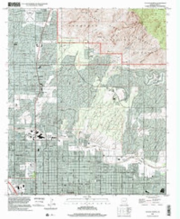
26 topographic sheets cover this place, the earliest surveyed in 1904 and the latest in 1996. It stands in the Tucson census division. It lies in ZIP code area 85704. The Survey maps it on the Tucson North quadrangle. 70,973 people lived here at the 2020 count. It stands 2,411 feet above sea level.
Population over time
2 figuresCasas Adobes grew from 66,795 to 70,973 between 2010 and 2020. These are the recorded population figures Wikidata holds for this place, reached through the Geographic Names Information System number this page is keyed on rather than by name, so they belong to this place and not to another of the same name. Most are census counts, but not all are: an early figure may be a founding or settlement estimate, and an estimate published within five years of a census is left out. The change column is computed, and is left blank where more than 20 years separate a figure from the one before it, because a gap that long is not a change between two counts.
| Year | People | Change |
|---|---|---|
| 2010 | 66,795 | |
| 2020 | 70,973 | +4,178 (+6%) |
Topographic sheets covering this place
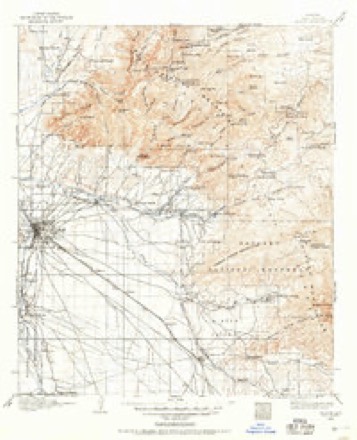
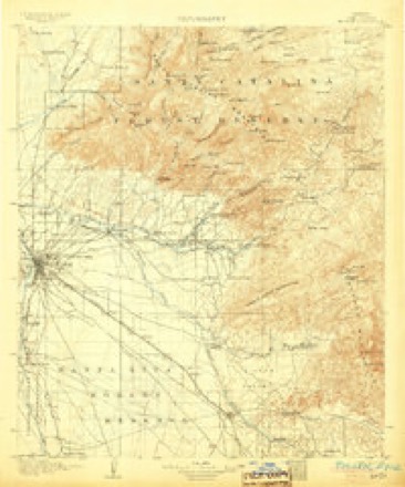
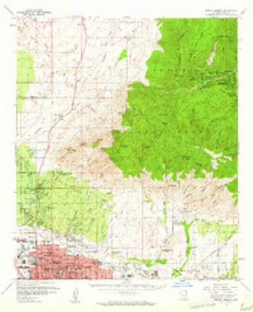
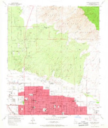
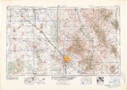
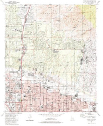
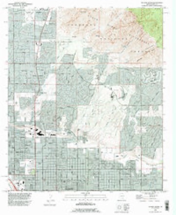
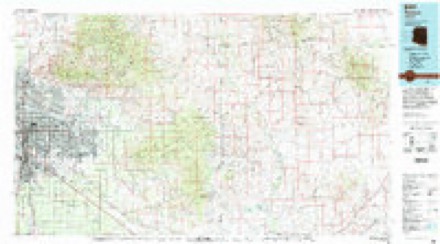
13 surveys from 26 printed sheetsMatched by testing this settlement's coordinate against the published boundary of every sheet in the United States Geological Survey's historical collection. Each opens the scanned sheet at the Survey.
- 1904 USGS Tucson quadrangle1:125000
- 1905 USGS Tucson quadrangle1:125000, 5 printings
- 1956 USGS Tucson quadrangle1:250000, 3 printings
- 1957 USGS Mount Lemmon quadrangle1:62500, 3 printings
- 1957 USGS Tucson North quadrangle1:24000, 4 printings
- 1958 USGS Tucson quadrangle1:250000
- 1959 USGS Tucson quadrangle1:250000, 2 printings
- 1962 USGS Tucson quadrangle1:250000
- 1964 USGS Tucson quadrangle1:250000
- 1984 USGS Tucson North quadrangle1:24000
- 1992 USGS Tucson North quadrangle1:24000
- 1994 USGS Tucson quadrangle1:100000, 2 printings
- 1996 USGS Tucson North quadrangle1:24000
Fires near this place
604 since 1993Regional context, not property-specific evidence. The federal wildfire occurrence database lists 604 fires within 5 miles of Casas Adobes between 1993 and 2020, burning about 1,276 acres in total. 29 started naturally. 10 were recorded as arson. Distance is straight-line from the map coordinates, so a fire counted here may appear on a neighbouring settlement's page as well.
| Reported cause | Fires |
|---|---|
| Missing data/not specified/undetermined | 558 |
| Natural | 29 |
| Arson/incendiarism | 10 |
| Power generation/transmission/distribution | 3 |
| Equipment and vehicle use | 3 |
| Smoking | 1 |
The most recent of them, most recent first, with the day each was reported and the service that recorded it.
| Date | Cause | Size | Reported by | Name on the report |
|---|---|---|---|---|
| 9 September 2019 | Missing data/not specified/undetermined | under an acre | Northwest Fire Rescue District | NOT NAMED |
| 7 September 2020 | Missing data/not specified/undetermined | under an acre | Arizona Department of Forestry and Fire Management - State Office | not named |
| 7 September 2020 | Missing data/not specified/undetermined | under an acre | Arizona Department of Forestry and Fire Management - State Office | not named |
| 6 September 2019 | Missing data/not specified/undetermined | under an acre | Tucson Fire Department | NOT NAMED |
| 6 September 2017 | Missing data/not specified/undetermined | under an acre | Tucson Fire Department | not named |
| 5 September 2020 | Missing data/not specified/undetermined | under an acre | Arizona Department of Forestry and Fire Management - State Office | not named |
| 5 September 2018 | Arson/incendiarism | under an acre | Tucson Fire Department | 1861516 |
| 30 September 2018 | Missing data/not specified/undetermined | under an acre | Tucson Fire Department | 1867765 |
Settlements close enough to share some of these fires:
Mines and quarries near this place
10 within 5 milesRegional context, not property-specific evidence. The federal mineral resources record lists 10 workings within 5 miles of Casas Adobes: 5 occurrences, 3 producers, 1 past producer, 1 prospect. 3 still produce. What was taken out: Sand and Gravel, Construction, Copper, Geothermal, Uranium. Distance is straight-line from the map coordinates, so a quarry counted here may appear on a neighbouring settlement's page as well.
| Where | Site | Commodity | Status | Recorded |
|---|---|---|---|---|
| Dumar Claims | Uranium | Prospect | ||
| Unknown | Geothermal | Occurrence | ||
| Action Sand & Gravel Pit | Sand and Gravel, Construction | Producer | ||
| Oro Rock & Sand | Sand and Gravel, Construction | Past Producer | ||
| Plant 26 | Sand and Gravel, Construction | Producer | ||
| Sand & Gravel Plant | Sand and Gravel, Construction | Producer | ||
| Unnamed Prospect Ml48 | Copper | Occurrence | Unknown | |
| Unnamed Prospect Tn1 | Copper | Occurrence | ||
| Unnamed Prospect Tn4 | Copper | Occurrence | ||
| Unnamed Prospect Tn6 | Copper | Occurrence |
Storms near this place
45 since 2007Regional context, not property-specific evidence. The National Weather Service names Casas Adobes in 45 storm reports between 2007 and 2026: 26 thunderstorm wind, 8 flash flood, 6 hail, 2 lightning. No death or injury is recorded in these reports. Each account below is quoted exactly as the forecast office filed it, from the NOAA Storm Events Database, and each date opens the federal record of that event.
| When | Event | Place named | Harm | What the report says |
|---|---|---|---|---|
| July 2022 | Flash Flood | Casas Adobes | $3,000,000 | Heavy rain of 1.5-2.5 fell in less than 1 hour over the Finger Rock Canyon watershed with 2.29 recorded in 30 minutes at the Mt. Kimball gauge near the headwaters, which was in the severe burn area of the 2020 Bighorn Fire burn scar. Finger Rock Wash rose over 14 feet at a downstream gauge at the mouth of the canyon. Residents of seven homes and 12 people from another which was used as an assisted living facility were evacuated due to as much as 3 feet of water inside the structures. Most of the structures will be purchased by the county and torn down. Several of the roads in the area were washed out and the wash structure itself was damaged. |
| July 2010 | Lightning | Casas Adobes | $80,000 | A lightning strike caused a house fire during the early morning hours of July 20th. The lightning strike likely occurred around 1 AM as storms impacted north Tucson, with the sparks smoldering in the roof's insulation until a neighbor noticed the fire spreading around 5 AM. The fire resulted in extension damage to the home before the fire was extinguished. |
| July 2021 | Thunderstorm Wind | Casas Adobes | $75,000 | Thunderstorm winds downed more than a dozen large trees at an apartment complex near Orange Grove and Oracle Rds. The downed trees fell on carports and vehicles, and destroyed an apartment stairwell. |
| August 2016 | Thunderstorm Wind | Casas Adobes | $50,000 | A slow-moving thunderstorm moved through Oro Valley, causing extensive wind damage. The strongest winds snapped three power poles along Hardy Rd near La Canada. A tree 12 inches in diameter was broken in half at the base on Magee Rd between La Cholla Rd and La Canada Rd and widespread tree damage occurred near CDO High School, the Oro Valley Aquatic Center and at numerous residences. Around 2000 TEP customers were without power for portions of the night and into the early morning hours. |
| August 2007 | Thunderstorm Wind | Casas Adobes | $50,000 | Numerous trees were downed due to strong thunderstorm winds in the vicinity of Oracle road and Ina road. Largest tree was about 6 inch diameter and the others 4 to 5 inches in diameter. |
| July 2011 | Thunderstorm Wind | Casas Adobes | $45,000 | Thunderstorm winds downed eight power poles along Oracle Road near Magee Road, resulting in the closure of some lanes of Oracle Road. Significant tree damage was along Campbell Avenue between Glenn Street and Grant Road. A tree was also downed on a vehicle in a business parking lot near Ina Road and La Cholla Boulevard. A trained spotter measured a wind gust of 60 mph. |
| July 2024 | Thunderstorm Wind | Casas Adobes | $30,000 | Several power lines and poles fallen across the roadway near Sunrise Dr. and Pontatoc Rd. due to thunderstorm winds. |
| October 2015 | Heavy Rain | Casas Adobes | $30,000 | Poor visibility and slick roads due to heavy rainfall during a severe thunderstorm caused a multiple-vehicle rollover accident at the intersection of Oracle Rd. and Orange Grove Rd. The 3 occupants of the vehicle were airlifted to a nearby hospital with minor injuries. In the same area, the rain leaking through the roof at a Bed, Bath and Beyond caused water damage and sparking in the electrical room. The store was evacuated and remained closed into the overnight hours for repairs. There were no injuries. |
| July 2014 | Thunderstorm Wind | Casas Adobes | $25,000 | A spotter measured a wind gust of 60 mph at Tucson Mall. Thunderstorm winds downed trees near Limberlost and First Avenue, one of which fell on a car, while another fell on a mobile home. A tree also fell on a jeep at Magee and Oracle while other trees were downed near River and La Cholla. About 1300 customers lost power due to downed power lines in the Flowing Wells neighborhood. |
| July 2016 | Thunderstorm Wind | Casas Adobes | $20,000 | A line of thunderstorms pushed northwest through Tucson. Wind damage occurred at an Eegee's restaurant at Thornydale Rd and Ina Rd, and a large tree was blown down nearby. Additionally, a shed was blown over into a fence. Other trees were blown down at Ina Rd and Mona Lisa Dr, near the CDO bike path near Magee Rd, and on Eaglestone Loop near Hartman Ln. |
| July 2010 | Thunderstorm Wind | Casas Adobes | $15,000 | Thunderstorm downburst winds caused wind damage across portions of the Tucson metro area. Several trees and power lines were downed near the intersection of Ina and Oracle Roads, and the winds caused some minor roof damage in this area as well. Another power pole was downed near Ajo Way and 6th Avenue, and also near Glenn and Alvernon Way. Small trees were reported in the road near the intersection of Grant and Wilmot. |
| July 2021 | Thunderstorm Wind | Casas Adobes | $10,000 | Thunderstorm winds blew a metal utility shed into a utility pole at Magee Rd. and La Caada Dr. |
| August 2015 | Thunderstorm Wind | Casas Adobes | $10,000 | Thunderstorm winds downed multiple trees along Sunrise Road between Swan and Via Palomita. Several trees were also blown over at the Quail Ridge Apartment complex, and part of a carport was damaged. |
| August 2013 | Thunderstorm Wind | Casas Adobes | $10,000 | Thunderstorm winds downed several trees on Tucson's northwest side. In addition, an adobe chimney was toppled onto its side. |
| August 2010 | Thunderstorm Wind | Casas Adobes | $10,000 | Thunderstorms developed over the Tucson metro area resulting in small hail and damaging winds up to 60 mph. Spotters reported trees down at Campbell Ave and Skyline Road. |
| August 2007 | Thunderstorm Wind | Casas Adobes | $10,000 | Seven to ten trees downed at Ina road and La Canada road. Trees were up to 12 inches in diameter. |
| August 2007 | Thunderstorm Wind | Casas Adobes | $10,000 | Power lines were reported down at Oracle road and River road. |
| August 2014 | Flash Flood | Casas Adobes | $5,000 | Law enforcement reported three road closures due to flash flooding around 1500 LST: Tangerine Road between Dove Mountain and I-10; Moonfire Road at Silverbell; and Silverbell Road south of Ina. At 1645 LST, broadcast media reported that a swift water rescue occurred at Snow Leopard Drive south of the intersection of Linda Vista and Camino de Oeste. |
| July 2022 | Thunderstorm Wind | Casas Adobes | $4,000 | Thunderstorm winds downed several trees near Skyline Dr. and Campbell Rd. in the Catalina Foothills. |
| August 2021 | Thunderstorm Wind | Casas Adobes | $3,000 | Thunderstorm winds downed several trees near the intersection of Ina and Oracle Rds. |
| July 2024 | Thunderstorm Wind | Casas Adobes | $2,000 | Numerous trees reported down in the areas of Oracle Rd and Wetmore Rd in Tucson and near Euclid St and Waverly in Tucson. |
| July 2014 | Lightning | Casas Adobes | $2,000 | A lightning strike to a power pole near Ina Rd. and Oracle Rd. left about 25 residents without power. |
| April 2026 | Dust Devil | Casas Adobes | $1,000 | Dust devil caused a 9 inch diameter tree branch to be broken. No injuries or fatalities associated with this dust devil. |
| July 2025 | Thunderstorm Wind | Casas Adobes | $1,000 | Photo of tree uprooted on social media due to an estimated 58 mph thunderstorm wind gust. |
| June 2022 | Thunderstorm Wind | Casas Adobes | $1,000 | Thunderstorm winds downed multiple tree branches and downed one shallow rooted tree in a parking lot along Ina Rd between La Cholla and Oracle Rds. |
| August 2018 | Thunderstorm Wind | Casas Adobes | $1,000 | Thunderstorm winds downed several trees south of Skyline Drive between 1st Ave and Campbell Ave. |
| August 2015 | Thunderstorm Wind | Casas Adobes | $1,000 | Thunderstorm winds snapped branches 4-5 inches in diameter near Campbell and Roger Roads. |
| August 2014 | Flash Flood | Casas Adobes | $1,000 | Thunderstorms produced over an inch of rain in less than 30 minutes in Tucson causing extensive street flooding in midtown. Some areas affected include Seneca and Country Club Roads, Grant Road between Swan and Campbell, as well as Tucson Boulevard between Speedway and Grant. A swift water rescue occurred at Fort Lowell Rd at Tucson Blvd for a vehicle stalled in flood waters. Water was up to 2 feet deep in some spots. |
| September 2007 | Thunderstorm Wind | Casas Adobes | $1,000 | An off duty National Weather Service employee reported several large tree limbs broken near Ina Road and Mona Lisa Road. |
| August 2017 | Thunderstorm Wind | Casas Adobes | $500 | Power lines were downed by thunderstorm winds between First Ave. and Oracle Rd. |
| September 2015 | Thunderstorm Wind | Casas Adobes | $500 | Thunderstorm winds broke a 10 inch diameter tree limb near Orange Grove and Oracle Roads. |
| July 2024 | Hail | Casas Adobes | - | A trained spotter estimated 1 inch hail in Tucson. |
| August 2022 | Flash Flood | Casas Adobes | - | Heavy rain of 1.5 on the Bighorn burn scar caused rapid rises in Finger Rock Wash. Road closures resulted near Havasu Rd and Columbus Blvd and Pontatoc Rd. south of Skyline Dr. |
| July 2022 | Flash Flood | Casas Adobes | - | Heavy rain of 1-2' in less than 1 hour caused the flooding of Magee Rd. east of La Canada Dr. at Pegler Wash and the closure of Ina Rd. at Pima Wash east of Oracle Rd. |
| August 2021 | Flash Flood | Casas Adobes | - | One inch of rain in less than 1 hour in Catalina Foothills caused flash flooding of River Rd. near Pontatoc Rd. |
| July 2020 | Flash Flood | Casas Adobes | - | Around an inch of rain in 30 minutes fell during the early morning hours near the headwaters of Pima Wash and Ventana Canyon Wash, within the Bighorn Fire burn scar area. Additional heavy rain of 0.75 to 1.5 fell in the urbanized area downstream of the burn area later that morning which caused combined runoff sufficient to cause a 2 foot sooty flow in Ventana Canyon Wash at Sunrise Drive and the closure of Snyder Road. |
| August 2019 | Funnel Cloud | Casas Adobes | - | A funnel cloud was reported near the intersection of Magee Rd and Oracle Rd. |
| July 2017 | Flash Flood | Casas Adobes | - | Heavy rain caused water nearly a foot deep to flow across West Chula Vista Rd as well as near Orange Grove and 1st Avenue. |
| July 2011 | Hail | Casas Adobes | - | Spotter reported several one inch diameter hail stones. |
| August 2008 | Hail | Casas Adobes | - | Trained spotter reported penny size hail at River and Swan. |
| August 2007 | Thunderstorm Wind | Casas Adobes | - | Two large trees were uprooted and on the roadway at Ina and Shannon roads. |
| August 2007 | Hail | Casas Adobes | - | An off duty NWS employee reported at least nickel size hail at the Foothills Mall at La Cholla and Ina roads. Larger hail pieces were present as well. |
| August 2007 | Hail | Casas Adobes | - | Penny size hail was reported by a trained spotter. |
| October 2015 | Hail | Casas Adobes | - | no account filed |
| August 2012 | Thunderstorm Wind | Casas Adobes | - | no account filed |
Nearest settlements
The eight closest, with where each one stands in the county. Distances are straight-line, computed from the Geographic Names Information System coordinates.
| Map | Place | Distance | Sheets |
|---|---|---|---|
| Valley View | 1.5 miles | 26 | |
| Flowing Wells | 2.2 miles | 20 | |
| Orange Grove Estates | 2.4 miles | 20 | |
| Jaynes | 2.6 miles | 20 | |
| Tucson National Estates | 2.6 miles | 20 | |
| Oracle Foothills Estates | 2.7 miles | 26 | |
| Gardner Estates | 2.9 miles | 20 | |
| Stockham | 3.5 miles | 20 |
Elsewhere
Matched on this settlement's Geographic Names Information System number rather than its name, so it cannot be a different place of the same name in another state.
| Wikipedia article on Casas Adobes | An encyclopaedic summary. Its text is share-alike, so it is linked here rather than copied. |
| Wikidata item Q79406 | The structured record the population and elevation above come from. Public domain (CC0). |
Provenance
This settlement is recorded in the Geographic Names Information System as feature 37210. The sheet list is computed by point-in-boundary test against the United States Geological Survey's historical topographic inventory. Both are works of the United States government and carry no copyright under 17 U.S.C. 105.
Wildfire. Short, Karen C. 2022. Spatial wildfire occurrence data for the United States, 1992-2020 [FPA_FOD_20221014]. 6th Edition. Fort Collins, CO: Forest Service Research Data Archive. https://doi.org/10.2737/RDS-2013-0009.6 Collected with United States Government funding and usable without additional permissions or fees.
Mines and quarries. USGS Mineral Resources Data System (MRDS) https://mrdata.usgs.gov/mrds/ A work of the United States government, no copyright under 17 U.S.C. 105.
Storms. NOAA National Centers for Environmental Information, Storm Events Database https://www.ncei.noaa.gov/stormevents/ A work of the United States government, no copyright under 17 U.S.C. 105. Narratives are quoted verbatim from the National Weather Service report and are not edited or summarised.