 Block
From the record
One of 127 National Register listings published here for Yavapai County · listed in 1978 · category: Building.
Sources: the case file at the National Archives · the National Register database, National Park Service
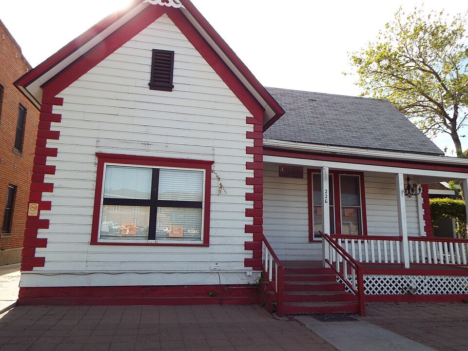
Listed on the National Register of Historic Places in 1978.
One of 127 National Register listings published here for Yavapai County · listed in 1978 · category: Building.
Sources: the case file at the National Archives · the National Register database, National Park Service
Regional context, not property-specific evidence. The federal wildfire occurrence database lists 434 fires within 5 miles of Shekels House between 1992 and 2020, burning about 1,567 acres in total. 91 started naturally. 25 were recorded as arson. Distance is straight-line from the map coordinates, so a fire counted here may appear on a neighbouring settlement's page as well.
| Reported cause | Fires |
|---|---|
| Missing data/not specified/undetermined | 175 |
| Recreation and ceremony | 96 |
| Natural | 91 |
| Arson/incendiarism | 25 |
| Smoking | 16 |
| Equipment and vehicle use | 12 |
| Misuse of fire by a minor | 7 |
| Debris and open burning | 6 |
| Power generation/transmission/distribution | 3 |
| Other causes | 1 |
| Fireworks | 1 |
| Railroad operations and maintenance | 1 |
The most recent of them, most recent first, with the day each was reported and the service that recorded it.
| Date | Cause | Size | Reported by | Name on the report |
|---|---|---|---|---|
| 6 September 2009 | Natural | under an acre | Prescott National Forest | APPLE |
| 5 September 2005 | Recreation and ceremony | under an acre | Prescott National Forest | MORGAN |
| 4 September 1995 | Recreation and ceremony | under an acre | Prescott National Forest | CARNATION |
| 30 September 2003 | Missing data/not specified/undetermined | under an acre | Prescott National Forest | SENATOR |
| 30 September 2001 | Recreation and ceremony | under an acre | Prescott National Forest | WILLOW SPRINGS |
| 30 September 1999 | Recreation and ceremony | under an acre | Prescott National Forest | HIGHLAND |
| 3 September 2001 | Recreation and ceremony | under an acre | Prescott National Forest | SLASH |
| 28 September 2020 | Missing data/not specified/undetermined | under an acre | Arizona Department of Forestry and Fire Management - State Office | not named |
Regional context, not property-specific evidence. The federal mineral resources record lists 31 workings within 5 miles of Shekels House: 12 past producers, 7 producers, 6 prospects, 6 unknowns. 7 still produce. What was taken out: Sand and Gravel, Construction, Gold, Silver, Copper. Distance is straight-line from the map coordinates, so a quarry counted here may appear on a neighbouring settlement's page as well.
| Where | Site | Commodity | Status | Recorded |
|---|---|---|---|---|
| Bullwhacker Prospect | Gold, Silver, Copper | Producer | 1878, 1879, 1936 | |
| Convergens | Copper, Gold, Molybdenum, Silver | Past Producer | ||
| Double L Lode | Gold, Silver | Prospect | ||
| Groom Creek Property | Lead, Gold, Silver, Copper | Prospect | ||
| Hoot Owl Claim | Silver, Gold, Lead | Prospect | ||
| Linden Property | Silver, Gold, Copper, Lead | Prospect | ||
| New Strike 1-7 M S 4593 | Silver, Zinc, Gold, Lead, Copper | Past Producer | ||
| New Strike Mine | Lead, Zinc, Copper, Silver, Gold | Producer | 1936, 1967 | |
| Patented Claims M S 1309, 3736, | Gold, Lead, Silver, Copper | Past Producer | ||
| Silver Flake Mine | Gold, Lead, Zinc, Silver, Uranium, Vanadium, Copper, Cobalt | Producer | 1885, 1895, 1954 |
Regional context, not property-specific evidence. The National Weather Service names Prescott, the town this property stands in, in 66 storm reports between 1993 and 2023: 33 hail, 8 thunderstorm wind, 8 flash flood, 5 lightning. The reports record 3 injuries. Each account below is quoted exactly as the forecast office filed it, from the NOAA Storm Events Database, and each date opens the federal record of that event.
| When | Event | Place named | Harm | What the report says |
|---|---|---|---|---|
| September 1999 | Hail | Prescott | 2 hurt, $18,000,000 | no account filed |
| August 2004 | Thunderstorm Wind | Prescott | 1 hurt | A micro burst pushed over a crane and it collapsed an under-construction riding arena. All the steal beams in-place for the arena fell down. The 67-year-old crane operator suffered head, back, and shoulder injuries. He was taken to a hospital for treatment. |
| September 2019 | Thunderstorm Wind | Prescott | $50,000 | A thunderstorm caused lots of wind damage (mostly downed tree branches) and 0.75 to 1.10 inches of rain in the Prescott and Dewey areas. |
| September 2003 | Lightning | Prescott | $10,000 | Lightning struck a radio station in Sedona and caused $10,000 damage to electrical equipment. |
| August 2003 | Lightning | Prescott | $10,000 | Lightning hit a radio station and caused $10,000 damage to electrical equipment. |
| August 2003 | Lightning | Prescott | $5,000 | Lightning hit an apartment building and started a fire. The fire caused $5,000 damage. Street flooding hampered firefighting efforts. |
| August 1998 | Tornado (F0) | Prescott | $4,000 | A house under construction was destroyed by an F0 tornado. A neighbour to the house under construction reported he saw a narrow, rotating cloud that extended from the ground to the base of a thunderstorm. This rotating cloud moved from about 300 yards away from the house under construction into the house under construction. The walls of the house were removed from the foundation and reduced to 2 x 4 inch stock and 4 by 8 feet sheets of plywood. This material was suspended in air about 30 seconds. |
| August 1997 | Thunderstorm Wind | Prescott | $2,000 | Strong thunderstorm winds knocked down several telephone poles. |
| July 2023 | Hail | Prescott | - | A spotter relayed a picture that showed a mixture of dime, nickel, and quarter sized hail. |
| July 2021 | Flash Flood | Prescott | - | The river gauge on Granite Creek rose 2.5 feet above base flow. |
| August 2020 | Flash Flood | Prescott | - | Heavy rain from a thunderstorm caused Granite Creek to rise 2.9 feet in an hour at the Granite Creek Gauge (GCRA3). |
| June 2015 | Heavy Rain | Prescott | - | A train spotter reported 2.50 inches of rain in just 45 minutes just west of Prescott Valley. Seven homes had minor flooding. |
| July 2014 | Heavy Rain | Prescott | - | The Coop observer in Prescott reported 1.63 inches in about 90 minutes. Local street flooding was also observed. |
| July 2006 | Hail | Prescott | - | Nickel sized hail was reported about 10 miles south of Prescott. |
| September 2006 | Heavy Rain | Prescott | - | Heavy rain fell over a large portion of Yavapai County from Prescott to Ash Fork. A spotter in Chino Valley reported about an inch of rain in just fifteen minutes with a total of over three inches of rain. Lowland flooding was observed near Paulden. Water was running over Highway 89 and was closed in several locations between mile posts 324 and 331. |
| September 2006 | Hail | Prescott | - | Penny to Nickel sized hail fell from Prescott to one mile west of Prescott. |
| September 2006 | Hail | Prescott | - | Penny sized hail was reported in Highland Pines...about 12 miles southwest of Prescott. |
| July 2006 | Funnel Cloud | Prescott | - | A funnel cloud was seen eight to ten miles south of Prescott. |
| August 2004 | Lightning | Prescott | - | Lightning knocked out power to 4,000 customers in the Prescott area. |
| September 2003 | Hail | Prescott | - | Pea to penny sized (1/4 to 3/4 inch diameter) hail was reported in Highland Pines west of Prescott. |
| September 2003 | Hail | Prescott | - | Dime sized (3/4 inch diameter) hail was reported in Prescott. |
| August 2003 | Hail | Prescott | - | 3/4 inch diameter hail was reported 10 miles northeast of Prescott. |
| August 2003 | Hail | Prescott | - | 3/4 inch diameter hail was reported in Prescott. |
| August 2003 | Flash Flood | Prescott | - | Creeks were flowing over Thumb Butte Road. |
| August 2003 | Flash Flood | Prescott | - | Vehicles were stranded on Cherry Road in Prescott due to water across the road. Yuma Drive was also flooded. |
| July 2003 | Thunderstorm Wind | Prescott | - | A thunderstorm in northeast Prescott produced a wind gust of 61 MPH. This storm also produced two inches of rain and pea sized hail. |
| July 2003 | Flash Flood | Prescott | - | Heavy rain caused flooding in the Prescott area. Several low water crossings were impassable. Willow Creek was flooding. A spotter in Chino Valley reported 0.60 inches of rain in just 15 minutes. |
| July 2002 | Hail | Prescott | - | One inch hail was reported in Prescott. |
| July 2001 | Hail | Prescott | - | Three-quarter inch hail covered the ground to one half inch deep in Prescott Valley. |
| June 2000 | Funnel Cloud | Prescott | - | A weather spotter in Prescott reported a funnel cloud 10 to 15 miles southwest of Prescott. |
| July 2000 | Hail | Prescott | - | A weather spotter reported 3/4 inch hail and heavy rain on the south end of Prescott. |
| July 2000 | Hail | Prescott | - | Yavapai County Sheriff reported one inch hail in Prescott. |
| July 2000 | Hail | Prescott | - | Public report of nickel sized hail. |
| July 2000 | Flash Flood | Prescott | - | Public report of street flooding in Prescott and Granite Creek nearly out of it's banks. |
| July 2000 | Hail | Prescott | - | Sheriff's office reported quarter sized hail. |
| September 1999 | Tornado (F0) | Prescott | - | Law enforcement officials reported a tornado touching down briefly west of the Prescott Country Club. |
| August 1998 | Lightning | Prescott | - | An isolated thunderstorm dropped heavy rain over downtown Prescott. Doppler radar estimates of 2 to 3 inches of rain fall in two hours caused widespread street flooding. Water rose just above curb level and seeped into a few downtown businesses. Lightning struck two homes, causing minor damage to one. |
| August 1998 | Hail | Prescott | - | A weather spooter reported 1.25 inch diameter hail. |
| August 1997 | Flash Flood | Prescott | - | Minor flooding at the Castle Canyon Mesa area in Prescott Valley. |
| May 1995 | Hail | Prescott | - | Several reports of hail up to three-quarters inches. A spotter reported hail up to one-half inch in diameter covering the ground. |
| May 1995 | Hail | Prescott | - | Several reports of hail up to three-quarters inches. A spotter reported hail up to one-half inch in diameter covering the ground. |
| September 1995 | Hail | Prescott | - | Dime-size hail covered the ground 1.5 inches deep and was accompanied by heavy rain. |
| June 1994 | Hail | Prescott | - | Large limbs were snapped off trees during a thunderstorm. |
| June 1994 | Hail | Prescott | - | Large limbs were snapped off trees during a thunderstorm. |
| August 1993 | Thunderstorm Wind | Prescott | - | Thunderstorms produced heavy rains and small hail. An observer in Prescott reported a peak gust of 68 mph. |
| May 2002 | Wildfire | Prescott | - | no account filed |
| July 2002 | Heavy Rain | Prescott | - | no account filed |
| July 2002 | Thunderstorm Wind | Prescott | - | no account filed |
| August 2001 | Heavy Rain | Prescott | - | no account filed |
| August 2001 | Hail | Prescott | - | no account filed |
| August 2001 | Hail | Prescott | - | no account filed |
| August 2001 | Thunderstorm Wind | Prescott | - | no account filed |
| August 2001 | Hail | Prescott | - | no account filed |
| September 1999 | Hail | Prescott | - | no account filed |
| September 1999 | Hail | Prescott | - | no account filed |
| September 1999 | Hail | Prescott | - | no account filed |
| September 1999 | Hail | Prescott | - | no account filed |
| September 1999 | Funnel Cloud | Prescott | - | no account filed |
| September 1999 | Hail | Prescott | - | no account filed |
| August 1998 | Flood | Prescott | - | no account filed |
8 papers published in this town, digitised by the Library of Congress and free to read: 2,864 issues, 15,389 pages. Every page is searchable, so a name or a street can be looked for directly in what the town printed about itself at the time.
| Newspaper | Published |
|---|---|
| The Weekly Arizona Miner | 1877 to 1885 |
| Arizona Weekly Miner | 1874 to 1877 |
| Weekly Arizona Journal-Miner | 1903 to 1908 |
| Weekly Journal-Miner | 1908 to 1929 |
| The Weekly Arizona Miner | 1868 to 1873 |
| Arizona Weekly Journal-Miner | 1885 to 1903 |
| Hoof and Horn | 1884 to 1889 |
| The Pick and Drill | 1897 to 1899 |
No historic map-sheet match is published for this property yet. That does not mean no map exists. This record needs a coordinate-quality review before it can be joined to a sheet boundary. Browse the county's mapped places while that work is pending.
Other National Register properties close enough to walk or drive between, ordered by distance from this one. Both positions come from the same geocoding pass that matched these properties to their map sheets.
| Photograph | Property | Distance | Listed |
|---|---|---|---|
| Fisher/Goldwater House | under 500 feet | 1978 | |
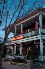 | Hotel Vendome | under 500 feet | 1983 |
 | Kenwill Apartments | under 500 feet | 1988 |
 | US Post Office and Courthouse-Prescott Main | under 500 feet | 1985 |
 | Yavapai County Courthouse | under 500 feet | 1977 |
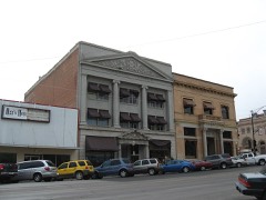 | Courthouse Plaza Historic District | 0.1 miles | 1978 |
| National Archives record | The nomination case file for reference 78003254 in Record Group 79. |
| Yavapai County | All 127 listed properties in this county. |