 Block
From the record
One of 127 National Register listings published here for Yavapai County · listed in 1986 · category: Building.
Sources: the case file at the National Archives · the National Register database, National Park Service
Listed on the National Register of Historic Places in 1986.
One of 127 National Register listings published here for Yavapai County · listed in 1986 · category: Building.
Sources: the case file at the National Archives · the National Register database, National Park Service
Regional context, not property-specific evidence. The federal wildfire occurrence database lists 282 fires within 5 miles of Robert W. Wingfield House between 1992 and 2020, burning about 1,375 acres in total. 19 started naturally. 1 was recorded as arson. Distance is straight-line from the map coordinates, so a fire counted here may appear on a neighbouring settlement's page as well.
| Reported cause | Fires |
|---|---|
| Missing data/not specified/undetermined | 153 |
| Equipment and vehicle use | 46 |
| Smoking | 21 |
| Natural | 19 |
| Debris and open burning | 16 |
| Misuse of fire by a minor | 13 |
| Recreation and ceremony | 9 |
| Power generation/transmission/distribution | 2 |
| Railroad operations and maintenance | 1 |
| Arson/incendiarism | 1 |
| Other causes | 1 |
The most recent of them, most recent first, with the day each was reported and the service that recorded it.
| Date | Cause | Size | Reported by | Name on the report |
|---|---|---|---|---|
| 4 September 2020 | Missing data/not specified/undetermined | under an acre | Arizona Department of Forestry and Fire Management - State Office | not named |
| 4 September 2014 | Missing data/not specified/undetermined | under an acre | Arizona Department of Forestry and Fire Management - State Office | MIDDLE VERDE |
| 28 September 2020 | Missing data/not specified/undetermined | under an acre | Arizona Department of Forestry and Fire Management - State Office | not named |
| 27 September 2020 | Missing data/not specified/undetermined | under an acre | Arizona Department of Forestry and Fire Management - State Office | not named |
| 26 September 2002 | Natural | under an acre | Prescott National Forest | VERDE |
| 25 September 2020 | Missing data/not specified/undetermined | under an acre | Arizona Department of Forestry and Fire Management - State Office | not named |
| 25 September 2020 | Missing data/not specified/undetermined | under an acre | Prescott National Forest | GADDIS |
| 21 September 2020 | Equipment and vehicle use | under an acre | Coconino National Forest | TRACTOR |
Regional context, not property-specific evidence. The federal mineral resources record lists 20 workings within 5 miles of Robert W. Wingfield House: 6 producers, 6 past producers, 4 prospects, 3 occurrences. 6 still produce. What was taken out: Gypsum-Anhydrite, Sand and Gravel, Construction, Sodium, Diatomite. Distance is straight-line from the map coordinates, so a quarry counted here may appear on a neighbouring settlement's page as well.
| Where | Site | Commodity | Status | Recorded |
|---|---|---|---|---|
| Camp Verde Salt Mine | Halite, Sodium, Gypsum-Anhydrite, Clay | Past Producer | Clay, Gypsum, Halite, Mirabilite | |
| Fairview Mine | Silver, Lead, Gold, Copper, Molybdenum | Producer | 1932, 1935, 1937 | |
| Graham-Wingfield Sulfate Ground | Salt, Sodium, Gypsum-Anhydrite | Prospect | ||
| Larson Quarry | Bentonite, Gypsum-Anhydrite | Past Producer | ||
| Saline Water Well Near Camp Verde | Halite, Bromine, Sodium | Occurrence | Brine, Halite | |
| Verde River Deposit | Diatomite, Clay, Gypsum-Anhydrite | Occurrence | Clay, Diatomite, Gypsum | |
| Verde River Deposit | Diatomite, Clay, Gypsum-Anhydrite, Limestone, General | Prospect | ||
| Camp Verde Deposit | Sodium, Clay, Gypsum-Anhydrite | Past Producer | ||
| Tungsten King | Tungsten | Prospect | ||
| Tungsten King Prospect | Tungsten | Producer | 1953 |
Regional context, not property-specific evidence. The National Weather Service names Camp Verde, the town this property stands in, in 31 storm reports between 1996 and 2025: 11 thunderstorm wind, 11 hail, 3 flash flood, 2 funnel cloud. No death or injury is recorded in these reports. Each account below is quoted exactly as the forecast office filed it, from the NOAA Storm Events Database, and each date opens the federal record of that event.
| When | Event | Place named | Harm | What the report says |
|---|---|---|---|---|
| July 2015 | Flash Flood | Camp Verde | $140,000 | Fifteen residents were rescued from homes in Verde Lakes Estates. Seven homes had significant flood damage. The flooding came form a tributary of West Clear Creek. |
| August 1997 | Flash Flood | Camp Verde | $5,000 | Residental outbuildings flooded when a normally dry wash overflowed. Up to a foot of water washed over several rural roads in low lying areas in and near Camp Verde. |
| May 1997 | Thunderstorm Wind | Camp Verde | $5,000 | A thunderstorm caused wind damage to eastern sections of Camp Verde. One report was received from the public of a tornado, but no witnesses could be found to verify this. We concluded the damage was caused by gusty winds, but no winds speeds were recorded. Several trailers were moved off their foundations in the White Hills Trailer Park. On Hardy Lane branches broke off trees and were scattered over the road. In the Sierra Verde area an older barn lost part of its roof. |
| July 1998 | Thunderstorm Wind | Camp Verde | $1,000 | A weather spotter reported down power lines due to thunderstorm outflow winds. |
| September 2025 | Hail | Camp Verde | - | Public reported, via Facebook, hail up to the size of quarters. |
| July 2018 | Hail | Camp Verde | - | One inch diameter hail was reported in Camp Verde. The hail put holes in solar panels at the US National Forest District Office. |
| August 2018 | Thunderstorm Wind | Camp Verde | - | A trained weather spotter reported an estimated wind gust to 60 MPH. |
| July 2014 | Thunderstorm Wind | Camp Verde | - | The Verde RAWS in Camp Verde recorded a peak wind gust of 64 MPH between 1005 PM MST and 1105 PM MST. The storm also produced 0.78 inches of rain in the same time period. |
| August 2013 | Heavy Rain | Camp Verde | - | State Highway 260 was temporarily closed because there was too much water on the roadway. |
| July 2007 | Hail | Camp Verde | - | Quarter sized (1 inch in diameter) fell in Camp Verde. |
| July 2007 | Hail | Camp Verde | - | A severe thunderstorm produced 1 inch diameter hail in Camp Verde. |
| July 2007 | Flash Flood | Camp Verde | - | One to two feet of water covered Lacy Lane in Camp Verde. |
| March 2005 | Funnel Cloud | Camp Verde | - | Several people reported seeing a funnel cloud northwest of Cottonwood in the Verde Valley. |
| August 2005 | Hail | Camp Verde | - | Quarter (1 inch diameter) to golf ball (1 3/4 inch diameter) sized hail fell in Camp Verde for up to 10 minutes. |
| August 2005 | Hail | Camp Verde | - | 3/4 inch diameter hail was reported in Camp Verde. |
| August 2003 | Tornado (F0) | Camp Verde | - | A tornado touched down five miles southeast of Camp Verde. 60 MPH wind was also reported in Camp Verde. |
| August 2003 | Thunderstorm Wind | Camp Verde | - | A garage roof was blown onto power poles. The power line was damaged. |
| August 2003 | Thunderstorm Wind | Camp Verde | - | Trees were blown down and a carport roof was blown off in Verde Valley. |
| July 2000 | Hail | Camp Verde | - | Storm spotter reported dime to nickel sized hail and wind gusts to 35 mph. |
| July 2000 | Thunderstorm Wind | Camp Verde | - | Yavapai County officials reported that thunderstorm wind had knocked down power lines. |
| July 1998 | Hail | Camp Verde | - | A weather spotter reported 1.25 inch diameter hail in Camp Verde. |
| May 1997 | Thunderstorm Wind | Camp Verde | - | Single thunderstorm gust to 59 kts/68 mph near Beaver Creek Country Club in Lake Montezuma. |
| October 1997 | Flood | Camp Verde | - | Heavy thunderstorm rains flooded several roads in Camp Verde, AZ causing over a dozen traffic accidents. |
| July 2006 | Heavy Rain | Camp Verde | - | no account filed |
| July 2002 | Hail | Camp Verde | - | no account filed |
| July 2001 | Hail | Camp Verde | - | no account filed |
| July 2001 | Thunderstorm Wind | Camp Verde | - | no account filed |
| August 2000 | Funnel Cloud | Camp Verde | - | no account filed |
| August 2000 | Thunderstorm Wind | Camp Verde | - | no account filed |
| January 1996 | Thunderstorm Wind | Camp Verde | - | no account filed |
| July 1996 | Hail | Camp Verde | - | no account filed |
No historic map-sheet match is published for this property yet. That does not mean no map exists. This record needs a coordinate-quality review before it can be joined to a sheet boundary. Browse the county's mapped places while that work is pending.
Other National Register properties close enough to walk or drive between, ordered by distance from this one. Both positions come from the same geocoding pass that matched these properties to their map sheets.
| Photograph | Property | Distance | Listed |
|---|---|---|---|
| Pecan Lane Rural Historic Landscape | 0.2 miles | 2000 | |
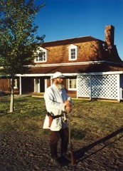 | Fort Verde District (Boundary Increase) | 1.1 miles | 1977 |
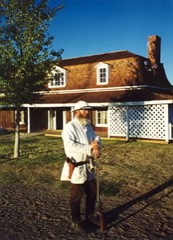 | Fort Verde District | 1.1 miles | 1971 |
| Camp Verde Grammar School | 1.3 miles | 2018 | |
| Hank and Myrtle Wingfield Homestead | 3.3 miles | 1999 | |
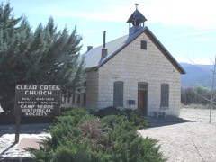 | Clear Creek Church | 4.2 miles | 1975 |
| National Archives record | The nomination case file for reference 86000146 in Record Group 79. |
| Yavapai County | All 127 listed properties in this county. |