 Block
BlockSilverado, California
47 topographic sheets cover this place, the earliest surveyed in 1901 and the latest in 1997. It stands in the Silverado census division. It lies in ZIP code area 92676. It lies near White Canyon. The Survey maps it on the Lake Forest quadrangle. 932 people lived here at the 2020 count.
Then and now
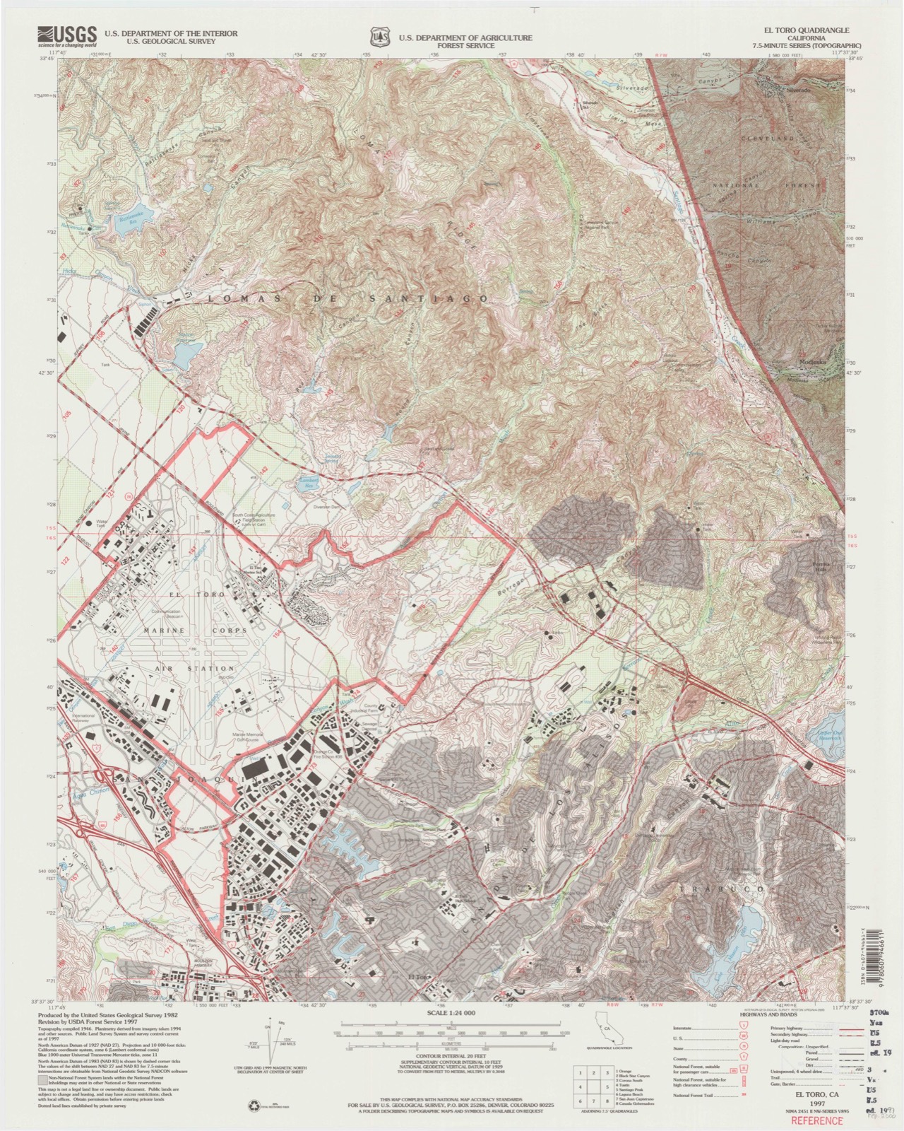
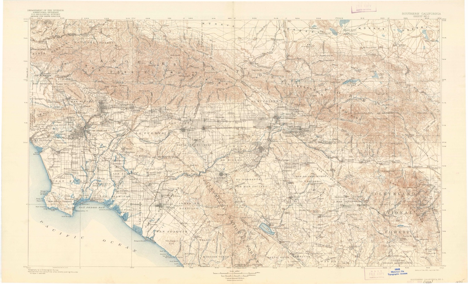
1901 to 1997The same ground, surveyed 96 years apart. Drag the handle to wipe between them. Both sheets are United States Geological Survey originals; neither has been altered.
Compare 1901 against another survey:
Topographic sheets covering this place
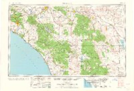
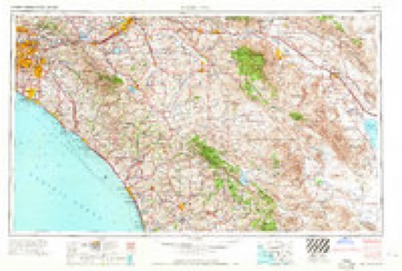
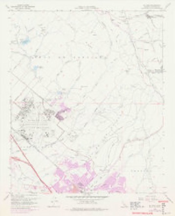
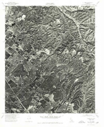
17 surveys from 47 printed sheetsMatched by testing this settlement's coordinate against the published boundary of every sheet in the United States Geological Survey's historical collection. Each opens the scanned sheet at the Survey.
- 1901 USGS Southern California Sheet No. 1 quadrangle1:250000, 6 printings
- 1902 USGS Corona quadrangle1:125000, 7 printings
- 1904 USGS Southern California Sheet No. 1 quadrangle1:250000, 2 printings
- 1935 USGS El Toro quadrangle1:31680, 4 printings
- 1942 USGS Santiago Peak quadrangle1:62500, 3 printings
- 1947 USGS Santa Ana quadrangle1:250000
- 1949 USGS El Toro quadrangle1:24000, 2 printings
- 1949 USGS Santa Ana quadrangle1:250000
- 1950 USGS El Toro quadrangle1:24000, 2 printings
- 1956 USGS Santa Ana quadrangle1:250000
- 1959 USGS Santa Ana quadrangle1:250000, 3 printings
- 1960 USGS Santa Ana quadrangle1:250000, 2 printings
- 1965 USGS Santa Ana quadrangle1:250000
- 1968 USGS El Toro quadrangle1:24000, 9 printings
- 1974 USGS El Toro quadrangle1:24000
- 1983 USGS Santa Ana quadrangle1:100000
- 1997 USGS El Toro quadrangle1:24000

Fires near this place
60 since 1993Regional context, not property-specific evidence. The federal wildfire occurrence database lists 60 fires within 5 miles of Silverado between 1993 and 2020, burning about 56,276 acres in total. None started naturally. 6 were recorded as arson. Distance is straight-line from the map coordinates, so a fire counted here may appear on a neighbouring settlement's page as well.
| Reported cause | Fires |
|---|---|
| Missing data/not specified/undetermined | 27 |
| Equipment and vehicle use | 10 |
| Recreation and ceremony | 7 |
| Arson/incendiarism | 6 |
| Power generation/transmission/distribution | 4 |
| Misuse of fire by a minor | 3 |
| Debris and open burning | 2 |
| Other causes | 1 |
The most recent of them, most recent first, with the day each was reported and the service that recorded it.
| Date | Cause | Size | Reported by | Name on the report |
|---|---|---|---|---|
| 26 September 1995 | Missing data/not specified/undetermined | under an acre | Cleveland National Forest | POTSIE |
| 25 September 2004 | Missing data/not specified/undetermined | 14 acres | Orange County Fire Authority | SANTIAGO FIRE |
| 25 September 2004 | Equipment and vehicle use | 14 acres | Riverside Unit | STATE FIRE |
| 25 September 2004 | Equipment and vehicle use | 20 acres | Cleveland National Forest | MODJESKA |
| 23 September 2010 | Equipment and vehicle use | 38 acres | Cleveland National Forest | LONG |
| 2 September 1997 | Equipment and vehicle use | 600 acres | Cleveland National Forest | SANTIAGO |
| 12 September 2014 | Missing data/not specified/undetermined | 959 acres | Cleveland National Forest | SILVERADO |
| 11 September 1994 | Arson/incendiarism | under an acre | Cleveland National Forest | SILVER |
Settlements close enough to share some of these fires:
Mines and quarries near this place
10 of 22 shownRegional context, not property-specific evidence. The federal mineral resources record lists 22 workings within 5 miles of Silverado: 9 past producers, 8 prospects, 3 occurrences, 2 producers. 2 still produce. What was taken out: Sand and Gravel, Construction, Lead, Clay, Stone, Dimension. Distance is straight-line from the map coordinates, so a quarry counted here may appear on a neighbouring settlement's page as well.
| Where | Site | Commodity | Status | Recorded |
|---|---|---|---|---|
| Blue Light | Lead, Zinc, Silver, Copper, Gold | Past Producer | Pyrite, Sphalerite | |
| Blue Light Mine | Lead, Gold, Silver, Zinc | Past Producer | ||
| Gypsum Canyon Deposit | Gypsum-Anhydrite | Occurrence | ||
| Ladd Canyon Deposits | Limestone, General | Prospect | ||
| Quincy Mine | Lead, Zinc, Silver | Prospect | ||
| Sentinal Oak | Gold, Silver, Lead, Zinc | Prospect | ||
| Silverado-Santa Rosa | Silver | Producer | ||
| Wilhunt Mines | Lead, Gold, Silver | Past Producer | ||
| Unnamed Prospect | Lead, Silver, Zinc | Prospect | ||
| Unnamed Prospect | Lead, Silver, Zinc | Prospect |
Storms near this place
15 since 2008Regional context, not property-specific evidence. The National Weather Service names Silverado in 15 storm reports between 2008 and 2022: 6 debris flow, 5 flash flood, 3 heavy rain, 1 thunderstorm wind. No death or injury is recorded in these reports. Each account below is quoted exactly as the forecast office filed it, from the NOAA Storm Events Database, and each date opens the federal record of that event.
| When | Event | Place named | Harm | What the report says |
|---|---|---|---|---|
| December 2021 | Flash Flood | Silverado | $800,000 | Reported 6 debris flows in Bond Fire scar and 4 in Silverado Canyon. Santiago Creek Road blockage from high water flows and mud. Jackson Creek Road flooded with mud and debris. Rainfall rates of up to 1.2 inches reported at Irvine Lake and Santiago Canyon site. |
| March 2021 | Flash Flood | Silverado | $75,000 | Confirmed 8 vehicles were damaged by a mud and debris flow on the Bond Fire. 6 homes had mud and water damaged. Swift water rescues were performed around 6 to 7 am at the peak of the mud and debris flows. Mud covered at least 3 locations on Silverado Canyon road and at Silverado Cafe. Rainfall rates as high as 0.20 inches in 15 minutes between 6 and 7 am. |
| March 2021 | Debris Flow | Silverado | $50,000 | Heavy rain of near 0.20 inches in 15 minutes occurred between 6 and 7 am over Bond fire scar near the Silverado Canyon and this prompted evacuation orders of residents. The debris flow brought areas of mud and debris over roads and into homes. This caused damage to 6 homes and 8 vehicles in the town of Silverado. This also closed Silverado Canyon Road between Olive Drive and Ladd Canyon Drive. |
| January 2021 | Debris Flow | Silverado | $10,000 | Reports of large amounts of mud and debris covering roadways and damaging homes in Silverado Canyon area. The area saw around 1.5 inches of rainfall from this system. |
| May 2008 | Flash Flood | Silverado | $5,000 | Heavy rain over the Santiago Burn Area triggered flash flooding and debris flows in Williams Canyon. The debris flows blocked a roadway and stranded the residents of two homes near the back of Williams Canyons. No major damage or injuries were reported. |
| March 2015 | Debris Flow | Silverado | $1,000 | A band of rain and thunderstorms moved over the Silverado Burn scar between 1045 and 1200 PST on the 2nd, producing rain rates in excess of 0.5 inches per 30 minutes. As a result, a moderate mud flow occurred in the backyard of a local resident. Video was shared with NWS San Diego. |
| February 2022 | Heavy Rain | Silverado | - | Heavy rain occurred near the town of Silverado and the Holy Fire burn scar. Maximum rain rate of 0.57 inches in one hour. |
| March 2022 | Debris Flow | Silverado | - | Orange County Public Works cleared mud and rocks one foot deep from Silverado Canyon Road near Olive Drive in the Bond Fire burn scar. |
| January 2021 | Flash Flood | Silverado | - | Minor flooding and debris flows occurred near Williams Canyon on the early morning of the 25th closing some local roadways. |
| December 2021 | Heavy Rain | Silverado | - | Mesonet SDOC1 Silverado Canyon measures 2.87 inches of storm total rainfall. |
| April 2020 | Heavy Rain | Silverado | - | In Silverado Canyon, 0.88 of rain was reported in 1 hour from 2 gages. |
| January 2016 | Thunderstorm Wind | Silverado | - | A 60 mph wind gust was recorded at the Fremont Canyon RAWS station in the Santa Ana foothills as a line of storms moved through the area. |
| January 2016 | Debris Flow | Silverado | - | Orange County Public Works reported three moderate debris flows in the Silverado Canyon area between 1200-1400 PST on the 6th. The first was 40-50 cubic yards long and occurred at Silverado Canyon Road and Hafra Way blocking the road. The second was at the K-rail 100-200 feet past Smeisic Ranch, was 1-2 feet deep and 10 cubic yards long and blocked Silverado Canyon Road at that location. The third was at the Smeisic Ranch ravine about 20-30 cubic yards across but did not cross the road. The road was cleared and re-opened at 0100 on the 7th. As of 1330 PST, rainfall amounts over past 6 hours were 1.22 inches, 0.94 inches over past 3 hours and 0.39 inches over past hour at Silverado Motorway Gage. Rainfall of 2.2 inches over past 6 hours, 1.65 inches over past 3 hours, and 0.71 inches over past hour were observed at Upper Silverado Canyon. |
| September 2015 | Flash Flood | Silverado | - | An Orange County Emergency Manager reported a debris flow 2 feet deep over Silverado Canyon Road at Maple Springs Truck Trail. Further downstream, there was another debris flow at Silverado Canyon Road and Oak Lane, but the road was still passable. |
| July 2015 | Debris Flow | Silverado | - | Orange County Fire reported that a portion of Silverado Canyon Rd. was temporarily closed, with up to 3 ft of mud across the roadway. |
Nearest settlements
The eight closest, with where each one stands in the county. Distances are straight-line, computed from the Geographic Names Information System coordinates.
| Map | Place | Distance | Sheets |
|---|---|---|---|
| Carbondale (historical) | 2.2 miles | 40 | |
| Modjeska | 2.6 miles | 47 | |
| Upper Aliso | 4.0 miles | 37 | |
| Foothill Ranch | 4.3 miles | 47 | |
| Portola Hills | 4.6 miles | 47 | |
| Beeks Place | 5.1 miles | 40 | |
| Rancho Trabuco | 6.1 miles | 37 | |
| Trabuco Canyon | 6.3 miles | 37 |
Elsewhere
Matched on this settlement's Geographic Names Information System number rather than its name, so it cannot be a different place of the same name in another state.
| Wikipedia article on Silverado | An encyclopaedic summary. Its text is share-alike, so it is linked here rather than copied. |
| Wikidata item Q3474887 | The structured record the population and elevation above come from. Public domain (CC0). |
Provenance
This settlement is recorded in the Geographic Names Information System as feature 1656629. The sheet list is computed by point-in-boundary test against the United States Geological Survey's historical topographic inventory. Both are works of the United States government and carry no copyright under 17 U.S.C. 105.
Wildfire. Short, Karen C. 2022. Spatial wildfire occurrence data for the United States, 1992-2020 [FPA_FOD_20221014]. 6th Edition. Fort Collins, CO: Forest Service Research Data Archive. https://doi.org/10.2737/RDS-2013-0009.6 Collected with United States Government funding and usable without additional permissions or fees.
Mines and quarries. USGS Mineral Resources Data System (MRDS) https://mrdata.usgs.gov/mrds/ A work of the United States government, no copyright under 17 U.S.C. 105.
Storms. NOAA National Centers for Environmental Information, Storm Events Database https://www.ncei.noaa.gov/stormevents/ A work of the United States government, no copyright under 17 U.S.C. 105. Narratives are quoted verbatim from the National Weather Service report and are not edited or summarised.