Block
BlockFrom the record
One of 136 National Register listings published here for Orange County · listed in 2021 · category: Building.
Sources: the National Register database, National Park Service
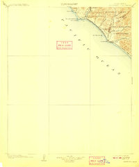
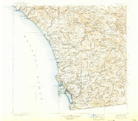
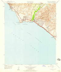
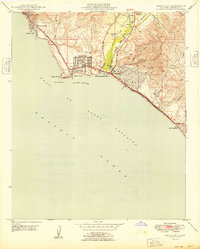
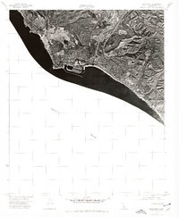
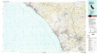
Listed on the National Register of Historic Places in 2021. 15 historic topographic surveys show this location, the earliest from 1902.
One of 136 National Register listings published here for Orange County · listed in 2021 · category: Building.
Sources: the National Register database, National Park Service
Regional context, not property-specific evidence. The federal wildfire occurrence database lists 60 fires within 5 miles of Edward and America Griffith House between 1994 and 2020, burning about 186 acres in total. 1 started naturally. 13 were recorded as arson. Distance is straight-line from the map coordinates, so a fire counted here may appear on a neighbouring settlement's page as well.
| Reported cause | Fires |
|---|---|
| Missing data/not specified/undetermined | 21 |
| Arson/incendiarism | 13 |
| Smoking | 9 |
| Equipment and vehicle use | 7 |
| Misuse of fire by a minor | 5 |
| Recreation and ceremony | 2 |
| Debris and open burning | 1 |
| Natural | 1 |
| Power generation/transmission/distribution | 1 |
The most recent of them, most recent first, with the day each was reported and the service that recorded it.
| Date | Cause | Size | Reported by | Name on the report |
|---|---|---|---|---|
| 22 September 2020 | Equipment and vehicle use | under an acre | Orange County Fire Authority | not named |
| 22 September 2010 | Recreation and ceremony | under an acre | California Department of Forestry & Fire Protection | not named |
| 13 September 2005 | Power generation/transmission/distribution | under an acre | California Department of Forestry & Fire Protection | not named |
| 7 August 2012 | Missing data/not specified/undetermined | under an acre | Orange County Fire Authority | not named |
| 5 August 2009 | Equipment and vehicle use | under an acre | California Department of Forestry & Fire Protection | not named |
| 28 August 2012 | Smoking | under an acre | Orange County Fire Authority | not named |
| 22 August 2007 | Arson/incendiarism | under an acre | California Department of Forestry & Fire Protection | not named |
| 19 August 2006 | Missing data/not specified/undetermined | under an acre | California Department of Forestry & Fire Protection | not named |
Regional context, not property-specific evidence. The federal mineral resources record lists 1 working within 5 miles of Edward and America Griffith House: 1 producer. All of them still produce. What was taken out: Sand and Gravel, Construction. Distance is straight-line from the map coordinates, so a quarry counted here may appear on a neighbouring settlement's page as well.
| Where | Site | Commodity | Status | Recorded |
|---|---|---|---|---|
| Capistrano Plant | Sand and Gravel, Construction | Producer |
Regional context, not property-specific evidence. The National Weather Service names Laguna Beach, the town this property stands in, in 14 storm reports between 1998 and 2019: 4 waterspout, 3 thunderstorm wind, 3 flash flood, 1 hail. No death or injury is recorded in these reports. Each account below is quoted exactly as the forecast office filed it, from the NOAA Storm Events Database, and each date opens the federal record of that event.
| When | Event | Place named | Harm | What the report says |
|---|---|---|---|---|
| February 2019 | Flash Flood | Laguna Beach | $80,000 | Storm channels were inundated by flash flooding with up to 2 inches of rain in 3 hours. Streets were closed and homes threatened by waters. |
| February 2005 | Flash Flood | Laguna Beach | $60,000 | Several vehicles were nearly submerged up to their roofs in flood waters on Laguna Canyon Road. |
| February 2017 | Thunderstorm Wind | Laguna Beach | $25,000 | Roughly 20 trees were downed by convective winds in Laguna Beach. The nearby Laguna Beach mesonet station measured a peak gust of 67 mph at 1737PST. |
| January 2010 | Thunderstorm Wind | Laguna Beach | $25,000 | High winds associated with a line of thunderstorms moved through south Orange County between 1330 and 1400 PST on the 19th. A spotter reported wind damage at his mother's condominium complex in Laguna Niguel, near Oso Parkway and Highway 73. A twelve foot tall tennis court enclosure with 4 inch aluminum posts was bent outwards at a 25 degree angle, two mature trees with a trunk diameter of greater than 12 inches were snapped off just above the ground level, and numerous 4 inch diameter tree branches from a pine tree broke off. The spotter was not at the location at the time, but observed the damage two months after it happened. The mother and another neighbor felt a suction and the windows of their condos shook violently. It is possible that a tornado briefly touched down in the complex, though no other reports of a tornado could be found. |
| February 2001 | Thunderstorm Wind | Laguna Beach | $25,000 | no account filed |
| February 2005 | Flash Flood | Laguna Beach | $20,000 | Some roads were washed out and others were covered in mud and rushing water after hours of heavy rain. |
| February 2003 | Flood | Laguna Beach | - | no account filed |
| July 2003 | Rip Current | Laguna Beach | - | no account filed |
| May 2001 | Waterspout | Laguna Beach | - | no account filed |
| August 2001 | Wildfire | Laguna Beach | - | no account filed |
| June 1999 | Waterspout | Laguna Beach | - | no account filed |
| April 1998 | Waterspout | Laguna Beach | - | no account filed |
| January 1998 | Waterspout | Laguna Beach | - | no account filed |
| April 1998 | Hail | Laguna Beach | - | no account filed |
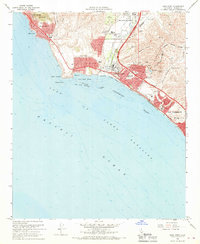
United States Geological Survey topographic sheets whose coverage includes this point. Matched by taking the coordinate the National Park Service records for this property, then testing that coordinate against the published boundary of every sheet.
Other National Register properties close enough to walk or drive between, ordered by distance from this one. Both positions come from the same geocoding pass that matched these properties to their map sheets.
| Photograph | Property | Distance | Listed |
|---|---|---|---|
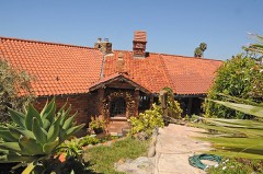 | Mariona | 2.7 miles | 1984 |
| VIRGINIA (sloop) | 2.9 miles | 1991 | |
| Joel R. Congdon House | 3.7 miles | 2002 | |
| Montanez Adobe | 4.3 miles | 1975 | |
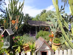 | Los Rios Street Historic District | 4.3 miles | 1983 |
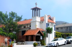 | St. Francis by-the-Sea American Catholic Church | 4.3 miles | 1988 |
| National Archives record | The nomination case file for reference 100006296 in Record Group 79. |
| Orange County | All 136 listed properties in this county. |