Block
BlockFrom the record
One of 3 National Register listings published here for Glenn County · listed in 2023 · category: District.
Sources: the National Register database, National Park Service
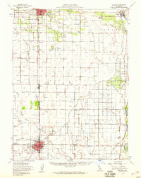
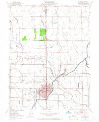
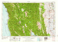
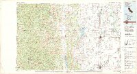
Listed on the National Register of Historic Places in 2023. 7 historic topographic surveys show this location, the earliest from 1906.
One of 3 National Register listings published here for Glenn County · listed in 2023 · category: District.
Sources: the National Register database, National Park Service
Regional context, not property-specific evidence. The federal wildfire occurrence database lists 36 fires within 5 miles of Willows-Glenn County Airport between 1993 and 2020, burning about 188 acres in total. None started naturally. None was recorded as arson. Distance is straight-line from the map coordinates, so a fire counted here may appear on a neighbouring settlement's page as well.
| Reported cause | Fires |
|---|---|
| Missing data/not specified/undetermined | 20 |
| Equipment and vehicle use | 9 |
| Debris and open burning | 4 |
| Misuse of fire by a minor | 2 |
| Smoking | 1 |
The most recent of them, most recent first, with the day each was reported and the service that recorded it.
| Date | Cause | Size | Reported by | Name on the report |
|---|---|---|---|---|
| 25 September 1997 | Missing data/not specified/undetermined | 26 acres | Tehama-Glenn Unit | THURMAN, L. |
| 23 September 2005 | Missing data/not specified/undetermined | 3.0 acres | California Department of Forestry & Fire Protection | not named |
| 18 September 2003 | Missing data/not specified/undetermined | under an acre | Tehama-Glenn Unit | 162 |
| 19 August 2020 | Missing data/not specified/undetermined | 1.0 acres | Tehama-Glenn Unit | S CULVER ST WILLOWS |
| 17 August 2003 | Debris and open burning | 1.5 acres | Sacramento National Wildlife Refuge | ROAD 60 |
| 15 August 2020 | Missing data/not specified/undetermined | under an acre | Tehama-Glenn Unit | FRENCH ST WILLOWS |
| 13 August 2020 | Missing data/not specified/undetermined | 1.0 acres | Tehama-Glenn Unit | W SYCAMORE ST WILLOWS 2 |
| 10 August 2020 | Missing data/not specified/undetermined | 11 acres | Tehama-Glenn Unit | N CRAWFORD ST WILLOWS |
Regional context, not property-specific evidence. The federal mineral resources record lists 12 workings within 5 miles of Willows-Glenn County Airport: 7 producers, 2 past producers, 2 occurrences, 1 unknown. 7 still produce. What was taken out: Sand and Gravel, Construction. Distance is straight-line from the map coordinates, so a quarry counted here may appear on a neighbouring settlement's page as well.
| Where | Site | Commodity | Status | Recorded |
|---|---|---|---|---|
| Colusa Pit | Sand and Gravel, Construction | Producer | ||
| Glenn County Gravel Pit | Sand and Gravel, Construction | Past Producer | Sedimentary | |
| Glenn County Gravel Pit | Sand and Gravel, Construction | Producer | ||
| Lester G. Madsen | Sand and Gravel, Construction | Producer | ||
| Lester G. Madsen | Sand and Gravel, Construction | Producer | ||
| Pacheco Pit | Sand and Gravel, Construction | Unknown | ||
| Pits | Sand and Gravel, Construction | Past Producer | Sedimentary | |
| T. P. Thuemler | Sand and Gravel, Construction | Occurrence | Sedimentary | |
| T. P. Thuemler | Sand and Gravel, Construction | Producer | ||
| Willows City Pit | Sand and Gravel, Construction | Occurrence | Sedimentary |
Regional context, not property-specific evidence. The National Weather Service names Willows, the town this property stands in, in 10 storm reports between 1993 and 2024: 8 flood, 2 tornado. No death or injury is recorded in these reports. Each account below is quoted exactly as the forecast office filed it, from the NOAA Storm Events Database, and each date opens the federal record of that event.
| When | Event | Place named | Harm | What the report says |
|---|---|---|---|---|
| April 1993 | Tornado (F1) | Willows | $500,000 | A tornado destroyed three barns and several outbuildings as it moved across rural land in the southeast part of the county. |
| May 2011 | Tornado (EF1) | Willows | $150,000 | The second tornado of the outbreak developed northeast of downtown Willows in Glenn County at approximately 5:12 pm. It moved east-northeast and passed just south of the town of Durham in Butte County. It caused significant damage to almond groves in Butte County, as well as destroyed one out building, damaged an open barn, and caused roofing damage to two other structures. The rating of an EF1 was based upon the uprooting of thousands of almond trees with many instances of broken large branches and trunks and the physical lifting and carrying of several large trees by five to ten feet. The estimated highest wind speed (3 second gust) based upon damage with this tornado is 105 mph. There were no injuries nor fatalities. |
| December 2024 | Flood | Willows | - | California Highway Patrol reported flooding from heavy rain leading to the closure of County Road 99W from Road 39 to Road 48 north of Willows. |
| January 2023 | Flood | Willows | - | Highway 162 is closed between East Canal Road in Willows to Road O due to flooding. There's no estimated time to reopen the roadway. Additional road closures including CR 99W and CR 48 and SR 162 from Willows east to CR P. |
| January 2019 | Flood | Willows | - | Highway 162 closed between 1st St. and County Rd. 9 in Willows because of storm related flooding. |
| February 2019 | Flood | Willows | - | California Highway Patrol reported slight flooding over Willow Creek Bridge on SB Interstate 5 north of Willows. |
| February 2019 | Flood | Willows | - | Caltrans District 3 reported that flooding has closed Highway 162 between 1st Street and County Rd P east of Willows in Glenn County. |
| February 2019 | Flood | Willows | - | Caltrans reported a flooded roadway in northern Willows. |
| February 2015 | Flood | Willows | - | CHP reported flooding at the intersection of Highway 99 west and Road 48. |
| December 2014 | Flood | Willows | - | Heavy rain caused closures on Highway 99W between CR 33 and 48, and portions of County Roads 33, 35, 48, Rd D just north of Willows. |
United States Geological Survey topographic sheets whose coverage includes this point. Matched by taking the middle of the area the National Park Service maps for this listing, then testing that coordinate against the published boundary of every sheet.
Other National Register properties close enough to walk or drive between, ordered by distance from this one. Both positions come from the same geocoding pass that matched these properties to their map sheets.
| Photograph | Property | Distance | Listed |
|---|---|---|---|
 | US Post Office-Willows Main | 0.4 miles | 1985 |
| National Archives record | The nomination case file for reference 100009029 in Record Group 79. |
| Glenn County | All 3 listed properties in this county. |