Block
BlockFrom the record
One of 35 National Register listings published here for Tulare County · listed in 2024 · category: Building.
Sources: the National Register database, National Park Service
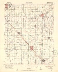
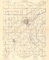
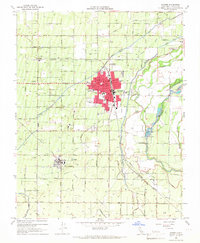
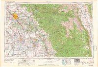
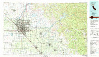
Listed on the National Register of Historic Places in 2024. 12 historic topographic surveys show this location, the earliest from 1923.
One of 35 National Register listings published here for Tulare County · listed in 2024 · category: Building.
Sources: the National Register database, National Park Service
Regional context, not property-specific evidence. The federal wildfire occurrence database lists 450 fires within 5 miles of Jeremiah D. and Mary Hyde House between 1992 and 2020, burning about 1,017 acres in total. None started naturally. 46 were recorded as arson. Distance is straight-line from the map coordinates, so a fire counted here may appear on a neighbouring settlement's page as well.
| Reported cause | Fires |
|---|---|
| Missing data/not specified/undetermined | 232 |
| Equipment and vehicle use | 74 |
| Debris and open burning | 67 |
| Arson/incendiarism | 46 |
| Misuse of fire by a minor | 13 |
| Smoking | 10 |
| Power generation/transmission/distribution | 5 |
| Railroad operations and maintenance | 2 |
| Recreation and ceremony | 1 |
The most recent of them, most recent first, with the day each was reported and the service that recorded it.
| Date | Cause | Size | Reported by | Name on the report |
|---|---|---|---|---|
| 9 September 2018 | Debris and open burning | under an acre | California Department of Forestry & Fire Protection | E LINCOLN AVE /S GREENWOO |
| 9 September 2018 | Debris and open burning | under an acre | California Department of Forestry & Fire Protection | S BETHEL AVE /E LINCOLN A |
| 9 September 2008 | Debris and open burning | 20 acres | Fresno-Kings Unit | BELMONT |
| 7 September 2017 | Missing data/not specified/undetermined | 1.0 acres | California Department of Forestry & Fire Protection | HWY 180 /N ACADEMY AV |
| 7 September 2015 | Arson/incendiarism | 1.0 acres | Fresno-Kings Unit | MADSEN |
| 6 September 2008 | Debris and open burning | 3.0 acres | Fresno-Kings Unit | BELMONT |
| 6 September 2007 | Power generation/transmission/distribution | under an acre | Fresno-Kings Unit | N RIO VISTA AV SANGER |
| 6 September 2001 | Debris and open burning | 5.0 acres | Fresno-Kings Unit | FKU 10939. |
Regional context, not property-specific evidence. The federal mineral resources record lists 12 workings within 5 miles of Jeremiah D. and Mary Hyde House: 5 producers, 3 unknowns, 3 past producers, 1 occurrence. 5 still produce. What was taken out: Sand and Gravel, Construction, Beryllium, Chromium, Asbestos. Distance is straight-line from the map coordinates, so a quarry counted here may appear on a neighbouring settlement's page as well.
| Where | Site | Commodity | Status | Recorded |
|---|---|---|---|---|
| H H Miner | Asbestos | Unknown | ||
| Reported Deposit | Chromium | Occurrence | ||
| Unnamed Location | Beryllium | Producer | ||
| Unnamed Location | Beryllium | Past Producer | ||
| Central Rock & Sand Co | Sand and Gravel, Construction | Unknown | ||
| Central Valley Ready Mix | Sand and Gravel, Construction | Producer | ||
| Industrial Asphalt Inc | Sand and Gravel, Construction | Unknown | ||
| Kings River | Sand and Gravel, Construction | Past Producer | Sedimentary | |
| Kings River | Sand and Gravel, Construction | Past Producer | ||
| Kings River Pit | Sand and Gravel, Construction | Producer |
Regional context, not property-specific evidence. The National Weather Service names Visalia, the town this property stands in, in 36 storm reports between 1995 and 2024: 9 heavy rain, 6 hail, 6 flood, 5 funnel cloud. No death or injury is recorded in these reports. Each account below is quoted exactly as the forecast office filed it, from the NOAA Storm Events Database, and each date opens the federal record of that event.
| When | Event | Place named | Harm | What the report says |
|---|---|---|---|---|
| February 1998 | Heavy Rain | Visalia | $13,900,000 | no account filed |
| September 2003 | Wildfire | Visalia | $824,000 | Homers Nose 2 Fire in the Sequoia-Kings Canyon Park was lightning ignited on the 5th and allowed to burn throughout the month. As of the 30th, it had consumed 230 acres at a cost of $824K with no fatalities or injuries nor structures lost. |
| September 1997 | Wildfire | Visalia | $750,000 | Amphitheater Fire. It was the result of an escaped prescribed burn. The total burn area was 242 acres within the Sequoia/Kings Canyon National Park. |
| May 1995 | Thunderstorm Wind | Visalia | $250,000 | National Weather Service survey conducted with straightline winds causing damage approximately three miles from the northwest to the southeast into the City of Visalia. Trees toppled, lines downed, minor structures moved, fences downed, and roof damage occurred. Newspaper accounts gave the time of start by eyewitnesses at 1940 PDT. Radar indicated 60 dBZ prior to the storm but it is unknown if the cell got stronger at the time of this report. Radar information is believed to be archived. |
| April 2003 | Heavy Rain | Visalia | $50,000 | Poor visibilities in a short-lived driving rain led to indirect damage of $50K as cars collided on a Visalia freeway. It was reported 17 vehicles were involved as 0.35" of rain fell in a very short period of time in and around the city. |
| April 2006 | Heavy Rain | Visalia | $50,000 | no account filed |
| December 1997 | Thunderstorm Wind | Visalia | $10,000 | Thunderstorm passage through the Visalia area brought gusty wind. Tree limbs were downed in the middle part of town causing some traffic flow problems. A barn roof was damaged on the west side of Central Visalia from the wind. As a result of the gusty wind and downed tree limbs, power lines were also felled causing power outages in the vicinity. |
| May 2009 | Thunderstorm Wind | Visalia | $2,000 | NWS Employee reported trees down and near zero visibility in blowing dust along SR 198 just east of Visalia. |
| February 2024 | Flood | Visalia | - | California Highway Patrol reported roadway flooding on SR 198 at the Ben Maddox Way exchange. |
| February 2024 | Flood | Visalia | - | California Highway Patrol reported the on ramp to eastbound SR 198 completely flooded between Court St. and Santa Fe St. |
| February 2024 | Flood | Visalia | - | An NWS Employee reported water 12-18 inches deep on E. Douglas Ave. between N. Enos St. and N. O'Malley St. following a period of heavy rainfall from a thunderstorm. |
| February 2024 | Flood | Visalia | - | California Highway Patrol reported roadway flooding on eastbound SR 198 at the Court St. underpass. |
| February 2023 | Heavy Rain | Visalia | - | Public report in Visalia of measured rainfall of 2.50 inches of rainfall inches of rainfall on February 24 and an additional 0.60 inches during the morning of February 25 for a total of 3.10 inches. |
| March 2018 | Funnel Cloud | Visalia | - | A brief cold air funnel was reported by an NWS employee at the corner of Houston Ave. and Mooney Blvd. in north Visalia. |
| September 2005 | Lightning | Visalia | - | Early morning thunderstorms moved over the east side of the Central and South San Joaquin Valley. Only trace to very light amounts of rain were reported on the Valley Floor. |
| May 2002 | Hail | Visalia | - | While no verifiable severe storm events occurred in Tulare County, significant damage was caused by large amounts of small hail and locally heavy thundershowers at a time of year when many stone and citrus fruits are vulnerable. |
| April 1999 | Hail | Visalia | - | Hail damage to young vines, strone fruit, and decidiuous crops. This particular damage band was reported between Goshen/Caldwell ESE through Visalia toward Exeter in Tulare County. |
| September 1999 | Lightning | Visalia | - | Lightning struck two poles in Visalia around 0730 PST. |
| May 1995 | Thunderstorm Wind | Visalia | - | Radar reports of 55-59 dBZ from the earlier Severe Thunderstorm Warning for Kings County was due to track into Tulare County and near Visalia by 1700 PDT. No damage was reported by either Kings or Tulare County Sheriffs from either event. |
| February 2005 | Heavy Rain | Visalia | - | no account filed |
| March 2005 | Funnel Cloud | Visalia | - | no account filed |
| April 2005 | Heavy Rain | Visalia | - | no account filed |
| December 2003 | Lightning | Visalia | - | no account filed |
| February 2003 | Funnel Cloud | Visalia | - | no account filed |
| February 2003 | Heavy Rain | Visalia | - | no account filed |
| April 2003 | Heavy Rain | Visalia | - | no account filed |
| January 2001 | Lightning | Visalia | - | no account filed |
| March 2000 | Flood | Visalia | - | no account filed |
| June 2000 | Flood | Visalia | - | no account filed |
| May 1998 | Heavy Rain | Visalia | - | no account filed |
| March 1998 | Hail | Visalia | - | no account filed |
| January 1997 | Funnel Cloud | Visalia | - | no account filed |
| March 1996 | Hail | Visalia | - | no account filed |
| March 1996 | Hail | Visalia | - | no account filed |
| March 1996 | Hail | Visalia | - | no account filed |
| March 1996 | Funnel Cloud | Visalia | - | no account filed |
United States Geological Survey topographic sheets whose coverage includes this point. Matched by taking the coordinate the National Park Service records for this property, then testing that coordinate against the published boundary of every sheet.
| National Archives record | The nomination case file for reference 100010826 in Record Group 79. |
| Tulare County | All 35 listed properties in this county. |