
BlockBefore
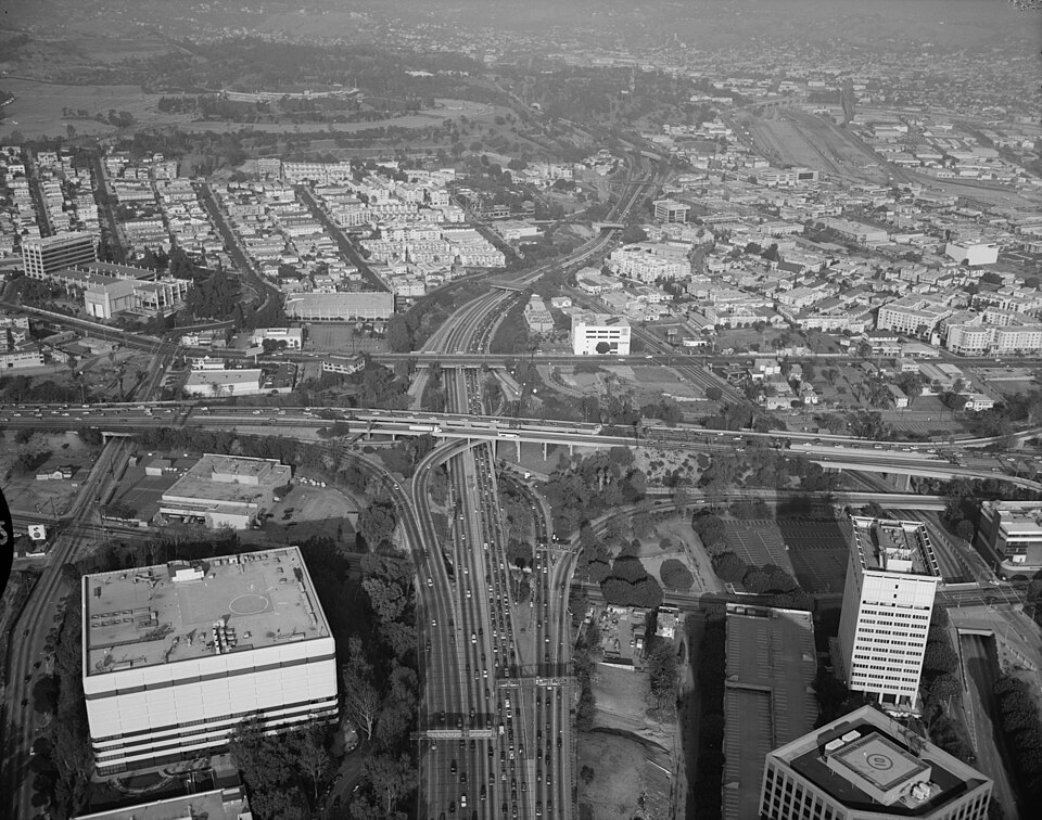
Photograph of Arroyo Seco Parkway
Photograph by Brian Grogan, Public domain. Via Wikimedia Commons.

Arroyo Seco Parkway Historic District

Built in 1940. Listed on the National Register of Historic Places in 2011.

From the record

“The Arroyo Seco Parkway, also known as the Pasadena Freeway, is one of the oldest freeways in the United States. It connects Los Angeles with Pasadena alongside the Arroyo Seco seasonal river.”

Wikipedia article Arroyo Seco Parkway, CC BY-SA 4.0.

One of 616 National Register listings published here for Los Angeles County · listed in 2011 · category: District · built in 1940.

Sources: the Wikipedia article · the case file at the National Archives · the National Register database, National Park Service

The listing

Storms near this property

8 since 2000

Regional context, not property-specific evidence. The National Weather Service names Los Angeles, the town this property stands in, in 8 storm reports between 2000 and 2026: 3 flood, 2 thunderstorm wind, 1 high wind, 1 tornado. The reports record 2 injuries. Each account below is quoted exactly as the forecast office filed it, from the NOAA Storm Events Database, and each date opens the federal record of that event.

WhenEvent Place namedHarm What the report says
March 2023Tornado (EF1)East Los Angeles1 hurtA weak tornado developed in the community of Montebello. The EF1 tornado impacted the area around the intersection of Washington Boulevard and Maple Avenue. There was substantial damage to the industrial warehouse and commercial business district, including nearly total roof collapse in one building and a total of 17 damaged structures. Numerous vehicles were damaged due to flying debris.
February 2000Thunderstorm WindLos Angeles1 hurtno account filed
February 2026FloodLos Angeles-Heavy rain produced significant roadway flooding on Interstate 110 near West 39th Street.
February 2026Flash FloodLos Angeles-Heavy rainfall generated flash flooding near the intersection of Interstates 10 and 110.
February 2026Thunderstorm WindLos Angeles-Strong thunderstorm winds knocked down several trees in the South Los Angeles area.
March 2002High WindLos Angeles-no account filed
February 2000FloodLos Angeles-no account filed
April 2000FloodLos Angeles-no account filed

Every storm recorded in Los Angeles County

Map coverage status

No historic map-sheet match is published for this property yet. That does not mean no map exists. This record needs a coordinate-quality review before it can be joined to a sheet boundary. Browse the county's mapped places while that work is pending.

Sources for this property

National Archives recordThe nomination case file for reference 10001198 in Record Group 79.
Wikipedia articleCommunity-written account of this property, licensed CC BY-SA.
Los Angeles CountyAll 616 listed properties in this county.

Provenance

  • Listing record. National Park Service National Register of Historic Places, listed-properties dataset, current to 2026-05-22.
  • Map join. Address geocoded through the United States Census geocoder, then tested against the published boundary of every sheet in the USGS Historical Topographic Map Collection.
  • How this page is made. Listing fields come from federal records; map-sheet coverage is a labelled coordinate-to-boundary calculation, not a source-field claim.
  • Storms. NOAA National Centers for Environmental Information, Storm Events Database https://www.ncei.noaa.gov/stormevents/ A work of the United States government, no copyright under 17 U.S.C. 105. Narratives are quoted verbatim from the National Weather Service report and are not edited or summarised.