BlockBefore
Photograph of Saline Valley salt tram
Photograph by LCGS Russ, CC BY 3.0. Via Wikimedia Commons.

Saline Valley Salt Tram Historic Structure

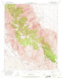
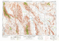
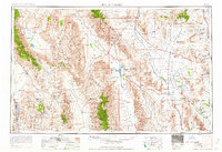
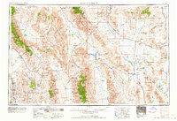
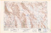
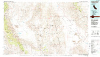
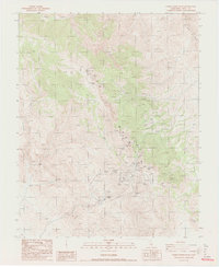
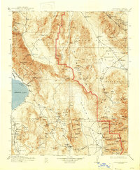
Listed on the National Register of Historic Places in 1974. 14 historic topographic surveys show this location, the earliest from 1908.

From the record

“The Saline Valley salt tram is located in Inyo County, California, United States. The electric aerial tramway was constructed from 1911 to 1913 to carry salt from the Saline Valley over the Inyo Mountains and into the Owens Valley.”

Wikipedia article Saline Valley salt tram, CC BY-SA 4.0.

One of 9 National Register listings published here for Inyo County · listed in 1974 · category: Structure.

Sources: the Wikipedia article · the case file at the National Archives · the National Register database, National Park Service

The listing

  • Address. N of Keeler between Gordo Peak and New York Butte, Keeler, 93545
  • When was it listed? December 1974
  • Category. structure
  • Census division. Independence
  • National Register reference number. 74000514 - the number the National Park Service assigned this property when it was listed, and the key its nomination file is catalogued under at the National Archives.

Mines and quarries near this property

10 of 47 shown

Regional context, not property-specific evidence. The federal mineral resources record lists 47 workings within 5 miles of Saline Valley Salt Tram Historic Structure: 16 past producers, 14 occurrences, 11 prospects, 2 producers. 4 still produce. What was taken out: Gold, Silver, Lead, Copper. Distance is straight-line from the map coordinates, so a quarry counted here may appear on a neighbouring settlement's page as well.

Where SiteCommodity StatusRecorded
American Flag MineSilver, Gold, Copper, LeadPast Producer
GivensLead, Copper, Silver, GoldOccurrence
Gold Standard MineGold, Silver, Copper, Lead, Iron, ZincPast ProducerChalcopyrite, Galena, Gold, Hematite, Malachite, Pyrite, Sphalerite, Tetrahedrite
Inyo Pit and MillCalciumProducer
Loadstar ClaimCopper, NickelOccurrence
Morning Sun ProspectSilver, Copper, Lead, ZincProspect
Trapier MineGold, Lead, SilverPast Producer
Unnamed ProspectGold, Silver, Copper, Zinc, LeadProspect
Auguste MineLead, Silver, Zinc, GoldPast Producer
BurgessGold, Lead, Silver, ZincPast Producer

Every working recorded in Inyo County

Storms near this property

15 since 2000

Regional context, not property-specific evidence. The National Weather Service names Keeler, the town this property stands in, in 15 storm reports between 2000 and 2025: 14 flash flood, 1 flood. No death or injury is recorded in these reports. Each account below is quoted exactly as the forecast office filed it, from the NOAA Storm Events Database, and each date opens the federal record of that event.

WhenEvent Place namedHarm What the report says
September 2022Flash FloodKeeler$200,000Hwy 190 was washed away by a 10 to 15 foot high wall of fast-moving water near Centennial Flats. One truck was swept away; the occupant was unharmed.
November 2025Flash FloodKeeler$100,000Flash flooding occurred in many places in Death Valley National Park. Roads closed due to flooding, debris flows, and damage included North Highway/Scotty's Castle Road, Badwater Road, and Highway 190 west of Darwin Falls. Some of the closed roads had just been reopened four days prior after damage from Tropical Storm Mario followed by the government shutdown.
July 2012Flash FloodKeeler$20,000Racetrack Road in Death Valley National Park was severely damaged by flooding.
August 2023Flash FloodKeeler$10,000The intersection of Highways 190 and 136 was washed out. The road remained closed and intermittently flooded for over a day.
August 2012Flash FloodKeeler$5,000Flash flooding rendered the intersection of Highways 190 and 136 impassable.
August 2011Flash FloodKeeler$5,000Flash flooding closed Highway 136 and trapped about 20 vehicles on Highway 190.
August 2022Flash FloodKeeler$2,000Water, dirt, and rocks covered Highway 136 southeast of Keeler. A few cars were stranded, and the highway was closed from Lone Pine to Highway 190.
August 2022Flash FloodKeeler$2,000A mud, dirt, and rock slide closed Highway 136 at Keeler.
September 2018Flash FloodKeeler$2,000Rocks and mud covered Highway 136.
September 2022Flash FloodKeeler$1,000Hwy 190 was closed.
August 2022Flash FloodKeeler$1,000Highway 190 was flooded and closed 4.5 miles E of Highway 136.
January 2019Flash FloodKeeler$1,000The intersection of Highway 190 and Highway 136 was flooded and briefly closed.
August 2013Flash FloodKeeler$1,000The intersection of Highways 190 and 136 was closed due to flooding.
July 2008Flash FloodKeeler-Highway 136 was flooded in Keeler.
August 2000FloodKeeler-State Route 190 at 3 miles west of the Junction of State Route 136 was closed for several hours due to flooding from a heavy thunderstorm.

Every storm recorded in Inyo County

Maps showing this location

14 surveys

United States Geological Survey topographic sheets whose coverage includes this point. Matched by taking the middle of the area the National Park Service maps for this listing, then testing that coordinate against the published boundary of every sheet.

Sources for this property

National Archives recordThe nomination case file for reference 74000514 in Record Group 79.
Wikipedia articleCommunity-written account of this property, licensed CC BY-SA.
Inyo CountyAll 9 listed properties in this county.

Provenance

  • Listing record. National Park Service National Register of Historic Places, listed-properties dataset, current to 2026-05-22.
  • Map join. Address geocoded through the United States Census geocoder, then tested against the published boundary of every sheet in the USGS Historical Topographic Map Collection.
  • How this page is made. Listing fields come from federal records; map-sheet coverage is a labelled coordinate-to-boundary calculation, not a source-field claim.
  • Mines and quarries. USGS Mineral Resources Data System (MRDS) https://mrdata.usgs.gov/mrds/ A work of the United States government, no copyright under 17 U.S.C. 105.
  • Storms. NOAA National Centers for Environmental Information, Storm Events Database https://www.ncei.noaa.gov/stormevents/ A work of the United States government, no copyright under 17 U.S.C. 105. Narratives are quoted verbatim from the National Weather Service report and are not edited or summarised.