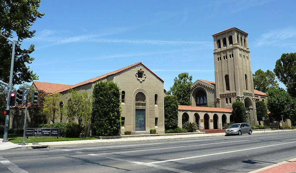
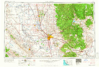
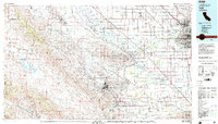
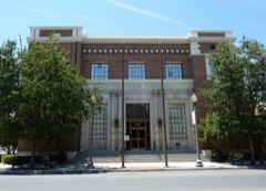
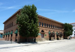
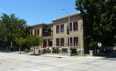
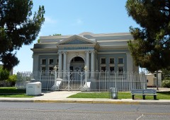
Built in 1931 (Spanish Colonial Revival architecture). Listed on the National Register of Historic Places in 1979. 14 historic topographic surveys show this location, the earliest from 1910.
From the record
“The First Baptist Church, also known as the Bell Towers, is a historic church complex built in 1931 in Bakersfield, California. The church moved to a new campus in 1977 and the building presently used as an office building.”
Wikipedia article First Baptist Church (Bakersfield, California), CC BY-SA 4.0.
One of 23 National Register listings published here for Kern County · listed in 1979 · category: Building · built in 1931, Spanish Colonial Revival architecture.
National Register reference number.79000478- the number the National Park Service assigned this property when it was listed, and the key its nomination file is catalogued under at the National Archives.
Fires near this property
740 since 1996
Regional context, not property-specific
evidence. The
federal wildfire occurrence database
lists 740 fires within 5 miles of First Baptist Church
between 1996 and 2020, burning about 913 acres in total. 2 started naturally. 117 were recorded as arson.
Distance is straight-line from the map coordinates, so a fire counted
here may appear on a neighbouring settlement's page as well.
Reported cause
Fires
Missing data/not specified/undetermined
495
Arson/incendiarism
117
Equipment and vehicle use
56
Misuse of fire by a minor
39
Smoking
18
Debris and open burning
10
Natural
2
Power generation/transmission/distribution
2
Recreation and ceremony
1
The most recent of
them, most recent first, with the day each was reported and the service
that recorded it.
Date
Cause
Size
Reported by
Name on the report
9 September 2020
Missing data/not specified/undetermined
under an acre
Kern County Fire Department
not named
9 September 2005
Missing data/not specified/undetermined
1.0 acres
California Department of Forestry & Fire Protection
not named
8 September 2020
Equipment and vehicle use
under an acre
Kern County Fire Department
not named
8 September 2019
Missing data/not specified/undetermined
2.0 acres
Kern County Fire Department
not named
8 September 2018
Missing data/not specified/undetermined
under an acre
California Department of Forestry & Fire Protection
not named
7 September 2017
Missing data/not specified/undetermined
under an acre
California Department of Forestry & Fire Protection
not named
7 September 2009
Misuse of fire by a minor
under an acre
California Department of Forestry & Fire Protection
not named
7 September 2009
Missing data/not specified/undetermined
under an acre
California Department of Forestry & Fire Protection
Regional context, not property-specific
evidence. The federal mineral resources record lists
10 workings within 5 miles of First Baptist Church: 8 past producers, 2 producers.
2 still produce. What was taken out: Sand and Gravel, Construction, Gold, Silica, Silver. Distance is straight-line from the
map coordinates, so a quarry counted here may appear on a neighbouring
settlement's page as well.
Regional context, not property-specific
evidence. The National Weather Service names
Bakersfield, the town this property stands in, in 48 storm reports between 1995 and 2023: 14 flood, 11 heavy rain, 5 hail, 4 wildfire.
The reports record 2 injuries. Each account below is quoted exactly as the forecast office
filed it, from the NOAA Storm Events Database, and each date
opens the federal record of that event.
While on the phone an office manager was mildly electrocuted due to a nearby lightning strike and the resulting electrical surge through the phone line.
The Democrat Wildfire was ignited by unknown cause and burned 550 acres before being contained with no fatalities or structures lost. The cost to contain was $565K.
Local media reported 1 foot deep water due to heavy rainfall at Airport Dr just north of State Rd. Three vehicles encountered the deep water and become stuck. Street flooding also reported on Fairfax Rd at Brundage Ave.
With strong gradient wind and some convective activity, a cold air funnel touched down briefly in Southeast Bakersfield near Pacheco Road and Kaiser Court. A few small trees were downed along with damage to a small shed.
Pictures indicating roadway flooding in downtown Bakersfield near the intersection on Union Ave. and Truxton Ave. were received on Facebook and Twitter.
Rainfall amounts of 0.5 to 1 inch in 24 hours over the Kern county produced ponding of water/flooding on roadways in the south end of the San Joaquin Valley, in and south of Bakersfield. The flooded areas included part of Highway 99 between Rosedale Highway and Olive Drive in Bakersfield and Highway 119 near Buena Vista.
Rainfall amounts of 0.4 to 0.85 inches reported across the City of Bakersfield, including 0.52 inches at Meadows Field Airport. Rainfall resulted in ponding of water on roadways.
Spotter reports confirmed radar imagery that thunderstorm activity, from the Mexican Monsoon, brought very heavy rain to areas north of Bakersfield in the foothills on the western face of the Southern Sierra Nevada. Drainage ditches all filled on mountain roads with creeks rapidly rising to full. Rainfall rates reached 1.5-2.0"/hour in the area approximately 10 miles north of Bakersfield to 23 miles east of Delano in Kern County. In the 24 hour period ending at 5 PM PDT on the 6th, Valley floor rain amounts included 0.07" at Madera, Visalia 0.01", Porterville 0.08", with an unofficial report of up to 2" of rain between 1530-1700 PDT 10 miles north of Bakersfield to the Tulare County line.
While rains have stopped and temperatures climbed to near normal for a period in late April, the winter and spring's above normal rainfall/snowfall is resulting in not only rainfall runoff, some snowmelt contributions, but "springing" into the South Valley stream group of Caliente, Tejoh, sycomore, El Paso, and San Emigdio Creeks at the rate of 120CFS. Damage was sustained on roads and property with water collecting in low-lying areas, such as the ancient Kern Lake bed. As of late April 2,000 acres of farmland was under water in the South San Joaquin Valley in the area southeast of Bakersfield. As of April 27th the snowpack water content in the Southern Sierra Nevada was 190% of normal. From the Kern County Ag Commissioner's Office, data indicates that 75,000 to 100,000 acres of cotton may not be planted in Kern County due to the wet and cool field conditions.
As reported by California Highway Patrol between Laval Road and the scales on Interstate-5 at the base of the grapevine. 40-50 cars pulled over to wait for the storm to diminish.
The SVR issued based on radar information, as previously described, for the period from 1519 PST until 1600 PST did provide some lead time. Additional one-inch hail was reported at 1530 PST in East Bakersfield by Kern County Emergency Management to NWSO San Joaquin Valley.
United States Geological Survey topographic
sheets whose coverage includes this point. Matched by taking the coordinate the National Park Service records for this property, then
testing that coordinate against the published boundary of every sheet.
Other National Register properties close
enough to walk or drive between, ordered by distance from this one. Both
positions come from the same geocoding pass that matched these properties
to their map sheets.
Listing record. National Park Service National Register of Historic Places, listed-properties dataset, current to 2026-05-22.
Map join. Address geocoded through the United States Census geocoder, then tested against the published boundary of every sheet in the USGS Historical Topographic Map Collection.
How this page is made. Listing fields come from federal records; map-sheet coverage is a labelled coordinate-to-boundary calculation, not a source-field claim.
Wildfire. Short, Karen C. 2022. Spatial wildfire occurrence data for the United States, 1992-2020 [FPA_FOD_20221014]. 6th Edition. Fort Collins, CO: Forest Service Research Data Archive. https://doi.org/10.2737/RDS-2013-0009.6 Collected with United States Government funding and usable without additional permissions or fees.
Mines and quarries. USGS Mineral Resources Data System (MRDS) https://mrdata.usgs.gov/mrds/ A work of the United States government, no copyright under 17 U.S.C. 105.
Storms. NOAA National Centers for Environmental Information, Storm Events Database https://www.ncei.noaa.gov/stormevents/ A work of the United States government, no copyright under 17 U.S.C. 105. Narratives are quoted verbatim from the National Weather Service report and are not edited or summarised.
 Block
Block