Block
BlockFrom the record
One of 38 National Register listings published here for Santa Barbara County · listed in 1979 · category: Building.
Sources: the case file at the National Archives · the National Register database, National Park Service
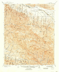
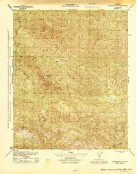
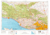
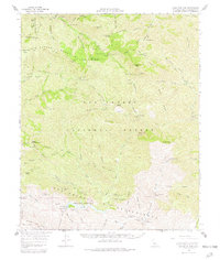
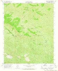
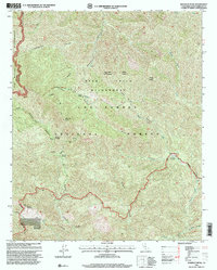
Listed on the National Register of Historic Places in 1979. 12 historic topographic surveys show this location, the earliest from 1902.
One of 38 National Register listings published here for Santa Barbara County · listed in 1979 · category: Building.
Sources: the case file at the National Archives · the National Register database, National Park Service
Regional context, not property-specific evidence. The federal wildfire occurrence database lists 5 fires within 5 miles of Madulce Guard Station and Site between 1997 and 2017, burning about 2 acres in total. 2 started naturally. 1 was recorded as arson. Distance is straight-line from the map coordinates, so a fire counted here may appear on a neighbouring settlement's page as well.
| Reported cause | Fires |
|---|---|
| Equipment and vehicle use | 2 |
| Natural | 2 |
| Arson/incendiarism | 1 |
The most recent of them, most recent first, with the day each was reported and the service that recorded it.
| Date | Cause | Size | Reported by | Name on the report |
|---|---|---|---|---|
| 11 September 2017 | Natural | under an acre | Los Padres National Forest | PINE |
| 10 August 1997 | Equipment and vehicle use | under an acre | Los Padres National Forest | CHOKECHERRY |
| 21 July 2006 | Natural | under an acre | Los Padres National Forest | BUCK |
| 11 November 2004 | Equipment and vehicle use | under an acre | Los Padres National Forest | BUCKHORN |
| 11 October 1999 | Arson/incendiarism | 1.5 acres | Los Padres National Forest | MADULCE |
Regional context, not property-specific evidence. The National Weather Service names Santa Barbara, the town this property stands in, in 28 storm reports between 1993 and 2025: 12 flash flood, 5 thunderstorm wind, 5 flood, 2 waterspout. The reports record 3 injuries. Each account below is quoted exactly as the forecast office filed it, from the NOAA Storm Events Database, and each date opens the federal record of that event.
| When | Event | Place named | Harm | What the report says |
|---|---|---|---|---|
| September 2017 | Thunderstorm Wind | Santa Barbara | 2 hurt | A severe thunderstorm generate damaging microburst winds across the city of Santa Barbara. Thunderstorm wind gusts up to 80 MPH were reported. With such strong winds, widespread significant damage was reported, including many trees being uprooted. Along San Pascual Street, a high voltage power line was knocked down, resulting in major burn injuries for one male. At Stearns Wharf, numerous boats were washed ashore and one teenage female was injured. |
| October 1998 | Wildfire | Santa Barbara | 1 hurt | The combination of dry vegetation and weak offshore winds helped fuel a wildfire in the Los Padres National Forest, north of the city of Santa Barbara. The Ogilvy Fire, started by sparks from weed cutting, burned over 4,200 acres of forest. One minor injury was reported. |
| December 2008 | Flash Flood | Santa Barbara | $10,000 | Bands of showers produced intense rainfall rates across the Tea Fire burn area. Rainfall rates in excess of 0.50 inches per hours were reported. The intense showers produced mud and debris flows which forced the closure of East Mountain Drive south of the burn scar. |
| October 2025 | Thunderstorm Wind | Santa Barbara | $2,000 | Strong thunderstorms generated gusty winds. In the community of Santa Barbara, a large tree was knocked down, striking a vehicle. No injuries were reported. |
| February 2024 | Flash Flood | Santa Barbara | - | California Highway Patrol reported the full closure of Highway 192 for several miles due to flooding. |
| February 2024 | Flash Flood | Santa Barbara | - | Heavy rainfall generated flash flooding that resulted in the closure of Highway 144 near Milpas Street. |
| February 2024 | Debris Flow | Santa Barbara | - | Heavy rainfall resulted in several large boulders (about half the size of a car) blocking Gibraltar Road. |
| February 2024 | Debris Flow | Santa Barbara | - | Heavy rainfall generated a mudslide across Sycamore Canyon Road near the intersection with Coyote Road. |
| January 2023 | Flash Flood | Santa Barbara | - | Heavy rainfall produced flash flooding on Highway 101 near Bath Street. Several vehicles were stuck in the flood waters. |
| December 2023 | Flash Flood | Santa Barbara | - | Significant flooding was reported on Highway 101 at the offramp for Mission Street. Over four feet of water flooded the offramp. |
| December 2023 | Flash Flood | Santa Barbara | - | Significant flooding was reported along Highway 101 at the Castillo Street offramp. Vehicles were turning the wrong way to try to avoid the flooding. Eventually, both the onramp and offramp were closed. |
| December 2023 | Flash Flood | Santa Barbara | - | Significant flooding was reported along Highway 101 at the Mission Street onramp and offramp. Hard closures were reported. |
| December 2023 | Flash Flood | Santa Barbara | - | Significant flooding was reported along Highway 101 at the Garden Street onramp and offramp. Hard closures were reported. |
| December 2023 | Flash Flood | Santa Barbara | - | Significant flooding was reported in the city of Santa Barbara. Several business, as well as the Superior Court House, reported significant flooding. |
| December 2023 | Flash Flood | Santa Barbara | - | Significant flooding was reported in the city of Santa Barbara. Numerous reports of vehicles stuck in flooded roadways, requiring rescues. |
| February 2010 | Flash Flood | Santa Barbara | - | Heavy showers produced mud and debris flows in and around the Tea, Gap and Jesusita Burn areas in southern Santa Barbara county. Automated rain gauges indicated rainfall rates as intense as 0.40 inches in 30 minutes. Per reports from the USGS, significant mud and debris flows quickly filled the catch basins. |
| January 2010 | Thunderstorm Wind | Santa Barbara | - | A microburst developed in the community of Santa Barbara. The downburst occurred along West Haley Avenue between Bath and De La Vina Streets. Several flowering trees were toppled upon power lines and vehicles. |
| February 1993 | Thunderstorm Wind | Santa Barbara | - | Intense thunderstorms with strong winds and heavy rains, hit the Santa Barbara area. Many trees were uprooted and power lines downed. |
| February 1993 | Thunderstorm Wind | Santa Barbara | - | Ventura, Los Angeles, Orange, and San Diego Counties ,Bands of thunderstorms moved in along the coast of southern California, from Santa Barbara to San Diego Counties. The strongest storms were in northern and central Orange County. Rainfall amounts ranged from a 0.25 to 0.50 inch of rain in 1 hour. Heavy rains, frequent lightning, small hail, and gusty winds were associated with the storms. Winds up to 35 mph were reported with some thunderstorms in Los Angeles and northern Orange Counties. |
| October 2004 | Flash Flood | Santa Barbara | - | no account filed |
| October 2004 | Funnel Cloud | Santa Barbara | - | no account filed |
| November 2001 | Flood | Santa Barbara | - | no account filed |
| February 2000 | Flood | Santa Barbara | - | no account filed |
| April 2000 | Flood | Santa Barbara | - | no account filed |
| October 2000 | Flood | Santa Barbara | - | no account filed |
| March 1999 | Flood | Santa Barbara | - | no account filed |
| December 1999 | Waterspout | Santa Barbara | - | no account filed |
| February 1997 | Waterspout | Santa Barbara | - | no account filed |
United States Geological Survey topographic sheets whose coverage includes this point. Matched by taking the coordinate the National Park Service records for this property, then testing that coordinate against the published boundary of every sheet.
| National Archives record | The nomination case file for reference 79000547 in Record Group 79. |
| Santa Barbara County | All 38 listed properties in this county. |