BlockBefore
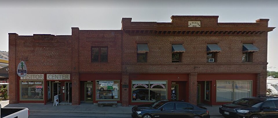
Photograph of C. A. Elster Building
Photograph by Marcie Jones, CC BY-SA 4.0. Via Wikimedia Commons.

C. A. Elster Building

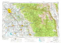
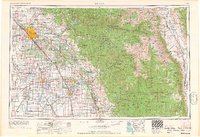
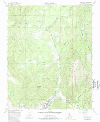
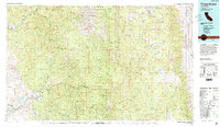
Listed on the National Register of Historic Places in 1982. 14 historic topographic surveys show this location, the earliest from 1904.

From the record

“Elster Building is a historic commercial building located at the corner of California State Route 190 and Tule River Dr. in Springville, California.”

Wikipedia article C. A. Elster Building, CC BY-SA 4.0.

One of 35 National Register listings published here for Tulare County · listed in 1982 · category: Building.

Sources: the Wikipedia article · the case file at the National Archives · the National Register database, National Park Service

The listing

  • What is counted as historic. The nomination lists 1 building as contributing to the listing.
  • Listed as. Elster, C. A., Building - the National Register files a house under its owner's surname.
  • Address. CA 190 and Tule River Dr., Springville, 93265
  • When was it listed? March 1982
  • Category. building
  • Census division. Springville-Johnsondale
  • National Register reference number. 82002279 - the number the National Park Service assigned this property when it was listed, and the key its nomination file is catalogued under at the National Archives.

Fires near this property

221 since 1992

Regional context, not property-specific evidence. The federal wildfire occurrence database lists 221 fires within 5 miles of C. A. Elster Building between 1992 and 2020, burning about 6,084 acres in total. 7 started naturally. 35 were recorded as arson. Distance is straight-line from the map coordinates, so a fire counted here may appear on a neighbouring settlement's page as well.

Reported cause Fires
Equipment and vehicle use89
Missing data/not specified/undetermined66
Arson/incendiarism35
Debris and open burning12
Natural7
Power generation/transmission/distribution5
Misuse of fire by a minor4
Fireworks1
Smoking1
Recreation and ceremony1

The most recent of them, most recent first, with the day each was reported and the service that recorded it.

DateCause SizeReported by Name on the report
9 September 1993Arson/incendiarism2.0 acresTulare UnitPLEASANT
6 September 2007Equipment and vehicle use1.0 acresTulare UnitFRAZIER - F#160
5 September 2002Equipment and vehicle use1.0 acresTulare UnitROADRUNNER
5 September 1992Missing data/not specified/undeterminedunder an acreTulare UnitWILSON
30 September 1999Missing data/not specified/undeterminedunder an acreTulare UnitSEBESTIAN
3 September 1998Natural90 acresTulare UnitYOUNG
3 September 1997Natural3.0 acresTulare UnitBLACK
28 September 1993Arson/incendiarism2.0 acresTulare UnitROCK

Every fire recorded in Tulare County

Mines and quarries near this property

10 of 19 shown

Regional context, not property-specific evidence. The federal mineral resources record lists 19 workings within 5 miles of C. A. Elster Building: 7 occurrences, 5 prospects, 3 past producers, 2 producers. 2 still produce. What was taken out: Tungsten, Granite, Manganese, Uranium. Distance is straight-line from the map coordinates, so a quarry counted here may appear on a neighbouring settlement's page as well.

Where SiteCommodity StatusRecorded
Barber No. 2Copper, GoldOccurrenceVein
Barber No. 2Copper, GoldUnknown
Frazier ValleyAsbestosUnknown
Springville Borrow PitGranite, Stone, Crushed/BrokenProducer
Tompkins PitSand and Gravel, ConstructionProducer
Unnamed ProspectsMagnesiteProspect
Freitas ClaimUraniumProspect
O'Kelley DepositManganeseOccurrence
O'Kelly ProspectManganeseOccurrence
Sequoia RanchUraniumProspect

Every working recorded in Tulare County

Storms near this property

24 since 1997

Regional context, not property-specific evidence. The National Weather Service names Springville, the town this property stands in, in 24 storm reports between 1997 and 2025: 17 flood, 3 wildfire, 2 heavy rain, 1 flash flood. The reports record 2 deaths. Each account below is quoted exactly as the forecast office filed it, from the NOAA Storm Events Database, and each date opens the federal record of that event.

WhenEvent Place namedHarm What the report says
January 1998FloodSpringville2 killedIn trying to cross the Tule River in the mountains of Tulare County, an elderly couple's car was swept downstream off of a 100-foot low-water crossing. The river was running at a higher than normal level of 5 feet deep due to recent rains in Central California.
September 1997WildfireSpringville$940,000Coffee Wildfire was caused from a vehicle fire. It reached a size of 2470 acres within the Sequoia National Forest.
April 2006Flash FloodSpringville$125,000no account filed
March 2013FloodSpringville$5,000Road flooding was reported at Highway 190 and Success Valley Drive.
December 2025FloodSpringville-CHP reports flooding on SR 190 near Globe Dr.
January 2023Debris FlowSpringville-Tulare County Sheriffs reported a small rock slide on Pleasant Oak Dr. near the intersection with SR 190.
January 2023FloodSpringville-California Highway Patrol reported Globe Dr. over the Tulare River Bridge in Springville was closed due to flooding.
February 2023FloodSpringville-California Highway Patrol reported near Lake Success on Success Valley Dr.
March 2023FloodSpringville-California Highway Patrol reported eastbound SR 190 flooded west of Pleasant Oak Dr.
March 2023FloodSpringville-Video posted on Twitter showing flooding in Springville.
March 2023FloodSpringville-California Highway Patrol reported Rio Vista Dr. was washed out near Cow Mountain Rd.
March 2023FloodSpringville-California Highway Patrol reported SR 190 flooded at Coffee Camp.
March 2023FloodSpringville-Video posted on Facebook showing Globe Dr. flooded by the Tule River in Springville.
March 2023FloodSpringville-Image shown on Twitter showing the River Island Country Club in Springville flooded.
March 2023FloodSpringville-A social media video was posted of a water rescue on the Tule River in Springville.
March 2023FloodSpringville-California Highway Patrol reported a landslide blocking the eastbound lanes of SR 190 at Pleasant Oak Dr.
December 2022FloodSpringville-California Highway Patrol reported a large rock washed up on the roadway just west of the intersection of SR 190 and Rd. 320.
March 2019FloodSpringville-California Highway Patrol reported flooding at the intersection of State Route 190 and Pleasant Oaks Dr. 4SW Springville.
March 2018FloodSpringville-California Highway Patrol reported Flash Flooding and a mudslide on State Route 190 east of Springville at the Powerhouse Bridge. About 3 feet of water covered the bridge.
December 2016FloodSpringville-California Highway Patrol reported boulders blocking the roadway at Avenue 176 and Road 320 just east of State Route 190 from road flooding.
July 2003WildfireSpringville-The Frazier Fire was fought by California Division of Forestry and burned 750 acres. Its cause and cost is unknown but no structures were lost nor did any fatalities occur.
July 2000WildfireSpringville-The Edison wildfire began on July 31st from an unknown cause and was contained the next day (August 1st) after burning 150 acres. No structures were lost and the cost to contain was unreported.
June 1998Heavy RainSpringville-no account filed
February 1998Heavy RainSpringville-no account filed

Every storm recorded in Tulare County

Maps showing this location

14 surveys

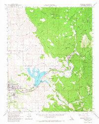
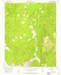
United States Geological Survey topographic sheets whose coverage includes this point. Matched by taking the coordinate the National Park Service records for this property, then testing that coordinate against the published boundary of every sheet.

Sources for this property

National Archives recordThe nomination case file for reference 82002279 in Record Group 79.
Wikipedia articleCommunity-written account of this property, licensed CC BY-SA.
Tulare CountyAll 35 listed properties in this county.

Provenance

  • Listing record. National Park Service National Register of Historic Places, listed-properties dataset, current to 2026-05-22.
  • Map join. Address geocoded through the United States Census geocoder, then tested against the published boundary of every sheet in the USGS Historical Topographic Map Collection.
  • How this page is made. Listing fields come from federal records; map-sheet coverage is a labelled coordinate-to-boundary calculation, not a source-field claim.
  • Wildfire. Short, Karen C. 2022. Spatial wildfire occurrence data for the United States, 1992-2020 [FPA_FOD_20221014]. 6th Edition. Fort Collins, CO: Forest Service Research Data Archive. https://doi.org/10.2737/RDS-2013-0009.6 Collected with United States Government funding and usable without additional permissions or fees.
  • Mines and quarries. USGS Mineral Resources Data System (MRDS) https://mrdata.usgs.gov/mrds/ A work of the United States government, no copyright under 17 U.S.C. 105.
  • Storms. NOAA National Centers for Environmental Information, Storm Events Database https://www.ncei.noaa.gov/stormevents/ A work of the United States government, no copyright under 17 U.S.C. 105. Narratives are quoted verbatim from the National Weather Service report and are not edited or summarised.