BlockBefore
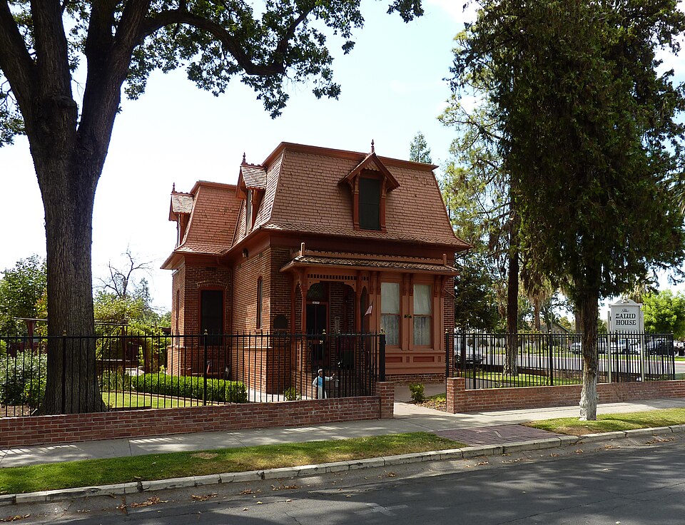
Photograph of Zalud House
Photograph by Bobak Ha'Eri, CC BY 3.0. Via Wikimedia Commons.

Zalud House

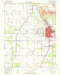
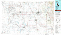
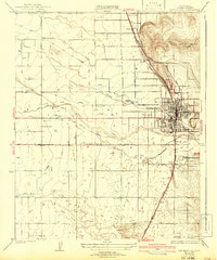
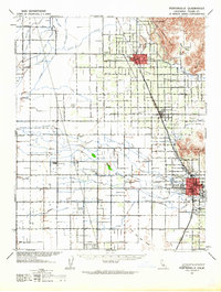
Listed on the National Register of Historic Places in 1987. 11 historic topographic surveys show this location, the earliest from 1929.

From the record

One of 35 National Register listings published here for Tulare County · listed in 1987 · category: Building.

Sources: the case file at the National Archives · the National Register database, National Park Service · the Wikipedia article
The listing

  • What is counted as historic. The nomination lists 3 buildingss as contributing to the listing.
  • Address. 393 N. Hockett St., Porterville, 93257
  • When was it listed? March 1987
  • Category. building
  • Census division. Porterville
  • Architectural style. Second Empire architecture in the United States and Canada
  • National Register reference number. 86003681 - the number the National Park Service assigned this property when it was listed, and the key its nomination file is catalogued under at the National Archives.

Fires near this property

746 since 1992

Regional context, not property-specific evidence. The federal wildfire occurrence database lists 746 fires within 5 miles of Zalud House between 1992 and 2020, burning about 5,939 acres in total. 1 started naturally. 340 were recorded as arson. Distance is straight-line from the map coordinates, so a fire counted here may appear on a neighbouring settlement's page as well.

Reported cause Fires
Arson/incendiarism340
Missing data/not specified/undetermined203
Equipment and vehicle use97
Misuse of fire by a minor58
Smoking23
Debris and open burning15
Recreation and ceremony4
Power generation/transmission/distribution3
Railroad operations and maintenance1
Firearms and explosives use1
Natural1

The most recent of them, most recent first, with the day each was reported and the service that recorded it.

DateCause SizeReported by Name on the report
9 September 1993Arson/incendiarismunder an acreTulare UnitHAVERT
9 September 1992Arson/incendiarismunder an acreTulare UnitRIVERBOTTOM #22
8 September 1996Equipment and vehicle useunder an acreTulare UnitPETTIS
6 September 2005Equipment and vehicle useunder an acreTulare UnitHARBISON
6 September 2004Arson/incendiarismunder an acreTulare UnitTULE #26
6 September 1999Missing data/not specified/undetermined1.0 acresTulare UnitLIME
5 September 1993Debris and open burning3.0 acresTulare UnitSINER
4 September 2000Equipment and vehicle useunder an acreTulare UnitBROOMBAUGH

Every fire recorded in Tulare County

Mines and quarries near this property

10 of 25 shown

Regional context, not property-specific evidence. The federal mineral resources record lists 25 workings within 5 miles of Zalud House: 15 past producers, 4 producers, 3 occurrences, 2 prospects. 4 still produce. What was taken out: Sand and Gravel, Construction, Magnesite, Chromium, Stone, Crushed/Broken. Distance is straight-line from the map coordinates, so a quarry counted here may appear on a neighbouring settlement's page as well.

Where SiteCommodity StatusRecorded
Deer Creek SilverCopper, Gold, SilverPast Producer
HoldridgeLimestone, GeneralPast Producer
Holston Chromite DepositIron, ChromiumPast Producer1895
Holston MineChromium, Rhodium, Ruthenium, Iridium, Palladium, PlatinumPast Producer1895, 1918
Middletons Sequoia Rock Co.Sand and Gravel, Construction, Silver, GoldPast Producer
Porterville White Granite QuarryGranitePast Producer1915
Prospect Near Holston ChromeChromium, Platinum, Ruthenium, Rhodium, Iridium, PalladiumOccurrenceChromite
Unnamed LocationGemstoneOccurrence
Valencia HeightsClayOccurrence
Frazier Valley Borrow PitStone, Crushed/BrokenProducer

Every working recorded in Tulare County

Storms near this property

27 since 1995

Regional context, not property-specific evidence. The National Weather Service names Porterville, the town this property stands in, in 27 storm reports between 1995 and 2021: 5 hail, 5 heavy rain, 5 wildfire, 4 thunderstorm wind. No death or injury is recorded in these reports. Each account below is quoted exactly as the forecast office filed it, from the NOAA Storm Events Database, and each date opens the federal record of that event.

WhenEvent Place namedHarm What the report says
February 2014Thunderstorm WindPorterville$2,000,000Trees down across Porterville. Damages reported to several houses due to fallen trees and limbs.
September 2003WildfirePorterville$460,560The Michael Fire had an unknown ignition near Chimney Peak in southeast Tulare County. It consumed 388 acres at a cost of $460K. No fatalities occurred nor were structures lost.
May 1995Tornado (F0)Porterville$200,000Eyewitness reports and subsequent interviews confirm a small F0 Tornado struck the Porterville Airport at noon. Two general aviation aircraft were destroyed, minor roof damage occurred to the airport administration buildings, fences were downed, and some minor farm structures were destroyed one-half mile east of the airport. One aircraft was tied down but was lifted from its tiedown chains. The tornado was seen one mile southwest of the field and moved northeast through the center of the airport. Heavy rain occurred on the airfield following the event.
October 2003WildfirePorterville$150,000The Albanita/Hooker Fire in the Sequoia National Forest was lightning ignited on September 3rd and then allowed to burn for resource management benefits. It consumed 4,483 acres by the end of October at an estimated cost of $150K. No injuries or fatalities were reported nor were any structures lost.
October 2007Thunderstorm WindPorterville$30,000Local police in Tulare reported trees and powerlines downed.
May 2009Thunderstorm WindPorterville$12,000Law enforcement in Porterville reported a roof blown off a barn due to outflow winds from a severe thunderstorm.
March 1998Thunderstorm WindPorterville$5,000Thunderstorm wind (estimated at more than 37Kts) brought down powerlines and damaged the roof of an elementary school in Porterville late in the afternoon.
May 2003Heavy RainPorterville$2,000One of many thunderstorms on this day throughout the Central and South San Joaquin Valley resulted in an estimated rainfall rate of 2"/hour near Porterville in the SE San Joaquin Valley. Spotters and police reported street flooding from the downpour with two homes damaged due to the excessive water.
August 2003LightningPorterville$1,000no account filed
December 2021Debris FlowPorterville-California Highway Patrol reported mud, rock and dirt covering most of North Plano St. near Lynch Dr.
November 2003WildfirePorterville-The Albanita/Hooker Fire was ignited September 3rd by lightning and allowed to burn as resource management burn until closed on the 8th of November. Its total cost was $150K and it consumed 4483 acres in the Sequoia National Forest.
September 2003WildfirePorterville-The Albanita/Hooker Fire in Sequoia National Forest was lightning ignited on the 3rd. It burned 175 acres by the 30th as it was allowed to burn for resource benefits. No injuries were reported nor was any structure lost.
April 1999HailPorterville-Hail damage to young vines, stone fruit, and deciduous crops. From the Tulare County Ag Commissioner some damage was reported in the vicinity of Porterville.
February 1998Funnel CloudPorterville-Spotter observed funnel to the WNW of Porterville High School. Classic 'V' shape about 1/3 of the way toward the ground. No damage occurred in the area.
January 2016HailPorterville-no account filed
March 2006Heavy RainPorterville-no account filed
March 2006HailPorterville-no account filed
April 2006HailPorterville-no account filed
April 2006LightningPorterville-no account filed
April 2005Heavy RainPorterville-no account filed
August 2003LightningPorterville-no account filed
December 2002Heavy RainPorterville-no account filed
July 2002WildfirePorterville-no account filed
January 1997HailPorterville-no account filed
January 1997Funnel CloudPorterville-no account filed

Every storm recorded in Tulare County

Maps showing this location

11 surveys

United States Geological Survey topographic sheets whose coverage includes this point. Matched by taking the coordinate the National Park Service records for this property, then testing that coordinate against the published boundary of every sheet.

Listed places nearby

2 within 8 miles

Other National Register properties close enough to walk or drive between, ordered by distance from this one. Both positions come from the same geocoding pass that matched these properties to their map sheets.

Photograph PropertyDistance Listed
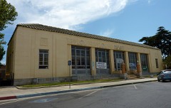
US Post Office-Porterville Main0.3 miles1985
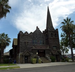
First Congregational Church0.3 miles1999

Sources for this property

National Archives recordThe nomination case file for reference 86003681 in Record Group 79.
Wikipedia articleCommunity-written account of this property, licensed CC BY-SA.
Tulare CountyAll 35 listed properties in this county.

Provenance

  • Listing record. National Park Service National Register of Historic Places, listed-properties dataset, current to 2026-05-22.
  • Map join. Address geocoded through the United States Census geocoder, then tested against the published boundary of every sheet in the USGS Historical Topographic Map Collection.
  • How this page is made. Listing fields come from federal records; map-sheet coverage is a labelled coordinate-to-boundary calculation, not a source-field claim.
  • Wildfire. Short, Karen C. 2022. Spatial wildfire occurrence data for the United States, 1992-2020 [FPA_FOD_20221014]. 6th Edition. Fort Collins, CO: Forest Service Research Data Archive. https://doi.org/10.2737/RDS-2013-0009.6 Collected with United States Government funding and usable without additional permissions or fees.
  • Mines and quarries. USGS Mineral Resources Data System (MRDS) https://mrdata.usgs.gov/mrds/ A work of the United States government, no copyright under 17 U.S.C. 105.
  • Storms. NOAA National Centers for Environmental Information, Storm Events Database https://www.ncei.noaa.gov/stormevents/ A work of the United States government, no copyright under 17 U.S.C. 105. Narratives are quoted verbatim from the National Weather Service report and are not edited or summarised.