 Block
From the record
26 National Register listings published here.
Sources: the National Register database, National Park Service
120 topographic sheets cover 103 settlements here, and 26 properties are on the National Register of Historic Places.
26 National Register listings published here.
Sources: the National Register database, National Park Service
Every property in this county listed on the National Register of Historic Places, with the year it was listed and the federal nomination document.
| Photograph | Property | Type | Listed | Reference |
|---|---|---|---|---|
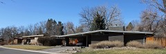 | Arapaho Hills | district | 2012 | 12000550 |
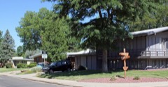 | Arapahoe Acres | district | 1998 | 98001249 |
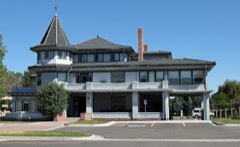 | David W. Brown House | building | 1980 | 80000875 |
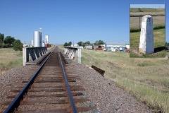 | Comanche Crossing of the Kansas Pacific Railroad | site | 1970 | 70000152 |
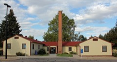 | Commandant of Cadets Building, US Air Force Academy | building | 2007 | 07000340 |
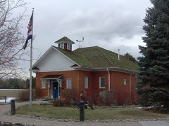 | Curtis School | building | 1992 | 92000808 |
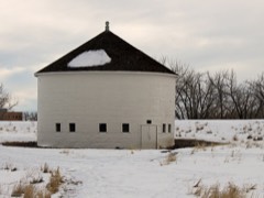 | DeLaney Barn | building | 1989 | 89000010 |
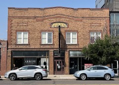 | Englewood I.O.O.F. Lodge No. 138 Building | building | 2021 | 100006716 |
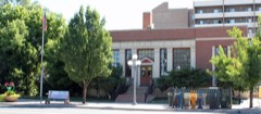 | Englewood Post Office | building | 2011 | 11000465 |
| Foster-Buell Estate | building | 1998 | 98000294 | |
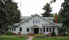 | Geneva Home | building | 1999 | 98001635 |
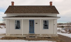 | Gully Homestead | building | 1986 | 86000022 |
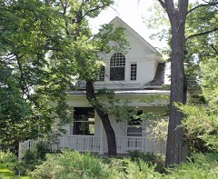 | Hopkins Farm | district | 2007 | 07000341 |
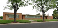 | Jamaica Primary School | building | 2017 | 100000928 |
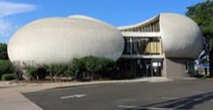 | Key Savings and Loan Association Building | building | 2016 | 16000447 |
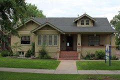 | Knight-Wood House | building | 2004 | 04001111 |
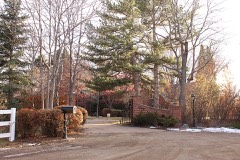 | Little Estate | building | 1998 | 98000610 |
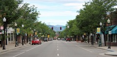 | Littleton Main Street | district | 1998 | 98000291 |
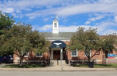 | Littleton Post Office | building | 2019 | 100003671 |
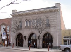 | Littleton Town Hall | building | 1980 | 80000876 |
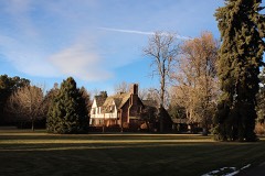 | Maitland Estate | building | 1998 | 98001130 |
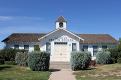 | Melvin School | building | 1984 | 84000790 |
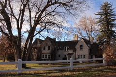 | Owen Estate | building | 1999 | 99001143 |
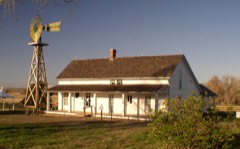 | Seventeen Mile House | building | 1983 | 83003501 |
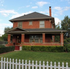 | William Smith House | building | 1985 | 85002565 |
| South Dahlia Lane | district | 2025 | 100012015 |
Every wildfire the federal occurrence database records inside this county: 1,940 of them, burning about 4,470 acres. 37 started naturally and 70 were recorded as arson. Each settlement page carries the fires within five miles of it.
| Reported cause | Fires |
|---|---|
| Missing data/not specified/undetermined | 1549 |
| Smoking | 109 |
| Equipment and vehicle use | 79 |
| Arson/incendiarism | 70 |
| Fireworks | 42 |
| Natural | 37 |
| Recreation and ceremony | 20 |
| Debris and open burning | 16 |
| Misuse of fire by a minor | 15 |
| Railroad operations and maintenance | 2 |
| Power generation/transmission/distribution | 1 |
The five largest, by the area the report gives. None of them was recorded as arson.
| Date | Cause | Size | Reported by | Name on the report |
|---|---|---|---|---|
| 21 August 2011 | Missing data/not specified/undetermined | 1,800 acres | Colorado State Forest Service-State Headquarters | BYERS |
| 28 November 2010 | Missing data/not specified/undetermined | 650 acres | Colorado State Forest Service-State Headquarters | not named |
| 24 June 2011 | Missing data/not specified/undetermined | 160 acres | Colorado State Forest Service-State Headquarters | BYERS |
| 17 July 2013 | Fireworks | 150 acres | Bennett Fire Protection District | UNKNOWN |
| 11 July 2018 | Equipment and vehicle use | 108 acres | Bennett Fire Protection District | UNKNOWN |
| 1 June 2018 | Equipment and vehicle use | 102 acres | Aurora Fire Department | UNKNOWN |
| 11 July 2018 | Equipment and vehicle use | 100 acres | Aurora Fire Department | UNKNOWN |
| 15 November 2010 | Missing data/not specified/undetermined | 100 acres | Colorado State Forest Service-State Headquarters | not named |
Every settlement page carries the fires within five miles of it - see the settlement index below.
The NOAA Storm Events Database holds 913 reports for this county, causing 2 deaths, 19 injuries and about $1,075,597,680 in recorded property damage. Each settlement page carries the reports that name it.
| Kind of event | Reports |
|---|---|
| Hail | 592 |
| Thunderstorm Wind | 146 |
| Tornado | 100 |
| Flash Flood | 36 |
| Lightning | 30 |
| Flood | 8 |
| Heavy Rain | 1 |
The most serious of them, by death, then injury, then recorded damage. The accounts are quoted exactly as the forecast office filed them.
| When | Event | Place named | Harm | What the report says |
|---|---|---|---|---|
| July 2018 | Flash Flood | Littleton | 1 killed, $500,000 | Thunderstorms produced very heavy rainfall, 1 to 2 inches in less than 30 minutes. At 4600 South Acoma, the floodwaters quickly inundated a basement apartment and trapped a 32-year-old woman inside. She was rescued, but died several hours later. |Floodwaters stalled several vehicles and forced the closure of several intersections including: East Iliff Ave. and South Chambers Road, Santa Fe Drive and West Oxford Ave., South Buckley Road and East Bates Ave., East 6th Ave. and South Picadilly Road, East Hampden Ave and South Uruvan Way. Flooding created a large sinkhole in Sheridan. A small SUV was fell into the hole. The driver was not injured. She escaped her vehicle before it was swallowed by the sinkhole. |
| June 2023 | Flash Flood | Arapahoe Park | 1 killed, $50,000 | Water rescues conducted between North Watkins Road near East 6th Ave south of Watkins. Occupant in one of the vehicles drowned. |
| August 1996 | Thunderstorm Wind | Westminster | 5 hurt | no account filed |
| June 2009 | Tornado (EF1) | Aurora Cherry Creek | 2 hurt, $500,000 | A tornado touched down in southeast Aurora, south of Buckley Airport, and moved south-southeast across open fields, some residential areas, and Southlands Mall. Numerous homes and apartments suffered window damage, minor roof damage and there were a few broken garage doors. The Southlands Mall had some roof and window damage, and wall damage to one of its restaurants. South of the mall, Lowe's received some roof damage, and lightweight sheds and other structures were destroyed. One resident, in the Sorrel Ranch subdivision, north of the mall, was swept off his porch while attempting to get close-up pictures of the tornado. He was found unconcious and bleeding in his front yard, with a dislocated shoulder, an injured neck, and multiple other injuries. In addition, the tornado flipped a trailer home. A man inside the trailer suffered minor injuries. |
| June 2011 | Lightning | (Bkf)Buckley Air Force Base | 2 hurt | Two airmen from the Colorado National Guard recieved minor injuries when they were struck by lightning. They were struck while on duty at a flight line at Buckely Air Force Base. |
| July 2001 | Thunderstorm Wind | Aurora Cherry Creek | 2 hurt | Two people received minor injuries when a wet microburst blew over several tents at the Cherry Creek Arts Festival. |
| August 2002 | Tornado (F1) | (Apa)Englwood Arapah | 1 hurt, $6,000,000 | The second tornado, associated with the storm, touched down in a subdivision that was under construction at Gartrell and Arapahoe Road. Four large condominiums under construction were destroyed. The most heavily damaged portions of the structures had not been sheet rocked. Adjacent sections, where the walls were in place, were not destroyed. A man suffered four broken ribs and several cuts and bruises when the trailer he sought shelter in, was flipped three times and torn apart by the tornado. |
| July 2018 | Tornado (EF1) | Peoria | 1 hurt, $200,000 | A tornado touched down briefly and tore the roof off a manufactured home. It partially destroyed an outbuilding, flipped over a UPS delivery truck and damaged farm equipment. The driver was hospitalized with minor injuries. |
| May 2015 | Lightning | Aurora Cherry Creek | 1 hurt | Juvenile male struck by lightning in field near Town Center Mall. |
| June 2014 | Tornado (EF1) | (Bkf)Buckley Air Force Base | 1 hurt | A tornado touched down near the Blackstone Country Club in Aurora, and flipped an empty construction trailer. Several golf carts were also damaged, a tree was dowend and a couple broken garage door panes of a home nearby was damaged. A caddy suffered a broken wrist when he was struck by one of the golf carts. |
| August 2010 | Lightning | Littleton | 1 hurt | A 14-year-old teenager was struck by lightning while washing her family's car. The bolt struck the street nearby; it then traveled up a stream of water flowing from the vehicle and hit the teenager. She received minor injuries. |
| July 1998 | Lightning | Deer Trail | 1 hurt | A woman was injured when lightning struck a nearby telephone pole. She sustained burns to her head and right shoulder. |
| September 2009 | Lightning | (Apa)Englwood Arapah | 1 hurt | no account filed |
| April 2001 | Lightning | Aurora Cherry Creek | 1 hurt | no account filed |
| June 2018 | Hail | Englewood | $276,400,000 | The property estimate value was the total storm damage summary for the event. |
| September 2014 | Hail | Centennial Airport | $213,300,000 | no account filed |
| June 2012 | Hail | Byers | $161,100,000 | no account filed |
| June 2009 | Hail | Aurora Cherry Creek | $161,000,000 | no account filed |
| June 2012 | Hail | South Glenn | $160,000,000 | no account filed |
| October 1998 | Hail | (Bkf)Buckley Fld Nas | $87,800,000 | no account filed |
| September 2013 | Flood | Skyline | $3,300,000 | Heavy rain, ranging from 4 to 12 inches through the entire storm event, caused widespread flooding along the entire drainage systems of East Tollgate and Coal Creeks. The areas around Parker Road and Piney Creek were flooded as several holding ponds did overflow their banks. Some of the worst flooded in Centenniel occurred along Arapahoe Road near Cottonwood. According to FEMA, 2,138 households were impacted by flooding.||Road closures included: East Fitzsimons Pkwy. and North Peoria, East 26th Ave and Fulton St., East 17th Ave and Dayton St., East Colfax and Peoria St., East 12th Ave. between Xanthia St. and Xenia St, East 12th Ave. and Yosemite St., East 11th Ave. and Willow St., East 11th Ave. and Xanthia St., East 11th Ave. and Xenia St., Del Mar Pkwy. and North Havana St., East 1st Ave and Moline St., East Alameda Ave. and South Havana St., South Peoria St. just North of East Ford Ave., South bound 225 and East Alameda Ave., East Alameda Ave. and East Alameda Dr., East Florida Ave. and South Galena St. |
| June 1986 | Tornado (F2) | not stated | $2,500,000 | no account filed |
| July 2001 | Hail | Littleton | $606,000 | The city of Littleton suffered $612,000 in damage to vehicles, roofs, buildings, landscaping and computers. Almost every vehicle owned by visitors and employees in the Littleton Center parking lot sustained damage. |
| September 1993 | Thunderstorm Wind | Denver | $500,000 | A severe thunderstorm rolled through the southeast portion of the Denver area. Dime-size hail was reported in many areas. Straight-line winds from the thunderstorm, measured by a weather spotter at 70 mph (61 knots), tore a roof off six apartments of an apartment complex in Aurora (10 miles southeast of Denver). Heavy rain, which accompanied the winds, caused major damage to the apartments as well as the contents. Many trees, fences and power poles were knocked down by the strong winds. Heavy rain flooded many roadways in Denver and Aurora. |
| August 2000 | Lightning | Aurora Cherry Creek | $250,000 | Lightning ripped most of the roof off a home in southeast Aurora. The bolt sparked a fire which destroyed the residence. |
| June 1989 | Tornado (F1) | not stated | $250,000 | no account filed |
| August 2010 | Lightning | Greenwood Vlg | $100,000 | Lightning sparked a fire in a restaurant shortly after midnight. It caused extensive damage. |
| May 2001 | Lightning | Aurora Cherry Creek | $100,000 | Lightning sparked a fire at an apartment complex, forcing the evacuation of 24 units. Most of the fire damage was confined to the attic. |
| May 1998 | Tornado (F0) | (Bkf)Buckley Fld Nas | $100,000 | A tornado struck a wooden hangar at Aurora Airpark. The hangar collapsed damaging a car and a single engine plane parked inside. A neighbouring steel hangar sustained only minor damage. The tornado moved northeast, hopped Interstate 70, and touched down again in an open field. The path length and duration of the tornado were estimated. |
| August 2008 | Lightning | Aurora Cherry Creek | $75,000 | Lightning struck a home. The ensuing fire caused extensive roof damage. |
| July 1997 | Lightning | (Bkf)Buckley Fld Nas | $75,000 | Lightning struck a home in unincorporated Arapahoe County. The fire started in the electrical panel boxes causing extensive damage to the home. |
| July 2011 | Lightning | Walnut Hills | $70,000 | Lightning triggered a fire which caused major structural damage to a home. |
| May 2023 | Flood | Parker | $50,000 | The heavy rainfall has caused road damage in Cherry Creek State Park, along East Lake View Road. This resulted in the closure of the east and west boat ramps at Cherry Creek Reservoir. |
| June 2023 | Flash Flood | Aurora Cherry Creek | $50,000 | Heavy rain caused extensive street flooding. |
| September 2019 | Lightning | Centennial Airport | $50,000 | Lightning caused extensive damage to a home. |
| August 2015 | Flash Flood | Centennial Airport | $50,000 | Heavy rain quickly flooded several intersections. Vehicles stalled in the flooded intersections. Two motorists had to be rescued from the flooded roadways; on at University Blvd and County Line Road and the other, at Univerity Blvd and Dry Creek Rd. At Centennial Airport, a hangar partially collapsed when 2.20 inches fell in one hour. At the Denver Broncos training facility in Dove Valley, the storm left the practice fields and parking lot flooded, and the viewing area near the field house damaged by strong winds. The fields, the team said, received 3.5 inches of rain in an hour during the storm. As a result, the practice facility was closed to the public the following day due to storm damage. |
| August 2013 | Flash Flood | Skyline | $50,000 | Heavy rain caused localized flash flooding in Aurora. An undergound parking garage at an apartment complex was inundated with 3 to 4 feet of water. Flash flooding forced a road closure at East Mississippi Ave. and Alton St. Also, several people had to be rescued when three vehicles stalled in flood waters at Alameda Ave. and Havana St. |
| June 2012 | Flash Flood | Byers | $50,000 | Flash flooding forced the closure of Quincy Road; South Gun Club Road, between East Exposition Avenue and East Alameda Avenue; South Picadilly Road, between State Highway 30 and East 6th Avenue; and County Road 50, between Delbert Road and County Road 17. |
| July 2011 | Lightning | Greenwood Vlg | $50,000 | Lightning struck a school. |
| June 2011 | Lightning | (Apa)Englwood Arapah | $50,000 | Lightning struck a home a sparked a fire. The fire caused extensive damage to the interior and exterior of the home. |
| May 1994 | Thunderstorm Wind | Centennial Airport | $50,000 | Thunderstorm wind gusts to 65 mph (56 knots) damaged 16 small airplanes and a hangar at Centennial Airport (13 miles southeast of Denver). |
| August 2000 | Lightning | Central Portion | $47,000 | Lightning struck three homes in Arapahoe County. |
| July 1999 | Lightning | Cherry Hills Vlg | $30,000 | Lightning triggered a fire at a residence in Cherry Hills. A small portion of the roof and ceiling were damaged before the fire could be extinguished. |
| July 1997 | Flash Flood | (Bkf)Buckley Fld Nas | $30,000 | Heavy rain caused flooding and flash flooding problems in central portions of Adams and Arapahoe Counties. Two home were extensively damaged when water flooded their basements and adjacent pasture area in Strasburg. Highwaters, 4 to 5 feet deep, had pooled in the lower lying areas of town. In addition, Quincy Road had to be blocked off between County Roads 129 and 137 in Arapahoe County. Up to 4 feet of water reportedly covered the roadway. |
| June 2014 | Lightning | (Apa)Englwood Arapah | $25,000 | Lightning struck a tree in a residential area which caused damage to the two surrounding homes. Parts of the tree went through the roof and basement of one of the homes as well as the driver-side window of the residents truck. |
| July 1984 | Tornado (F1) | not stated | $25,000 | no account filed |
| June 1967 | Tornado (F1) | not stated | $25,000 | no account filed |
| August 1999 | Thunderstorm Wind | Deer Trail | $20,000 | Intense thunderstorm winds snapped 9 telephone poles, leaving about 40 residents without power for approximately 3 hours. Each pole had been snapped about 5 feet from its base. Most of the damage occurred along County Road 197 approaching State Highway 36. |
| August 2008 | Lightning | Aurora Cherry Creek | $20,000 | no account filed |
| May 2015 | Flash Flood | Peoria | $15,000 | Floodwaters damaged Arapahoe County Road 42 at the Kingsburrow Bridge. Water overtopped the road at several locations. |
| June 2015 | Flood | (Bkf)Buckley Air Force Base | $15,000 | In Aurora, water was reportedly flowing over the roads at East 6th Ave. and South Pacadilly Road. Additional flooding was reported on South Gun Club Road between East Alameda Ave. and East Exposition Avenue, forcing the closure of the road. |
| June 2015 | Flash Flood | Smoky Hill | $15,000 | Major flooding occurred in the westbound lane of Arapahoe Road near the Colorado E470 bridge. |
| August 2009 | Hail | Peoria | $15,000 | Some farm equipment and fiberglass structures were damaged by hail. |
| August 2022 | Flash Flood | Greenwood Vlg | $10,000 | Heavy rain produced flash flooding. Several intersections were flooded covered in 6 to 12 inches of water, and resulted in several road closures. |
| July 2010 | Flash Flood | Byers | $10,000 | Heavy rain caused flash flooding near Interstate 70 at Byers. Two feet of water was observed moving across the exit ramp. One car was washed into a tree but no one was injured. |
| June 2009 | Tornado (EF0) | (Bkf)Buckley Air Force Base | $10,000 | A small tornado touched down and crossed Interstate 70, flipping a semi-trailer. |
| August 2008 | Flash Flood | Skyline | $10,000 | Extensive flooding was reported; with several motorists stranded in standing water. |
| July 1998 | Tornado (F1) | Byers | $10,000 | A tornado touched down and partially lifted a wood and metal barn off its foundation. As a result one third of the structure was destroyed. A large garage door to the main house was also buckled. A neighbour who lived just north of the farmstead measured a peak wind gust to 71 mph (62 kts). |
| July 2011 | Flash Flood | Skyline | $10,000 | no account filed |
| August 2013 | Flash Flood | (Bkf)Buckley Air Force Base | $5,000 | Road closures were set up in both directions on both Picadilly Road and Gun Club Road, just north of Buckley AFB. A man had to be rescued when his car was trapped in flood waters at the intersection of 6th Ave. and Picadilly Road. Flash Flooding was also observed at the junction of E-470 and I-70 with water running over the road. |
The Survey's mineral resources record lists 104 workings inside this county. 14 still produce and 90 are closed or unrecorded. Each settlement page carries the workings within five miles of it.
| Commodity | Workings |
|---|---|
| Sand and Gravel, Construction | 94 |
| Gold | 6 |
| Manganese | 4 |
The least common of them first, because a county's hundredth gravel pit says nothing its first ten did not.
| Where | Site | Commodity | Status | Recorded |
|---|---|---|---|---|
| Buckley Field Manganese Deposits | Manganese | Occurrence | Psilomelane | |
| Buckley Field Mn Deposit | Manganese | Prospect | 1952 | |
| Buckley Field Mn Deposit #1 | Manganese | Unknown | ||
| Denver Basin Mn Deposits | Manganese | Unknown | ||
| Big Dry Creek Placers | Gold | Occurrence | 1858 | |
| Big Dry Creek Placers | Gold | Unknown | ||
| Cherry Creek Mine | Gold | Past Producer | ||
| Cherry Creek Placers | Gold | Unknown | ||
| Little Dry Creek Placers | Gold | Occurrence | Placer | |
| Little Dry Creek Placers | Gold | Unknown | ||
| Central Construction Pit | Sand and Gravel, Construction | Producer | ||
| Cherry Creek Sand Plant | Sand and Gravel, Construction | Producer | ||
| Clarke Pit | Sand and Gravel, Construction | Producer | ||
| Englewood Plant | Sand and Gravel, Construction | Producer | ||
| Gravel Pit | Sand and Gravel, Construction | Unknown | ||
| Gravel Pit | Sand and Gravel, Construction | Unknown | ||
| Gravel Pit | Sand and Gravel, Construction | Unknown | ||
| Gravel Pit | Sand and Gravel, Construction | Producer | ||
| Gravel Pit | Sand and Gravel, Construction | Unknown | ||
| Gravel Pit | Sand and Gravel, Construction | Unknown | ||
| Gravel Pit | Sand and Gravel, Construction | Unknown | ||
| Gravel Pit | Sand and Gravel, Construction | Unknown | ||
| Gravel Pit | Sand and Gravel, Construction | Unknown | ||
| Gravel Pit | Sand and Gravel, Construction | Unknown | ||
| Gravel Pit | Sand and Gravel, Construction | Unknown | ||
| Gravel Pit | Sand and Gravel, Construction | Unknown | ||
| Gravel Pit | Sand and Gravel, Construction | Unknown | ||
| Gravel Pit | Sand and Gravel, Construction | Producer | ||
| Gravel Pit | Sand and Gravel, Construction | Producer | ||
| Gravel Pit | Sand and Gravel, Construction | Unknown | ||
| Gravel Pit | Sand and Gravel, Construction | Unknown | ||
| Gravel Pit | Sand and Gravel, Construction | Unknown | ||
| Gravel Pit | Sand and Gravel, Construction | Unknown | ||
| Gravel Pit | Sand and Gravel, Construction | Unknown | ||
| Gravel Pit | Sand and Gravel, Construction | Unknown | ||
| Gravel Pit | Sand and Gravel, Construction | Unknown | ||
| Gravel Pit | Sand and Gravel, Construction | Unknown | ||
| Gravel Pit | Sand and Gravel, Construction | Unknown | ||
| Gravel Pit | Sand and Gravel, Construction | Producer | ||
| Gravel Pit | Sand and Gravel, Construction | Unknown | ||
| Gravel Pit | Sand and Gravel, Construction | Unknown | ||
| Gravel Pit | Sand and Gravel, Construction | Producer | ||
| Gravel Pit | Sand and Gravel, Construction | Unknown | ||
| Gravel Pit | Sand and Gravel, Construction | Unknown | ||
| Gravel Pit | Sand and Gravel, Construction | Unknown | ||
| Gravel Pit | Sand and Gravel, Construction | Unknown | ||
| Gravel Pit | Sand and Gravel, Construction | Unknown | ||
| Gravel Pit | Sand and Gravel, Construction | Unknown | ||
| Gravel Pit | Sand and Gravel, Construction | Unknown | ||
| Gravel Pit | Sand and Gravel, Construction | Unknown | ||
| Gravel Pit | Sand and Gravel, Construction | Unknown | ||
| Gravel Pit | Sand and Gravel, Construction | Unknown | ||
| Gravel Pit | Sand and Gravel, Construction | Unknown | ||
| Gravel Pit | Sand and Gravel, Construction | Unknown | ||
| Gravel Pit | Sand and Gravel, Construction | Unknown | ||
| Gravel Pit | Sand and Gravel, Construction | Unknown | ||
| Gravel Pit | Sand and Gravel, Construction | Producer | ||
| Gravel Pit | Sand and Gravel, Construction | Unknown | ||
| Gravel Pit | Sand and Gravel, Construction | Unknown | ||
| Gravel Pit | Sand and Gravel, Construction | Producer | ||
| Gravel Pit | Sand and Gravel, Construction | Unknown | ||
| Gravel Pit | Sand and Gravel, Construction | Unknown | ||
| Gravel Pit | Sand and Gravel, Construction | Unknown | ||
| Gravel Pit | Sand and Gravel, Construction | Unknown | ||
| Gravel Pit | Sand and Gravel, Construction | Unknown | ||
| Gravel Pit | Sand and Gravel, Construction | Unknown | ||
| Gravel Pit | Sand and Gravel, Construction | Unknown | ||
| Gravel Pit | Sand and Gravel, Construction | Unknown | ||
| Gravel Pit | Sand and Gravel, Construction | Producer | ||
| Gravel Pits | Sand and Gravel, Construction | Past Producer | ||
| Gravel Pits | Sand and Gravel, Construction | Unknown | ||
| Gravel Pits | Sand and Gravel, Construction | Unknown | ||
| Gravel Pits | Sand and Gravel, Construction | Unknown | ||
| Gravel Pits | Sand and Gravel, Construction | Unknown | ||
| Gravel Pits | Sand and Gravel, Construction | Unknown | ||
| Gravel Pits | Sand and Gravel, Construction | Unknown | ||
| Littleton Pit | Sand and Gravel, Construction | Producer | ||
| Littleton Plant | Sand and Gravel, Construction | Producer | ||
| Unknown | Sand and Gravel, Construction | Occurrence | Gravel | |
| Unknown | Sand and Gravel, Construction | Occurrence | Gravel | |
| Unknown | Sand and Gravel, Construction | Occurrence | Gravel | |
| Unknown | Sand and Gravel, Construction | Occurrence | Gravel | |
| Unknown | Sand and Gravel, Construction | Occurrence | Gravel | |
| Unknown | Sand and Gravel, Construction | Occurrence | Gravel | |
| Unknown | Sand and Gravel, Construction | Occurrence | Gravel | |
| Unknown | Sand and Gravel, Construction | Occurrence | Gravel | |
| Unknown | Sand and Gravel, Construction | Occurrence | Gravel | |
| Unknown | Sand and Gravel, Construction | Occurrence | Gravel | |
| Unknown | Sand and Gravel, Construction | Occurrence | Gravel | |
| Unknown | Sand and Gravel, Construction | Occurrence | Gravel | |
| Unknown | Sand and Gravel, Construction | Occurrence | Gravel | |
| Unknown | Sand and Gravel, Construction | Occurrence | Gravel | |
| Unknown | Sand and Gravel, Construction | Occurrence | Gravel | |
| Unknown | Sand and Gravel, Construction | Occurrence | Gravel | |
| Unknown | Sand and Gravel, Construction | Occurrence | Gravel | |
| Unknown | Sand and Gravel, Construction | Occurrence | Gravel | |
| Unknown | Sand and Gravel, Construction | Occurrence | Gravel | |
| Unknown | Sand and Gravel, Construction | Occurrence | Gravel | |
| Unknown | Sand and Gravel, Construction | Occurrence | Gravel | |
| Unknown | Sand and Gravel, Construction | Occurrence | Gravel | |
| Unknown | Sand and Gravel, Construction | Occurrence | Gravel | |
| Unknown | Sand and Gravel, Construction | Occurrence | Gravel | |
| Unknown | Sand and Gravel, Construction | Occurrence | Gravel | |
| Unknown | Sand and Gravel, Construction | Occurrence | Gravel |
Named settlements recorded in the Geographic Names Information System, each with the topographic sheets covering it. Villages, hamlets and abandoned places alike. Each is shown with the nearest named watercourse or landform and the survey quadrangle it falls on.
Southwest Arapahoe census division · 80111 · On Piney Creek · Parker quadrangle
24 sheets, 1890 to 1981
South Aurora census division · 80011 · On West Toll Gate Creek · Fitzsimons quadrangle
26 sheets, 1890 to 1981
South Aurora census division · 80011 · On West Toll Gate Creek · Fitzsimons quadrangle
26 sheets, 1890 to 1981
South Aurora census division · 80017 · Fitzsimons quadrangle
26 sheets, 1890 to 1981
Southwest Arapahoe census division · 80122 · Highlands Ranch quadrangle
26 sheets, 1890 to 1981
South Aurora census division · 80017 · On East Toll Gate Creek · Fitzsimons quadrangle
26 sheets, 1890 to 1981
Southwest Arapahoe census division · 80112 · Highlands Ranch quadrangle
26 sheets, 1890 to 1981
Southwest Arapahoe census division · 80112 · Highlands Ranch quadrangle
26 sheets, 1890 to 1981
South Aurora census division · 80012 · On West Toll Gate Creek · Fitzsimons quadrangle
26 sheets, 1890 to 1981
South Aurora census division · 80011 · On West Toll Gate Creek · Fitzsimons quadrangle
26 sheets, 1890 to 1981
Southwest Arapahoe census division · 80111 · On Cottonwood Creek · Englewood quadrangle
27 sheets, 1890 to 1997
South Aurora census division · 80016 · On Piney Creek · Parker quadrangle
24 sheets, 1890 to 1981
Southwest Arapahoe census division · 80113 · Englewood quadrangle
27 sheets, 1890 to 1997
Southwest Arapahoe census division · 80122 · Highlands Ranch quadrangle
26 sheets, 1890 to 1981
Southwest Arapahoe census division · 80121 · Englewood quadrangle
27 sheets, 1890 to 1997
Southwest Arapahoe census division · 80123 · Near Lee Gulch · Littleton quadrangle
21 sheets, 1899 to 1983
Southwest Arapahoe census division · 80123 · Near Lee Gulch · Littleton quadrangle
21 sheets, 1899 to 1983
Southwest Arapahoe census division · 80128 · Littleton quadrangle
21 sheets, 1899 to 1983
Southwest Arapahoe census division · 80123 · Near Lee Gulch · Littleton quadrangle
21 sheets, 1899 to 1983
Southwest Arapahoe census division · 80123 · Near Lee Gulch · Littleton quadrangle
21 sheets, 1899 to 1983
Southwest Arapahoe census division · 80113 · Englewood quadrangle
27 sheets, 1890 to 1997
South Aurora census division · 80018 · Coal Creek quadrangle
23 sheets, 1890 to 1981
Southwest Arapahoe census division · 80113 · On Little Dry Creek · Englewood quadrangle
27 sheets, 1890 to 1997
Southwest Arapahoe census division · 80120 · Near Lee Gulch · Littleton quadrangle
21 sheets, 1899 to 1983
Southwest Arapahoe census division · 80121 · Highlands Ranch quadrangle
26 sheets, 1890 to 1981
East Arapahoe census division · 80018 · Coal Creek quadrangle
23 sheets, 1890 to 1981
South Aurora census division · 80012 · Fitzsimons quadrangle
26 sheets, 1890 to 1981
South Aurora census division · 80015 · On Cottonwood Creek · Fitzsimons quadrangle
26 sheets, 1890 to 1981
Southwest Arapahoe census division · 80123 · On Big Dry Creek · Littleton quadrangle
21 sheets, 1899 to 1983
South Aurora census division · 80013 · Fitzsimons quadrangle
26 sheets, 1890 to 1981
East Arapahoe census division · 80011 · Fitzsimons quadrangle
26 sheets, 1890 to 1981
South Aurora census division · 80011 · On West Toll Gate Creek · Fitzsimons quadrangle
26 sheets, 1890 to 1981
Southwest Arapahoe census division · 80120 · Near Lee Gulch · Littleton quadrangle
21 sheets, 1899 to 1983
Southwest Arapahoe census division · 80111 · Highlands Ranch quadrangle
26 sheets, 1890 to 1981
South Aurora census division · 80011 · On West Toll Gate Creek · Fitzsimons quadrangle
26 sheets, 1890 to 1981
South Aurora census division · 80016 · Parker quadrangle
24 sheets, 1890 to 1981
Southwest Arapahoe census division · 80120 · Near Lee Gulch · Littleton quadrangle
21 sheets, 1899 to 1983
South Aurora census division · 80012 · On East Toll Gate Creek · Fitzsimons quadrangle
26 sheets, 1890 to 1981
South Aurora census division · 80015 · On Piney Creek · Fitzsimons quadrangle
26 sheets, 1890 to 1981
Southwest Arapahoe census division · 80110 · On Big Dry Creek · Fort Logan quadrangle
20 sheets, 1899 to 1983
South Aurora census division · 80017 · On East Toll Gate Creek · Fitzsimons quadrangle
26 sheets, 1890 to 1981
Southwest Arapahoe census division · 80111 · On Lone Tree Creek · Parker quadrangle
24 sheets, 1890 to 1981
Southwest Arapahoe census division · 80122 · Highlands Ranch quadrangle
26 sheets, 1890 to 1981
South Aurora census division · 80013 · Coal Creek quadrangle
23 sheets, 1890 to 1981
South Aurora census division · 80017 · Fitzsimons quadrangle
26 sheets, 1890 to 1981
South Aurora census division · 80015 · On Lone Tree Creek · Fitzsimons quadrangle
26 sheets, 1890 to 1981
East Arapahoe census division · 80018 · Coal Creek quadrangle
23 sheets, 1890 to 1981
South Aurora census division · 80017 · On East Toll Gate Creek · Fitzsimons quadrangle
26 sheets, 1890 to 1981
South Aurora census division · 80012 · On East Toll Gate Creek · Fitzsimons quadrangle
26 sheets, 1890 to 1981
Southwest Arapahoe census division · 80120 · Littleton quadrangle
21 sheets, 1899 to 1983
Southwest Arapahoe census division · 80112 · Highlands Ranch quadrangle
26 sheets, 1890 to 1981
South Aurora census division · 80015 · On Piney Creek · Fitzsimons quadrangle
26 sheets, 1890 to 1981