 Block
From the record
13 National Register listings published here, 1 of them a National Historic Landmark.
Sources: the National Register database, National Park Service
65 topographic sheets cover 27 settlements here, and 13 properties are on the National Register of Historic Places.
13 National Register listings published here, 1 of them a National Historic Landmark.
Sources: the National Register database, National Park Service
Every property in this county listed on the National Register of Historic Places, with the year it was listed and the federal nomination document.
| Photograph | Property | Type | Listed | Reference |
|---|---|---|---|---|
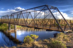 | Costilla Crossing Bridge | structure | 1985 | 85000194 |
| Denver & Rio Grande Railroad San Juan Extension (Boundary Increase) | district | 2007 | 07000374 | |
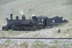 | Engine No. 463 | structure | 1975 | 75000502 |
| Garcia-Espinosa-Garland Ranch Headquarters | district | 2018 | 100003274 | |
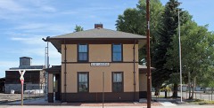 | La Jara Depot | building | 1975 | 75000503 |
| McIntire Ranch | site | 2008 | 08000204 | |
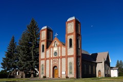 | Our Lady of Guadalupe Church | district | 2018 | 100003275 |
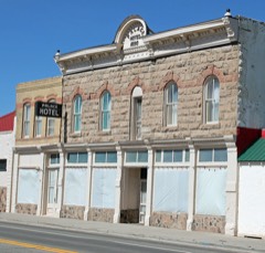 | Palace Hotel | building | 1994 | 94001013 |
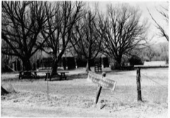 | Pike's Stockade | site | 1966 | 66000244 |
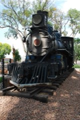 | Rio Grande Engine No. 168 | structure | 1979 | 79000601 |
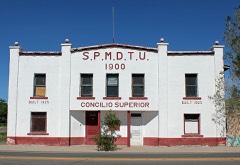 | S.P.M.D.T.U. Concilio Superior | building | 2001 | 01000322 |
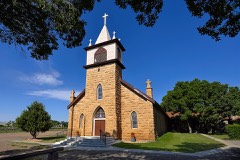 | St. Joseph's Church | district | 2018 | 100003276 |
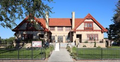 | Warshauer Mansion | building | 1974 | 74000564 |
Every wildfire the federal occurrence database records inside this county: 261 of them, burning about 3,795 acres. 92 started naturally and 14 were recorded as arson. Each settlement page carries the fires within five miles of it.
| Reported cause | Fires |
|---|---|
| Natural | 92 |
| Missing data/not specified/undetermined | 84 |
| Recreation and ceremony | 38 |
| Arson/incendiarism | 14 |
| Equipment and vehicle use | 11 |
| Smoking | 10 |
| Debris and open burning | 8 |
| Railroad operations and maintenance | 4 |
The five largest, by the area the report gives. One of them was set deliberately.
| Date | Cause | Size | Reported by | Name on the report |
|---|---|---|---|---|
| 27 October 2019 | Missing data/not specified/undetermined | 2,183 acres | Colorado State Forest Service-State Headquarters | G-18 |
| 21 April 2013 | Missing data/not specified/undetermined | 918 acres | San Luis Valley Field Office | STOCKADE |
| 29 July 1995 | Natural | 201 acres | Rio Grande National Forest | JOHN |
| 18 March 1994 | Recreation and ceremony | 80 acres | Conejos County Office | not named |
| 10 July 2011 | Equipment and vehicle use | 76 acres | San Luis Valley Field Office | MOGOTE |
| 29 March 2010 | Arson/incendiarism | 50 acres | Colorado State Forest Service-State Headquarters | not named |
| 9 May 2020 | Debris and open burning | 48 acres | Conejos County Office | MAGOTE |
| 28 May 2015 | Natural | 41 acres | Rio Grande National Forest | PIEDROSA CREEK |
Every settlement page carries the fires within five miles of it - see the settlement index below.
The NOAA Storm Events Database holds 14 reports for this county, causing no deaths, no injuries and about $25,250 in recorded property damage. Each settlement page carries the reports that name it.
| Kind of event | Reports |
|---|---|
| Hail | 8 |
| Tornado | 5 |
| Debris Flow | 1 |
The most serious of them, by death, then injury, then recorded damage. The accounts are quoted exactly as the forecast office filed them.
| When | Event | Place named | Harm | What the report says |
|---|---|---|---|---|
| July 1990 | Tornado (F0) | not stated | $25,000 | no account filed |
| June 1953 | Tornado (F2) | not stated | $250 | no account filed |
| August 2022 | Debris Flow | Mogote | - | Mud slide reported at highway 17 and county road d.5. |
| May 2021 | Tornado (EF0) | Bountiful | - | Local county Sheriff reported a tornado touch down with a few power poles snapped off and downed. |
| April 2005 | Tornado (F0) | Manassa | - | A brief tornado caused no known damage. |
| April 2005 | Tornado (F0) | Manassa | - | A brief tornado caused no known damage. |
| July 2014 | Hail | Antonito | - | no account filed |
| June 2010 | Hail | La Jara | - | no account filed |
| June 2010 | Hail | Sanford | - | no account filed |
| July 2009 | Hail | Capulin | - | no account filed |
| July 2007 | Hail | Antonito | - | no account filed |
| July 2006 | Hail | La Jara | - | no account filed |
| August 1997 | Hail | Antonito | - | no account filed |
| July 1961 | Hail | not stated | - | no account filed |
The Survey's mineral resources record lists 101 workings inside this county. 33 still produce and 68 are closed or unrecorded. Each settlement page carries the workings within five miles of it.
| Commodity | Workings |
|---|---|
| Sand and Gravel, Construction | 42 |
| Gold | 26 |
| Silver | 12 |
| Gold, Silver | 7 |
| Copper, Lead | 6 |
| Pumice | 6 |
| Silver, Gold | 4 |
| Lead, Copper | 3 |
| Copper, Lead, Silver | 3 |
| Molybdenum, Silver | 3 |
| Perlite | 3 |
| Molybdenum | 2 |
| Molybdenum, Zinc, Antimony | 2 |
| Antimony, Molybdenum, Zinc | 2 |
The least common of them first, because a county's hundredth gravel pit says nothing its first ten did not.
| Where | Site | Commodity | Status | Recorded |
|---|---|---|---|---|
| A-C Property | Aluminum, Sulfur, Sulfuric Acid, Potassium | Occurrence | 1972 | |
| Alum Creek | Molybdenum, Iron, Copper, Zinc, Lead | Occurrence | Molybdenite | |
| Apex Tunnel | Antimony | Occurrence | Vein | |
| Cliff | Gold, Copper, Iron, Silver | Past Producer | ||
| Decatur West District | Gold, Silver, Aluminum, Copper, Lead, Molybdenum, Tin, Antimony, Zinc | Past Producer | 1870, 1938 | |
| Dee Stock | Copper, Molybdenum, Lead, Zinc | Occurrence | 1971 | |
| Eurydice Shaft | Gold, Lead, Silver, Zinc, Copper | Past Producer | ||
| King Turquoise | Gemstone | Past Producer | ||
| Mammoth Revenvue Mine | Gold, Copper, Silver, Zinc | Producer | ||
| Mammoth-Revenue Mine | Gold, Silver, Lead, Copper, Antimony, Zinc, Molybdenum | Producer | Vein | |
| Merrimac Mine | Gold, Silver, Lead, Copper, Zinc, Molybdenum, Antimony | Past Producer | Vein | |
| Reynolds Tunnel | Uranium, Vanadium | Past Producer | ||
| Riverview Mine | Gold, Silver, Lead | Occurrence | Vein | |
| Unknown | Volcanic Materials | Occurrence | ||
| Ute District | Silver, Gold, Lead, Copper, Tellurium, Antimony, Molybdenum, Zinc | Producer | 1880, 1974 | |
| Valley Queen Mine | Silver, Gold, Copper, Lead, Zinc, Antimony, Molybdenum | Past Producer | Vein | |
| Copper King | Copper | Prospect | ||
| Emma Mine | Silver, Gold, Copper | Past Producer | 1881 | |
| Forest King Mine | Gold, Silver, Copper, Lead, Antimony, Molybdenum, Zinc | Past Producer | Vein | |
| Glacier Mine | Silver, Gold, Copper, Lead, Molybdenum, Zinc, Antimony | Past Producer | 1918 | |
| Lake View Claim | Gold, Silver, Copper, Lead, Molybdenum, Zinc, Antimony | Past Producer | Vein | |
| Parole Mine | Gold, Silver, Copper, Lead, Antimony, Molybdenum, Zinc | Past Producer | Vein | |
| Telluride Mtn. | Molybdenum | Occurrence | Molybdenite | |
| Trill Bird Deposit | Gold, Copper | Occurrence | 1971 | |
| Unk | Molybdenum | Prospect | ||
| Vera Breccia Pipe | Gold, Copper | Occurrence | 1971 | |
| Antonito Mill | Perlite | Producer | ||
| Congress | Gold, Copper, Lead, Silver | Past Producer | ||
| Forest King | Gold, Molybdenum, Silver | Past Producer | ||
| Gilmore | Gold, Copper, Lead, Silver | Past Producer | ||
| Johns-Manville | Perlite | Producer | ||
| Mammoth | Gold, Molybdenum, Silver | Past Producer | ||
| Merrimac | Gold, Molybdenum, Silver | Past Producer | ||
| Parole | Gold, Copper, Lead, Silver | Past Producer | ||
| Silbrico | Perlite | Producer | ||
| Capulin Deposit | Pumice | Prospect | ||
| Eurydice Mine | Gold, Silver, Copper, Lead | Past Producer | 1938 | |
| Prospect | Pumice | Prospect | ||
| Prospect | Pumice | Prospect | ||
| Unk | Pumice | Unknown | ||
| Unknown | Pumice | Occurrence | Pumice | |
| Unknown | Pumice | Producer | Pumice | |
| Glacier | Gold, Silver | Past Producer | ||
| Globe | Gold, Silver | Occurrence | ||
| Lake View | Gold, Silver | Past Producer | ||
| Mammoth | Gold, Silver | Past Producer | ||
| Platoro Project | Gold, Silver | Past Producer | ||
| Prospect | Gold, Silver | Prospect | ||
| Prospect | Gold, Silver | Prospect | ||
| Prospect | Gold, Silver | Prospect | ||
| Prospect | Gold, Silver | Prospect | ||
| Siskiyon | Gold, Silver | Past Producer | ||
| Unk | Gold, Silver | Past Producer | ||
| Valley Queen | Gold, Silver | Past Producer | ||
| Asiatic | Gold | Past Producer | ||
| Asiatic Mine | Gold | Occurrence | 1904 | |
| Decatur South District | Gold | Past Producer | 1912 | |
| Pass Me By Mine | Gold | Occurrence | 1897 | |
| Pass-Me-By | Gold | Past Producer | ||
| Unk | Sand and Gravel, Construction | Producer | ||
| Unk | Sand and Gravel, Construction | Producer | ||
| Unk | Sand and Gravel, Construction | Producer | ||
| Unk | Sand and Gravel, Construction | Producer | ||
| Unk | Sand and Gravel, Construction | Producer | ||
| Unk | Sand and Gravel, Construction | Producer | ||
| Unk | Sand and Gravel, Construction | Producer | ||
| Unk | Sand and Gravel, Construction | Producer | ||
| Unk | Sand and Gravel, Construction | Producer | ||
| Unk | Sand and Gravel, Construction | Producer | ||
| Unk | Sand and Gravel, Construction | Producer | ||
| Unk | Sand and Gravel, Construction | Producer | ||
| Unk | Sand and Gravel, Construction | Producer | ||
| Unk | Sand and Gravel, Construction | Producer | ||
| Unk | Sand and Gravel, Construction | Producer | ||
| Unk | Sand and Gravel, Construction | Producer | ||
| Unk | Sand and Gravel, Construction | Producer | ||
| Unk | Sand and Gravel, Construction | Producer | ||
| Unk | Sand and Gravel, Construction | Producer | ||
| Unk | Sand and Gravel, Construction | Producer | ||
| Unk | Sand and Gravel, Construction | Producer | ||
| Unk | Sand and Gravel, Construction | Producer | ||
| Unk | Sand and Gravel, Construction | Producer | ||
| Unk | Sand and Gravel, Construction | Producer | ||
| Unk | Sand and Gravel, Construction | Producer | ||
| Unk | Sand and Gravel, Construction | Producer | ||
| Unknown | Sand and Gravel, Construction | Occurrence | Gravel | |
| Unknown | Sand and Gravel, Construction | Occurrence | Sand and Gravel | |
| Unknown | Sand and Gravel, Construction | Occurrence | Sand and Gravel | |
| Unknown | Sand and Gravel, Construction | Occurrence | Gravel | |
| Unknown | Sand and Gravel, Construction | Occurrence | Sand and Gravel | |
| Unknown | Sand and Gravel, Construction | Occurrence | Sand and Gravel | |
| Unknown | Sand and Gravel, Construction | Occurrence | Sand and Gravel | |
| Unknown | Sand and Gravel, Construction | Occurrence | Sand and Gravel | |
| Unknown | Sand and Gravel, Construction | Occurrence | Sand and Gravel | |
| Unknown | Sand and Gravel, Construction | Occurrence | Sand and Gravel | |
| Unknown | Sand and Gravel, Construction | Occurrence | Sand and Gravel | |
| Unknown | Sand and Gravel, Construction | Occurrence | Sand and Gravel | |
| Unknown | Sand and Gravel, Construction | Occurrence | Sand and Gravel | |
| Unknown | Sand and Gravel, Construction | Occurrence | Sand and Gravel | |
| Unknown | Sand and Gravel, Construction | Occurrence | Sand and Gravel | |
| Unknown | Sand and Gravel, Construction | Occurrence | Sand and Gravel |
Named settlements recorded in the Geographic Names Information System, each with the topographic sheets covering it. Villages, hamlets and abandoned places alike. Each is shown with the nearest named watercourse or landform and the survey quadrangle it falls on.
West Conejos census division · 81120 · Near Neff Mountain · Cumbres quadrangle
21 sheets, 1922 to 2001
West Conejos census division · 81120 · On Fox Creek · Fox Creek quadrangle
19 sheets, 1922 to 2001
West Conejos census division · 81120 · On Osier Creek · Osier quadrangle
19 sheets, 1922 to 1985
West Conejos census division · 81120 · Near Sawmill Gulch · Platoro quadrangle
23 sheets, 1913 to 2001