 Block
From the record
13 National Register listings published here.
Sources: the National Register database, National Park Service
55 topographic sheets cover 18 settlements here, and 13 properties are on the National Register of Historic Places.
13 National Register listings published here.
Sources: the National Register database, National Park Service
Every property in this county listed on the National Register of Historic Places, with the year it was listed and the federal nomination document.
| Photograph | Property | Type | Listed | Reference |
|---|---|---|---|---|
| "Sierras y Colores" Mural | object | 2023 | 100009205 | |
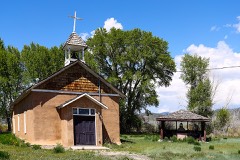 | Capilla de San Isidro | building | 2013 | 13000523 |
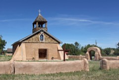 | Capilla de Viejo San Acacio | building | 2012 | 12000091 |
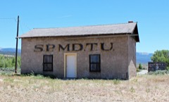 | Chama Sociedad Proteccion Mutua de Trabajadores Unidos (SPMDTU) Lodge Hall | building | 2018 | 100003273 |
| Fort Garland | district | 1970 | 70000156 | |
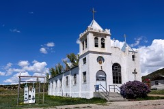 | Iglesia de San Francisco de Assisi | building | 2012 | 12000144 |
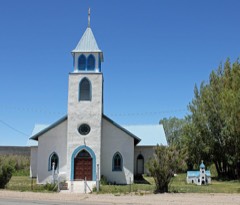 | Iglesia de San Pedro y San Pablo | building | 2012 | 12000090 |
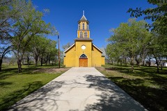 | Iglesia de la Inmaculada Concepcion | building | 2012 | 12000089 |
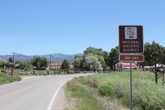 | Plaza de San Luis de la Culebra | district | 1978 | 78000837 |
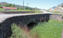 | Rito Seco Creek Culvert | structure | 2002 | 02001146 |
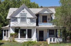 | A.A. Salazar House | building | 1998 | 97001281 |
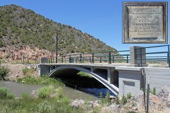 | San Luis Bridge | structure | 1985 | 85000195 |
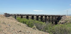 | San Luis Southern Railway Trestle | structure | 2004 | 03001361 |
Every wildfire the federal occurrence database records inside this county: 48 of them, burning about 121,912 acres. 3 started naturally and 8 were recorded as arson. Each settlement page carries the fires within five miles of it.
| Reported cause | Fires |
|---|---|
| Recreation and ceremony | 15 |
| Missing data/not specified/undetermined | 8 |
| Arson/incendiarism | 8 |
| Debris and open burning | 5 |
| Smoking | 5 |
| Natural | 3 |
| Equipment and vehicle use | 2 |
| Misuse of fire by a minor | 1 |
| Railroad operations and maintenance | 1 |
The five largest, by the area the report gives. One of them was set deliberately.
| Date | Cause | Size | Reported by | Name on the report |
|---|---|---|---|---|
| 26 June 2018 | Arson/incendiarism | 107,995 acres | Pike and San Isabel National Forest | SPRING CREEK |
| 18 June 2006 | Natural | 13,820 acres | Pueblo Interagency Dispatch Center | MATO VEGA |
| 24 March 2020 | Debris and open burning | 67 acres | Costilla County Fire Protection District | N/A |
| 9 July 2019 | Recreation and ceremony | 10 acres | Rio Grande National Forest | TOBIN |
| 26 April 1993 | Recreation and ceremony | 3.0 acres | Costilla County Fire Protection District | not named |
| 12 April 1993 | Smoking | 3.0 acres | Costilla County Fire Protection District | not named |
| 28 April 1993 | Recreation and ceremony | 3.0 acres | Costilla County Fire Protection District | not named |
| 22 April 1993 | Recreation and ceremony | 2.0 acres | Costilla County Fire Protection District | not named |
Every settlement page carries the fires within five miles of it - see the settlement index below.
The NOAA Storm Events Database holds 24 reports for this county, causing no deaths, no injuries and about $640,000 in recorded property damage. Each settlement page carries the reports that name it.
| Kind of event | Reports |
|---|---|
| Flash Flood | 10 |
| Tornado | 7 |
| Hail | 6 |
| Heavy Rain | 1 |
The most serious of them, by death, then injury, then recorded damage. The accounts are quoted exactly as the forecast office filed them.
| When | Event | Place named | Harm | What the report says |
|---|---|---|---|---|
| August 1996 | Hail | San Luis | $450,000 | no account filed |
| September 2019 | Flash Flood | La Veta Pass | $150,000 | Costillo County Emergency Manager reported flash flood and rock slide in Forbes Park, CO off the spring burn scar. Several dozen 36 inch boulders moved down the hill and a newly built retention pond was nearly blown out by the force of the water. 15-20 tons of sediment now fill the new pond. |
| August 2009 | Flash Flood | San Luis | $30,000 | The San Luis Peoples Ditch had two breaches, flooding two properties. Some house experience flooding of basements and crawl spaces. Several county roads were washed out. |
| June 1995 | Hail | North of San Luis | $5,000 | Hail collected on Highway 159 and caused vehicles to slide into each other. Plows had to clear the roadway. |
| July 1970 | Tornado (F0) | not stated | $2,500 | no account filed |
| July 1955 | Tornado (F3) | not stated | $2,500 | no account filed |
| July 2022 | Flash Flood | Chama | - | Flooding along County Road R and the San Luis Peoples ditch near San Luis. |
| July 2021 | Flash Flood | Ft Garland | - | Flash flooding occurred at County lane 6 and Jauvez road in Ft. Garland. Significant torrents of water carved out the road in places. |
| July 2021 | Heavy Rain | Ft Garland | - | Heavy rainfall of 1.75 inches. |
| June 2021 | Tornado (EFU) | Blanca | - | Brief landspout tornado. |
| July 2020 | Flash Flood | Ft Garland | - | Video sent to the EM from a person who lives at this location shows heavy flows off of Bear Creek and Indian Creek. |
| July 2020 | Flash Flood | Blanca | - | A few county roads were washed out due to heavy rains from thunderstorms in Blanca, CO. |
| July 2019 | Flash Flood | La Veta Pass | - | Wagon creek has risen out of its banks and is impacting parts of Forbes Park Road at this time, per county EM. |
| July 2019 | Flash Flood | La Veta Pass | - | Culvert that runs under US Hwy 160 has been topped and now water is running across road surface. |
| July 2019 | Flash Flood | La Veta Pass | - | Costilla County Emergency Manager reported some of the railroad tracks for the Rio Grande Scenic Rail Road have been washed out near Fir. |
| July 2009 | Flash Flood | Ft Garland | - | A thunderstorm produced intense rainfall which caused flash flooding and a mudslide just east of Fort Garland, closing or restricting travel on US Highway 160 for over two hours. |
| June 2006 | Tornado (F0) | Ft Garland | - | Tornado caused no known damage over open country. |
| June 1995 | Tornado (F0) | Blanca | - | Tornado with condensation funnel just off the ground. The tornado was in open country and caused no known damage. |
| July 1994 | Tornado (F0) | San Acacio | - | The Colorado State Patrol reported a brief tornado touchdown in an open field west of San Acacio (19 miles southeast of Alamosa). No damage or injuries was reported. |
| May 2008 | Hail | San Luis | - | no account filed |
| June 2005 | Hail | Ft Garland | - | no account filed |
| July 1997 | Hail | Ft Garland | - | no account filed |
| May 1980 | Tornado (F1) | not stated | - | no account filed |
| May 1959 | Hail | not stated | - | no account filed |
The Survey's mineral resources record lists 50 workings inside this county. 2 still produce and 48 are closed or unrecorded. Each settlement page carries the workings within five miles of it.
| Commodity | Workings |
|---|---|
| Gold | 24 |
| Silver | 17 |
| Gold, Silver | 10 |
| Copper | 7 |
| Iron | 4 |
| Tellurium | 4 |
| Silver, Gold | 2 |
| Uranium | 1 |
| Silver, Copper | 1 |
| Vanadium | 1 |
| Gold, Copper, Lead, Silver | 1 |
| Copper, Silver | 1 |
| Stone | 1 |
| Bismuth, Lead, Tellurium | 1 |
The least common of them first, because a county's hundredth gravel pit says nothing its first ten did not.
| Where | Site | Commodity | Status | Recorded |
|---|---|---|---|---|
| Blanca District | Tungsten, Gold, Silver, Molybdenum, Copper | Past Producer | vein | |
| El Plomo Mine | Gold, Silver, Lead | Past Producer | 1946 | |
| El Plomo District | Gold, Silver, Lead, Copper, Zinc, Molybdenum | Past Producer | ||
| Hamilton Mine | Gold, Silver, Bismuth, Lead, Tellurium | Prospect | Vein | |
| Jake & Hank Quarry | Stone | Producer | Scoria | |
| Loco Alice Prospect | Uranium, Silver, Copper, Vanadium | Prospect | Carnotite, Jarosite, Malachite, Volborthite | |
| San Acacio | Sand and Gravel, Construction | Producer | ||
| San Luis Mine | Gold, Silver, Copper, Lead, Molybdenum, Zinc | Past Producer | 1890, 1991 | |
| Sunnyside Tunnel | Gold, Silver, Lead, Copper | Past Producer | Galena, Pyrite | |
| Unnamed Prospect | Gold, Copper, Lead, Silver | Prospect | Anglesite, Galena | |
| Unnamed Prospect | Silver, Lead, Copper, Gold | Prospect | Anglesite, Galena | |
| Unnamed Prospect | Copper, Gold, Silver, Lead | Prospect | Anglesite, Galena | |
| X. T. C. Claim | Copper, Silver | Prospect | Chalcocite, Chalcopyrite | |
| unnamed prospect | Copper, Gold, Silver, Zinc | Past Producer | flat vein | |
| John Moore and Lucky Claims | Iron, Silver, Gold | Past Producer | Replacement | |
| Lone Star of the West Mine | Copper, Silver, Gold | Past Producer | Chalcocite, Chalcopyrite | |
| Giant Gulch Placer | Gold, Tellurium | Past Producer | 1909 | |
| Gold Anchor Mine | Gold, Silver, Tellurium | Prospect | 1898 | |
| Last Chance Placer | Gold, Tellurium | Past Producer | 1936 | |
| Lower Star of the West Mine | Iron, Gold, Silver | Past Producer | Replacement | |
| Star of the West Mine | Iron, Gold, Silver, Copper | Past Producer | 1877, 1883 | |
| Upper Star of the West Mine | Iron, Gold, Silver | Past Producer | 1881, 1883 | |
| Willow Gulch Placer | Gold, Tellurium | Past Producer | Placer | |
| Blue Bird Mine | Copper, Silver | Prospect | Chalcocite, Chalcopyrite | |
| Copper Queen Mine | Copper, Silver | Prospect | Chalcocite, Chalcopyrite | |
| Hub Hall Claim | Copper | Occurrence | Vein | |
| Rico Claims | Copper, Silver | Prospect | vein | |
| Silver Tip Mine | Copper, Silver | Past Producer | Chalcocite, Chalcopyrite | |
| Blanca Mutual Mining and Milling Co. Claims | Gold, Silver | Past Producer | 1898 | |
| Blanca Peak Mining Co. Claims | Gold, Silver | Prospect | Vein | |
| Homestake Tunnel | Gold, Silver | Prospect | Pyrite | |
| Midnight Sun | Gold, Silver | Prospect | Vein | |
| Climax Tunnel | Gold, Silver | Prospect | Gold, Silver | |
| Copper King Claim | Gold, Silver | Prospect | ||
| Excelsior Tunnel | Silver, Gold | Prospect | vein | |
| Hidden Treasure Claim | Gold, Silver | Prospect | Vein | |
| Lizzie G. Group | Gold, Silver | Prospect | ||
| Mamarth Claim | Gold, Silver | Prospect | fissure vein | |
| Merrimac Claim | Gold, Silver | Occurrence | ||
| Millie G. Claim | Gold, Silver | Prospect | Underground | |
| Monte Christo Mine | Gold, Silver | Past Producer | Vein | |
| Paul H. and Daisy Claims | Gold, Silver | Prospect | ||
| Rock and Rye Claim | Gold, Silver | Prospect | ||
| Badger State Placers 1-5 | Gold | Past Producer | 1898 | |
| Denver Placers 6-8 | Gold | Past Producer | 1910, 1911 | |
| Magnolia Group | Gold | Prospect | ||
| Mountain View Mine | Gold | Past Producer | breccia pipe | |
| Otero Placers 1 and 2 | Gold | Past Producer | Placer | |
| Placer | Gold | Past Producer | placer | |
| Spanish Basin Placer Co. Claims | Gold | Past Producer | Placer |
Named settlements recorded in the Geographic Names Information System, each with the topographic sheets covering it. Villages, hamlets and abandoned places alike. Each is shown with the nearest named watercourse or landform and the survey quadrangle it falls on.
San Luis census division · 81152 · On Vallejos Creek · San Luis quadrangle
12 sheets, 1954 to 1988
Blanca census division · 81133 · On West Indian Creek · Trinchera Ranch quadrangle
11 sheets, 1954 to 1988
No longer a settlement
San Luis census division · 81152 · On San Francisco Creek · San Luis quadrangle
12 sheets, 1954 to 1988
Blanca census division · 81133 · On Placer Creek · Russell quadrangle
17 sheets, 1889 to 1988
San Luis census division · 81152 · On Rito Seco · San Luis quadrangle
12 sheets, 1954 to 1988
San Luis census division · 81152 · On Vallejos Creek · San Luis quadrangle
12 sheets, 1954 to 1988
San Luis census division · 81152 · On Vallejos Creek · San Luis quadrangle
12 sheets, 1954 to 1988
The vanished settlements of Costilla County: the places named above that are no longer on the map.