 Block
From the record
7 National Register listings published here.
Sources: the National Register database, National Park Service
44 topographic sheets cover 10 settlements here, and 7 properties are on the National Register of Historic Places.
7 National Register listings published here.
Sources: the National Register database, National Park Service
Every property in this county listed on the National Register of Historic Places, with the year it was listed and the federal nomination document.
| Photograph | Property | Type | Listed | Reference |
|---|---|---|---|---|
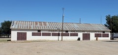 | American Legion Hall | building | 2007 | 07001248 |
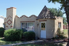 | Crow-Hightower House | building | 2013 | 13000605 |
 | Eads Community Church | building | 2013 | 13000606 |
 | Eads School Gymnasium | building | 2013 | 13000607 |
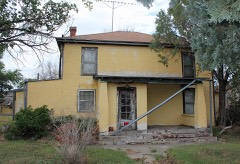 | Hotel Holly-Haswell Hotel | district | 2013 | 13000608 |
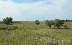 | Sand Creek Massacre Site | site | 2001 | 01001055 |
| Sand Creek Massacre Site (Boundary Increase) | site | 2016 | 16000637 |
Every wildfire the federal occurrence database records inside this county: 43 of them, burning about 20,306 acres. 5 started naturally and none was recorded as arson. Each settlement page carries the fires within five miles of it.
| Reported cause | Fires |
|---|---|
| Missing data/not specified/undetermined | 31 |
| Natural | 5 |
| Debris and open burning | 4 |
| Recreation and ceremony | 2 |
| Equipment and vehicle use | 1 |
The five largest, by the area the report gives. None of them was recorded as arson.
| Date | Cause | Size | Reported by | Name on the report |
|---|---|---|---|---|
| 18 April 2000 | Missing data/not specified/undetermined | 16,000 acres | Pueblo County | KIOWA COUNTY |
| 13 June 2020 | Natural | 1,336 acres | Kiowa Fire Protection District | N/A |
| 15 June 2020 | Missing data/not specified/undetermined | 1,199 acres | Kiowa County | COUNTY RD T |
| 17 July 2016 | Natural | 743 acres | Kiowa County | RUSH CREEK |
| 17 July 2016 | Natural | 455 acres | Kiowa County | BIG SANDY |
| 6 August 2010 | Missing data/not specified/undetermined | 200 acres | Colorado State Forest Service-State Headquarters | not named |
| 21 November 2005 | Missing data/not specified/undetermined | 200 acres | Colorado State Forest Service-State Headquarters | not named |
| 18 August 1993 | Natural | 142 acres | Royal Gorge Field Office | CHIVINGTON |
Every settlement page carries the fires within five miles of it - see the settlement index below.
The NOAA Storm Events Database holds 500 reports for this county, causing no deaths, 5 injuries and about $841,090 in recorded property damage. Each settlement page carries the reports that name it.
| Kind of event | Reports |
|---|---|
| Hail | 323 |
| Tornado | 92 |
| Thunderstorm Wind | 60 |
| Flash Flood | 10 |
| Funnel Cloud | 7 |
| Heavy Rain | 6 |
| Wildfire | 1 |
| Lightning | 1 |
The most serious of them, by death, then injury, then recorded damage. The accounts are quoted exactly as the forecast office filed them.
| When | Event | Place named | Harm | What the report says |
|---|---|---|---|---|
| May 2016 | Thunderstorm Wind | Eads | 3 hurt, $10,000 | Three semi-trailers were blown over on US Highway between 1 and 3 miles north of Eads. |
| April 2012 | Tornado (EF1) | Chivington | 1 hurt, $40,000 | Power poles just south of Chivington were downed...and a mobile home was destroyed and a church was damaged. |
| May 1978 | Tornado (F1) | not stated | 1 hurt, $2,500 | no account filed |
| May 1975 | Tornado (F2) | not stated | $250,000 | no account filed |
| October 1971 | Tornado (F3) | not stated | $250,000 | no account filed |
| May 2012 | Lightning | Brandon | $50,000 | Lightning struck a local oil company's holding tanks, igniting 350 barrels holding 15,000 gallons. |
| September 2000 | Tornado (F1) | Sheridan Lake | $50,000 | A tornado destroyed a small, poorly constructed mobile home and damaged some nearby grain bins on the far north side of Sheridan Lake. Some windows were also broken and shingles were ripped off houses. The tornado moved east-southeast through open country of Kiowa county and dissipated near the Colorado-Kansas border. |
| April 2012 | Tornado (EF2) | Chivington | $30,000 | A tornado destroyed an unoccupied mobile home and a garage. |
| June 1990 | Tornado (F0) | not stated | $25,000 | no account filed |
| May 1989 | Tornado (F1) | not stated | $25,000 | no account filed |
| May 1982 | Tornado (F2) | not stated | $25,000 | no account filed |
| July 2016 | Hail | Sheridan Lake | $20,000 | The hail broke windows and caused other damage at and near the Plainview School. |
| July 2016 | Thunderstorm Wind | Sheridan Lake | $10,000 | A hog farm sustained damage to the roofs on four buildings. |
| May 2010 | Tornado (EF0) | Chivington | $10,000 | A tornado occurred over a rural area, taking down one power pole, flipping a center pivot irrigation system, and damaging an abandon farm house. |
| March 2007 | Tornado (EF2) | Towner | $10,000 | The Prowers County tornado crossed into Kiowa County and traveled another 11 miles...destroying electrical transmission poles (EF2 damage). The tornado did not hit any other structures in Kiowa County. |
| August 2004 | Tornado (F0) | Arlington | $10,000 | Around Blue Lakes Reservoir...three tornadoes were observed in close proximity. One of these tornados hit a camper and destroying it. |
| June 2011 | Thunderstorm Wind | Eads | $7,000 | Numerous powers poles knocked down. |
| May 2015 | Tornado (EF0) | Chivington | $3,000 | A large tornado moved over mostly open country caused some damage to fencing...and then moved in Cheyenne County. |
| July 1982 | Tornado (F1) | not stated | $2,500 | no account filed |
| July 1978 | Tornado (F0) | not stated | $2,500 | no account filed |
| May 2016 | Thunderstorm Wind | Haswell | $2,000 | Windows broken in a house due to hail and winds. |
| June 2012 | Thunderstorm Wind | Brandon | $2,000 | A power pole was snapped at mile marker 182 on State Highway 96. |
| March 2007 | Tornado (EF1) | Towner | $2,000 | A second tornado developed from the same supercell that spawned the Holly tornado. It destroyed four electrical transmission poles on State Highway 96...east of Towner...and then moved through a rural area...before crossing into Greeley County Kansas. |
| May 2016 | Thunderstorm Wind | Eads | $1,000 | Slight roof damage to a house. |
| April 2010 | Tornado (EF1) | Eads | $1,000 | Tornado occurred over open country, but totally destroyed a small storage barn 10.3 miles southwest of Eads. Debris from the barn was carried as far as 1500 feet to the north-northeast. |
| March 1980 | Tornado (F1) | not stated | $250 | no account filed |
| July 1967 | Tornado (F1) | not stated | $250 | no account filed |
| June 1983 | Tornado (F1) | not stated | $30 | no account filed |
| July 1982 | Tornado (F1) | not stated | $30 | no account filed |
| July 1958 | Tornado | not stated | $30 | no account filed |
| April 2025 | Hail | Eads | - | Images Shared From Emergency Management Of Large Hail. |
| May 2025 | Hail | Brandon | - | Hail up to 1.5 inches fell in parts of central Kiowa County from an isolated supercell. |
| May 2025 | Hail | Brandon | - | Hail up to 1.25 inches fell in parts of central Kiowa County from an isolated supercell. |
| April 2025 | Hail | Chivington | - | There was 1.5 inch hail measured. |
| August 2025 | Hail | Eads | - | Hail measured to 1.5 inches occurred in south central Kiowa County. |
| May 2024 | Hail | Eads | - | A CoCoRaHS source reported hail of 1 inch in diameter. |
| July 2024 | Hail | Sheridan Lake | - | Hail measured to 1 inch fell south of Sheridan Lake. |
| May 2023 | Tornado (EFU) | Eads | - | Brief ground circulation beneath funnel cloud. |
| July 2023 | Tornado (EFU) | Haswell | - | Photo of brief anticyclonic tornado. |
| June 2023 | Thunderstorm Wind | Eads | - | Power poles snapped. |
| July 2022 | Heavy Rain | Haswell | - | Heavy rainfall of 1.64 inches. |
| July 2022 | Heavy Rain | Towner | - | Heavy rainfall of 1.14 inches. |
| July 2022 | Heavy Rain | Eads | - | Heavy rainfall of 2.3 inches. |
| July 2022 | Heavy Rain | Brandon | - | Heavy rainfall of 2.47 inches. Some hail was mixed in with the rain. |
| June 2022 | Hail | Brandon | - | Spotter reported numerous 1 to 1.5 inch hailstones. |
| March 2021 | Heavy Rain | Towner | - | Heavy rain of 2.25 inches. |
| March 2021 | Heavy Rain | Eads | - | Heavy rain of 1.54 inches. |
| July 2021 | Thunderstorm Wind | Brandon | - | Multiple grain augers were blown over. Severe crop damage was observed. Two grain bins were destroyed with damage to three others. |
| July 2021 | Thunderstorm Wind | Towner | - | A garage was destroyed. There were also 33 broken telephone poles on Highway 96 around the town of Towner. |
| July 2021 | Thunderstorm Wind | Sheridan Lake | - | A well built outbuilding was blown down, multiple power poles down, multiple trees uprooted and snapped, and an RV was rolled over. |
| July 2021 | Thunderstorm Wind | Brandon | - | Winds were estimated at 40 to 60 mph with blowing dust. |
| June 2021 | Thunderstorm Wind | Sheridan Lake | - | An RV was blown over by thunderstorm outflow. Visibility was also near zero because of blowing dust. |
| May 2021 | Flash Flood | Sheridan Lake | - | Flooding of fields, and road side ditches. |
| July 2020 | Hail | Eads | - | Eleven miles west northwest of Eads. 0.40 inches of water. |
| July 2020 | Hail | Brandon | - | Nine miles north of Brandon, 1.75 inch hail. |
| June 2020 | Hail | Brandon | - | Large hail to 1.75 inches. |
| June 2020 | Hail | Eads | - | Public report of 1 inch hail. |
| May 2019 | Hail | Eads | - | Large hail reported by storm chaser south of Eads, CO. |
| May 2019 | Hail | Eads | - | Large hail reported by Kiowa County Emergency Manager in Eads, CO. |
| May 2019 | Hail | Eads | - | Large hail reported by storm chaser south of Eads, CO. |
The Survey's mineral resources record lists 29 workings inside this county. None of them still produces: all are closed or unrecorded. Each settlement page carries the workings within five miles of it.
| Commodity | Workings |
|---|---|
| Sand and Gravel, Construction | 29 |
The least common of them first, because a county's hundredth gravel pit says nothing its first ten did not.
| Where | Site | Commodity | Status | Recorded |
|---|---|---|---|---|
| Eads Ready Mix | Sand and Gravel, Construction | Unknown | ||
| Eads Ready Mix | Sand and Gravel, Construction | Unknown | ||
| Unk | Sand and Gravel, Construction | Unknown | ||
| Unk | Sand and Gravel, Construction | Unknown | ||
| Unk | Sand and Gravel, Construction | Unknown | ||
| Unk | Sand and Gravel, Construction | Unknown | ||
| Unk | Sand and Gravel, Construction | Unknown | ||
| Unk | Sand and Gravel, Construction | Unknown | ||
| Unk | Sand and Gravel, Construction | Unknown | ||
| Unk | Sand and Gravel, Construction | Unknown | ||
| Unk | Sand and Gravel, Construction | Unknown | ||
| Unk | Sand and Gravel, Construction | Unknown | ||
| Unk | Sand and Gravel, Construction | Unknown | ||
| Unk | Sand and Gravel, Construction | Unknown | ||
| Unk | Sand and Gravel, Construction | Unknown | ||
| Unknown | Sand and Gravel, Construction | Occurrence | Gravel | |
| Unknown | Sand and Gravel, Construction | Occurrence | Gravel | |
| Unknown | Sand and Gravel, Construction | Occurrence | Gravel | |
| Unknown | Sand and Gravel, Construction | Occurrence | Gravel | |
| Unknown | Sand and Gravel, Construction | Occurrence | Gravel | |
| Unknown | Sand and Gravel, Construction | Occurrence | Gravel | |
| Unknown | Sand and Gravel, Construction | Occurrence | Gravel | |
| Unknown | Sand and Gravel, Construction | Occurrence | Gravel | |
| Unknown | Sand and Gravel, Construction | Occurrence | Gravel | |
| Unknown | Sand and Gravel, Construction | Occurrence | Gravel | |
| Unknown | Sand and Gravel, Construction | Occurrence | Gravel | |
| Unknown | Sand and Gravel, Construction | Occurrence | Gravel | |
| Unknown | Sand and Gravel, Construction | Occurrence | Gravel | |
| Unknown | Sand and Gravel, Construction | Occurrence | Gravel |
Named settlements recorded in the Geographic Names Information System, each with the topographic sheets covering it. Villages, hamlets and abandoned places alike. Each is shown with the nearest named watercourse or landform and the survey quadrangle it falls on.
Haswell census division · 81021 · On Johns Creek · Arlington quadrangle
13 sheets, 1891 to 1981
Sheridan Lake census division · 81071 · Sheridan Lake quadrangle
14 sheets, 1890 to 1988