 Block
From the record
13 National Register listings published here.
Sources: the National Register database, National Park Service
70 topographic sheets cover 19 settlements here, and 13 properties are on the National Register of Historic Places.
13 National Register listings published here.
Sources: the National Register database, National Park Service
Every property in this county listed on the National Register of Historic Places, with the year it was listed and the federal nomination document.
| Photograph | Property | Type | Listed | Reference |
|---|---|---|---|---|
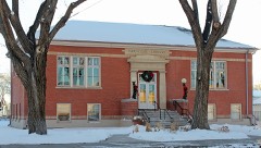 | Carnegie Library | building | 1995 | 95000439 |
| Central School Auditorium and Gymnasium | building | 1996 | 96000274 | |
| Creede Branch, Denver and Rio Grande Railroad | district | 2002 | 02001408 | |
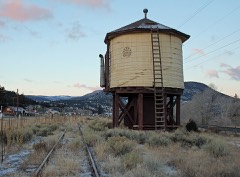 | Denver & Rio Grande Railroad South Fork Water Tank | structure | 2002 | 02001132 |
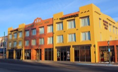 | El Monte Hotel | building | 1990 | 90000870 |
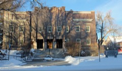 | First Methodist Episcopal Church | building | 2003 | 03001011 |
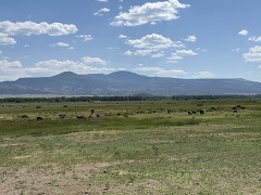 | Keck Homestead | building | 1998 | 98000437 |
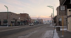 | Monte Vista Downtown Historic District | district | 1991 | 91001612 |
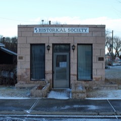 | Monte Vista Library | building | 1995 | 95000782 |
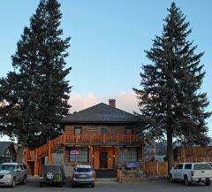 | Spruce Lodge | building | 2008 | 08001009 |
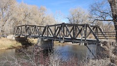 | Sutherland Bridge | structure | 1985 | 85000234 |
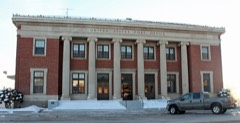 | US Post Office and Federal Building-Monte Vista Main | building | 1986 | 86000182 |
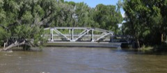 | Wheeler Bridge | structure | 1985 | 85000235 |
Every wildfire the federal occurrence database records inside this county: 258 of them, burning about 9,696 acres. 75 started naturally and 16 were recorded as arson. Each settlement page carries the fires within five miles of it.
| Reported cause | Fires |
|---|---|
| Missing data/not specified/undetermined | 97 |
| Natural | 75 |
| Recreation and ceremony | 43 |
| Arson/incendiarism | 16 |
| Smoking | 9 |
| Equipment and vehicle use | 6 |
| Debris and open burning | 5 |
| Power generation/transmission/distribution | 3 |
| Misuse of fire by a minor | 3 |
| Fireworks | 1 |
The five largest, by the area the report gives. None of them was recorded as arson.
| Date | Cause | Size | Reported by | Name on the report |
|---|---|---|---|---|
| 19 June 2002 | Missing data/not specified/undetermined | 9,294 acres | Rio Grande National Forest | MILLION |
| 18 April 2011 | Missing data/not specified/undetermined | 120 acres | Colorado State Forest Service-State Headquarters | DEL NORTE |
| 4 April 2007 | Natural | 51 acres | Monte Vista National Wildlife Refuge | UNIT 7 |
| 13 March 2000 | Debris and open burning | 30 acres | Rio Grande National Forest | RIO GRANDE CO ASSIST |
| 18 April 2011 | Missing data/not specified/undetermined | 25 acres | Colorado State Forest Service-State Headquarters | SOUTH FORK |
| 3 April 2005 | Missing data/not specified/undetermined | 20 acres | CSFS-Alamosa District | not named |
| 10 April 1993 | Recreation and ceremony | 15 acres | Rio Grande County | not named |
| 9 August 2009 | Natural | 9.0 acres | Rio Grande National Forest | HANDKERCHIEF MESA |
Every settlement page carries the fires within five miles of it - see the settlement index below.
The NOAA Storm Events Database holds 35 reports for this county, causing no deaths, no injuries and about $22,013,000 in recorded property damage. Each settlement page carries the reports that name it.
| Kind of event | Reports |
|---|---|
| Hail | 21 |
| Heavy Rain | 4 |
| Thunderstorm Wind | 3 |
| Tornado | 2 |
| Wildfire | 2 |
| Flash Flood | 2 |
| Funnel Cloud | 1 |
The most serious of them, by death, then injury, then recorded damage. The accounts are quoted exactly as the forecast office filed them.
| When | Event | Place named | Harm | What the report says |
|---|---|---|---|---|
| July 2002 | Wildfire | South Fork | $11,000,000 | no account filed |
| June 2002 | Wildfire | South Fork | $11,000,000 | no account filed |
| September 2012 | Tornado (EF0) | Del Norte | $5,000 | A strong storm produced a non-mesocyclone (landspout) tornado just south of Del Norte. There was minor damage to several properties...including one property which sustained damage to a camper and minor structural damage to the house. |
| July 1994 | Hail | South Fork | $5,000 | A spotter reported marble-size hail caused damage to homes east of South Fork (38 miles west northwest of Alamosa), and stripped leaves off of trees. |
| June 1995 | Tornado (F0) | Monte Vista | $3,000 | Tornado moved haying machine and knocked over a towed camper on Highway 15. |
| August 2024 | Hail | Monte Vista | - | A trained spotter reported hail of 0.88 inches in diameter. |
| August 2024 | Hail | Monte Vista | - | A public report via CoCoRaHS reported hail of 0.75 inches in diameter. |
| August 2024 | Heavy Rain | Monte Vista | - | A COOP Observer reported 0.87 inches of rain, which fell in a short period of time and was produced by a strong thunderstorm. |
| October 2022 | Heavy Rain | South Fork | - | Heavy rainfall of 1.17 inches. |
| October 2022 | Heavy Rain | Del Norte | - | Heavy rainfall of 1.19 inches. |
| October 2022 | Heavy Rain | Del Norte | - | Heavy rainfall of 1.07 inches. |
| August 2003 | Flash Flood | South Fork | - | Heavy thunderstorm rains caused Beaver Creek road...Mill Creek road and some secondary roads to be closed due to water. Mud and debris flowed across the roads inundated drainage ditches in and near the Million Burn scar. |
| August 2003 | Flash Flood | South Fork | - | Heavy thunderstorm rains caused Beaver Creek road...Escondida road and Skyline road to close due to high water and mud and ash flows. |
| June 1995 | Hail | Center | - | The barley and potato crop sustained extensive damage in a 12- by 3-mile swath from a portion of southern Saguache County to northern Rio Grande County from the Gunbarrell Station to Rio Grande County's mile road. |
| July 2012 | Hail | South Fork | - | no account filed |
| May 2008 | Hail | Monte Vista | - | no account filed |
| July 2006 | Hail | South Fork | - | no account filed |
| June 2004 | Hail | Del Norte | - | no account filed |
| April 2002 | Funnel Cloud | Del Norte | - | no account filed |
| June 2000 | Hail | Del Norte | - | no account filed |
| September 2000 | Hail | South Fork | - | no account filed |
| June 1999 | Hail | Del Norte | - | no account filed |
| June 1999 | Hail | Monte Vista | - | no account filed |
| September 1998 | Hail | Del Norte | - | no account filed |
| July 1998 | Hail | Del Norte | - | no account filed |
| April 1990 | Thunderstorm Wind | not stated | - | no account filed |
| September 1986 | Hail | not stated | - | no account filed |
| April 1981 | Thunderstorm Wind | not stated | - | no account filed |
| April 1977 | Hail | not stated | - | no account filed |
| August 1973 | Hail | not stated | - | no account filed |
| August 1973 | Thunderstorm Wind | not stated | - | no account filed |
| July 1971 | Hail | not stated | - | no account filed |
| July 1967 | Hail | not stated | - | no account filed |
| September 1960 | Hail | not stated | - | no account filed |
| July 1955 | Hail | not stated | - | no account filed |
The Survey's mineral resources record lists 123 workings inside this county. 4 still produce and 119 are closed or unrecorded. Each settlement page carries the workings within five miles of it.
| Commodity | Workings |
|---|---|
| Sand and Gravel, Construction | 52 |
| Copper | 23 |
| Gold, Silver | 21 |
| Gold | 20 |
| Silver | 8 |
| Pumice | 4 |
| Zinc | 3 |
| Aluminum | 3 |
| Volcanic Materials | 2 |
| Silver, Gold | 2 |
| Perlite | 2 |
| Stone | 2 |
| Asbestos | 2 |
| Copper, Lead, Silver | 2 |
The least common of them first, because a county's hundredth gravel pit says nothing its first ten did not.
| Where | Site | Commodity | Status | Recorded |
|---|---|---|---|---|
| Alum Creek Property | Copper, Molybdenum | Occurrence | Galena, Molybdenite, Sphalerite | |
| Decatur Ne District | Gold, Lead, Silver, Copper, Aluminum, Asbestos, Zinc | Producer | 1870, 1874, 1939 | |
| Golconda Mine | Gold, Silver, Copper, Lead | Past Producer | Galena, Sphalerite | |
| Guadaloupe Claims Group | Silver, Copper, Gold, Iron, Zinc, Lead | Unknown | ||
| Guadaloupe Mine | Gold, Silver, Lead, Copper, Zinc | Past Producer | 1875, 1930 | |
| Ida Tunnel | Gold, Silver, Copper | Past Producer | ||
| Lady Bug Mine | Silver, Zinc, Lead, Gold, Copper, Cadmium, Bismuth | Occurrence | 1896 | |
| Lady Bug Mine | Silver, Gallium, Indium, Lead, Zinc | Past Producer | ||
| Little Annie | Gold, Copper, Silver, Lead | Past Producer | ||
| Marble Mountain Deposit | Aluminum, Potassium | Occurrence | 1915 | |
| Miser Mine | Lead, Copper, Gold, Silver, Zinc | Past Producer | 1875, 1930 | |
| Shaws Spring | Geothermal | Producer | ||
| Spiegel | Iron | Past Producer | ||
| Summitville District | Silver, Lead, Copper, Gold, Aluminum, Molybdenum, Zinc | Past Producer | 1870, 1971 | |
| Summitville Mine | Silver, Gold, Copper, Lead, Zinc | Producer | 1971 | |
| Treasure Comstock Group | Copper, Lead, Gold | Occurrence | Chalcopyrite | |
| Unnamed Prospect | Silver, Copper, Lead | Occurrence | Pyrite | |
| Aztec Tunnel | Gold, Copper, Lead, Silver | Past Producer | ||
| Bobcat | Gold, Copper, Lead, Silver | Past Producer | ||
| Iowa Mine | Silver, Gold, Copper | Past Producer | 1882 | |
| Jasper | Asbestos, Gold | Occurrence | ||
| Perry Mine | Silver, Gold | Past Producer | 1874, 1875 | |
| St Christopher Perlite | Perlite | Unknown | ||
| St. Christopher Perlite No. 1,2,3 | Perlite | Occurrence | ||
| Unk | Stone | Unknown | ||
| Unk | Stone | Unknown | ||
| Unk | Asbestos | Unknown | ||
| Unknown | Volcanic Materials | Occurrence | ||
| Unknown | Volcanic Materials | Occurrence | ||
| South Mountain | Aluminum | Occurrence | ||
| Unknown | Aluminum | Unknown | ||
| Pumice Deposit | Pumice | Occurrence | ||
| Unknown | Pumice | Occurrence | ||
| Unknown | Pumice | Occurrence | ||
| Unknown | Pumice | Occurrence | ||
| Golconda Group | Gold, Silver | Past Producer | ||
| Perry Mine | Gold, Silver | Past Producer | ||
| Robert Burns Claim | Silver, Gold | Past Producer | ||
| Summitville Mine | Gold, Silver | Plant | 1873, 1986 | |
| Treasure Comstock Group | Gold, Silver | Unknown | ||
| Unknown | Silver, Gold | Past Producer | ||
| Annie | Gold, Copper | Past Producer | ||
| Beverly Shaft Mine | Gold | Past Producer | ||
| Bowen Placer | Gold | Past Producer | ||
| Little Annie Placers | Gold | Past Producer | 1870, 1875 | |
| Rio Grande Granite Quarry | Gold | Unknown | ||
| Unk | Gold | Unknown | ||
| Unknown | Gold | Unknown | ||
| Unknown | Gold | Unknown | ||
| Unknown | Gold | Unknown | ||
| Aztec Mine | Gold, Silver, Copper | Past Producer | 1870 | |
| Bob Tail Mine | Gold, Silver, Copper | Past Producer | 1870 | |
| Chandler Tunnel | Gold, Silver, Copper | Past Producer | 1875, 1876, 1957 | |
| Copper Hill Mine | Gold, Silver, Copper | Past Producer | Surface/Underground | |
| Del Norte Mine | Gold, Silver, Copper | Past Producer | 1873 | |
| Dexter Tunnel | Gold, Silver, Copper | Past Producer | 1873 | |
| Esmond Mine | Gold, Silver, Copper | Past Producer | 1872 | |
| French Tunnel | Gold, Silver, Copper | Past Producer | 1872, 1880 | |
| Highland Mary Mine | Gold, Silver, Copper | Past Producer | 1875 | |
| Hugh Bly Mine | Gold, Silver, Copper | Past Producer | Surface/Underground | |
| Ida Tunnel | Gold, Silver, Copper | Past Producer | 1872 | |
| Iowa Mine | Copper, Gold, Silver | Unknown | ||
| Missionary Tunnel | Gold, Silver, Copper | Past Producer | 1874 | |
| Montroy Tunnel | Gold, Silver, Copper | Past Producer | 1879, 1880 | |
| Mt Morriah Mining Co | Copper, Gold, Silver | Past Producer | ||
| Narrow Gauge Mine | Gold, Silver, Copper | Past Producer | Underground | |
| Pickens Cut | Gold, Silver, Copper | Past Producer | 1926, 1931 | |
| Reynolds Mine | Copper, Gold, Silver | Unknown | ||
| Science Tunnel | Gold, Silver, Copper | Occurrence | ||
| Winchester Tunnel | Gold, Silver, Copper | Past Producer | Surface/Underground | |
| Chandler Mine | Copper | Past Producer | ||
| Mathias North Pit & Plant | Sand and Gravel, Construction | Unknown | ||
| Pog Pit | Sand and Gravel, Construction | Past Producer | ||
| Unk | Sand and Gravel, Construction | Unknown | ||
| Unk | Sand and Gravel, Construction | Unknown | ||
| Unk | Sand and Gravel, Construction | Unknown | ||
| Unk | Sand and Gravel, Construction | Unknown | ||
| Unk | Sand and Gravel, Construction | Unknown | ||
| Unk | Sand and Gravel, Construction | Unknown | ||
| Unk | Sand and Gravel, Construction | Unknown | ||
| Unk | Sand and Gravel, Construction | Unknown | ||
| Unk | Sand and Gravel, Construction | Unknown | ||
| Unk | Sand and Gravel, Construction | Unknown | ||
| Unk | Sand and Gravel, Construction | Unknown | ||
| Unk | Sand and Gravel, Construction | Unknown | ||
| Unk | Sand and Gravel, Construction | Unknown | ||
| Unk | Sand and Gravel, Construction | Unknown | ||
| Unk | Sand and Gravel, Construction | Unknown | ||
| Unk | Sand and Gravel, Construction | Unknown | ||
| Unk | Sand and Gravel, Construction | Unknown | ||
| Unk | Sand and Gravel, Construction | Unknown | ||
| Unk | Sand and Gravel, Construction | Unknown | ||
| Unk | Sand and Gravel, Construction | Unknown | ||
| Unk | Sand and Gravel, Construction | Unknown | ||
| Unk | Sand and Gravel, Construction | Unknown | ||
| Unk | Sand and Gravel, Construction | Unknown | ||
| Unk | Sand and Gravel, Construction | Unknown | ||
| Unk | Sand and Gravel, Construction | Unknown | ||
| Unk | Sand and Gravel, Construction | Unknown | ||
| Unk | Sand and Gravel, Construction | Unknown | ||
| Unk | Sand and Gravel, Construction | Unknown | ||
| Unk | Sand and Gravel, Construction | Unknown | ||
| Unk | Sand and Gravel, Construction | Unknown | ||
| Unk | Sand and Gravel, Construction | Unknown | ||
| Unk | Sand and Gravel, Construction | Unknown | ||
| Unk | Sand and Gravel, Construction | Unknown | ||
| Unk | Sand and Gravel, Construction | Unknown | ||
| Unk | Sand and Gravel, Construction | Unknown | ||
| Unk | Sand and Gravel, Construction | Unknown | ||
| Unk Pits | Sand and Gravel, Construction | Unknown | ||
| Unknown | Sand and Gravel, Construction | Occurrence | Gravel | |
| Unknown | Sand and Gravel, Construction | Occurrence | Gravel | |
| Unknown | Sand and Gravel, Construction | Occurrence | Gravel | |
| Unknown | Sand and Gravel, Construction | Occurrence | Gravel | |
| Unknown | Sand and Gravel, Construction | Occurrence | Gravel | |
| Unknown | Sand and Gravel, Construction | Occurrence | Gravel | |
| Unknown | Sand and Gravel, Construction | Occurrence | ||
| Unknown | Sand and Gravel, Construction | Occurrence | Gravel | |
| Unknown | Sand and Gravel, Construction | Occurrence | ||
| Unknown | Sand and Gravel, Construction | Occurrence | ||
| Unknown | Sand and Gravel, Construction | Occurrence | ||
| Unknown | Sand and Gravel, Construction | Occurrence | Gravel | |
| Unknown Pits | Sand and Gravel, Construction | Unknown |
Named settlements recorded in the Geographic Names Information System, each with the topographic sheets covering it. Villages, hamlets and abandoned places alike. Each is shown with the nearest named watercourse or landform and the survey quadrangle it falls on.
Del Norte census division · 81154 · Near Gerrard Gulch · South Fork East quadrangle
21 sheets, 1914 to 2001
Del Norte census division · 81154 · On South Fork Rio Grande · South Fork West quadrangle
22 sheets, 1914 to 2001
Del Norte census division · 81132 · Near Lookout Mountain · Del Norte quadrangle
19 sheets, 1915 to 2001
Del Norte census division · 81132 · On Dry Pole Creek · Del Norte quadrangle
19 sheets, 1915 to 2001
Del Norte census division · 81154 · In Gerrard Gulch · South Fork East quadrangle
21 sheets, 1914 to 2001
Del Norte census division · 81132 · On Bowen Creek · Indian Head quadrangle
19 sheets, 1915 to 2001
Del Norte census division · 81132 · On Spring Creek · Jasper quadrangle
22 sheets, 1922 to 2001
Del Norte census division · 81144 · Near Peñascito · Sevenmile Plaza quadrangle
17 sheets, 1915 to 1982
Del Norte census division · 81154 · On South Fork Rio Grande · South Fork West quadrangle
22 sheets, 1914 to 2001
Del Norte census division · 81154 · On Cropsy Creek · Summitville quadrangle
24 sheets, 1913 to 2001
No longer a settlement
Monte Vista census division · 81144 · Near Nicomodes Gulch · Monte Vista quadrangle
18 sheets, 1915 to 1982
The vanished settlements of Rio Grande County: the places named above that are no longer on the map.