 Block
Boulder, Colorado
29 topographic sheets cover this place, the earliest surveyed in 1902 and the latest in 1984. It stands in the Boulder census division. It lies in ZIP code area 80302. It stands on Gregory Creek. The Survey maps it on the Boulder quadrangle. 108,250 people lived here at the 2020 count. It stands 5,430 feet above sea level.
Research this city
On record in Boulder
Buildings and businesses the archive holds for this place. Each opens its own page, with the source record it came from.
On the National Register 12 of 26 shown
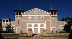 Colorado ChautauquaNational Historic Landmark · listed 1978
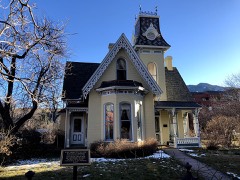 Arnett-Fullen Houselisted 2009
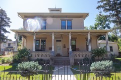 Hannah Barker Houselisted 2019
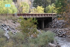 Boulder Creek Bridgelisted 2003
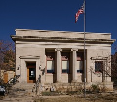 Carnegie Librarylisted 1979
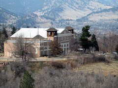 Chautauqua Auditoriumlisted 1974
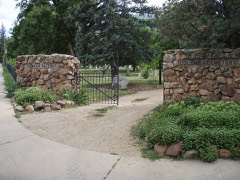 Columbia Cemeterylisted 1997
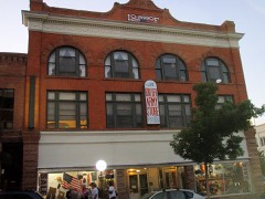 Downtown Boulder Historic Districtlisted 1980
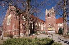 First Baptist Church of Boulderlisted 2004
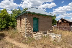 Fox Mine Officelisted 1996
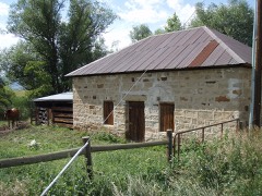 Fox Stone Barnlisted 1996
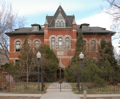 Highland Schoollisted 1978
Population over time
2 figuresBoulder grew from 97,385 to 108,250 between 2010 and 2020. These are the recorded population figures Wikidata holds for this place, reached through the Geographic Names Information System number this page is keyed on rather than by name, so they belong to this place and not to another of the same name. Most are census counts, but not all are: an early figure may be a founding or settlement estimate, and an estimate published within five years of a census is left out. The change column is computed, and is left blank where more than 20 years separate a figure from the one before it, because a gap that long is not a change between two counts.
| Year | People | Change |
|---|---|---|
| 2010 | 97,385 | |
| 2020 | 108,250 | +10,865 (+11%) |
Topographic sheets covering this place
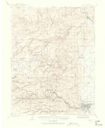
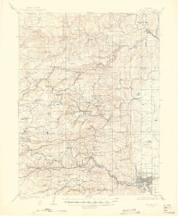
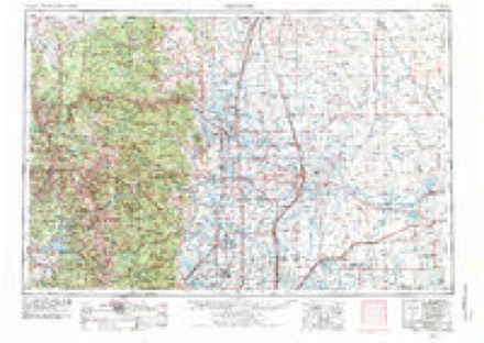
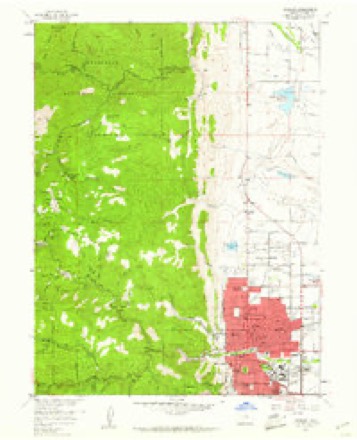
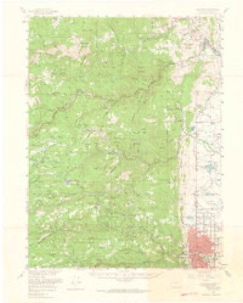
12 surveys from 29 printed sheetsMatched by testing this settlement's coordinate against the published boundary of every sheet in the United States Geological Survey's historical collection. Each opens the scanned sheet at the Survey.
- 1902 USGS Boulder quadrangle1:62500
- 1904 USGS Boulder quadrangle1:62500, 6 printings
- 1954 USGS Greeley quadrangle1:250000, 3 printings
- 1957 USGS Boulder quadrangle1:24000, 3 printings
- 1957 USGS Boulder quadrangle1:62500, 3 printings
- 1957 USGS Greeley quadrangle1:250000
- 1958 USGS Greeley quadrangle1:250000
- 1961 USGS Greeley quadrangle1:250000
- 1964 USGS Greeley quadrangle1:250000
- 1965 USGS Greeley quadrangle1:250000
- 1966 USGS Boulder quadrangle1:24000, 5 printings
- 1984 USGS Estes Park quadrangle1:100000, 3 printings
Fires near this place
892 since 1992Regional context, not property-specific evidence. The federal wildfire occurrence database lists 892 fires within 5 miles of Boulder between 1992 and 2020, burning about 1,237 acres in total. 26 started naturally. 18 were recorded as arson. Distance is straight-line from the map coordinates, so a fire counted here may appear on a neighbouring settlement's page as well.
| Reported cause | Fires |
|---|---|
| Missing data/not specified/undetermined | 714 |
| Equipment and vehicle use | 47 |
| Smoking | 38 |
| Natural | 26 |
| Arson/incendiarism | 18 |
| Recreation and ceremony | 18 |
| Debris and open burning | 11 |
| Fireworks | 8 |
| Misuse of fire by a minor | 6 |
| Power generation/transmission/distribution | 3 |
| Railroad operations and maintenance | 2 |
| Other causes | 1 |
The most recent of them, most recent first, with the day each was reported and the service that recorded it.
| Date | Cause | Size | Reported by | Name on the report |
|---|---|---|---|---|
| 9 September 2017 | Missing data/not specified/undetermined | 5.0 acres | Boulder Fire Rescue Department | UNKNOWN |
| 9 September 1993 | Natural | under an acre | Colorado State Forest Service-Boulder District | not named |
| 8 September 2017 | Missing data/not specified/undetermined | under an acre | Boulder Fire Rescue Department | UNKNOWN |
| 8 September 2017 | Missing data/not specified/undetermined | under an acre | Boulder Fire Rescue Department | UNKNOWN |
| 8 September 2016 | Missing data/not specified/undetermined | under an acre | Boulder Fire Rescue Department | UNKNOWN |
| 8 September 2014 | Equipment and vehicle use | under an acre | Boulder Fire Rescue Department | UNKNOWN |
| 7 September 2020 | Missing data/not specified/undetermined | under an acre | Boulder Fire Rescue Department | N/A |
| 7 September 1994 | Natural | under an acre | Arapaho and Roosevelt National Forests and Pawnee National Grassland | HAWKINS |
Settlements close enough to share some of these fires:
Mines and quarries near this place
10 of 98 shownRegional context, not property-specific evidence. The federal mineral resources record lists 98 workings within 5 miles of Boulder: 52 past producers, 29 occurrences, 16 producers, 1 unknown. 16 still produce. What was taken out: Gold, Silver, Sand and Gravel, Construction, Tungsten. Distance is straight-line from the map coordinates, so a quarry counted here may appear on a neighbouring settlement's page as well.
| Where | Site | Commodity | Status | Recorded |
|---|---|---|---|---|
| Buckskin Joe No 1 | Gold, Copper, Lead, Silver, Zinc | Past Producer | ||
| Copper King Nickel Mine | Nickel | Past Producer | ||
| East Boston | Gold, Copper, Silver, Lead | Past Producer | ||
| Fox Hills Outcrop | Coal, Uranium | Past Producer | ||
| Gold Hill Beryl Claims (unverifiable) | Beryllium | Past Producer | ||
| Lewis Lode | Bituminous, Uranium | Past Producer | ||
| Marion Mill | Uranium, Vanadium | Unknown | ||
| Marshal Or Langford Surface Iron | Iron | Producer | Limonite, Siderite | |
| Oklahoma | Gold, Lead, Silver, Tungsten | Past Producer | ||
| Poormans Relief | Gold, Zinc, Copper, Lead, Silver | Past Producer | Telluride, Gold, Pyrite |
Storms near this place
60 of 98 shownRegional context, not property-specific evidence. The National Weather Service names Boulder in 98 storm reports between 1993 and 2023: 64 hail, 15 thunderstorm wind, 13 lightning, 2 flash flood. The reports record 6 injuries. Each account below is quoted exactly as the forecast office filed it, from the NOAA Storm Events Database, and each date opens the federal record of that event.
| When | Event | Place named | Harm | What the report says |
|---|---|---|---|---|
| July 2000 | Lightning | Boulder | 3 hurt | Three children were injured, one critically, when lightning hit a nearby tree atop Panorama Point on Flagstaff Mountain. Lightning hit the tree, entered the ground, then struck the children. |
| June 2009 | Thunderstorm Wind | Boulder | 1 hurt, $20,000 | Thunderstorm winds knocked a tree on to two vehicles in Boulder. One of the two drivers was injured when the tree smashed the windshield of her car. |
| August 2009 | Lightning | Boulder | 1 hurt | A woman riding her bike in training for an Ironman Triathalon was struck by lightning. She was in the 78th mile of a 100-mile training ride when she was hit. Initially, she lost her vision and couldn't move her arms. After a short stay in the hospital, she made a full recovery. |
| August 2002 | Lightning | Boulder | 1 hurt | A hiker was struck by lightning near the Royal Arch Trail, near the fourth Flatiron. She was briefly knocked unconcious. The hiker and her companion had sought shelter under a rock when the storm hit. |
| July 1997 | Flash Flood | Boulder | $100,000 | Heavy rain and hail triggered a flash flood which sent a wall of water through the window of the financial aid office at the University of Colorado campus. In addition, ceiling tiles, carpets and dressing rooms were damaged at the Coors Event Center when a pipe draining rainwater broke during the downpour. In all, 10 buildings at CU received water damage causing an estimate $100,000 in damage. |
| June 2009 | Lightning | Boulder | $25,000 | Lightning struck an oil tank. The lid was partially torn off and flames shot out of the tank. The railing around the tank was also damaged. |
| June 2002 | Lightning | Boulder | $25,000 | Lightning struck a garage and caused a small fire. Two vehicles parked in the garage were damaged. |
| April 2000 | Lightning | Boulder | $20,000 | Lightning sparked a house fire in Boulder. The fire damaged a portion of the roof and a bedroom on the third floor. |
| May 2007 | Lightning | Boulder | $10,000 | no account filed |
| June 2009 | Lightning | Boulder | $5,000 | Lightning struck a veterinary hospital, damaging an exterior electrical box. |
| May 2007 | Lightning | Boulder | $5,000 | no account filed |
| July 1994 | Thunderstorm Wind | Boulder | $500 | Thunderstorm winds knocked down power lines in Boulder, causing power outages. |
| September 2013 | Flood | Boulder | - | Flooding was occurring along Boulder Creek in Boulder where it crested. Flooding also occurred along South Boulder Creek near Eldorado Springs with flooding impacting nearby homes. |
| September 2013 | Flash Flood | Boulder | - | Heavy rainfall and flash flooding washed out the east bound lane of James Canyon. Overland Road was also washed out, along the west bound lane of the Peak to Peak Highway near Jamestown. |
| June 2006 | Hail | Boulder | - | Large hail broke a car windshield. |
| June 2006 | Hail | Boulder | - | Large hail broke a car windshield. |
| April 2003 | Lightning | Boulder | - | Lightning damaged electrical equipment at a Long Term Ecological Research (LTER) Station located atop Niwot Ridge, at an elevation of 11,600 ft. |
| May 1999 | Lightning | Boulder | - | Lightning ignited a small fire in a three-story structure in Sunshine Canyon. The fire was quickly extinguished and caused only minor damage. |
| June 1997 | Tornado (F1) | Boulder | - | A tornado touched down near Baseline Reservoir. The tornado struck a home, tearing off part of the roof. A storage building nearby was nearly levelled and 5 trees were uprooted. The twister then moved onto Baseline Reservoir forming a huge waterspout. Several recreational vehicles and a boat dock were also damaged. |
| June 2023 | Hail | Boulder | - | no account filed |
| June 2023 | Hail | Boulder | - | no account filed |
| June 2023 | Hail | Boulder | - | no account filed |
| June 2021 | Hail | Boulder | - | no account filed |
| July 2019 | Hail | Boulder | - | no account filed |
| July 2019 | Hail | Boulder | - | no account filed |
| July 2019 | Hail | Boulder | - | no account filed |
| July 2019 | Hail | Boulder | - | no account filed |
| July 2019 | Hail | Boulder | - | no account filed |
| July 2019 | Hail | Boulder | - | no account filed |
| July 2019 | Hail | Boulder | - | no account filed |
| June 2018 | Hail | Boulder | - | no account filed |
| June 2018 | Hail | Boulder | - | no account filed |
| June 2018 | Hail | Boulder | - | no account filed |
| June 2018 | Hail | Boulder | - | no account filed |
| May 2018 | Hail | Boulder | - | no account filed |
| May 2018 | Hail | Boulder | - | no account filed |
| August 2018 | Thunderstorm Wind | Boulder | - | no account filed |
| June 2016 | Hail | Boulder | - | no account filed |
| May 2014 | Heavy Rain | Boulder | - | no account filed |
| June 2013 | Hail | Boulder | - | no account filed |
| June 2013 | Hail | Boulder | - | no account filed |
| September 2013 | Thunderstorm Wind | Boulder | - | no account filed |
| April 2010 | Hail | Boulder | - | no account filed |
| August 2010 | Thunderstorm Wind | Boulder | - | no account filed |
| August 2010 | Thunderstorm Wind | Boulder | - | no account filed |
| April 2007 | Hail | Boulder | - | no account filed |
| May 2007 | Hail | Boulder | - | no account filed |
| July 2007 | Hail | Boulder | - | no account filed |
| August 2007 | Hail | Boulder | - | no account filed |
| May 2006 | Hail | Boulder | - | no account filed |
| June 2006 | Hail | Boulder | - | no account filed |
| June 2006 | Hail | Boulder | - | no account filed |
| June 2006 | Hail | Boulder | - | no account filed |
| June 2006 | Hail | Boulder | - | no account filed |
| June 2006 | Hail | Boulder | - | no account filed |
| June 2006 | Hail | Boulder | - | no account filed |
| July 2005 | Thunderstorm Wind | Boulder | - | no account filed |
| August 2004 | Hail | Boulder | - | no account filed |
| August 2004 | Thunderstorm Wind | Boulder | - | no account filed |
| August 2004 | Hail | Boulder | - | no account filed |
Nearest settlements
The eight closest, with where each one stands in the county. Distances are straight-line, computed from the Geographic Names Information System coordinates.
| Map | Place | Distance | Sheets |
|---|---|---|---|
| Ara | 1.3 miles | 29 | |
| Seven Hills | 2.3 miles | 29 | |
| Orodell | 2.9 miles | 29 | |
| Valmont | 3.2 miles | 26 | |
| Boulder Junction | 3.3 miles | 26 | |
| Pine Brook Hill | 3.4 miles | 29 | |
| El Vado | 4.1 miles | 29 | |
| Silver Spruce | 4.2 miles | 29 |
Elsewhere
Matched on this settlement's Geographic Names Information System number rather than its name, so it cannot be a different place of the same name in another state.
| Wikipedia article on Boulder | An encyclopaedic summary. Its text is share-alike, so it is linked here rather than copied. |
| Wikidata item Q192517 | The structured record the population and elevation above come from. Public domain (CC0). |
Provenance
This settlement is recorded in the Geographic Names Information System as feature 178680. The sheet list is computed by point-in-boundary test against the United States Geological Survey's historical topographic inventory. Both are works of the United States government and carry no copyright under 17 U.S.C. 105.
Wildfire. Short, Karen C. 2022. Spatial wildfire occurrence data for the United States, 1992-2020 [FPA_FOD_20221014]. 6th Edition. Fort Collins, CO: Forest Service Research Data Archive. https://doi.org/10.2737/RDS-2013-0009.6 Collected with United States Government funding and usable without additional permissions or fees.
Mines and quarries. USGS Mineral Resources Data System (MRDS) https://mrdata.usgs.gov/mrds/ A work of the United States government, no copyright under 17 U.S.C. 105.
Storms. NOAA National Centers for Environmental Information, Storm Events Database https://www.ncei.noaa.gov/stormevents/ A work of the United States government, no copyright under 17 U.S.C. 105. Narratives are quoted verbatim from the National Weather Service report and are not edited or summarised.