 Block
Olathe, Colorado
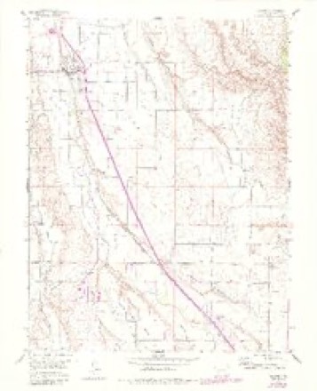
16 topographic sheets cover this place, the earliest surveyed in 1955 and the latest in 1983. It stands in the Olathe census division. It lies in ZIP code area 81425. The Survey maps it on the Olathe quadrangle. 2,019 people lived here at the 2020 count. It stands 5,361 feet above sea level.
Population over time
2 figuresOlathe grew from 1,849 to 2,019 between 2010 and 2020. These are the recorded population figures Wikidata holds for this place, reached through the Geographic Names Information System number this page is keyed on rather than by name, so they belong to this place and not to another of the same name. Most are census counts, but not all are: an early figure may be a founding or settlement estimate, and an estimate published within five years of a census is left out. The change column is computed, and is left blank where more than 20 years separate a figure from the one before it, because a gap that long is not a change between two counts.
| Year | People | Change |
|---|---|---|
| 2010 | 1,849 | |
| 2020 | 2,019 | +170 (+9%) |
Topographic sheets covering this place
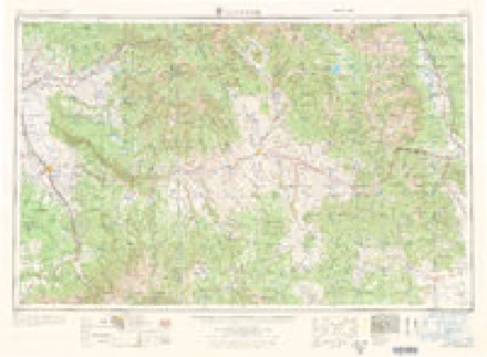
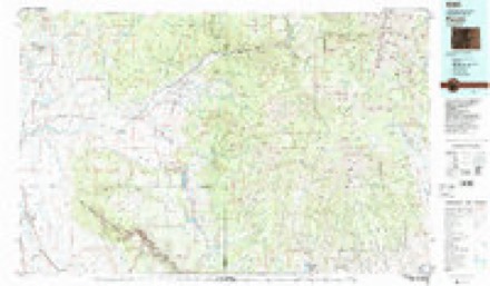
6 surveys from 16 printed sheetsMatched by testing this settlement's coordinate against the published boundary of every sheet in the United States Geological Survey's historical collection. Each opens the scanned sheet at the Survey.
- 1955 USGS Olathe quadrangle1:24000, 7 printings
- 1956 USGS Montrose quadrangle1:250000, 3 printings
- 1959 USGS Montrose quadrangle1:250000
- 1960 USGS Montrose quadrangle1:250000, 2 printings
- 1968 USGS Montrose quadrangle1:250000
- 1983 USGS Paonia quadrangle1:100000, 2 printings
Fires near this place
59 since 1993Regional context, not property-specific evidence. The federal wildfire occurrence database lists 59 fires within 5 miles of Olathe between 1993 and 2020, burning about 218 acres in total. 5 started naturally. 1 was recorded as arson. Distance is straight-line from the map coordinates, so a fire counted here may appear on a neighbouring settlement's page as well.
| Reported cause | Fires |
|---|---|
| Missing data/not specified/undetermined | 30 |
| Debris and open burning | 7 |
| Recreation and ceremony | 6 |
| Smoking | 6 |
| Natural | 5 |
| Equipment and vehicle use | 3 |
| Other causes | 1 |
| Arson/incendiarism | 1 |
The most recent of them, most recent first, with the day each was reported and the service that recorded it.
| Date | Cause | Size | Reported by | Name on the report |
|---|---|---|---|---|
| 6 August 2015 | Natural | under an acre | Dinosaur National Monument | MTC DFPC HELO SUPPORT |
| 5 August 2018 | Missing data/not specified/undetermined | under an acre | Olathe Fire Protection District | UNKNOWN |
| 3 August 2018 | Missing data/not specified/undetermined | under an acre | Olathe Fire Protection District | UNKNOWN |
| 2 August 2020 | Debris and open burning | under an acre | Olathe Fire Protection District | N/A |
| 30 July 2018 | Debris and open burning | under an acre | Olathe Fire Protection District | UNKNOWN |
| 19 July 1993 | Missing data/not specified/undetermined | 1.0 acres | Montrose Fire Protection District | not named |
| 18 July 2011 | Missing data/not specified/undetermined | under an acre | Colorado State Forest Service-State Headquarters | MONTROSE |
| 18 July 2006 | Natural | under an acre | Grand Mesa, Uncompahgre and Gunnison National Forests | FALL CREEK 2 |
Settlements close enough to share some of these fires:
Mines and quarries near this place
10 of 20 shownRegional context, not property-specific evidence. The federal mineral resources record lists 20 workings within 5 miles of Olathe: 15 unknowns, 5 occurrences. None of them still produces. What was taken out: Sand and Gravel, Construction. Distance is straight-line from the map coordinates, so a quarry counted here may appear on a neighbouring settlement's page as well.
| Where | Site | Commodity | Status | Recorded |
|---|---|---|---|---|
| Gravel Pit | Sand and Gravel, Construction | Unknown | ||
| Gravel Pit | Sand and Gravel, Construction | Unknown | ||
| Gravel Pit | Sand and Gravel, Construction | Unknown | ||
| Gravel Pit | Sand and Gravel, Construction | Unknown | ||
| Gravel Pit | Sand and Gravel, Construction | Unknown | ||
| Gravel Pit | Sand and Gravel, Construction | Unknown | ||
| Gravel Pit | Sand and Gravel, Construction | Unknown | ||
| Gravel Pit | Sand and Gravel, Construction | Unknown | ||
| Gravel Pit | Sand and Gravel, Construction | Unknown | ||
| Gravel Pit | Sand and Gravel, Construction | Unknown |
Storms near this place
13 since 1996Regional context, not property-specific evidence. The National Weather Service names Olathe in 13 storm reports between 1996 and 2023: 4 flash flood, 2 thunderstorm wind, 2 hail, 1 lightning. The reports record 2 injuries. Each account below is quoted exactly as the forecast office filed it, from the NOAA Storm Events Database, and each date opens the federal record of that event.
| When | Event | Place named | Harm | What the report says |
|---|---|---|---|---|
| May 2005 | Tornado (F1) | Olathe | 1 hurt, $20,000 | A small tornado traveled across adjacent farms along Highway 50 in Montrose County, leaving a narrow damage path 50 to 75 yards wide. A three-sided wood-framed tin-roofed barn, approximately 35' x 12' was lifted up, flipped and carried 20 feet to the W-NW landing on its roof and crushing a large chicken coop. A small chicken coop on the south side of the barn was blown approximately 50-70 feet to the N-NW and its roof was not found. Small limbs were broken on trees, a number of shingles were torn from roofs and impaled on objects, and a trampoline and sheets of tin were lifted and blown up to 75 yards into a field. One of the residents was hit in the leg by a flying chair, and a horse was injured in the leg by flying debris. Residents at one of the farms said they heard a loud "wind" noise and saw a great deal of debris swirling around and a lot of dust obscuring their vision. Reports indicate a number of funnel cloud sightings in the area around the time of the storm damage. |
| June 1999 | Lightning | Olathe | 1 hurt | no account filed |
| June 2021 | Flash Flood | Olathe | $300,000 | Several homes were flooded with water, mud and debris in the Coal Creek area with 2 feet of water estimated over Kiowa Road between 4 and 6 PM MDT on the 24th. One home saw water levels up to 4 feet with significant damage to the residence and property. Several roads had minor damage from mud and cutting of the dirt in areas. Small rocks and boulders were displaced on steep drainages. Rainfall estimates from local residents varied, but averaged near 1.75 inches in less than 2 hours. No homes were declared a total loss and there were no injuries of note or fatalities. The flash flood was, in addition to the heavy rain, the result of overwhelmed canals and culverts. |
| May 2023 | Flood | Olathe | $5,000 | Accelerated snowmelt led to high rises in Roubideau Creek which subsequently led to the washout of portions of Roubideau Canyon Road which runs along the creek. |
| September 2002 | Thunderstorm Wind | Olathe | $2,000 | no account filed |
| May 2020 | Hail | Olathe | - | A severe thunderstorm produced large hail estimated to be the size of quarters in Olathe. |
| August 2016 | Heavy Rain | Olathe | - | About 14 miles southwest of Olathe 0.65 inches of rain fell within about 55 minutes. |
| June 2015 | Flash Flood | Olathe | - | A normally dry wash quickly filled and ran at bankfull conditions due to runoff from heavy rainfall. |
| June 2015 | Flash Flood | Olathe | - | Normally dry washes in the area were running out of their banks which caused minor flooding. |
| August 2010 | Flash Flood | Olathe | - | Heavy rainfall resulted in the Gunnison River stage rapidly rising about 4 feet through the BLM's Gunnison Gorge Wilderness Area. Numerous camp sites and trail heads were destroyed or covered in debris and boulders to the point that they were no longer usable. The movement of boulders and silt significantly changed the characteristic of the Gunnison River in a number of places, such as the Miracle Mile rapids where rapids no longer exist. Six river runners were trapped at the T-Dyke boater site during the event. Numerous small fish were killed by the flash flood. |
| May 2005 | Hail | Olathe | - | no account filed |
| May 2005 | Funnel Cloud | Olathe | - | no account filed |
| June 1996 | Thunderstorm Wind | Olathe | - | no account filed |
Nearest settlements
The eight closest, with where each one stands in the county. Distances are straight-line, computed from the Geographic Names Information System coordinates.
| Map | Place | Distance | Sheets |
|---|---|---|---|
| Frost | 2.7 miles | 16 | |
| Hoovers Corner | 4.1 miles | 14 | |
| Roe | 5.0 miles | 16 | |
| Pea Green Corner | 6.7 miles | 16 | |
| Montrose | 10.4 miles | 17 | |
| Oak Grove | 10.4 miles | 17 | |
| Fairview | 12.4 miles | 17 | |
| Lujane | 15.5 miles | 20 |
Elsewhere
Matched on this settlement's Geographic Names Information System number rather than its name, so it cannot be a different place of the same name in another state.
| Wikipedia article on Olathe | An encyclopaedic summary. Its text is share-alike, so it is linked here rather than copied. |
| Wikidata item Q2306759 | The structured record the population and elevation above come from. Public domain (CC0). |
Provenance
This settlement is recorded in the Geographic Names Information System as feature 204746. The sheet list is computed by point-in-boundary test against the United States Geological Survey's historical topographic inventory. Both are works of the United States government and carry no copyright under 17 U.S.C. 105.
Wildfire. Short, Karen C. 2022. Spatial wildfire occurrence data for the United States, 1992-2020 [FPA_FOD_20221014]. 6th Edition. Fort Collins, CO: Forest Service Research Data Archive. https://doi.org/10.2737/RDS-2013-0009.6 Collected with United States Government funding and usable without additional permissions or fees.
Mines and quarries. USGS Mineral Resources Data System (MRDS) https://mrdata.usgs.gov/mrds/ A work of the United States government, no copyright under 17 U.S.C. 105.
Storms. NOAA National Centers for Environmental Information, Storm Events Database https://www.ncei.noaa.gov/stormevents/ A work of the United States government, no copyright under 17 U.S.C. 105. Narratives are quoted verbatim from the National Weather Service report and are not edited or summarised.