 Block
Superior, Colorado
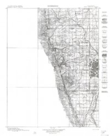
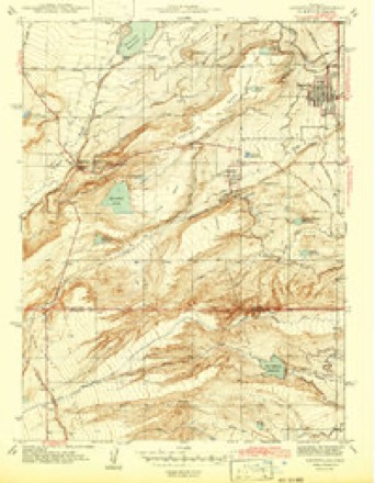
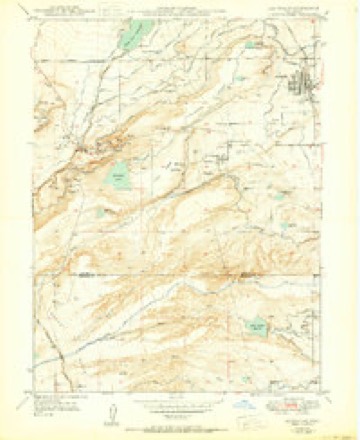
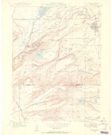
25 topographic sheets cover this place, the earliest surveyed in 1899 and the latest in 1983. It stands in the Boulder census division. It lies in ZIP code area 80027. The Survey maps it on the Louisville quadrangle.
Topographic sheets covering this place
11 surveys from 25 printed sheetsMatched by testing this settlement's coordinate against the published boundary of every sheet in the United States Geological Survey's historical collection. Each opens the scanned sheet at the Survey.
- 1899 USGS West Denver quadrangle1:125000
- 1942 USGS Louisville quadrangle1:31680, 2 printings
- 1942 USGS Louisville quadrangle1:24000
- 1950 USGS Louisville quadrangle1:24000
- 1953 USGS Denver quadrangle1:250000, 6 printings
- 1957 USGS Denver quadrangle1:250000
- 1957 USGS Louisville quadrangle1:24000, 2 printings
- 1958 USGS Denver quadrangle1:250000
- 1960 USGS Denver quadrangle1:250000
- 1965 USGS Louisville quadrangle1:24000, 7 printings
- 1983 USGS Denver West quadrangle1:100000, 2 printings
Fires near this place
270 since 1992Regional context, not property-specific evidence. The federal wildfire occurrence database lists 270 fires within 5 miles of Superior between 1992 and 2020, burning about 1,224 acres in total. 11 started naturally. 10 were recorded as arson. Distance is straight-line from the map coordinates, so a fire counted here may appear on a neighbouring settlement's page as well.
| Reported cause | Fires |
|---|---|
| Missing data/not specified/undetermined | 204 |
| Smoking | 15 |
| Equipment and vehicle use | 12 |
| Natural | 11 |
| Arson/incendiarism | 10 |
| Recreation and ceremony | 7 |
| Misuse of fire by a minor | 6 |
| Fireworks | 3 |
| Railroad operations and maintenance | 1 |
| Debris and open burning | 1 |
The most recent of them, most recent first, with the day each was reported and the service that recorded it.
| Date | Cause | Size | Reported by | Name on the report |
|---|---|---|---|---|
| 8 September 2017 | Missing data/not specified/undetermined | under an acre | Boulder Fire Rescue Department | UNKNOWN |
| 7 September 2016 | Missing data/not specified/undetermined | under an acre | Denver County | UNKNOWN |
| 6 September 2010 | Missing data/not specified/undetermined | under an acre | Colorado State Forest Service-State Headquarters | not named |
| 5 September 2020 | Missing data/not specified/undetermined | under an acre | Rocky Mountain Fire Protection District | N/A |
| 4 September 2017 | Missing data/not specified/undetermined | under an acre | Boulder Fire Rescue Department | UNKNOWN |
| 30 September 2016 | Missing data/not specified/undetermined | under an acre | Boulder Fire Rescue Department | UNKNOWN |
| 29 September 2018 | Missing data/not specified/undetermined | under an acre | Louisville Fire Protection District | UNKNOWN |
| 29 September 2010 | Missing data/not specified/undetermined | under an acre | Colorado State Forest Service-State Headquarters | not named |
Settlements close enough to share some of these fires:
Mines and quarries near this place
10 of 15 shownRegional context, not property-specific evidence. The federal mineral resources record lists 15 workings within 5 miles of Superior: 7 occurrences, 6 past producers, 2 producers. 2 still produce. What was taken out: Sand and Gravel, Construction, Clay, Uranium, Gold. Distance is straight-line from the map coordinates, so a quarry counted here may appear on a neighbouring settlement's page as well.
| Where | Site | Commodity | Status | Recorded |
|---|---|---|---|---|
| Fox Hills Outcrop | Coal, Uranium | Past Producer | ||
| Lewis Lode | Bituminous, Uranium | Past Producer | ||
| Marshal Or Langford Surface Iron | Iron | Producer | Limonite, Siderite | |
| Unknown | Fire Clay (Refractory) | Occurrence | ||
| Cracker Jack | Tungsten | Past Producer | ||
| South Boulder Cr. Placers | Gold | Occurrence | Gold | |
| South Boulder Creek Placers | Gold | Occurrence | Gold | |
| Sunday Tungsten | Tungsten | Past Producer | ||
| Rocky Flats Pit | Clay | Past Producer | ||
| Rocky Flats and Plainview | Clay | Past Producer |
Storms near this place
8 since 2009Regional context, not property-specific evidence. The National Weather Service names Superior in 8 storm reports between 2009 and 2023: 2 thunderstorm wind, 2 flash flood, 2 hail, 1 lightning. The reports record 3 injuries. Each account below is quoted exactly as the forecast office filed it, from the NOAA Storm Events Database, and each date opens the federal record of that event.
| When | Event | Place named | Harm | What the report says |
|---|---|---|---|---|
| September 2013 | Flood | Superior | 3 hurt, $297,000,000 | Heavy rain, ranging from 6 to 18 inches through the storm event, caused widespread flooding along the entire drainage systems of Boulder and St. Vrain Creeks. Three vehicles were partially submerged when floodwaters undercut Dillon Road near CO287, between Lafayette and Broomfield. When the road first collapsed, several people were able to get out of the water quickly, but three were trapped in their vehicles and had to be rescued. The three drivers were taken to local hospitals for treatment. Extensive flooding was reported in Longmont and forced several road closures. Floodwaters tipped over two storage tanks containing sulfuric acid at the Longmont Brewery. Several shelters were set up for evacuees. Numerous bridges, culverts and roads were damaged in eastern Boulder County. The town of Lyons was completely isolated by floodwaters. The wastewater treatment plant was destroyed. There were numerous rock and mud slides in the area. Mandatory evacuations were ordered for the entire town of Lyons. Train tracks were washed out near the intersection of the Diagonal and Jay Road in Boulder. Boulder Canyon was closed from Nederland to Magnolia. South Boulder Road was closed due to flooding between Cherryvale and 55th. About 40 buildings on the University of Boulder campus were damaged and 400 students evacuated. ||According to FEMA, 10,588 homes were impacted by flooding. Preliminary damage assessments for Boulder, Lyons, Longmont, Jamestown, Superior and unincorporated Boulder County included: 337 homes destroyed; 428 homes with major damage; 3,426 homes with minor damage; 33 commercial buildings with major damage; 54 commercial buildings with minor damage. The most extensive damage impacted lakes and rivers; in particular, along and near the St. Vrain River corridor. ||The breakdown for the damage estimate in Boulder County included: $132 million for the city of Longmont; $91.2 million in damage to government facilities, roads and bridges in unincorporated Boulder County; $49 million for the city of Boulder's infrastructure, parks and open space; $25 million for the county's parks, trails and open spaces. |
| June 2009 | Lightning | Superior | $10,000 | Lightning struck and apartment complex, knocking some bricks from a building in the complex. A water heater was also damaged. |
| September 2013 | Flash Flood | Superior | - | Continuous moderate to heavy rainfall produced flash flooding. |
| September 2013 | Flash Flood | Superior | - | Flash flooding forced the closure of the Boulder-Denver Turnpike, from McCaslin Blvd. to the Boulder city limits. The roadway was inundated by 2 ft of standing water near Superior. Water was reportedly overtopping all the cross bridges along Table Mesa Blvd, from Lehigh to Broadway. Baseline and 76th was flooded and impassable. Flash flooding was observed on Marshall Road, about 4 miles south of Boulder. Another road was washed out at 4th and Hawthorne. In Superior, one property was destroyed. |
| July 2023 | Thunderstorm Wind | Superior | - | no account filed |
| June 2018 | Hail | Superior | - | no account filed |
| June 2015 | Hail | Superior | - | no account filed |
| July 2011 | Thunderstorm Wind | Superior | - | no account filed |
Nearest settlements
The eight closest, with where each one stands in the county. Distances are straight-line, computed from the Geographic Names Information System coordinates.
| Map | Place | Distance | Sheets |
|---|---|---|---|
| Rock Creek | 1.3 miles | 25 | |
| Paragon Estates | 2.0 miles | 25 | |
| Louisville | 2.6 miles | 25 | |
| Marshall | 3.2 miles | 25 | |
| Maple Grove | 3.9 miles | 20 | |
| Boulder Junction | 4.9 miles | 26 | |
| Lafayette | 5.0 miles | 20 | |
| Ninemile Corner | 5.5 miles | 22 |
Provenance
This settlement is recorded in the Geographic Names Information System as feature 203891. The sheet list is computed by point-in-boundary test against the United States Geological Survey's historical topographic inventory. Both are works of the United States government and carry no copyright under 17 U.S.C. 105.
Wildfire. Short, Karen C. 2022. Spatial wildfire occurrence data for the United States, 1992-2020 [FPA_FOD_20221014]. 6th Edition. Fort Collins, CO: Forest Service Research Data Archive. https://doi.org/10.2737/RDS-2013-0009.6 Collected with United States Government funding and usable without additional permissions or fees.
Mines and quarries. USGS Mineral Resources Data System (MRDS) https://mrdata.usgs.gov/mrds/ A work of the United States government, no copyright under 17 U.S.C. 105.
Storms. NOAA National Centers for Environmental Information, Storm Events Database https://www.ncei.noaa.gov/stormevents/ A work of the United States government, no copyright under 17 U.S.C. 105. Narratives are quoted verbatim from the National Weather Service report and are not edited or summarised.