 Block
From the record
One of 92 National Register listings published here for Boulder County · listed in 2003 · category: Building.
Sources: the case file at the National Archives · the National Register database, National Park Service
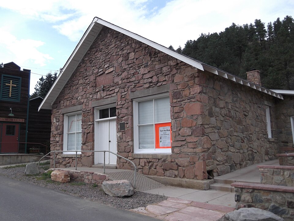
Listed on the National Register of Historic Places in 2003.
One of 92 National Register listings published here for Boulder County · listed in 2003 · category: Building.
Sources: the case file at the National Archives · the National Register database, National Park Service
Regional context, not property-specific evidence. The federal wildfire occurrence database lists 166 fires within 5 miles of Jamestown Town Hall between 1992 and 2020, burning about 14,831 acres in total. 44 started naturally. 8 were recorded as arson. Distance is straight-line from the map coordinates, so a fire counted here may appear on a neighbouring settlement's page as well.
| Reported cause | Fires |
|---|---|
| Missing data/not specified/undetermined | 81 |
| Natural | 44 |
| Recreation and ceremony | 14 |
| Arson/incendiarism | 8 |
| Equipment and vehicle use | 8 |
| Fireworks | 5 |
| Debris and open burning | 3 |
| Other causes | 1 |
| Smoking | 1 |
| Power generation/transmission/distribution | 1 |
The most recent of them, most recent first, with the day each was reported and the service that recorded it.
| Date | Cause | Size | Reported by | Name on the report |
|---|---|---|---|---|
| 9 September 1992 | Recreation and ceremony | under an acre | Arapaho and Roosevelt National Forests and Pawnee National Grassland | not named |
| 7 September 1994 | Natural | under an acre | Arapaho and Roosevelt National Forests and Pawnee National Grassland | NORTH EAST SUGARLOAF |
| 7 September 1992 | Debris and open burning | under an acre | Colorado State Forest Service-Boulder District | not named |
| 5 September 2020 | Missing data/not specified/undetermined | under an acre | Lefthand Fire Protection District | N/A |
| 5 September 2013 | Natural | under an acre | Arapaho and Roosevelt National Forests and Pawnee National Grassland | SLAUGHTERHOUSE |
| 5 September 2013 | Natural | 1.0 acres | Lefthand Fire Protection District | UNKNOWN |
| 3 September 2001 | Recreation and ceremony | under an acre | Arapaho and Roosevelt National Forests and Pawnee National Grassland | FAIRVIEW |
| 14 September 1994 | Natural | 3.0 acres | Arapaho and Roosevelt National Forests and Pawnee National Grassland | NUGGET HILL |
Regional context, not property-specific evidence. The federal mineral resources record lists 374 workings within 5 miles of Jamestown Town Hall: 207 past producers, 122 occurrences, 39 producers, 4 prospects. 39 still produce. What was taken out: Gold, Silver, Uranium, Fluorine-Fluorite. Distance is straight-line from the map coordinates, so a quarry counted here may appear on a neighbouring settlement's page as well.
| Where | Site | Commodity | Status | Recorded |
|---|---|---|---|---|
| Argo | Uranium, Fluorine-Fluorite, Gold, Silver, Lead, Copper | Producer | Vein | |
| Argo | Fluorine-Fluorite, Gold, Copper, Uranium, Lead, Silver | Past Producer | Fluorspar, Galena, Sphalerite, Pyrite, Tennantite, Chalcopyrite, Enargite | |
| Beryl #2 | Niobium (Columbium), Feldspar, Beryllium, Mica | Producer | Beryl, Feldspar, Mica | |
| Beryl No.1 & 2 Claims | Beryllium, Mica, Niobium (Columbium), Feldspar | Past Producer | ||
| Buckhorn | Gold, Silver, Lead, Copper, Fluorine-Fluorite | Past Producer | Pyrite, Chalcopyrite, Galena | |
| Buena Mine | Silver, Gold, Copper, Tungsten, Fluorine-Fluorite | Past Producer | Krennerite, Gold, Sylvanite, Petzite | |
| Buena Vista Mine Nos 1-2-3 | Barium-Barite | Past Producer | ||
| Castle Gulch | Gemstone, Silver | Past Producer | ||
| Cobalt Gold Mining Co | Nickel, Gold | Past Producer | ||
| Columbine | Feldspar, Mica, Beryllium, Niobium (Columbium), Copper | Producer | Beryl, Columbite, Feldspar, Malachite, Mica |
Regional context, not property-specific evidence. The National Weather Service names Jamestown, the town this property stands in, in 12 storm reports between 2004 and 2021: 9 flash flood, 2 lightning, 1 heavy rain. No death or injury is recorded in these reports. Each account below is quoted exactly as the forecast office filed it, from the NOAA Storm Events Database, and each date opens the federal record of that event.
| When | Event | Place named | Harm | What the report says |
|---|---|---|---|---|
| July 2011 | Flash Flood | Jamestown | $300,000 | Heavy rain produced significant flash flooding in the Fourmile burn scar. |
| July 2021 | Flash Flood | Jamestown | $10,000 | Localized flash flooding reported from Geer Canyon to Left Hand Canyon to CO36. |
| June 2021 | Flash Flood | Jamestown | $10,000 | Heavy rain produced flash flooding in Geer Canyon in the Calwood burn area. |
| July 2012 | Flash Flood | Jamestown | $10,000 | Flash flooding occurred in the Four Mile Canyon burn area. |
| July 2011 | Flash Flood | Jamestown | $5,000 | Heavy rain produced large debris flow along Fourmile Canyon Drive. |
| September 2013 | Flash Flood | Jamestown | - | Heavy rainfall produced a mudslide at Left Hand and Olde Stage Road. One foot of debris was reported on the roadway near Gregory Canyon. |
| July 2006 | Flash Flood | Jamestown | - | Heavy rain in the Overland burn area caused minor flash flooding in Jamestown. The roads behind the Jamestown Fire Hall was washed out when a culvert became blocked with debris. A rockslide was also reported in town. |
| July 2005 | Flash Flood | Jamestown | - | Heavy rain in the vicinity of the Overland burn scar, triggered a mudslide in Jamestown. Rocks the size of bowling balls, along with silt and mud slid down the mountain and into town. One parked car was buried by the debris. |
| August 2005 | Lightning | Jamestown | - | Lightning sparked a small fire near Jamestown. The blaze was quickly contained and consumed less than an acre. |
| June 2004 | Heavy Rain | Jamestown | - | Heavy rain producing thunderstorms caused rock and mud slides to occur near the Overland burn area, near Jamestown. An estimated 50 tons of sand, dirt, rock and ash slid into town. stopping up a culvert under Main Street. The slide covered 150 to 225 feet of Main Street. About a half an inch of rain fell in 30 minutes. |
| June 2004 | Lightning | Jamestown | - | Lightning sparked two small fires, one in Geer Canyon, and another 7.5 miles up Sunshine Canyon. Both were quickly contained and caused no damage to structures in the area. |
| July 2004 | Flash Flood | Jamestown | - | Heavy rain in the Overland burn area caused flash flooding problems in Jamestown. Up to a foot of water reportedly covered the highway near Jamestown. Many of the town's culverts bagan to fill with dirt, causing the overflow to wash onto the streets and into homes. Heavy machinery had to be called in to remove piles of mud, up to 7 feet deep. Parked cars slid down the street with the mud and water, and many had to be dug out. The fire station in Jametown was inundated with 10 inches of muddy water. |
No historic map-sheet match is published for this property yet. That does not mean no map exists. This record needs a coordinate-quality review before it can be joined to a sheet boundary. Browse the county's mapped places while that work is pending.
Other National Register properties close enough to walk or drive between, ordered by distance from this one. Both positions come from the same geocoding pass that matched these properties to their map sheets.
| Photograph | Property | Distance | Listed |
|---|---|---|---|
| Jamestown Town Hall (Boundary Increase) | under 500 feet | 2007 | |
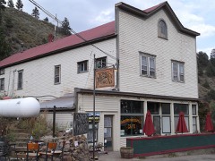 | Jamestown Mercantile Building | under 500 feet | 1989 |
| Snowbound Mine | 3.1 miles | ||
 | Gold Hill Historic District | 3.9 miles | 1989 |
 | Salina School | 4.3 miles | 1989 |
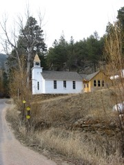 | Little Church in the Pines | 4.4 miles | 1989 |
| National Archives record | The nomination case file for reference 03000615 in Record Group 79. |
| Boulder County | All 92 listed properties in this county. |