 Block
From the record
One of 83 National Register listings published here for Jefferson County · listed in 2013 · category: Building.
Sources: the National Register database, National Park Service
Listed on the National Register of Historic Places in 2013.
One of 83 National Register listings published here for Jefferson County · listed in 2013 · category: Building.
Sources: the National Register database, National Park Service
Regional context, not property-specific evidence. The federal wildfire occurrence database lists 1,206 fires within 5 miles of Fruitdale Grade School between 2003 and 2020, burning about 302 acres in total. 11 started naturally. 17 were recorded as arson. Distance is straight-line from the map coordinates, so a fire counted here may appear on a neighbouring settlement's page as well.
| Reported cause | Fires |
|---|---|
| Missing data/not specified/undetermined | 1027 |
| Equipment and vehicle use | 46 |
| Smoking | 33 |
| Arson/incendiarism | 17 |
| Recreation and ceremony | 17 |
| Debris and open burning | 16 |
| Misuse of fire by a minor | 13 |
| Fireworks | 13 |
| Natural | 11 |
| Power generation/transmission/distribution | 8 |
| Railroad operations and maintenance | 4 |
| Other causes | 1 |
The most recent of them, most recent first, with the day each was reported and the service that recorded it.
| Date | Cause | Size | Reported by | Name on the report |
|---|---|---|---|---|
| 9 September 2011 | Missing data/not specified/undetermined | 1.0 acres | Colorado State Forest Service-State Headquarters | ARVADA |
| 9 September 2010 | Arson/incendiarism | under an acre | Colorado State Forest Service-State Headquarters | not named |
| 9 September 2010 | Missing data/not specified/undetermined | under an acre | Colorado State Forest Service-State Headquarters | not named |
| 8 September 2019 | Missing data/not specified/undetermined | under an acre | Colorado State Forest Service-State Headquarters | N/A |
| 8 September 2019 | Missing data/not specified/undetermined | under an acre | Colorado State Forest Service-State Headquarters | N/A |
| 8 September 2018 | Missing data/not specified/undetermined | under an acre | Arvada Fire Protection District | UNKNOWN |
| 8 September 2015 | Missing data/not specified/undetermined | under an acre | West Metro Fire Rescue | UNKNOWN |
| 8 September 2015 | Missing data/not specified/undetermined | under an acre | West Metro Fire Rescue | UNKNOWN |
Regional context, not property-specific evidence. The federal mineral resources record lists 29 workings within 5 miles of Fruitdale Grade School: 12 past producers, 10 occurrences, 4 producers, 3 unknowns. 4 still produce. What was taken out: Sand and Gravel, Construction, Gold, Zeolites, Gold, Silver. Distance is straight-line from the map coordinates, so a quarry counted here may appear on a neighbouring settlement's page as well.
| Where | Site | Commodity | Status | Recorded |
|---|---|---|---|---|
| North Table Mountain | Zeolites | Producer | ||
| Rio Grande Pit | Sand and Gravel, Construction, Gold, Silver | Past Producer | 1973 | |
| Unknown | Stone, Crushed/Broken | Producer | ||
| Linda 1&2 Mine | Gold | Occurrence | ||
| Swadley Placers | Gold | Past Producer | 1858, 1859 | |
| Youngfield Pit | Sand and Gravel, Construction, Gold | Past Producer | 1979 | |
| Allied Dirt Div Green Mtn Pit | Sand and Gravel, Construction | Producer | ||
| Asphalt Paving Co Pit | Sand and Gravel, Construction | Past Producer | ||
| Asphalt Paving Co Pit | Sand and Gravel, Construction | Past Producer | ||
| Brannan Pit 26 | Sand and Gravel, Construction | Unknown |
Regional context, not property-specific evidence. The National Weather Service names Wheat Ridge, the town this property stands in, in 17 storm reports between 1994 and 2025: 14 hail, 1 thunderstorm wind, 1 flash flood, 1 lightning. No death or injury is recorded in these reports. Each account below is quoted exactly as the forecast office filed it, from the NOAA Storm Events Database, and each date opens the federal record of that event.
| When | Event | Place named | Harm | What the report says |
|---|---|---|---|---|
| May 2023 | Lightning | Wheat Ridge | $25,000 | Lightning damaged a home in Wheat Ridge. |
| July 2025 | Hail | Wheat Ridge | - | Report from mping. |
| August 1998 | Flash Flood | Wheat Ridge | - | Heavy rain caused flooding and flash flooding problems over southwest portions of Metropolitan Denver. An observer in Lakewood recorded 3.26 inches of rainfall in one hour. Several streets were flooded in central Lakewood. In addition, a trailer park along Lena Gulch in Wheat Ridge was evacuated due to the highwaters. |
| June 1997 | Thunderstorm Wind | Wheat Ridge | - | A dry microburst produced an estimated 60 mph (53 kt) wind gust in Wheat Ridge. |
| May 1995 | Hail | Wheat Ridge | - | Severe thunderstorms rumbled across the Denver Metropolitan area dropping mainly pea- to marble sized-hail. Wheat Ridge received hail stones up to 1.25 inches in diameter. Hail piled up to two inches deep in Wheat Ridge and Northwest Denver. |
| June 2023 | Hail | Wheat Ridge | - | no account filed |
| June 2023 | Hail | Wheat Ridge | - | no account filed |
| July 2019 | Hail | Wheat Ridge | - | no account filed |
| May 2017 | Hail | Wheat Ridge | - | no account filed |
| June 2006 | Hail | Wheat Ridge | - | no account filed |
| August 2004 | Hail | Wheat Ridge | - | no account filed |
| May 2001 | Hail | Wheat Ridge | - | no account filed |
| May 2001 | Hail | Wheat Ridge | - | no account filed |
| May 2001 | Hail | Wheat Ridge | - | no account filed |
| July 2001 | Hail | Wheat Ridge | - | no account filed |
| June 1999 | Hail | Wheat Ridge | - | no account filed |
| October 1994 | Hail | Wheat Ridge | - | no account filed |
No historic map-sheet match is published for this property yet. That does not mean no map exists. This record needs a coordinate-quality review before it can be joined to a sheet boundary. Browse the county's mapped places while that work is pending.
Other National Register properties close enough to walk or drive between, ordered by distance from this one. Both positions come from the same geocoding pass that matched these properties to their map sheets.
| Photograph | Property | Distance | Listed |
|---|---|---|---|
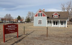 | James H. Baugh House | 0.3 miles | 2012 |
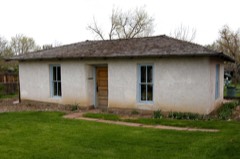 | Pioneer Sod House | 0.4 miles | 1973 |
 | Tower of Memories | 2.0 miles | 1987 |
| Crown Hill Burial Park | 2.2 miles | 2008 | |
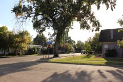 | Reno Park Addition Historic District | 2.3 miles | 1999 |
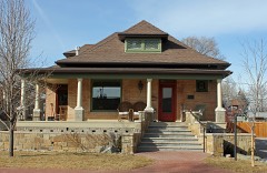 | Russell-Graves House | 2.4 miles | 1983 |
| National Archives record | The nomination case file for reference 13000078 in Record Group 79. |
| Jefferson County | All 83 listed properties in this county. |