 Block
Norfolk, Connecticut
32 topographic sheets cover this place, the earliest surveyed in 1892 and the latest in 1993. It stands in Norfolk town. It lies in ZIP code area 06058. It stands on Spaulding Brook. The Survey maps it on the Norfolk quadrangle. 551 people lived here at the 2020 count.
On record in Norfolk
Buildings and businesses the archive holds for this place. Each opens its own page, with the source record it came from.
On the National Register 12 of 25 shown
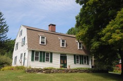 Amos Baldwin Houselisted 2016
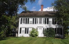 Francis Jr. Benedict Houselisted 2002
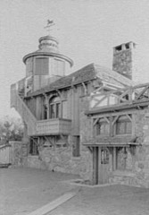 Starling Childs Camplisted 1982
 Farnum Houselisted 1982
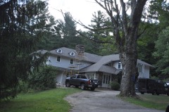 Gould Houselisted 1982
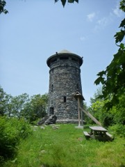 Haystack Mountain Towerlisted 1993
 Hillsidelisted 1982
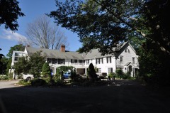 Low Houselisted 1984
 Moseley House-Farmlisted 1984
 Moss Hilllisted 1982
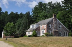 Mulville Houselisted 1984
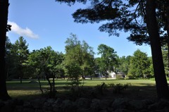 Noble Houselisted 1984
Population over time
2 figuresNorfolk fell from 553 to 551 between 2010 and 2020. These are the recorded population figures Wikidata holds for this place, reached through the Geographic Names Information System number this page is keyed on rather than by name, so they belong to this place and not to another of the same name. Most are census counts, but not all are: an early figure may be a founding or settlement estimate, and an estimate published within five years of a census is left out. The change column is computed, and is left blank where more than 20 years separate a figure from the one before it, because a gap that long is not a change between two counts.
| Year | People | Change |
|---|---|---|
| 2010 | 553 | |
| 2020 | 551 | -2 (-0%) |
Topographic sheets covering this place
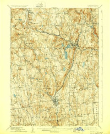
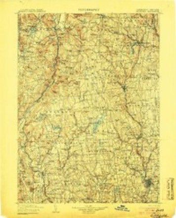
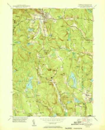
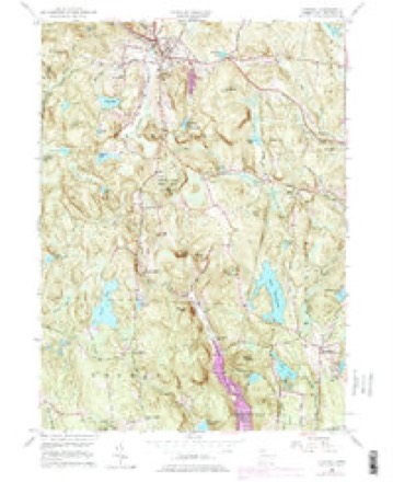
12 surveys from 32 printed sheetsMatched by testing this settlement's coordinate against the published boundary of every sheet in the United States Geological Survey's historical collection. Each opens the scanned sheet at the Survey.
- 1892 USGS Winsted quadrangle1:62500, 10 printings
- 1904 USGS Litchfield quadrangle1:125000, 3 printings
- 1947 USGS Hartford quadrangle1:250000, 2 printings
- 1948 USGS Hartford quadrangle1:250000, 2 printings
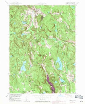
- 1951 USGS Norfolk quadrangle1:31680, 2 printings
- 1956 USGS Norfolk quadrangle1:24000, 4 printings
- 1961 USGS Hartford quadrangle1:250000
- 1962 USGS Hartford quadrangle1:250000, 3 printings
- 1965 USGS Hartford quadrangle1:250000, 2 printings
- 1965 USGS Norfolk quadrangle1:24000
- 1985 USGS Waterbury quadrangle1:100000
- 1993 USGS Waterbury quadrangle1:100000





What happened here
An account from the chapter on Norfolk town. The inset identifies its exact source book and publication year.
The Wilderness
Another of Norfolk's noblest boys who most faithfully and efficiently served his country and gave his life in the War of the Rebellion was Colonel George Ryan, who as Colonel of the 140th New York Regiment led his men in a charge at the battle of Laurel Hill, or Spottsylvania, Va., where he was mortally wounded May 8th, 1864.
In the county-history sources
230,190 words on this townshipHistory of Litchfield County, Connecticut, published 1881 names this settlement in its chapter on Norfolk Town. These are the passages that mention it, exactly as the scans read.
This town lies in the north part of the county, and is bounded as follows : on the north by Massachusetts, on the east by Colebrook and Winchester, on the south by Goshen, and on the west by Canaan and North Canaan. The surface of the town is elevated and mountainous, and the soil is a gravelly loam. Blackberry River, which is formed by the junction of two rivers at Norfolk, and flows west into the Housatonic, affords an excellent water-power for manufacturing purposes.
Passage source: History of Litchfield County, Connecticut, published 1881.
When the English fired the first shot of the war at Lexington, in April, 1775, the militia all through New England started for the scene, and remote Norfolk was not behind the rest, - Capt. Timothy Gaylord with twenty- four men started for Boston. They were needed but a short time, and were soon sent home. These volunteer eftbrts, before the army was organized, showed the temper of the people. One other deserves mention : everybody has heard of Col. Ethan Allen's famous surprise and capture of Ticonderoga and Crown Point, - " in the name of the Lord Jehovah and of the Continental Congress," - but not all are aware that that expedition was originated by Connecticut men at Hartford, most of whom were in the Legislature, aud still fewer know that Norfolk was represented in it, not indeed by a man, but by a horse. Capt. Edward Mott, of Preston, was sent with sixteen men from Hartford to take these forts, and ordered to gather more among Warner's men in Berkshire, and among the " Green Mountain Boys" under Allen at Bennington. Of course speed was essential to insure success. Norfolk was directly in their path to Berkshire, and when they reached the town one of their horses gave out, and Mott applied to your selectmen for another. Samuel Knapp, grandfatiier to the present justice of the peace, was the prompt and patriotic man who complied with their request. His horse was loaned, being first appraised at sixteen pounds ten shillings, Mott paying fifteen shillings ctish down. On the return of the animal, a few weeks later, bearing ample evidence of having been to war, the appraisers judged that the owner ought to receive five pounds, " the horse being so much damnified." The bill was sent into the colony trea.surer, with the fifteen shillings honestly deducted, and was promptly paid. Knapp's receii)t for four pounds five shillings is still extant at Hartford.
Passage source: History of Litchfield County, Connecticut, published 1881.
Meantime, the Canada campaign was vigorously prosecuted ; but the difficulties were great, the troops poorly disciplined and ill fed, suffering much from smallpox and dysentery, and many a Norfolk boy in this first campaign lost his health or his life from these causes. Montreal was taken, but the attack on Quebec, late in December, foiled, and the gallant Montgomery's death sent a thrill of discouragement through the land. The British troops in Canada, however, were few, and early in 1776 the work was pushed again, in order to reduce the province before reinforcements could arrive from England. The Norfolk men had been discharged, with the other Connecticut troops, when their time was out, in December, but their ardor was not cooled. A new regiment was enlisted in this part of the State, to serve in Canada for a year from Feb. 1, 1776, of which Charles Burrall and Nathaniel Buel, of Salisbury, were made colonel and lieutenant-colonel, and John Sedgwick, of North Cornwall, major. Titus Watson, of Norfolk, who had been lieutenant the previous year, was made captain, and gathered a company largely composed of Norfolk men, and many of them his old comrades. This was a large contribution for the town to make, and, crowning the whole, Mr. Robbins was given up to become chaplain for the regiment. He was earnestly patriotic, but the controlling motive which led him to go was his desire to advance the moral and spiritual interests of the men while exposed to the demoralizing influences of the war. His diary during the campaign, which has been published, reveals this very clearly. His work among the sick and wounded, his manner of alluding to the preaching services he held, his sadness at the numerous excesses that passed before his eyes, his discouragement at seeing i^etty rivalries and animosities among the officers, burdened his mind quite as much as his anxiety for the result of the conflict. He was not at all a " fighting chaplain," - indeed, some of his contemporaries appear to have considered him somewhat deficient in the strictly soldierly qualities, - but he was faithful to his duties so long as he continued in the service, and was respected among his brother officers. Lieut.- Col. Buel was a specially intimate friend, and they tented together much of the time.
Passage source: History of Litchfield County, Connecticut, published 1881.
Machine-read from a century-old scan, so expect the errors a machine makes: misspelled names, dropped words, stray characters.
Read the whole chapter on Norfolk Town - it names this place 31 more 31 times.
Fires near this place
72 since 1992Regional context, not property-specific evidence. The federal wildfire occurrence database lists 72 fires within 5 miles of Norfolk between 1992 and 2020, burning about 61 acres in total. None started naturally. None was recorded as arson. Distance is straight-line from the map coordinates, so a fire counted here may appear on a neighbouring settlement's page as well.
| Reported cause | Fires |
|---|---|
| Missing data/not specified/undetermined | 54 |
| Debris and open burning | 13 |
| Misuse of fire by a minor | 2 |
| Recreation and ceremony | 2 |
| Equipment and vehicle use | 1 |
The most recent of them, most recent first, with the day each was reported and the service that recorded it.
| Date | Cause | Size | Reported by | Name on the report |
|---|---|---|---|---|
| 19 September 2016 | Missing data/not specified/undetermined | under an acre | Connecticut Division of Forestry | COLEBROOK ROAD COLEBROOK |
| 22 August 2020 | Missing data/not specified/undetermined | under an acre | Connecticut Division of Forestry | 31 GREENWOODS ROAD |
| 15 August 2019 | Missing data/not specified/undetermined | under an acre | Connecticut Division of Forestry | not named |
| 21 July 2018 | Missing data/not specified/undetermined | under an acre | Connecticut Division of Forestry | 107 MAIN STREET |
| 17 July 2019 | Missing data/not specified/undetermined | under an acre | Connecticut Division of Forestry | not named |
| 3 June 2017 | Missing data/not specified/undetermined | under an acre | Connecticut Division of Forestry | 210 DOOLITTLE DR |
| 1 June 2012 | Missing data/not specified/undetermined | under an acre | Connecticut Division of Forestry | NORTH CANAAN |
| 9 May 2005 | Missing data/not specified/undetermined | 3.0 acres | Connecticut Division of Forestry | not named |
Settlements close enough to share some of these fires:
Mines and quarries near this place
9 within 5 milesRegional context, not property-specific evidence. The federal mineral resources record lists 9 workings within 5 miles of Norfolk: 7 past producers, 1 unknown, 1 producer. 1 still produces. What was taken out: Stone, Dimension, Iron, Sand and Gravel, Construction, Cobalt, Nickel. Distance is straight-line from the map coordinates, so a quarry counted here may appear on a neighbouring settlement's page as well.
| Where | Site | Commodity | Status | Recorded |
|---|---|---|---|---|
| Crissey Quarry | Granite | Past Producer | ||
| Mitchell Nickel Sulfide Mine | Cobalt, Nickel | Past Producer | ||
| Quarry | Limestone, Dimension | Past Producer | ||
| East Canaan Pit | Sand and Gravel, Construction | Producer | ||
| Magnetite Mine | Iron | Past Producer | ||
| Quarry | Stone, Dimension | Past Producer | ||
| Quarry | Stone, Dimension | Past Producer | ||
| Sand & Gravel Operfion | Sand and Gravel, Construction | Unknown | ||
| Toby Hill Iron Mine | Iron | Past Producer |
Storms near this place
34 since 1993Regional context, not property-specific evidence. The National Weather Service names Norfolk in 34 storm reports between 1993 and 2023: 24 thunderstorm wind, 5 hail, 2 flash flood, 2 tornado. No death or injury is recorded in these reports. Each account below is quoted exactly as the forecast office filed it, from the NOAA Storm Events Database, and each date opens the federal record of that event.
| When | Event | Place named | Harm | What the report says |
|---|---|---|---|---|
| July 2023 | Flash Flood | South Norfolk | $1,000,000 | Several portions of Route 272 were washed out due to flash flooding between Bruey Road to Route 263 in Goshen. Numerous side roads were also closed including Smith Road, Old Goshen Road, Estey Road and Meekertown Road. |
| July 2023 | Flood | South Norfolk | $500,000 | Several portions of Route 272 were washed out due to flash flooding between Bruey Road to Route 263 in Goshen. Numerous side roads were also closed including Smith Road, Old Goshen Road, Estey Road and Meekertown Road. |
| May 1996 | Thunderstorm Wind | Norfolk | $20,000 | no account filed |
| August 1997 | Thunderstorm Wind | Norfolk | $3,000 | no account filed |
| July 1999 | Thunderstorm Wind | Norfolk | $1,000 | no account filed |
| April 2022 | Thunderstorm Wind | West Norfolk | - | Multiple trees and wires were downed on Wagnum Road by Wagnum Lake. |
| April 2022 | Thunderstorm Wind | West Norfolk | - | A power pole, tree and wires were downed on Mountain Road. |
| April 2022 | Thunderstorm Wind | Norfolk | - | A tree was downed on Litchfield Road. |
| April 2022 | Thunderstorm Wind | Norfolk | - | A tree and wires were downed on Westside Road near Mountain Road. |
| April 2022 | Thunderstorm Wind | Norfolk | - | Trees and wires were downed on Greenwoods Road East. |
| July 2022 | Tornado (EF0) | South Norfolk | - | An EF-0 tornado touched down about 2 miles south-southwest of Dennis Hill State Park along Smith Road and traveled northeastward for about 5 miles before ending about 2 miles southwest of Colebrook along Pinney Street. Damage was sporadic and consisted mostly of downed hardwood trees and broken tree branches. A couple of barns along Pinney Street lost some siding and one of the barns had a door torn off. There were many eye witnesses which provided both video and pictures of the tornado. |
| July 2022 | Thunderstorm Wind | West Norfolk | - | Trees and wires were reported down blocking US-44. |
| December 2021 | Thunderstorm Wind | Norfolk | - | Trees were downed in the Town of Norfolk. |
| November 2020 | Thunderstorm Wind | West Norfolk | - | A tree was downed on wires, resulting in a fire. |
| August 2020 | Tornado (EF0) | Norfolk | - | The NWS Albany received photo and eyewitness accounts consistent with an EF0 tornado near Norfolk, CT. Therefore, an EF0 tornado was confirmed and was on the ground for approximately 0.5 miles in length, with a path width of approximately 100 yards. This tornado occurred with the same supercell that produced tornadoes in Sharon, CT, Falls Village, CT, and Sandisfield, MA. |
| August 2019 | Thunderstorm Wind | Norfolk | - | A tree was downed in Norfolk. |
| September 2018 | Thunderstorm Wind | Norfolk | - | A tree was downed onto wires. |
| May 2018 | Thunderstorm Wind | West Norfolk | - | Trees and wires were reported down on River Place. |
| May 2018 | Thunderstorm Wind | Norfolk | - | Wires were downed on Winchester Road. |
| May 2013 | Thunderstorm Wind | Norfolk | - | Multiple trees and wires were reported down as a result of thunderstorm winds in Norfolk. |
| May 2012 | Thunderstorm Wind | Norfolk | - | Trees and wires were reported down due to strong thunderstorm winds, which closed a portion of Route 272, about 2 miles north-northwest of Norfolk. |
| June 2011 | Hail | Norfolk | - | Golf ball size hail was reported during a thunderstorm in Norfolk. |
| June 2011 | Hail | Norfolk | - | Ping-pong ball size hail was reported during a thunderstorm in Norfolk. |
| August 2011 | Thunderstorm Wind | Norfolk | - | Wires were reported down in Norfolk due to strong thunderstorm winds. |
| January 2010 | Flash Flood | Norfolk | - | Route 44 in Norfolk was reported closed due to a mudslide. |
| May 2010 | Thunderstorm Wind | Norfolk | - | Trees were reported down in Norfolk due to strong thunderstorm winds. |
| June 2008 | Thunderstorm Wind | Norfolk | - | Trees and wires were reported down near Norfolk due to strong thunderstorm winds. |
| June 2008 | Thunderstorm Wind | Norfolk | - | Trees and wires were reported down near Norfolk due to strong thunderstorm winds. |
| August 2007 | Thunderstorm Wind | Norfolk | - | A tree was reported to have fallen on a house on Route 44 in Norfolk due to strong thunderstorm winds. In addition, wires were also reported down. |
| December 2006 | Thunderstorm Wind | Norfolk | - | Trees were reported down in Norfolk due to thunderstorm winds. |
| April 1995 | Hail | Norfolk | - | Trees and power lines were reported blown down. A fast moving squall line preceding a strong Arctic cold front produced strong to severe thunderstorms with wind gusts to 40 to 60 mph. Some locations experienced gusts in excess of 60 or 70 mph. Up to 87,000 electric customers lost power statewide as numerous trees and tree limbs fell and brought down power lines. |
| August 1993 | Thunderstorm Wind | Norfolk | - | Several trees downed by thunderstorm winds. |
| December 2019 | Hail | Norfolk | - | no account filed |
| July 1995 | Hail | Norfolk | - | no account filed |
Nearest settlements
The eight closest, with where each one stands in the county. Distances are straight-line, computed from the Geographic Names Information System coordinates.
| Map | Place | Distance | Sheets |
|---|---|---|---|
| West Norfolk | 1.3 miles | 38 | |
| Grantville | 3.8 miles | 32 | |
| Canaan Valley | 4.3 miles | 43 | |
| Turkey Cobble | 4.5 miles | 32 | |
| East Canaan | 4.5 miles | 43 | |
| Mill Brook | 4.9 miles | 35 | |
| South Norfolk | 4.9 miles | 32 | |
| North Colebrook | 4.9 miles | 39 |
Elsewhere
Matched on this settlement's Geographic Names Information System number rather than its name, so it cannot be a different place of the same name in another state.
| Wikipedia article on Norfolk | An encyclopaedic summary. Its text is share-alike, so it is linked here rather than copied. |
| Wikidata item Q5843544 | The structured record the population and elevation above come from. Public domain (CC0). |
Provenance
This settlement is recorded in the Geographic Names Information System as feature 209306. The sheet list is computed by point-in-boundary test against the United States Geological Survey's historical topographic inventory. Both are works of the United States government and carry no copyright under 17 U.S.C. 105.
Wildfire. Short, Karen C. 2022. Spatial wildfire occurrence data for the United States, 1992-2020 [FPA_FOD_20221014]. 6th Edition. Fort Collins, CO: Forest Service Research Data Archive. https://doi.org/10.2737/RDS-2013-0009.6 Collected with United States Government funding and usable without additional permissions or fees.
Mines and quarries. USGS Mineral Resources Data System (MRDS) https://mrdata.usgs.gov/mrds/ A work of the United States government, no copyright under 17 U.S.C. 105.
Storms. NOAA National Centers for Environmental Information, Storm Events Database https://www.ncei.noaa.gov/stormevents/ A work of the United States government, no copyright under 17 U.S.C. 105. Narratives are quoted verbatim from the National Weather Service report and are not edited or summarised.