 Block
Woodbury, Connecticut
33 topographic sheets cover this place, the earliest surveyed in 1893 and the latest in 1993. It stands in Woodbury town. It lies in ZIP code area 06798. It stands on Hesseky Brook. The Survey maps it on the Woodbury quadrangle.
On record in Woodbury
Buildings and businesses the archive holds for this place. Each opens its own page, with the source record it came from.
On the National Register 8 records
 Leroy Anderson Houselisted 2012
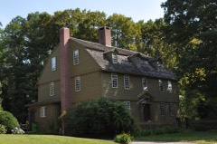 Jabez Bacon Houselisted 1971
 Glebe Houselisted 1971
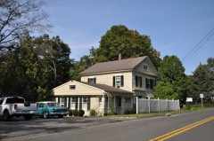 Hotchkissville Historic Districtlisted 1996
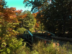 Minortown Road Bridgelisted 2001
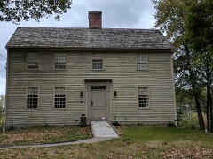 David Sherman Houselisted 2002
 Woodbury Historic District No. 1listed 1971
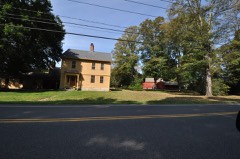 Woodbury Historic District No. 2listed 1972
Topographic sheets covering this place
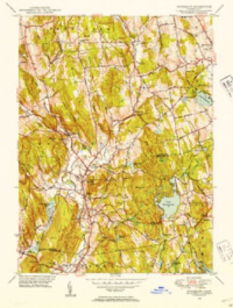
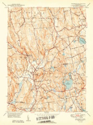
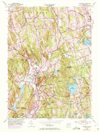
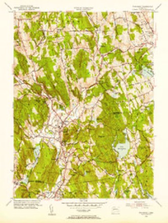
14 surveys from 33 printed sheetsMatched by testing this settlement's coordinate against the published boundary of every sheet in the United States Geological Survey's historical collection. Each opens the scanned sheet at the Survey.
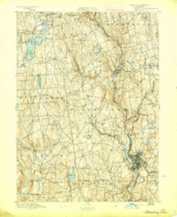
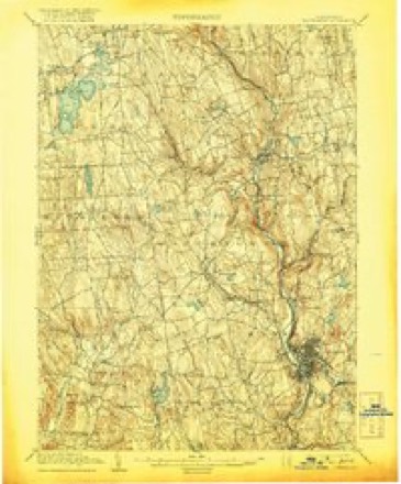
- 1893 USGS Waterbury quadrangle1:62500, 2 printings
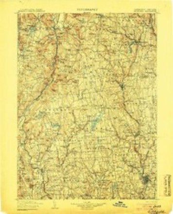
- 1904 USGS Litchfield quadrangle1:125000, 3 printings
- 1904 USGS Waterbury quadrangle1:62500, 8 printings
- 1947 USGS Hartford quadrangle1:250000, 2 printings
- 1948 USGS Hartford quadrangle1:250000, 2 printings
- 1948 USGS Woodbury quadrangle1:31680
- 1950 USGS Woodbury quadrangle1:31680, 2 printings
- 1955 USGS Woodbury quadrangle1:24000, 4 printings
- 1955 USGS Woodbury quadrangle1:31680
- 1961 USGS Hartford quadrangle1:250000
- 1962 USGS Hartford quadrangle1:250000, 3 printings
- 1965 USGS Hartford quadrangle1:250000, 2 printings
- 1985 USGS Waterbury quadrangle1:100000
- 1993 USGS Waterbury quadrangle1:100000





In the county-history sources
2,249 words on this townshipHistory of Litchfield County, Connecticut, published 1881 names this settlement in its chapter on Woodbury Town. These are the passages that mention it, exactly as the scans read.
INTRODUCTION. A LITTLE more than two hundred years ago the pleasant hills and sunny valleys of Woodbury, now teeming with life, intelligence, and happiness, were one vast solitude, unvisited by the cheering rays of civilization, everything betokening that the silence of nature had been unbroken by human voices since those early days " when the morning stars sang together," save by those of nature's own uncultivated children, the red hunters of the forest. Nature in all its great magnificence met the enchanted view of the pale-face in these sweetly fertile plains and mountain fastnesses. The grim chiefs of the woody wilds alone roamed over these retired solitudes, save the wild beasts that growled upon a thousand hills. Every year had the Indians set fire to the fallen leaves, thus denuding the trees of the lower branches, and destroying the underbrush, so that the dense woods presented a most magnificent and enchanting appearance. Thus the " eye was allowed to rove witli delight from ridge to ridge, and from hill to hill, which, like the divisions of an immense temple, were crowded with innumerable pillars, the branches of whose shafts, interlocking, formed the arcliwork of support to that leafy roof which covered and crowned the whole." On the meadows by our noble river were scanty patches of maize, beans, and tobacco, the results of the rude husbandry of the untutored savage of the forest. The whole face of nature was one vast solitude, uncheered by the benign rays of civilization. From Wyantenuck to Mattatuck, and fmm I'ootatuck to Bantam, were heard the dismal howl of the wolf and the war-cry of the red man. Amid these secluded wilds, and by the silvery waters of the Qiiassapaug, sported the timid deer, and coy doves built their lovely nests. Here dwelt a race groping in the shadow of dim imaginings, faintly led by the light of nature. Here desperate fights and deadly ambuscades were planned. Here did the prisoner of war sufi'er the extreme tortures of his enemies. Here the romantic lover
Passage source: History of Litchfield County, Connecticut, published 1881.
The second purchase of lands from the Pootatucks was made March 17, 1685-86. This was the Shepaug purchase, comprising two-thirds of the present town of Roxbury and a part of Southbury. On the 18th day of May, 1700, the inhabitants of the town, having become numerous for those days, made their fourth, or Nonnewaug purchase. Till this time it seems that the sagamore of that name had retained his po.ssessions in the valley of the Nonnewaug, in East Sprain stream. But now it came his turn to make room, and it seems that he and his counselors did it with a good grace, as the deed informs us the sale was made " For valid considerations moving thereto, besides y" desire y' is w"'in us of a friendly correspondency w"" y'' English inhabitants of s'^ Woodbury." At a very early day that part of Southbury, known as Kettletown, had been purchased of the Indians for the consideration of a brass kettle. It had been bought the second time seven years after the settlement of the town ; and on the 25th of October, 1705, it became necessary to purchase it the third time. Something more than a quarter of a century had passed since the last sale, and by this time it is probable that they again felt the need of the " consideration." This was the fifth regular purchase of the Pootatucks. On the 28th day of May, next year, the town bought the sixth, or confirmatory purchase. This covered and confirmed all former grants and purchases, together with a considerable tract of land in Roxbury, and a piece eighty rods wide, from Steep Rock, in Washington, to the mouth of the Shepaug, on the west side of that river. In this deed the Indians reserved a large tract of land in the southwest part of Southbury, called the Pootatuck Reservation. This was bounded on the north by a line drawn from Shepaug Falls to the " Bent" of the Pomperaug, east by that river, or by a line drawn parallel to, or a few rods east of it, from the " Bent" to its mouth, south by the Pootatuck, and west by the Shepaug River. This reservation, now called "The Purchase," contained the principal Indian village, located on the Pootatuck River, south of South Britain village. After this sale the Indians continued to convey portions of their land, from time to time, till 1733, when there was left to them only a remnant of their possessions at the southwest corner, in which was located their remaining village, called the " Pootatuck Wigwams." They retained their title to this last resting-place for a quarter of a century longer, when, reduced to a mere handful in numbers, in May, 1759, they sold their cherished Pootatuck, and the "remnant that remained" took up their abode with the "Scaticook Indians" at Kent, where a few of mixed blood remain to this day. In all their later sales they reserved the right to take game on the lands forever, - a right which was always religiously respected by our fathers whenever a straggling Pootatuck revisited the graves of his ancestors, or wandered in his once wide dominions !
Passage source: History of Litchfield County, Connecticut, published 1881.
Machine-read from a century-old scan, so expect the errors a machine makes: misspelled names, dropped words, stray characters.
Read the whole chapter on Woodbury Town - it names this place 1 more 1 time.
Fires near this place
179 since 1993Regional context, not property-specific evidence. The federal wildfire occurrence database lists 179 fires within 5 miles of Woodbury between 1993 and 2020, burning about 129 acres in total. None started naturally. 7 were recorded as arson. Distance is straight-line from the map coordinates, so a fire counted here may appear on a neighbouring settlement's page as well.
| Reported cause | Fires |
|---|---|
| Missing data/not specified/undetermined | 138 |
| Debris and open burning | 22 |
| Arson/incendiarism | 7 |
| Recreation and ceremony | 6 |
| Misuse of fire by a minor | 4 |
| Smoking | 1 |
| Fireworks | 1 |
The most recent of them, most recent first, with the day each was reported and the service that recorded it.
| Date | Cause | Size | Reported by | Name on the report |
|---|---|---|---|---|
| 30 September 2005 | Debris and open burning | under an acre | Connecticut Division of Forestry | not named |
| 3 September 2012 | Missing data/not specified/undetermined | under an acre | Connecticut Division of Forestry | MIDDLEBURY |
| 28 September 2017 | Missing data/not specified/undetermined | under an acre | Connecticut Division of Forestry | HOLMES RD & WASHINGTON-WOODBURY RD |
| 25 September 2015 | Missing data/not specified/undetermined | under an acre | Connecticut Division of Forestry | not named |
| 22 September 2010 | Missing data/not specified/undetermined | under an acre | Connecticut Division of Forestry | not named |
| 21 September 2007 | Missing data/not specified/undetermined | under an acre | Connecticut Division of Forestry | not named |
| 2 September 2005 | Missing data/not specified/undetermined | under an acre | Connecticut Division of Forestry | not named |
| 19 September 2011 | Missing data/not specified/undetermined | 1.0 acres | Connecticut Division of Forestry | MIDDLEBURY |
Settlements close enough to share some of these fires:
Mines and quarries near this place
10 of 19 shownRegional context, not property-specific evidence. The federal mineral resources record lists 19 workings within 5 miles of Woodbury: 10 past producers, 9 producers. 9 still produce. What was taken out: Stone, Crushed/Broken, Sand and Gravel, Construction, Stone, Dimension, Stone. Distance is straight-line from the map coordinates, so a quarry counted here may appear on a neighbouring settlement's page as well.
| Where | Site | Commodity | Status | Recorded |
|---|---|---|---|---|
| Woodbury Pegmatite Quarry | Feldspar, Quartz | Past Producer | Feldspar | |
| Woodbury Pegmatite Quarry | Beryllium, Feldspar, Mica | Past Producer | ||
| Gneiss Rock Quarry No. Ej-010 | Stone | Producer | Gneiss | |
| Granite Gneiss Rock Quarry | Stone | Producer | Gneiss | |
| Granitic Gneiss Rock Quarry No. Ej-006 | Stone | Producer | Gneiss | |
| Basalt Rock Quarry No. Ej-011 | Stone, Dimension | Past Producer | ||
| Quarry | Stone, Dimension | Past Producer | ||
| Roxbury Quarry | Stone, Dimension | Past Producer | ||
| Woodbury Basalt Trap Rock Quarry | Stone, Dimension | Past Producer | ||
| Basalt Rock Quarry No. Ej-008 | Stone, Crushed/Broken | Producer | Basalt |
Storms near this place
25 since 1998Regional context, not property-specific evidence. The National Weather Service names Woodbury in 25 storm reports between 1998 and 2024: 10 thunderstorm wind, 10 flash flood, 3 hail, 1 tornado. No death or injury is recorded in these reports. Each account below is quoted exactly as the forecast office filed it, from the NOAA Storm Events Database, and each date opens the federal record of that event.
| When | Event | Place named | Harm | What the report says |
|---|---|---|---|---|
| August 2024 | Flash Flood | Woodbury | $10,000 | Flooding was observed on Good Hill Road between Railtree Road and Transylvania Road with numerous cars stranded. |
| June 2001 | Flash Flood | Woodbury | $10,000 | no account filed |
| July 1999 | Thunderstorm Wind | Woodbury | $3,000 | no account filed |
| August 2024 | Flash Flood | North Woodbury | $2,000 | Local law enforcement reported numerous roads being impassible due to being inundated with water in the town of Woodbury. |
| August 2024 | Flash Flood | Woodbury | $2,000 | Business parking lots along Main Street south were flooded as well as portions of U.S. 6 and Route 64. |
| June 1998 | Thunderstorm Wind | Woodbury | $1,500 | no account filed |
| August 2024 | Flash Flood | Woodbury | $1,000 | Route 317 was closed at the Pomperaug River bridge due to flood waters. |
| August 2024 | Flash Flood | North Woodbury | $1,000 | Judson Avenue was closed due to flooding. |
| August 2024 | Flash Flood | North Woodbury | $500 | Ash Swamp Road was closed due to flooding. |
| September 2023 | Flood | North Woodbury | - | Route 317 was closed between Bear Hill Road and Hollow Road. Water from the Pomperaug River was over the road. |
| June 2021 | Thunderstorm Wind | North Woodbury | - | Local law enforcement received a few reports of downed trees on wires. |
| September 2021 | Flash Flood | North Woodbury | - | Judson Avenue was reported impassable near Orton lane due to flooding. |
| September 2021 | Flash Flood | Woodbury | - | Route 317 in Woodbury was reported impassable due to flooding. |
| August 2020 | Thunderstorm Wind | Woodbury | - | Several trees were downed near the intersection of Grassy Hill Rd. and Owl Ridge Rd. Some were snapped in half. |
| September 2011 | Flash Flood | Woodbury | - | In Woodbury Center Route 317, Route 47 and Judson Avenue were closed due to flooding. Major flooding occurred on the Pomperaug River at Southbury New Haven County. The river gage located near Poverty Road in Southbury exceeded its 9 foot flood stage around 6:45 am EST, its 10 foot moderate flood stage around 7:45 am, its 12 foot major flood stage around 8:45 am, it crested at 15.64 feet around 11 am and fell below flood stage by 5:30 pm September 8th. |
| June 2011 | Thunderstorm Wind | Woodbury | - | Trees were reported down in Woodbury due to strong thunderstorm winds. |
| June 2011 | Tornado (EF1) | Woodbury | - | A National Weather Service Storm Survey Team confirmed a brief tornado touchdown on Great Hollow Road within a greater area of straight line wind damage consistent with a microburst. |
| June 2011 | Thunderstorm Wind | Woodbury | - | Straight line wind damage occurred in Woodbury consistent with a microburst with winds moving southwest to northeast. Most of the damage was to hardwood trees and covered an area approximately one mile wide by one and one half miles long. The area of damage was bounded roughly by Upper Grassy Hill Road and Great Hollow Road. |
| July 2009 | Hail | North Woodbury | - | Quarter size hail was reported in Woodbury during a thunderstorm. |
| July 2009 | Hail | North Woodbury | - | Quarter size hail was reported in Woodbury during a thunderstorm. |
| July 2008 | Thunderstorm Wind | North Woodbury | - | A tree was reported down in Woodbury due to strong thunderstorm winds. |
| May 2007 | Thunderstorm Wind | Woodbury | - | Thunderstorm winds downed trees near the ski area in Woodbury. |
| August 2007 | Thunderstorm Wind | North Woodbury | - | Trees and wires were reported down due to strong thunderstorm winds in Woodbury. |
| August 2006 | Thunderstorm Wind | Woodbury | - | A trained spotter reported that trees were blown down in Woodbury. |
| June 2002 | Hail | Woodbury | - | no account filed |
Nearest settlements
The eight closest, with where each one stands in the county. Distances are straight-line, computed from the Geographic Names Information System coordinates.
| Map | Place | Distance | Sheets |
|---|---|---|---|
| North Woodbury | 0.4 miles | 33 | |
| Acropolis (historical) | 0.6 miles | 33 | |
| Pomeraug | 1.3 miles | 33 | |
| Hotchkissville | 1.6 miles | 33 | |
| Minortown | 2.9 miles | 33 | |
| Roxbury | 5.3 miles | 33 | |
| Gulls Hollow | 5.9 miles | 34 | |
| Roxbury Falls | 5.9 miles | 33 |
Provenance
This settlement is recorded in the Geographic Names Information System as feature 212238. The sheet list is computed by point-in-boundary test against the United States Geological Survey's historical topographic inventory. Both are works of the United States government and carry no copyright under 17 U.S.C. 105.
Wildfire. Short, Karen C. 2022. Spatial wildfire occurrence data for the United States, 1992-2020 [FPA_FOD_20221014]. 6th Edition. Fort Collins, CO: Forest Service Research Data Archive. https://doi.org/10.2737/RDS-2013-0009.6 Collected with United States Government funding and usable without additional permissions or fees.
Mines and quarries. USGS Mineral Resources Data System (MRDS) https://mrdata.usgs.gov/mrds/ A work of the United States government, no copyright under 17 U.S.C. 105.
Storms. NOAA National Centers for Environmental Information, Storm Events Database https://www.ncei.noaa.gov/stormevents/ A work of the United States government, no copyright under 17 U.S.C. 105. Narratives are quoted verbatim from the National Weather Service report and are not edited or summarised.