BlockBefore
Photograph of Rye House
Photograph by JERRYE & ROY KLOTZ, M.D, CC BY-SA 4.0. Via Wikimedia Commons.

Rye House

Listed on the National Register of Historic Places in 2000.

From the record

“Rye House is a historic summer estate property at 122-132 Old Mount Tom Road in Litchfield, Connecticut. Developed in 1910 for a wealthy New York City widow, it is a prominent local example of Tudor Revival architecture, and a major example of the trend of country estate development in the region.”

Wikipedia article Rye House (Litchfield, Connecticut), CC BY-SA 4.0.

One of 166 National Register listings published here for Litchfield County · listed in 2000 · category: District.

Sources: the Wikipedia article · the case file at the National Archives · the National Register database, National Park Service · the Wikipedia article

The listing

  • Address. 122-132 Old Mount Tom Rd., Litchfield, 06750
  • When was it listed? August 2000
  • Category. district
  • Town. Litchfield town
  • National Register reference number. 00000940 - the number the National Park Service assigned this property when it was listed, and the key its nomination file is catalogued under at the National Archives.

Fires near this property

103 since 1993

Regional context, not property-specific evidence. The federal wildfire occurrence database lists 103 fires within 5 miles of Rye House between 1993 and 2020, burning about 42 acres in total. None started naturally. 4 were recorded as arson. Distance is straight-line from the map coordinates, so a fire counted here may appear on a neighbouring settlement's page as well.

Reported cause Fires
Missing data/not specified/undetermined92
Arson/incendiarism4
Recreation and ceremony4
Debris and open burning3

The most recent of them, most recent first, with the day each was reported and the service that recorded it.

DateCause SizeReported by Name on the report
3 September 2017Missing data/not specified/undetermined1.2 acresConnecticut Division of Forestry30 GARLAND RD
28 September 2016Missing data/not specified/undeterminedunder an acreConnecticut Division of Forestry302 PROSPECT MOUNTIAN ROAD LITCHFIELD
4 August 2011Missing data/not specified/undeterminedunder an acreConnecticut Division of ForestryLITCHFIELD
10 August 1993Arson/incendiarism2.0 acresConnecticut Division of Forestrynot named
8 July 2019Missing data/not specified/undeterminedunder an acreConnecticut Division of Forestrynot named
8 July 2016Missing data/not specified/undeterminedunder an acreConnecticut Division of ForestryWEST SHORE ROAD WASHINTON
6 July 2016Missing data/not specified/undeterminedunder an acreConnecticut Division of ForestryHEMLOCK HILL ROAD GOSHEN
4 July 2016Missing data/not specified/undeterminedunder an acreConnecticut Division of ForestrySOUTH STREET LITCHFIELD

Every fire recorded in Litchfield County

Mines and quarries near this property

10 of 23 shown

Regional context, not property-specific evidence. The federal mineral resources record lists 23 workings within 5 miles of Rye House: 18 past producers, 3 occurrences, 1 producer, 1 prospect. 1 still produces. What was taken out: Sulfur, Iron, Nickel, Stone, Stone, Dimension, Cobalt, Nickel. Distance is straight-line from the map coordinates, so a quarry counted here may appear on a neighbouring settlement's page as well.

Where SiteCommodity StatusRecorded
Buck DepositCobalt, Copper, NickelPast Producer
Buck Nickel Sulfide MineIron, Sulfur, NickelPast ProducerMetamorphosed Replacement
Comstock ProspectGraniteProspect
Curtis DepositNickel, CobaltPast Producer
Marble Rock Quarries No. Fj-019Marble, DimensionPast Producer
Bethmor MineSand and Gravel, ConstructionProducer
Coe Road PitSand and Gravel, ConstructionPast Producer
Comstock Biotite Granite Rock ProspectStoneOccurrence1900
Gneiss Rock Quarry No. Ei-013StonePast ProducerGneiss
Grannis DepositCobalt, NickelPast Producer

Every working recorded in Litchfield County

Storms near this property

42 since 1994

Regional context, not property-specific evidence. The National Weather Service names Litchfield, the town this property stands in, in 42 storm reports between 1994 and 2024: 22 thunderstorm wind, 12 hail, 3 funnel cloud, 2 flash flood. No death or injury is recorded in these reports. Each account below is quoted exactly as the forecast office filed it, from the NOAA Storm Events Database, and each date opens the federal record of that event.

WhenEvent Place namedHarm What the report says
December 2000Flash FloodLitchfield$75,000no account filed
May 2000Thunderstorm WindLitchfield$55,000no account filed
August 1999Thunderstorm WindLitchfield$40,000Widely scattered thunderstorms developed ahead of a warm front in Litchfield County during the afternoon of August 5. One of the storms became locally severe as it produced wind gusts strong enough to knock numerous trees and power lines down in the town of Litchfield. The hardest hit area was at the Rose Haven Rest Home on North Street in Litchfield. A utility pole with a transformer attached to it smashed through the roof of a Subaru car. Also, a tree crushed the hood of a Toyota Camry at the retirement home.
August 2019LightningLitchfield$10,000Lightning struck and damaged a house on Highmark Road. This prompted a massive response by local firefighters. There were occupants in the house when the lightning strike occurred but no injuries were reported.
August 2009LightningLitchfield$5,000A house on Milton Road in Litchfield was struck by lightning.
July 2010Tornado (EF1)East Litchfield$4,000A supercell that moved across Litchfield County during the afternoon hours produced a tornado that made brief touchdowns in East Litchfield, Thomaston and Terryville with damage mainly to hardwood and softwood trees. There was little evidence of direct structural damage.||In East Litchfield, tornadic damage occurred in a line across East Litchfield Road and East Litchfield Road South.
July 1999Thunderstorm WindLitchfield$3,000no account filed
July 1999Flash FloodLitchfield$500no account filed
June 2024Thunderstorm WindEast Litchfield-Trees were downed across the road.
June 2023HailLitchfield-Trained spotter reported penny size hail near Litchfield.
June 2023HailLitchfield-Hail slightly larger than a quarter was reported in Litchfield.
May 2022Thunderstorm WindLitchfield-A large tree limb was reported down on wires in Litchfield.
July 2022Thunderstorm WindLitchfield-Two trees were reported down near Litchfield.
May 2021Thunderstorm WindLitchfield-A tree branch was downed onto a wire, resulting in a fire.
May 2021Thunderstorm WindEast Litchfield-Trees and wires were downed at Marsh Road and Buell Road.
May 2021Thunderstorm WindLitchfield-Trees were downed onto wires on South Street.
May 2021Thunderstorm WindLitchfield-Multiple trees were reported down.
July 2021Thunderstorm WindLitchfield-Several trees were downed.
November 2020Thunderstorm WindEast Litchfield-A dozen large pine trees were toppled at a property on Wildcat Hill Road in Harwinton. In addition, a chicken coop and storage building were destroyed.
June 2015Funnel CloudLitchfield-A trained spotter reported a funnel cloud during a thunderstorm in Litchfield.
September 2014Thunderstorm WindLitchfield-Trees and wires were reported down in Litchfield as a result of thunderstorm winds.
May 2013HailLitchfield-A member of the public reported nickel size hail from a thunderstorm in Litchfield.
May 2013HailLitchfield-A member of the public reported via Facebook that nickel to quarter size hail occurred along Route 63 near Litchfield.
July 2012HailLitchfield-Quarter size (measured) hail was reported during a thunderstorm in Litchfield.
June 2012Thunderstorm WindLitchfield-A tree was reported down due to thunderstorm winds in Litchfield.
June 2011Thunderstorm WindLitchfield-Trees were reported down across Route 202 in Litchfield due to strong thunderstorm winds.
June 2010Funnel CloudLitchfield-A funnel cloud was sighted over the Village Green in Litchfield.
July 2010Funnel CloudLitchfield-A funnel cloud was observed from the Village Green in Litchfield.
July 2010HailLitchfield-Hail ranging from a half an inch up to golf ball size was reported during a thunderstorm throughout the Town of Litchfield.
July 2010Thunderstorm WindLitchfield-Trees were reported down on Route 63 in Litchfield heading toward Morris due to strong thunderstorm winds.
July 2010Thunderstorm WindEast Litchfield-Wires were reported down on a car in East Litchfield due to strong thunderstorm winds.
July 2010HailEast Litchfield-Golf ball size hail was reported during a thunderstorm in East Litchfield.
July 2010HailEast Litchfield-Penny to nickel size hail was reported during a thunderstorm in Harwinton.
July 2009HailLitchfield-Penny size hail was reported in Litchfield during a thunderstorm.
June 2008Thunderstorm WindLitchfield-Three large trees were downed due to strong thunderstorm winds in Litchfield. One tree was reported down on North Lake Street, another on Beach Street, and a third on Maple Street at Milton Road.
July 2006Thunderstorm WindLitchfield-A trained spotter reported that trees were blown down, in Litchfield.
July 2006HailLitchfield-A trained spotter reported that nickle-sized hail occurred, in Litchfield.
June 2005Thunderstorm WindLitchfield-Trees were blown down.
August 2004Thunderstorm WindLitchfield-*** DOWNBURST *** Four- to five-inch diameter trees down along a 1 to 1.5 mile stretch of Route 202.
September 1998HailLitchfield-The remnants of a squall line that moved into northwest Connecticut from eastern New York, produced dime size hail at Washington Depot during the early morning hours of the 7th.
June 1994Thunderstorm WindLitchfield-State and local police reported trees and wires down. A few hundred customers lost electric service.
July 1999HailLitchfield-no account filed

Every storm recorded in Litchfield County

Map coverage status

No historic map-sheet match is published for this property yet. That does not mean no map exists. This record needs a coordinate-quality review before it can be joined to a sheet boundary. Browse the county's mapped places while that work is pending.

Listed places nearby

6 within 8 miles

Other National Register properties close enough to walk or drive between, ordered by distance from this one. Both positions come from the same geocoding pass that matched these properties to their map sheets.

Photograph PropertyDistance Listed
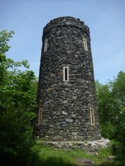
Mount Tom Tower1.9 miles1993
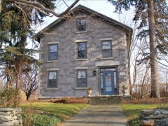
Henry B. Bissell House2.6 miles1990
Milton Center Historic District3.3 miles1986
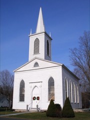
Trinity Church3.5 miles1976
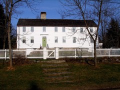
David Welch House3.5 miles1984
Warren Congregational Church3.9 miles1991

Sources for this property

National Archives recordThe nomination case file for reference 00000940 in Record Group 79.
Wikipedia articleCommunity-written account of this property, licensed CC BY-SA.
Litchfield CountyAll 166 listed properties in this county.

Provenance

  • Listing record. National Park Service National Register of Historic Places, listed-properties dataset, current to 2026-05-22.
  • Map join. Address geocoded through the United States Census geocoder, then tested against the published boundary of every sheet in the USGS Historical Topographic Map Collection.
  • How this page is made. Listing fields come from federal records; map-sheet coverage is a labelled coordinate-to-boundary calculation, not a source-field claim.
  • Wildfire. Short, Karen C. 2022. Spatial wildfire occurrence data for the United States, 1992-2020 [FPA_FOD_20221014]. 6th Edition. Fort Collins, CO: Forest Service Research Data Archive. https://doi.org/10.2737/RDS-2013-0009.6 Collected with United States Government funding and usable without additional permissions or fees.
  • Mines and quarries. USGS Mineral Resources Data System (MRDS) https://mrdata.usgs.gov/mrds/ A work of the United States government, no copyright under 17 U.S.C. 105.
  • Storms. NOAA National Centers for Environmental Information, Storm Events Database https://www.ncei.noaa.gov/stormevents/ A work of the United States government, no copyright under 17 U.S.C. 105. Narratives are quoted verbatim from the National Weather Service report and are not edited or summarised.