BlockBefore
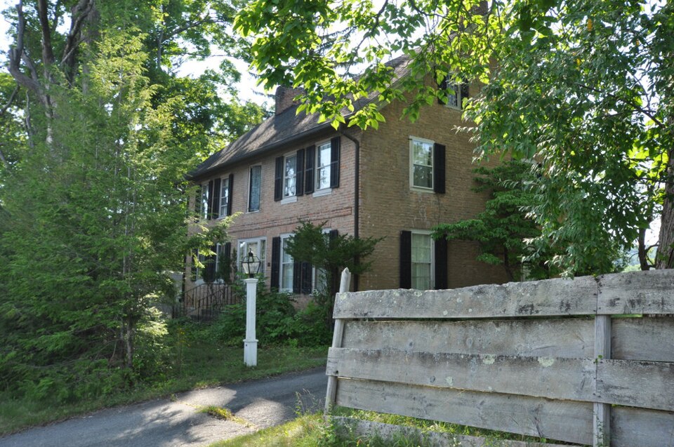
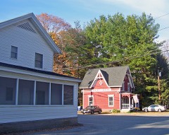
Photograph of James Pardee House
Photograph by Magicpiano, CC BY-SA 3.0. Via Wikimedia Commons.

James Pardee House

Listed on the National Register of Historic Places in 2003.

From the record

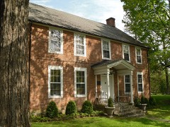
“The James Pardee House, situated on the grounds of the John Pardee Homestead at 129 North Main Street, is one of the well-known historic homes built in the eighteenth century in the town of Sharon, Connecticut, according to the 1935 edition of The Connecticut Guide. Constructed in 1782 of locally produced salmon-colored brick, the Pardee House retains much of its original character and represents a significant and well-preserved vernacular expression of the late Georgian style in architecture, materials and workmanship in the State of Connecticut.”

Wikipedia article James Pardee House, CC BY-SA 4.0.

One of 166 National Register listings published here for Litchfield County · listed in 2003 · category: Building.

Sources: the Wikipedia article · the case file at the National Archives · the National Register database, National Park Service

The listing

  • Listed as. Pardee, James, House - the National Register files a house under its owner's surname.
  • Address. 129 N. Main St., Sharon, 06069
  • When was it listed? August 2003
  • Category. building
  • Town. Sharon town
  • National Register reference number. 03000813 - the number the National Park Service assigned this property when it was listed, and the key its nomination file is catalogued under at the National Archives.

The ground it stands on

19,196 words

The chapter on Sharon Town in History of Litchfield County, Connecticut, published 1881 names Sharon. This is what it says, exactly as the scans read.

Jackson, and the patent was taken out in Jackson's name, and the land for many years was called Jackson's patent. Daniel Jackson was the first New England man who lived in Sharon. His house stood where the house lately owned by the Sharon Manufacturing Company stands. He was originally from Newtown, in Fairfield County, but at the time of his purchase he resided in Dover, N. Y. His son, Jehiel Jackson, who once lived where George Maxam now lives, in the Great Hollow, was the first white child born in Sharon. Mr. Jackson lived but a few years in town. In February, 1739, he sold his patent to Garret Winegar, and removed to Great Barrington, Mass."

Passage source: History of Litchfield County, Connecticut, published 1881.

Capt. Edmund Bennet was from the parish of Columbia, in Lebanon, and came to Sharon soon after the Revolutionary war. He was a blacksmith by trade. One of his sons, Hon. Milo L. Bennett, was a judge of the Supreme Court of Vermont.

Passage source: History of Litchfield County, Connecticut, published 1881.

Machine-read from a century-old scan, so expect the errors a machine makes: misspelled names, dropped words, stray characters.

Read the whole chapter on Sharon Town - 19,196 words on its settlement, mills, schools and churches.

Fires near this property

91 since 1993

Regional context, not property-specific evidence. The federal wildfire occurrence database lists 91 fires within 5 miles of James Pardee House between 1993 and 2020, burning about 42 acres in total. 5 started naturally. 6 were recorded as arson. Distance is straight-line from the map coordinates, so a fire counted here may appear on a neighbouring settlement's page as well.

Reported cause Fires
Missing data/not specified/undetermined55
Debris and open burning16
Arson/incendiarism6
Natural5
Recreation and ceremony4
Equipment and vehicle use3
Other causes2

The most recent of them, most recent first, with the day each was reported and the service that recorded it.

DateCause SizeReported by Name on the report
29 September 2019Missing data/not specified/undeterminedunder an acreConnecticut Division of Forestrynot named
28 September 2019Missing data/not specified/undetermined3.5 acresConnecticut Division of Forestrynot named
20 September 2020Recreation and ceremonyunder an acreConnecticut Division of Forestry341 MILLERTON ROAD
20 September 2010Missing data/not specified/undeterminedunder an acreFire Department of New Yorknot named
19 September 2009Arson/incendiarismunder an acreFire Department of New Yorknot named
1 September 2017Missing data/not specified/undeterminedunder an acreConnecticut Division of Forestry11 WILLIAMS RD
27 August 2020Missing data/not specified/undeterminedunder an acreConnecticut Division of ForestryWEST WOODS ROAD #1
16 August 1993Recreation and ceremony2.0 acresConnecticut Division of Forestrynot named

Every fire recorded in Litchfield County

Mines and quarries near this property

10 of 14 shown

Regional context, not property-specific evidence. The federal mineral resources record lists 14 workings within 5 miles of James Pardee House: 13 past producers, 1 producer. 1 still produces. What was taken out: Iron, Manganese, Iron, Sand and Gravel, Construction, Stone, Dimension. Distance is straight-line from the map coordinates, so a quarry counted here may appear on a neighbouring settlement's page as well.

Where SiteCommodity StatusRecorded
Marble QuarriesMarble, DimensionPast Producer
Amenia Sand and Gravel PitSand and Gravel, ConstructionPast ProducerSedimentary
Amenia Sand and Gravel PitSand and Gravel, ConstructionProducer
QuarryStone, DimensionPast Producer
Quartzite QuarryStone, DimensionPast Producer
Chatfield MineIronPast Producer
Indian Pond MineIronPast Producer
Manhattan Sharon MineIronPast ProducerResidual
Amenia Limonite MineIron, ManganesePast Producer1825, 1835
Amenia MineIron, ManganesePast Producer1760

Every working recorded in Litchfield County

Storms near this property

30 since 1998

Regional context, not property-specific evidence. The National Weather Service names Sharon, the town this property stands in, in 30 storm reports between 1998 and 2022: 24 thunderstorm wind, 3 hail, 2 flash flood, 1 lightning. No death or injury is recorded in these reports. Each account below is quoted exactly as the forecast office filed it, from the NOAA Storm Events Database, and each date opens the federal record of that event.

WhenEvent Place namedHarm What the report says
June 1999LightningSharon$50,000Lightning from a thunderstorm struck a house in Sharon, Litchfield County. The result was a fire that gutted a portion of the building.
July 2010Thunderstorm WindSharon$5,000Numerous trees and wires were downed by straight line winds from a thunderstorm. Damage was observed along Main Street in Sharon, along Fairfield Road and on West Cornwall Road near Route 7.
May 1998Thunderstorm WindSharon$3,000no account filed
May 2022Thunderstorm WindSharon-A tree was reported down on power lines.
July 2021Flash FloodSharon-There was a report of an entire road being impassable near Route 41 and Lambert Road.
December 2021Thunderstorm WindSharon-Trees were downed in the Town of Sharon.
November 2020Thunderstorm WindSharon-Numerous tree limbs were downed on Jackson Hill Road.
August 2020Thunderstorm WindSharon-A tree was downed onto wires.
August 2019Thunderstorm WindSharon-Trees were downed in the town of Sharon.
April 2019Thunderstorm WindSharon-Trees were blown down, with one falling onto a house.
August 2019Thunderstorm WindSharon-Powerlines were downed, resulting in a grass fire on Valley Road.
June 2018Thunderstorm WindSharon-A tree was knocked down across a roadway.
August 2018Thunderstorm WindSharon-A tree was downed at Millerton Road and Mudge Pond Road.
June 2017Thunderstorm WindSharon-A tree was reported down in Sharon due to thunderstorm winds.
May 2015Thunderstorm WindSharon-A tree was reported down on Amenia Union Road in Sharon due to thunderstorm winds.
June 2013Flash FloodSharon-Heavy rainfall led to flash flooding in Sharon. The basement of the Sharon Hospital flooded. A total of six roads were closed throughout the town, as well as one bridge. A supermarket also was impacted by the flood waters.
July 2012Thunderstorm WindSharon-Multiple trees and wires were reported down due to thunderstorm winds in Sharon.
July 2012HailSharon-Penny size (measured) hail was reported during a thunderstorm in Sharon.
June 2012Thunderstorm WindSharon-Two trees were reported down due to thunderstorm winds in Sharon.
September 2012Thunderstorm WindSharon-Trees were reported down due to thunderstorm winds in Sharon.
June 2011HailSharon-Quarter size hail was reported during a thunderstorm in Sharon.
August 2011Thunderstorm WindSharon-Multiple trees were reported down in Sharon due to strong thunderstorm winds.
June 2010Thunderstorm WindSharon-Large trees were reported down on wires blocking a road in Sharon due to strong thunderstorm winds.
June 2010Thunderstorm WindSharon-Wires were reported down in Sharon due to strong thunderstorm winds.
July 2010HailSharon-Nickel to quarter size hail was reported during a thunderstorm in Sharon.
July 2009Thunderstorm WindSharon-A tree was reported down on a rural road in Sharon due to strong thunderstorm winds.
July 2009Thunderstorm WindSharon-Wires were reported down in Mitcheltown due to strong thunderstorm winds.
July 2006Thunderstorm WindSharon-An emergency manager reported that wires were blown down in Sharon.
August 2006Thunderstorm WindSharon-A trained spotter reported that trees and wires were blown down in Sharon.
July 2005Thunderstorm WindSharon-Trees down

Every storm recorded in Litchfield County

Map coverage status

No historic map-sheet match is published for this property yet. That does not mean no map exists. This record needs a coordinate-quality review before it can be joined to a sheet boundary. Browse the county's mapped places while that work is pending.

Listed places nearby

6 within 8 miles

Other National Register properties close enough to walk or drive between, ordered by distance from this one. Both positions come from the same geocoding pass that matched these properties to their map sheets.

Photograph PropertyDistance Listed
Ebenezer Gay House0.5 miles1979
Sharon Historic District0.8 miles1993
Gov. Smith Homestead1.0 miles1982
Sharon Valley Historic District1.1 miles1982
Lime Rock Park Race Track5.6 miles2009
Lime Rock Historic District5.6 miles1984

Sources for this property

National Archives recordThe nomination case file for reference 03000813 in Record Group 79.
Wikipedia articleCommunity-written account of this property, licensed CC BY-SA.
Litchfield CountyAll 166 listed properties in this county.

Provenance

  • Listing record. National Park Service National Register of Historic Places, listed-properties dataset, current to 2026-05-22.
  • Map join. Address geocoded through the United States Census geocoder, then tested against the published boundary of every sheet in the USGS Historical Topographic Map Collection.
  • How this page is made. Listing fields come from federal records; map-sheet coverage is a labelled coordinate-to-boundary calculation, not a source-field claim.
  • Wildfire. Short, Karen C. 2022. Spatial wildfire occurrence data for the United States, 1992-2020 [FPA_FOD_20221014]. 6th Edition. Fort Collins, CO: Forest Service Research Data Archive. https://doi.org/10.2737/RDS-2013-0009.6 Collected with United States Government funding and usable without additional permissions or fees.
  • Mines and quarries. USGS Mineral Resources Data System (MRDS) https://mrdata.usgs.gov/mrds/ A work of the United States government, no copyright under 17 U.S.C. 105.
  • Storms. NOAA National Centers for Environmental Information, Storm Events Database https://www.ncei.noaa.gov/stormevents/ A work of the United States government, no copyright under 17 U.S.C. 105. Narratives are quoted verbatim from the National Weather Service report and are not edited or summarised.