 Block
From the record
One of 166 National Register listings published here for Litchfield County · listed in 2022 · category: Building.
Sources: the National Register database, National Park Service
Listed on the National Register of Historic Places in 2022.
One of 166 National Register listings published here for Litchfield County · listed in 2022 · category: Building.
Sources: the National Register database, National Park Service
The chapter on Washington Town in History of Litchfield County, Connecticut, published 1881 names Washington. This is what it says, exactly as the scans read.
The town of Washington is located south of the centre of the county, and is bounded ius follows: on the north by Kent, Warren, and Litchfield, on the east by Morris and Bethlehem, on the south by Wooilbury and Koxbury, and on the we.st by New Milford and Kent. Its surface is rolling and soil fertile.
Passage source: History of Litchfield County, Connecticut, published 1881.
The history of JIasonry in Washington must necessarily be divided into two periods, the first extending from the establishment of Rising Sun Lodge, No. 27, to the rise of that great persecution and humbug, Anti-Masonry ; the second period embracing the time from the restoration of Rising Sun Lodge to the present time. During the long interval between the suspension of the lodge and restoration of its charter, two full volumes of records were lost, and its jewels were purloined, so that all that remained to us who were active in its restoration were its third volume of
Passage source: History of Litchfield County, Connecticut, published 1881.
Machine-read from a century-old scan, so expect the errors a machine makes: misspelled names, dropped words, stray characters.
Read the whole chapter on Washington Town - 6,700 words on its settlement, mills, schools and churches.
Regional context, not property-specific evidence. The federal wildfire occurrence database lists 85 fires within 5 miles of Harry O. Erikson Pavilion Hall between 1993 and 2020, burning about 69 acres in total. None started naturally. 4 were recorded as arson. Distance is straight-line from the map coordinates, so a fire counted here may appear on a neighbouring settlement's page as well.
| Reported cause | Fires |
|---|---|
| Missing data/not specified/undetermined | 70 |
| Debris and open burning | 7 |
| Arson/incendiarism | 4 |
| Other causes | 1 |
| Recreation and ceremony | 1 |
| Misuse of fire by a minor | 1 |
| Equipment and vehicle use | 1 |
The most recent of them, most recent first, with the day each was reported and the service that recorded it.
| Date | Cause | Size | Reported by | Name on the report |
|---|---|---|---|---|
| 3 September 2017 | Missing data/not specified/undetermined | 1.2 acres | Connecticut Division of Forestry | 30 GARLAND RD |
| 21 September 2016 | Missing data/not specified/undetermined | under an acre | Connecticut Division of Forestry | 26 TOMPKINS HILL ROAD WASHINGTON |
| 15 August 2016 | Missing data/not specified/undetermined | under an acre | Connecticut Division of Forestry | 200 CHURCH HILL ROAD WASHINGTON |
| 10 August 1993 | Arson/incendiarism | 2.0 acres | Connecticut Division of Forestry | not named |
| 8 July 2016 | Missing data/not specified/undetermined | under an acre | Connecticut Division of Forestry | WEST SHORE ROAD WASHINTON |
| 3 July 2017 | Missing data/not specified/undetermined | under an acre | Connecticut Division of Forestry | 278 NEW MILFORD TPK |
| 29 July 2016 | Missing data/not specified/undetermined | under an acre | Connecticut Division of Forestry | 146 WYKEHAM ROAD WASHINGTON |
| 27 July 2016 | Missing data/not specified/undetermined | under an acre | Connecticut Division of Forestry | TOWN HILL ROAD WARREN |
Regional context, not property-specific evidence. The federal mineral resources record lists 18 workings within 5 miles of Harry O. Erikson Pavilion Hall: 15 past producers, 2 occurrences, 1 producer. 1 still produces. What was taken out: Marble, Dimension, Iron, Stone, Dimension, Sand and Gravel, Construction. Distance is straight-line from the map coordinates, so a quarry counted here may appear on a neighbouring settlement's page as well.
| Where | Site | Commodity | Status | Recorded |
|---|---|---|---|---|
| Hornblende Gneiss Quarry No. Fj-020 | Stone | Past Producer | ||
| Kent Limonite Mine | Iron, Manganese, Zinc, Titanium, Metal | Past Producer | Limonite, Melanterite, Pyrolusite, Siderite, Sphalerite | |
| Pyrite Occurrence No. Fj-022 | Sulfur-Pyrite | Occurrence | Pyrite | |
| Roebling Mica, Feldspar, Beryl Mine | Mica, Feldspar, Gemstone | Past Producer | Muscovite, Plagioclase, Quartz | |
| Roebling Mica-Feldspar-Beryl Mine | Beryllium, Feldspar, Mica | Past Producer | ||
| Silver Mine | Silver | Past Producer | ||
| Coe Road Pit | Sand and Gravel, Construction | Past Producer | ||
| Drzal Pit | Sand and Gravel, Construction | Producer | ||
| Hornblende Gneiss Quarry | Stone, Dimension | Past Producer | ||
| Kent Mine | Iron | Past Producer |
Regional context, not property-specific evidence. The National Weather Service names Washington, the town this property stands in, in 14 storm reports between 1996 and 2024: 7 thunderstorm wind, 4 flash flood, 2 tornado, 1 hail. The reports record 1 injury. Each account below is quoted exactly as the forecast office filed it, from the NOAA Storm Events Database, and each date opens the federal record of that event.
| When | Event | Place named | Harm | What the report says |
|---|---|---|---|---|
| June 2001 | Tornado (F1) | Washington | 1 hurt, $150,000 | no account filed |
| June 2024 | Flash Flood | Washington | $25,000 | Route 199 or Roxbury Road was washed out in Washington. |
| July 1998 | Thunderstorm Wind | Washington | $9,000 | A cold front moving east from New York State touched off a severe thunderstorm in Litchfield County. Wind blew down trees in in the town of Washington. |
| June 1998 | Thunderstorm Wind | Washington | $8,000 | no account filed |
| September 2023 | Flash Flood | Washington | $5,000 | A portion of Tunnel Road was washed out due to flash flooding near Roxbury. |
| October 1996 | Flash Flood | Washington | $5,000 | no account filed |
| May 1998 | Tornado (F1) | Washington | $4,000 | no account filed |
| September 2023 | Flash Flood | Washington | - | Several inches of water was reported over Route 199. |
| August 2020 | Thunderstorm Wind | Washington | - | Trees were downed on Painter Ridge Road. |
| July 2007 | Thunderstorm Wind | Washington | - | Trees and wires were reported down in Washington due to strong thunderstorm winds. |
| July 2006 | Thunderstorm Wind | Washington | - | An amateur radio operator reported that between 330 PM EST and 345 PM EST, numerous tree limbs up to 10 inches in diameter were blown down in Washington, closing Route 199. |
| May 2005 | Hail | Washington | - | no account filed |
| September 2003 | Thunderstorm Wind | Washington | - | no account filed |
| May 2000 | Thunderstorm Wind | Washington | - | no account filed |
No historic map-sheet match is published for this property yet. That does not mean no map exists. This record needs a coordinate-quality review before it can be joined to a sheet boundary. Browse the county's mapped places while that work is pending.
Other National Register properties close enough to walk or drive between, ordered by distance from this one. Both positions come from the same geocoding pass that matched these properties to their map sheets.
| Photograph | Property | Distance | Listed |
|---|---|---|---|
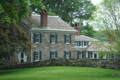 | New Preston Hill Historic District | 0.9 miles | 1985 |
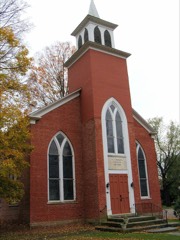 | St. Andrew's Episcopal Church | 1.2 miles | 1994 |
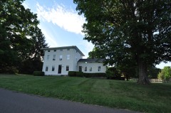 | Calhoun-Ives Historic District | 1.7 miles | 1995 |
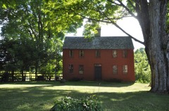 | Capt. Philo Beardsley House | 2.5 miles | 1979 |
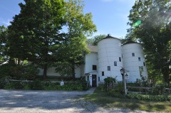 | Hine-Buckingham Farms | 3.0 miles | 2004 |
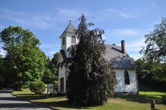 | Merryall Union Evangelical Society Chapel | 3.9 miles | 1986 |
| National Archives record | The nomination case file for reference 100007375 in Record Group 79. |
| Litchfield County | All 166 listed properties in this county. |