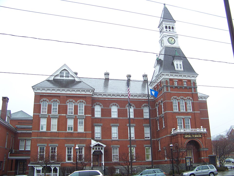
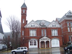
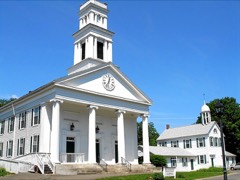
Listed on the National Register of Historic Places in 1972.
From the record
“The Thomaston Opera House is a historic performance venue and the town hall of Thomaston, Connecticut. Located at 153 Main Street, it was built in 1883-85, and is a good local example of Romanesque architecture.”
Wikipedia article Thomaston Opera House, CC BY-SA 4.0.
One of 166 National Register listings published here for Litchfield County · listed in 1972 · category: Building.
National Register reference number.72001319- the number the National Park Service assigned this property when it was listed, and the key its nomination file is catalogued under at the National Archives.
The town of Thomaston, the youngest town in the county, is located in tiie southeastern part of Litchfield County, and is bounded as follows : on the north by Litchfield and Harwinton, on the east by Plymouth, on the south by Watertown and Now Haven County, and on the west by Watertown and Litchfield. The surface of the town is hilly, and soil generally fertile. The early history of the town has been given in detail in the history of Plymouth, of which this town formed a part until 1875. Names of the early settlers, proprietors' meetings, early rules and regulations, etc., will be found in the historj' of the mother-town.
The section occupied by the village of Thomaston was originally known as Plymouth Hollow, and fiftyfive years ago consisted of about thirteen dwellings, located as follows : Ou East Main Street, on the site of the Plume & Atwood office, stood a dwelling occupied by Lyman Fenn, and on the premises now occupied by John H. Wood was also a house, but its occupant is unknown. There was a house standing on North Main Street, where Dr. B. W. Pease now resides, and Junius Blakesley lived in a dwelling which stood near the present residence of Henry R. Warner. On the property now owned by Miles Morse, on Main Street, stood a hotel. Bela Blakesley lived on the premises now occupied by the Bradstreet Block and the widow of Edward Thomas, and the property now owned by Aaron Thomas was in the possession of the Ford family. The premises now occupied by T. J. Bradstreet and Mrs. Blakesley were owned by Mica Blakesley, and on the place now occupied by Mrs. George Reynolds was a tannery. The next location on the north side of the street belonged to Seth Thomas, and was occupied by him a number of years ; it is now covered by the clock-shop. The next place below has been occupied by the Blakesley family a long time. One of the oldest buildings in the village stood on Centre Street, and was occupied by Levi Castle. The " farm-house" of Seth Thomas, so called, was also standing at the time of which we are writing.
Regional context, not property-specific
evidence. The
federal wildfire occurrence database
lists 113 fires within 5 miles of Thomaston Opera House
between 1994 and 2020, burning about 702 acres in total. None started naturally. 12 were recorded as arson.
Distance is straight-line from the map coordinates, so a fire counted
here may appear on a neighbouring settlement's page as well.
Reported cause
Fires
Missing data/not specified/undetermined
64
Debris and open burning
18
Arson/incendiarism
12
Recreation and ceremony
9
Misuse of fire by a minor
8
Smoking
1
Equipment and vehicle use
1
The most recent of
them, most recent first, with the day each was reported and the service
that recorded it.
Regional context, not property-specific
evidence. The federal mineral resources record lists
14 workings within 5 miles of Thomaston Opera House: 11 past producers, 2 producers, 1 occurrence.
2 still produce. What was taken out: Sand and Gravel, Construction, Stone, Dimension, Stone, Iron, Fluorine-Fluorite, Lead. Distance is straight-line from the
map coordinates, so a quarry counted here may appear on a neighbouring
settlement's page as well.
Regional context, not property-specific
evidence. The National Weather Service names
Thomaston, the town this property stands in, in 11 storm reports between 1997 and 2025: 6 thunderstorm wind, 3 hail, 2 tornado.
No death or injury is recorded in these reports. Each account below is quoted exactly as the forecast office
filed it, from the NOAA Storm Events Database, and each date
opens the federal record of that event.
A supercell that moved across Litchfield County during the afternoon hours produced a tornado that made brief touchdowns in East Litchfield, Thomaston and Terryville with damage mainly to hardwood and softwood trees. There was little evidence of direct structural damage.||In Thomaston, tornadic damage occurred near D Welton Way.
A supercell that moved across Litchfield County during the afternoon hours produced a tornado that made brief touchdowns in East Litchfield, Thomaston and Terryville with damage mainly to hardwood and softwood trees. There was little evidence of direct structural damage.||In Thomaston, tornadic damage occurred just west of Fenn Road.
No historic map-sheet match is published
for this property yet. That does not mean no map exists. This record needs
a coordinate-quality review before it can be joined to a sheet boundary.
Browse the county's mapped places while that work is
pending.
Listed places nearby
6 within 8 miles
Other National Register properties close
enough to walk or drive between, ordered by distance from this one. Both
positions come from the same geocoding pass that matched these properties
to their map sheets.
Listing record. National Park Service National Register of Historic Places, listed-properties dataset, current to 2026-05-22.
Map join. Address geocoded through the United States Census geocoder, then tested against the published boundary of every sheet in the USGS Historical Topographic Map Collection.
How this page is made. Listing fields come from federal records; map-sheet coverage is a labelled coordinate-to-boundary calculation, not a source-field claim.
Wildfire. Short, Karen C. 2022. Spatial wildfire occurrence data for the United States, 1992-2020 [FPA_FOD_20221014]. 6th Edition. Fort Collins, CO: Forest Service Research Data Archive. https://doi.org/10.2737/RDS-2013-0009.6 Collected with United States Government funding and usable without additional permissions or fees.
Mines and quarries. USGS Mineral Resources Data System (MRDS) https://mrdata.usgs.gov/mrds/ A work of the United States government, no copyright under 17 U.S.C. 105.
Storms. NOAA National Centers for Environmental Information, Storm Events Database https://www.ncei.noaa.gov/stormevents/ A work of the United States government, no copyright under 17 U.S.C. 105. Narratives are quoted verbatim from the National Weather Service report and are not edited or summarised.
 Block