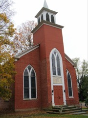
Listed on the National Register of Historic Places in 1977.
From the record
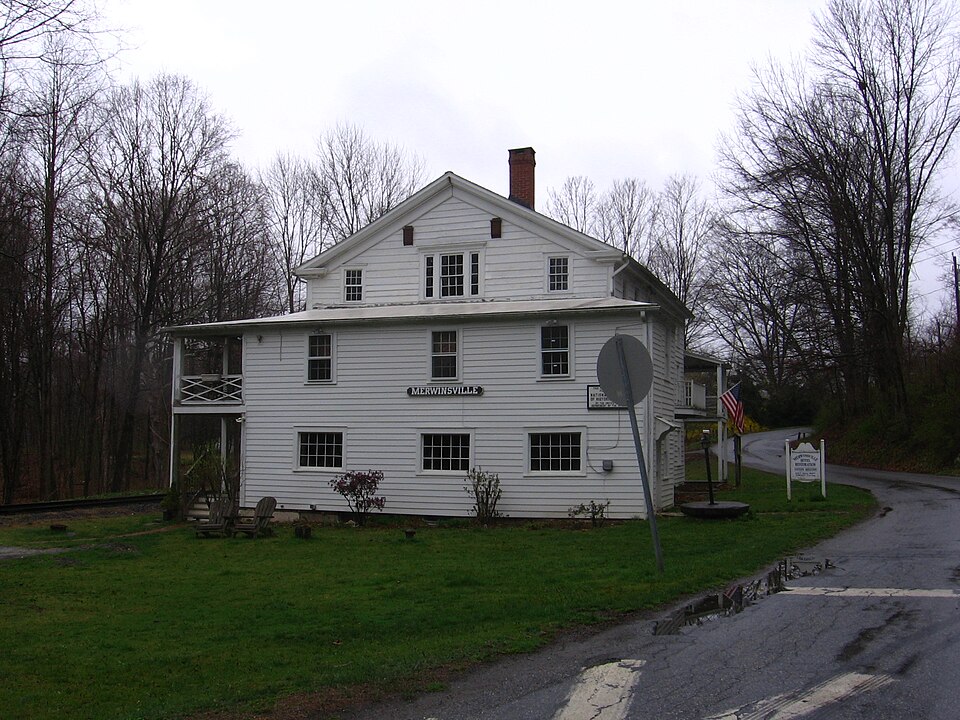
“The Merwinsville Hotel is a historic hotel building and former railroad station at 1 Brown's Forge Road in the Gaylordsville village of New Milford, Connecticut. Built in 1842-43, it is one of the oldest hotels built specifically for a railroad stop in the United States.”
Wikipedia article Merwinsville Hotel, CC BY-SA 4.0.
One of 166 National Register listings published here for Litchfield County · listed in 1977 · category: Building.
National Register reference number.77001398- the number the National Park Service assigned this property when it was listed, and the key its nomination file is catalogued under at the National Archives.
What happened here
An account from the chapter on New Milford town. The inset identifies its exact
source book and publication year.
Shortly after this we had an exciting chase. We had come up with Early^s troops at Mt. Jackson, where they had established a hospital, and we gave chase after them with our three army corps stretched across the entire valley from mountain to mountain. The valley was undulating, and as we reached a rise of ground we could see Early's troops just going over the next rise, and so it continued all the afternoon, our light artillery driving ahead of the infantry, and throwing solid shot or shell after them kept them moving at a lively pace while the infantry followed.
A peculiar case of Sabbath-breaking was brought before one of the justices of the peace in New Milford, soon after the Housatonic railroad was put in running order, about thiity-five years ago. The rails used at first on the road consisted of flat bars of iron spiked to long pieces of timber. A man, who is still living, was walking from Gaylordsville on the railroad on Sunday morning, and seeing the end of one of these iron rails bent upward, and supposing it endangered the safety of the train, bent the rail to its proper place with stones, and anything he could obtain, to accomplish the object, and then proceeded quietly on his way home. On Monday morning he was arrest- ed for doing this work, and brought before a justice of the peace. After hearings the testimony the justice remarked that it was a clear case of Sabbath-breaking, but that the case was not as bad as he had heard it was, and therefore he would imposethe fine of only one dollar and the costs. To sum up such a case, we would say that for obeying the instincts of humanity, in saving a railroad train from being wrecked, this man had to pay what would take him at that time a whole week to earn.
Gaylordsville is in the northwest corner of the town of New Milford, on the Housatonic river, where the valley is about a mile wide but is shut in on every side by abrupt, high hills. On the south is the high rocky hill covered with woods, which is the northern extremity of the Straits Mountain, at the foot of which is a small elevation called Cedar Hill ; and on the west of the village is West Hill. At the northwest is Ten Mile Hill or Cat Rocks, covered with woods, lying east and west, parallel with Ten Mile river which is on the north of it, and east of this hill is
Regional context, not property-specific
evidence. The
federal wildfire occurrence database
lists 78 fires within 5 miles of Merwinsville Hotel
between 1992 and 2020, burning about 242 acres in total. 1 started naturally. 1 was recorded as arson.
Distance is straight-line from the map coordinates, so a fire counted
here may appear on a neighbouring settlement's page as well.
Reported cause
Fires
Missing data/not specified/undetermined
50
Debris and open burning
15
Equipment and vehicle use
4
Recreation and ceremony
3
Smoking
2
Misuse of fire by a minor
1
Arson/incendiarism
1
Power generation/transmission/distribution
1
Natural
1
The most recent of
them, most recent first, with the day each was reported and the service
that recorded it.
Regional context, not property-specific
evidence. The federal mineral resources record lists
15 workings within 5 miles of Merwinsville Hotel: 11 past producers, 4 producers.
4 still produce. What was taken out: Sand and Gravel, Construction, Iron, Stone, Limestone, Dimension. Distance is straight-line from the
map coordinates, so a quarry counted here may appear on a neighbouring
settlement's page as well.
Regional context, not property-specific
evidence. The National Weather Service names
Gaylordsville, the town this property stands in, in 1 storm report in 2007: 1 thunderstorm wind.
No death or injury is recorded in these reports. Each account below is quoted exactly as the forecast office
filed it, from the NOAA Storm Events Database, and each date
opens the federal record of that event.
National Weather Service meteorologists conducted a storm survey in conjunction with 5 emergency coordinators, the highway superintendent and emergency management officials from New Milford to investigate damage in the Gaylordsville and New Milford areas.||They determined that damaging straight line winds within a thunderstorm, with estimated winds of 85 to 95 mph, downed numerous pine and poplar trees on Straight Rock Drive and Long Mountain Road. The trees were knocked down and uprooted all in one direction, indicating that straight line winds caused the damage.
No historic map-sheet match is published
for this property yet. That does not mean no map exists. This record needs
a coordinate-quality review before it can be joined to a sheet boundary.
Browse the county's mapped places while that work is
pending.
Listed places nearby
6 within 8 miles
Other National Register properties close
enough to walk or drive between, ordered by distance from this one. Both
positions come from the same geocoding pass that matched these properties
to their map sheets.
Listing record. National Park Service National Register of Historic Places, listed-properties dataset, current to 2026-05-22.
Map join. Address geocoded through the United States Census geocoder, then tested against the published boundary of every sheet in the USGS Historical Topographic Map Collection.
How this page is made. Listing fields come from federal records; map-sheet coverage is a labelled coordinate-to-boundary calculation, not a source-field claim.
Wildfire. Short, Karen C. 2022. Spatial wildfire occurrence data for the United States, 1992-2020 [FPA_FOD_20221014]. 6th Edition. Fort Collins, CO: Forest Service Research Data Archive. https://doi.org/10.2737/RDS-2013-0009.6 Collected with United States Government funding and usable without additional permissions or fees.
Mines and quarries. USGS Mineral Resources Data System (MRDS) https://mrdata.usgs.gov/mrds/ A work of the United States government, no copyright under 17 U.S.C. 105.
Storms. NOAA National Centers for Environmental Information, Storm Events Database https://www.ncei.noaa.gov/stormevents/ A work of the United States government, no copyright under 17 U.S.C. 105. Narratives are quoted verbatim from the National Weather Service report and are not edited or summarised.
 Block